Sinan Jaeun & Imjado Bike Route: 81km One Way
Cycling · Published 8/3/2026 ·
자전거길 트랙·시설 (공공데이터: 행정안전부 국토종주 자전거길 DB) · 🏆인증센터 💧급수대 🚻화장실 🔧공기주입기 · 지도 © OpenStreetMap ⤓ GPX 다운로드
At a Glance
| Metric | Rating |
|---|---|
| Course difficulty | ★★★★☆ |
| Supplies & amenities (certification centers, water stations) | ☆☆☆☆☆ |
| Certification centers (0) | ☆☆☆☆☆ |
| Seasonal difficulty — Spring | ★★☆☆☆ |
| Seasonal difficulty — Summer | ★★★★★ |
| Seasonal difficulty — Fall | ★★☆☆☆ |
| Seasonal difficulty — Winter | ★★★★☆ |
※ Source: Cross-Country Bicycle Path database, Ministry of the Interior and Safety of Korea · Seasonal ratings are rough guides
Overview
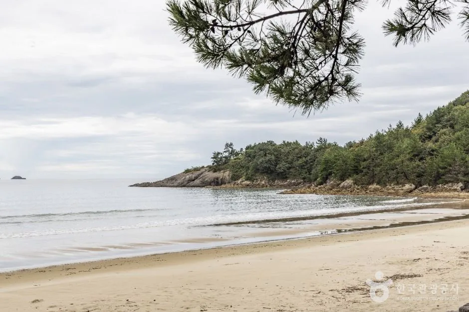 Photo: Korea Tourism Organization Tourism Photo Gallery (Yugak-ri) · KOGL
The Sinan-gun (Jaeun, Imja-do) Bicycle Road is a long-distance, one-way route linking the islands of Sinan-gun in Jeollanam-do. If inland cross-country routes like the Han River or Nakdong River trails are about “following a river mile after mile,” this one is more about crossing bridges from island to island with the sea right beside you. Tidal flats and salt farms, sea walls, pine groves, low hills and village lanes come around again and again, so the scenery changes a lot — and so does your exposure to the wind.
There are three main ways I’d suggest using it.
First, as a one-day full-distance ride. Since it’s a one-way course, the least punishing approach is to set off early, reach the far end before sunset, spend the night near the finish, and head back the next day. The estimated ride times based on an average of 17 km/h are pure pedaling time, so once you add photo stops, meals, and waiting out the wind, you’ll want to budget considerably more.
Second, splitting it into a two-day island tour. Divide the route into two chunks — the Jaeun-do area and the Imja/Jido area — and break for the night at accommodation in between (pensions and minbak guesthouses have grown up around the beaches). Done that way, even beginners and intermediate riders can handle it. This approach also suits the natural pace of a Sinan trip.
Third, a folding bike or Brompton combined with public transport. Carry a folding bike by train or express bus as far as the Mokpo area, then get into Sinan by intercity or rural bus, or catch a ride with someone, and ride only the island sections you want. You don’t have to cover the whole route to get the full flavor of island riding.
On the flip side, I wouldn’t recommend this for families or complete beginners. The distance alone is substantial, and as I’ll explain later, there are no official rest facilities anywhere along the route.
Course Information
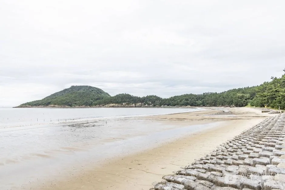 Photo: Korea Tourism Organization tourism photo gallery (669 Jaeun Seobu 2-gil) · KOGL
This is a one-way route, starting out toward Jaeun-do and finishing up toward Imja-do and Jido. Jaeun-do is the island known for Baekgil and Bungye beaches, and from there you cross an inter-island bridge heading south toward Amtae-do to enter the main Shinan island cluster, then work your way back north toward Jido and Imja-do. Over the past decade or so, Shinan has seen a wave of new inter-island and mainland-connecting bridges open, which means you can now string the islands together by bike without the multiple ferry transfers of years past. That said, the bridge approaches include stretches you’ll be sharing with cars, so stay alert.
The surface isn’t a dedicated bike path from end to end the way the riverside routes are. You’re better off thinking of it as a mix of shared-road sections on provincial and county roads, dead-straight runs along the top of seawalls, paved village lanes, and beach access roads. Elevation change is mostly modest, but there are short, sharp ups and downs that come with island terrain — and above all, the headwind blowing straight in off the sea is what really sets the difficulty. The same stretch can feel more than twice as hard with the wind against you as it does with the wind at your back.
The scenery is this route’s greatest asset. Tidal flats at low water, salt farms laid out in neat squares, windbreak stands of black pine, red sunsets one after another — and in summer, green fills the scallion fields and the village walls. This route isn’t part of the national cross-country certification program, so there’s no need to hunt down certification centers and shape your ride around them. That leaves you free to detour off to a beach or a viewpoint whenever you feel like it.
Local Eats
 Photo: Korea Tourism Organization photo gallery (9 Bakdal-ro) · KOGL
Sinan is one of Korea’s premier seafood and salt-farm regions, so the food here stops being about refueling and becomes a reason to make the trip. Rather than naming specific restaurants, I’ll just point you toward what the area is generally known for.
- Mineo (croaker): The waters off Imja-do in Sinan are widely known for summer croaker. It usually comes as sashimi, in a soup, or pan-fried. Be warned, though — it’s very seasonal and on the pricier side.
- Nakji (small octopus): The signature ingredient of the Sinan–Muan area, typically served as yeonpo-tang or tangtangi.
- Salted shrimp and sun-dried salt (jeotgal, sea salt): Sinan’s sun-dried salt and jeotgal are famous nationwide. They also make good souvenirs from a ride.
- Silver pomfret, skate, gim (laver), seomcho (island spinach), and scallions: Depending on the season, these are the local ingredients you’ll commonly run into in village restaurant set meals or at the markets.
Please, don’t forget the resupply warning. On the island sections, shops cluster only around the township centers and the beaches, and in between you’ll hit stretches of several to well over ten kilometers with no convenience stores or restaurants at all. On top of that, rural restaurants commonly close after lunch, or shut down for the day once they run out of ingredients. The right move is to top up water and snacks every time you pass through a township center, on the assumption that you have no idea when the next shop will appear.
Supplies and Facilities
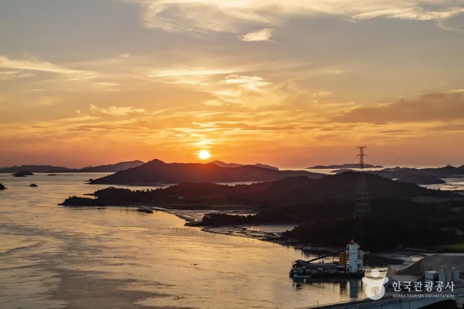 Photo: Korea Tourism Organization photo gallery (Jangdango-gil 7-63) · KOGL
According to the bike route database maintained by the Ministry of the Interior and Safety of Korea, this route has zero certification centers, zero restrooms, zero water fountains, and zero air pumps. In other words, plan on the assumption that the route itself provides no support facilities whatsoever. This is a completely different world from the Four Rivers trails, where water fountains, restrooms, and air pumps show up at regular intervals.
So in practice, here’s what you fall back on instead:
- Convenience stores and marts in township centers — your resupply points for water, sports drinks, and snacks
- Public buildings, tourist information centers, beach management facilities, and parking lot restrooms — restroom substitutes
- A spare tube, patch kit, and a hand pump or CO₂ cartridges — your air pump substitute, and non-negotiable. If you flat out on an island section, help is hard to come by.
- Two bottles, or at least 1.5L of water capacity — with no fountains, you have to carry the margin yourself.
This route isn’t part of the Cross-Country Certification program, so there’s no passport to stamp here. If collecting certification stamps is the point of your trip, you’ll want to plan the Four Rivers and Cross-Country routes separately.
The Ride Home
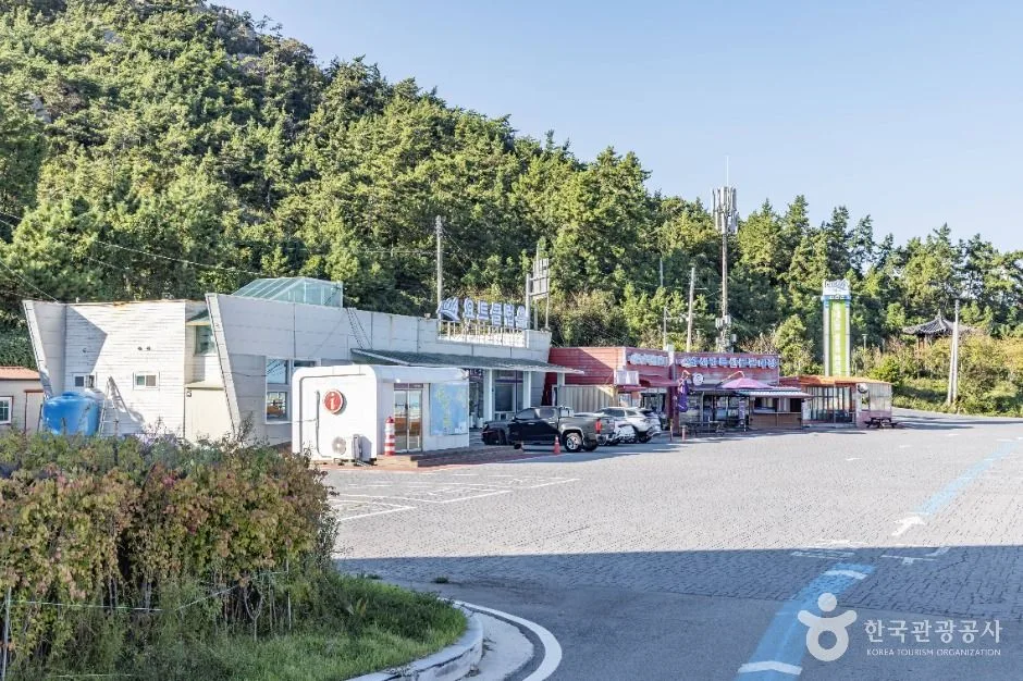 Photo: Korea Tourism Organization photo gallery (Pakdal-ro 7) · KOGL
Since this is an 81 km one-way route, you need to lock down your return plan before you leave. Island bus and train service runs thin, so winging it at the far end rarely works out.
① Ride back the way you came (162 km round trip) The surest option, and by far the hardest. Even for a fit intermediate-to-advanced rider, 162 km is an all-day affair — and whatever tailwind pushed you out becomes a headwind on the way home. Plan on a pre-dawn start and night lights, and factor in that you’ll cross the no-services stretches twice. Realistically, I’d suggest staying overnight and riding back the next day.
② Take the train (Honam Line stations around Mokpo, Muan, and Hampyeong) The gateway to riding in Sinan is generally the Mokpo area, with Mokpo Station serving as the main regional access point. Here’s the general picture for carrying a bike on Korean rail:
- Mugunghwa-ho, ITX, and other conventional trains: some trains have bike racks and will take a fully assembled bike, but it varies by service, so checking ahead is essential.
- KTX and other high-speed trains: a regular assembled bike is basically a no-go. The usual approach is to fold a folding bike into a dedicated bag or cover and treat it as luggage.
- Either way, bringing a bag or cover dramatically cuts your odds of being turned away.
③ Take the bus Intercity and express buses run out of Mokpo Bus Terminal, and within Sinan, rural buses loop around the islands. That said, whether your bike goes in the luggage bay is often up to the driver, and without a folding bike in a bag you may well be refused. Headways are long and the last bus leaves early, so aim to reach the end point at least two hours before that last departure. (For actual timetables, trust the schedules posted locally.)
④ Support car or taxi Having someone drive out to pick you up at the end point is the most reliable setup for island riding. Local taxis are few and far between, so waits can be long — and in practice, your bike has to fold to fit.
Safety & Cautions
- Shared-roadway sections: This isn’t a dedicated bike path the whole way, so you’ll repeatedly find yourself sharing pavement with cars. Run a rear blinker even in daylight, stay right, and ride single file.
- Bridge and seawall approaches: These are the spots where the wind suddenly picks up and the road narrows. A crosswind can shove your handlebars sideways, so slow down and get low.
- Farm machinery and trucks: Around the green onion fields and salt flats, farm vehicles and tractors sometimes take up the whole road.
- Pedestrians and tourists: Slow way down through the beach and village stretches, and give people a heads-up with your bell or your voice.
- Ice and road surface: In winter, sea spray and frost can leave patches of ice on the bridges and in shaded curves.
- Lights at night: There’s almost no street lighting on the island roads. A headlight and taillight aren’t optional here — they’re required.
- Water and dehydration: There are zero water fountains on this route, which makes dehydration the most realistic danger you’ll face. Sip every 20–30 minutes before you feel thirsty, and add electrolytes in summer.
- Signal and emergencies: For medical emergencies call 119; for police, 112. Cell coverage drops off along some coastal stretches, so save your map and route for offline use before you set out.
Season, Weather, and Gear
The sweet spots are late spring (April–June) and autumn (September–November). Mild temperatures and clear air, which is when the tidal flats and salt farms look their best.
- Spring: Probably the best riding conditions of the year, though March and April can bring strong westerlies along with yellow dust and fine particulates.
- Summer: The hardest season, hands down. The open coastal stretches have almost no shade, so you’re in direct sun the whole way, with humidity and heat piled on top. It also overlaps with typhoon and heavy-rain season, so checking the forecast isn’t optional. I’d strongly suggest riding at dawn or in the morning.
- Autumn: Steady winds and comfortable temperatures make it great for long distances. The sun sets early, though, so keep an eye on your finish time.
- Winter: The temperature itself isn’t really the problem — the northwesterly monsoon winds are. Wind chill drops fast, and if you hit a headwind on a one-way route, your whole plan can fall apart.
Essentials: helmet, front and rear lights, spare tube and puncture repair kit, hand pump or CO₂, multi-tool, two water bottles, snacks, sunscreen, a windbreaker, a phone power bank, and a bit of cash (small shops on the islands may not take cards).
Tips for International Riders
① Route Name in Roman Letters Sinan-gun (Jaeun, Imja-do) Bicycle Road — an island route in Sinan-gun, Jeollanam-do province. The nearest major gateway city is Mokpo.
② The Certification System, in Practice — This Route Isn’t Part of It Korea runs a national Bike Certification System built mainly around the Four Rivers and Cross-Country routes. That said, this route isn’t covered by it, and there are zero certification centers along the way. If collecting stamps is part of your plan, you’ll want to build a separate certified route into your itinerary. For reference, here’s how the system generally works.
- Bike Passport: Your safest bet is buying one in person at a staffed certification center or an authorized retailer. The official online channel is usually Korean-only and requires Korean identity verification and a domestic card, so buying ahead of time is tough if you don’t have a Korean ID or a card issued here.
- Unstaffed certification centers: These are mostly small stamp booths shaped like red phone boxes. The stamp hangs inside on a chain — just press it into the right box in your passport yourself. Nobody’s on duty, and they’re open around the clock.
- After finishing a section: Fill in all the stamps for a designated section and you get a certification sticker; complete the whole thing and you typically receive a completion certificate and a medal.
③ If You’re Arriving Without a Bike Seoul’s public bike share, Ttareungi, has an English app and takes foreign cards — but it’s Seoul-only, and you can’t use it in Sinan. Large, permanently staffed rental shops are rare on rural islands, so realistically you have three options:
- Book ahead with a bike rental or tour outfit in the Mokpo area or another major city, then travel out
- Buy or rent a folding bike and bring it along on the train or bus
- Ask your accommodation (pension or guesthouse) about their own rental bikes when you book — if they have them, expect basic around-town bikes that may not hold up over long distances
④ Map Apps Google Maps cycling directions in Korea just aren’t reliable. They’ll often hand you a driving route as-is, or fail to produce a route at all. Use these instead:
- KakaoMap or Naver Map — both have English interfaces, and their cycling mode and public transit timetables are far more accurate.
- Prepare for going offline — signal can drop along the coast and on bridge sections, so save your route in advance or load a GPX file onto your cycling computer.
- Book lodging and transport early — island accommodation fills up fast in peak season, and buses run infrequently. I’d book at least a day ahead.
⑤ Two Sentences Worth Remembering “There are no water stations, restrooms, or air pumps on this route,” and “It’s a one-way route, so sort out your return transport in advance.” Stick to those two, and Sinan’s tidal flats, salt farms, and sunsets will more than make up for it.
Other bike paths nearby
- Yeongsan River Bike Path: route, distance, and 7 certification centers — roughly 58 km as the crow flies
- Seomjin River Bike Path: the 154 km route and 8 certification centers — roughly 126 km as the crow flies
- Jeju Fantasy Bike Path: route, distance, and 9 certification centers — roughly 170 km as the crow flies
📍 Sinan Jaeun & Imjado Bike Route: 81km One WayLocation
Contact: bumseok.view [at] gmail [dot] com
Comments