Sinan Jeungdo Island Bike Path: Course, Distance & Certification Centers
Cycling · Published 8/11/2026 ·
자전거길 트랙·시설 (공공데이터: 행정안전부 국토종주 자전거길 DB) · 🏆인증센터 💧급수대 🚻화장실 🔧공기주입기 · 지도 © OpenStreetMap ⤓ GPX 다운로드
At a Glance
| Metric | Rating |
|---|---|
| Course difficulty | ★★☆☆☆ |
| Supplies & amenities (certification centers, water stations) | ★☆☆☆☆ |
| Certification centers | 0 (☆☆☆☆☆) |
| Seasonal difficulty — Spring | ★★☆☆☆ |
| Seasonal difficulty — Summer | ★★★★☆ |
| Seasonal difficulty — Fall | ★★☆☆☆ |
| Seasonal difficulty — Winter | ★★★☆☆ |
※ Source: Cross-Country Bike Path database, Ministry of the Interior and Safety of Korea · Seasonal ratings are for reference only
Overview
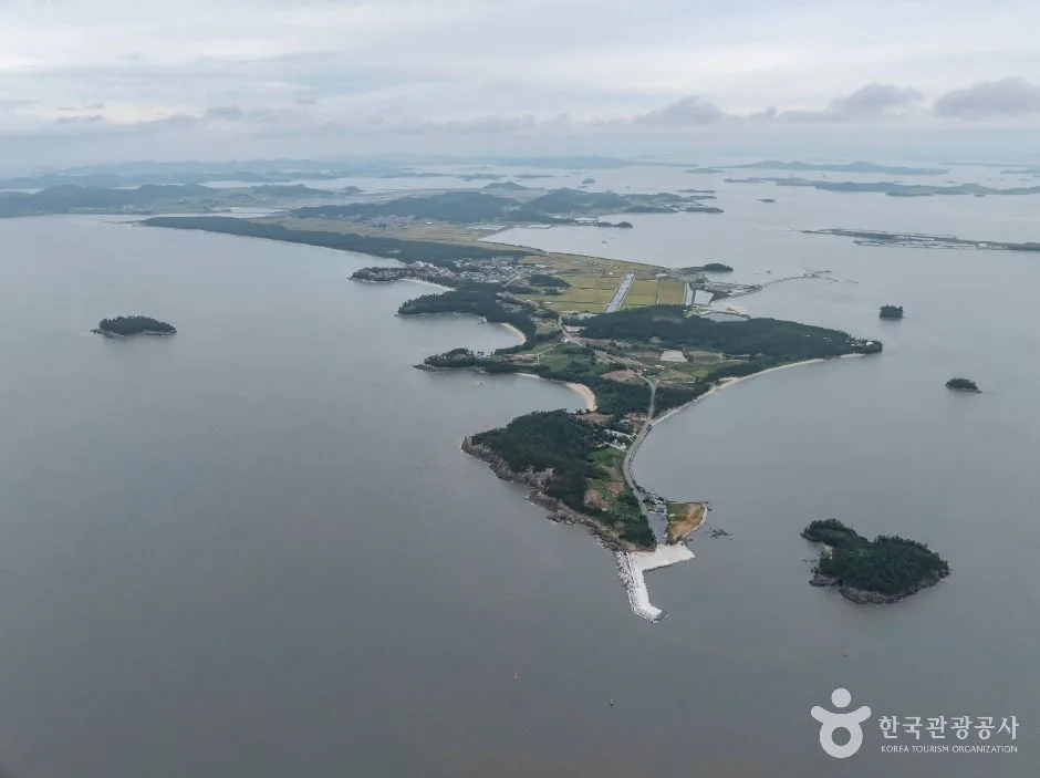 Photo: Korea Tourism Organization Tourism Photo Gallery (Munjungyeong-gil 188) · Kogl (Korea Open Government License)
The Sinan-gun Jeungdo Bicycle Path takes the island of Jeungdo, in Sinan-gun, Jeollanam-do, as its stage. Among Korea’s bike routes, it belongs to a category with a distinctly different character. Unlike the cross-country routes that follow rivers through the interior, this path threads between the sea, tidal flats, and vast salt fields. There’s almost nothing blocking your view, and the sea horizon stretches on and on, so the scenery doesn’t change much while you pedal — but what it lacks in variety, it more than makes up for in sheer intensity.
The grades are gentle overall. Being an island, there are stretches of short rolling ups and downs, but it’s fair to say there are essentially no long climbs. So it’s not your legs that determine the real difficulty of this route — it’s the wind, the sun, and your resupply plan.
Here are some concrete ways to make use of it.
First, as a leisurely day-ride course. The most natural itinerary is to set out in the morning, reach the turnaround point around lunchtime, and head back in the afternoon. Rather than chasing speed, stopping often at the salt fields, tidal flats, and beaches suits the character of this path.
Second, as your means of getting around on a one-night island trip. Jeungdo is a designated international Cittaslow (slow city), and the pace of a bicycle fits it far better than a car. Leave your luggage at your lodging and loop the island by bike alone, and you can satisfy both the sightseeing and the riding in one go.
Third, as a trip paired with a mini velo or folding bike (a Brompton, say). Carrying your folded bike on public transit to Sinan and unfolding it on-site works well here. The road surface is generally well maintained, so small wheels aren’t at much of a disadvantage.
Fourth, as a partial-ride course for families and beginner riders. You don’t have to complete the whole route — cutting it down to an out-and-back through just the salt field area or the beach section is plenty satisfying on its own.
Course Information
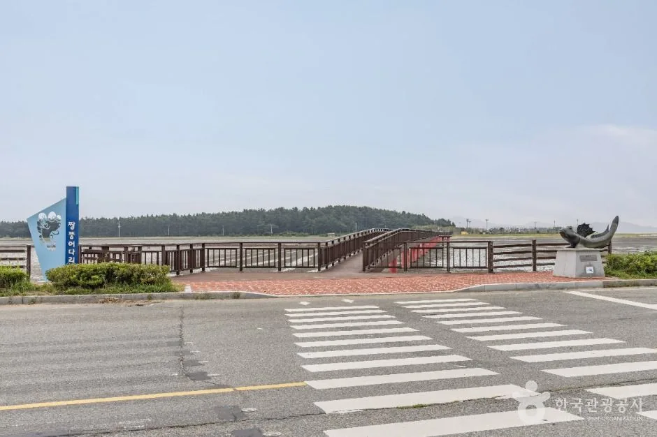 Photo: Korea Tourism Organization Photo Gallery (Daecho-ri) · KOGL (Korea Open Government License)
The route starts around the bridge that serves as the gateway to Jeungdo, cuts through the interior of the island, and then follows the coastline. Jeungdo is connected to the mainland via the Jeungdo Bridge and Saok Island, which means you can reach it without ever boarding a ferry — an island you can simply ride onto. For cyclists, that’s a huge plus.
The main waypoints include the Taepyeong Salt Farm area, the Salt Museum, the mudflats near Jjangttungeo Bridge, and Ujeon Beach with the coastal pine forest stretching behind it. Taepyeong Salt Farm is widely known as the largest single sea-salt farm in Korea, and the sight of its crystallization ponds spreading out endlessly in a grid pattern is the signature image of this route. Around Jjangttungeo Bridge, you can watch mudskippers and crabs scurrying across the flats at low tide.
The road surface changes character from section to section. This isn’t one of those routes with long stretches of dedicated bike path completely separated from cars, like the riverside trails — it’s safer to think of it as alternating between shared island roads and dedicated segments. Traffic is nothing compared to what you’d see in a city, but during peak tourist season the cars and tour buses do pick up, so don’t let your guard down.
The defining feature of the scenery is its openness. With few windbreak forests or buildings, you take the wind head-on. With a tailwind, you pick up speed without trying; with a headwind, even flat ground feels like a climb. If you’re riding out and back, it’s worth factoring in ahead of time that the perceived difficulty can differ dramatically between the two legs.
This route isn’t part of the national cross-country bike path certification system, so there are no certification centers along the way. It’s best understood as a path for enjoying the scenery and local culture rather than for the fun of collecting stamps.
Local Eats
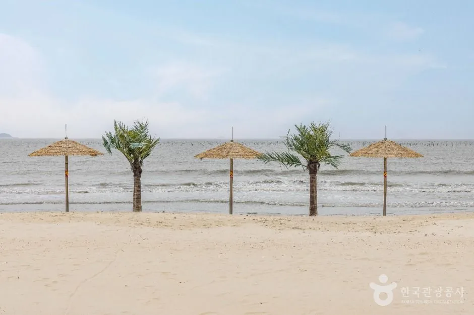 Photo: Korea Tourism Organization photo gallery (Munjungyeong-gil 459-2) · KOGL (Korea Open Government License)
Shinan County is a place where life revolves around the sea and the tidal flats, and the food reflects that completely. Rather than pointing you toward specific restaurants, I’ll cover the foods this region is generally known for.
The headliner is cheonilyeom (sun-dried sea salt) and everything made from it. The salt itself is a local specialty, and you’ll commonly find products made with hamcho (Salicornia, a salt-marsh plant) as well as jeotgal (salted fermented seafood) cured with salt from the local salt farms.
For seafood, nakji (octopus) dishes are the big name here. Octopus caught in the tidal flats typically shows up as yeonpo-tang (a clear octopus soup), stir-fried, or as a raw seasoned salad. Beyond that, southwest-coast fish like croaker, pomfret, and sea bass appear on tables depending on the season, and if you look at Shinan County as a whole, Heuksando hongeo (fermented skate) is considered the signature specialty. Hongeo has an intensely pungent fermented aroma that can be a real challenge for foreign visitors, so if it’s your first time, I’d suggest starting with a small taste.
When it comes to resupply, you absolutely need to plan ahead. This isn’t an urban route, so convenience stores aren’t dotted along it at regular intervals. On the open stretches between the salt farms and the coast, you can end up riding considerable distances with no shops or vending machines at all. Local restaurants also keep shorter hours than city ones, and some close entirely in the off-season or on weekdays. So stock up on water and ride food before you set out, and plan your meal stop for the middle of the course in advance. The “something will turn up along the way” approach — better to assume it just doesn’t work on this route.
Supplies & Facilities
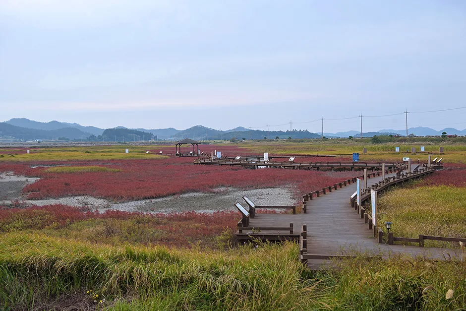 Photo: Korea Tourism Organization photo gallery (Jido-Jeungdo-ro 1053-11) · Kogl (Korea Open Government License)
According to the bike route database maintained by the Ministry of the Interior and Safety of Korea, this route’s facility count reads: certification centers, 0. Restrooms, 0. Water stations, 0. Air pumps, 0. In other words, this is a course with no dedicated cycling amenities managed as part of the route information.
So here’s how to actually deal with that.
Water: bring all of it yourself. With no water stations along the route, you’re better off starting out with two full bottles or a hydration pack. The salt flat areas offer almost no shade, and you’ll burn through fluids fast.
Restrooms: none are registered as route facilities. That said, major tourist spots and public parking lots generally have public restrooms nearby, so the smart move is to use them preemptively whenever you arrive at a sightseeing stop.
Air pumps: none registered either, so a portable pump or CO₂ cartridges plus a spare tube are non-negotiable. On the islands, finding a bike repair shop on short notice is tough — plan on handling any flat entirely on your own.
As for the certification program: this route isn’t part of Korea’s national cross-country certification system, so there are no stamp booths along the course for your certification passport. If collecting certification stickers is the point of your ride, know in advance that this course won’t count. The upside is that the local tourist attractions themselves make perfectly good destinations in their own right.
Getting Back
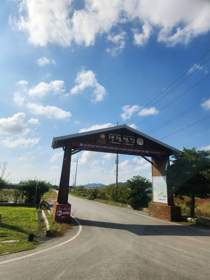 Photo: Korea Tourism Organization photo gallery (Jeungdong-ri) · KOGL (Korea Open Government License)
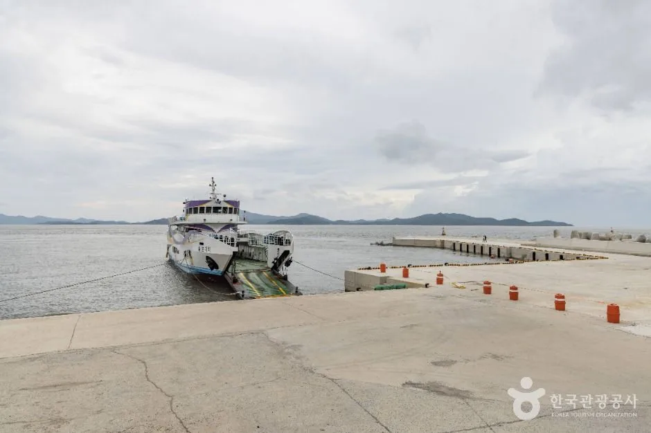
It’s a one-way route, but getting back isn’t much of a burden. At 37.8km each way, simply riding back the way you came puts you at 75.6km round trip — a distance you can comfortably knock out in a day. There’s no need to arrange any long-haul transportation for the return; if you’ve left your car or booked a room at the starting point, riding back is the simplest and most reliable option.
That said, if you’re planning on the round trip, be sure to check your energy level and how much water you have left at the turnaround point. If you had a tailwind on the way out, odds are you’ll be fighting a headwind on the way back, so it’s wise to budget extra time for the return leg. And if you’re running on empty, there’s no shame in the flexible call of turning around early instead of pushing all the way to the halfway mark — that’s a perfectly good choice too.
Safety and Cautions
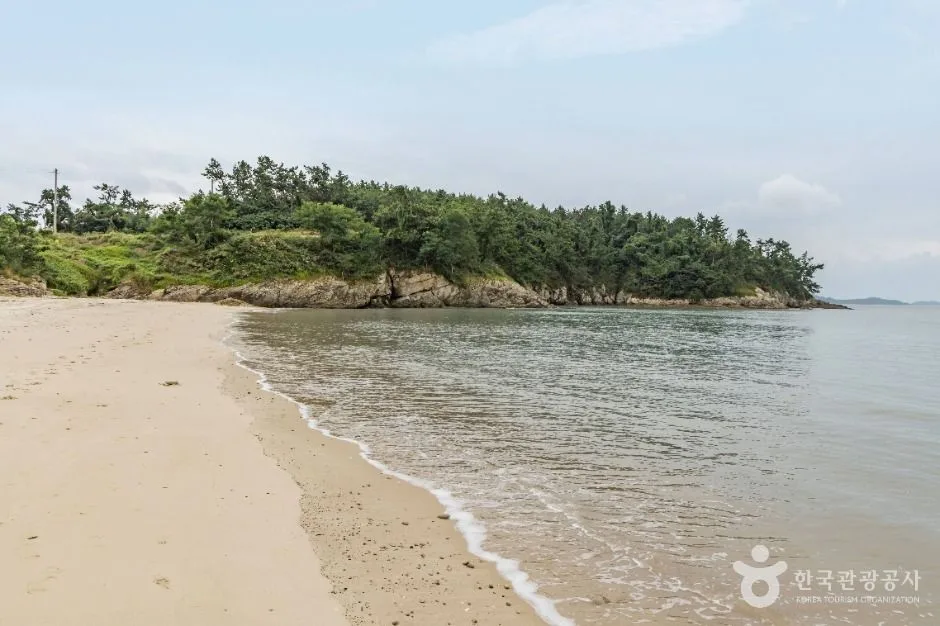 Photo: Korea Tourism Organization photo gallery (San 37-6, Ujeon-ri) · KOGL (Korea Open Government License)
There are shared-road sections along this route, so ride with the assumption that you’ll be sharing the pavement with cars. Keep to the right, and stay alert for the sound of vehicles approaching from behind. I wouldn’t recommend wearing earbuds in both ears.
Slow down in sections where pedestrians mix in. Around tourist spots, beach promenades, and bridges, visitors who aren’t expecting bicycles can suddenly step into your path. Getting into the habit of announcing yourself early — with a bell or your voice — goes a long way toward preventing accidents.
Wind is the most realistic hazard on this route. On the open salt flats and coastal stretches, a crosswind can push your bike sideways. It helps to keep a light grip on the handlebars and lower your upper body to keep the tires planted.
Ice is the thing to watch in winter. Coastal areas are humid, so thin ice can linger on shaded pavement and on bridge decks. The rule in these sections is simple: no sudden braking, no sudden steering.
Night riding calls for extra caution. Roads on the islands have few streetlights, so it gets dark fast once the sun goes down. Make sure you have a front light and a rear blinker, and if possible, plan your schedule so you’re done riding before sunset.
Hydration and dehydration deserve repeating. The glare off the salt flats and the total lack of shade drive up how hot it feels considerably. Don’t wait until you’re thirsty — sip small amounts every 20 to 30 minutes instead.
Season, Weather, and Gear
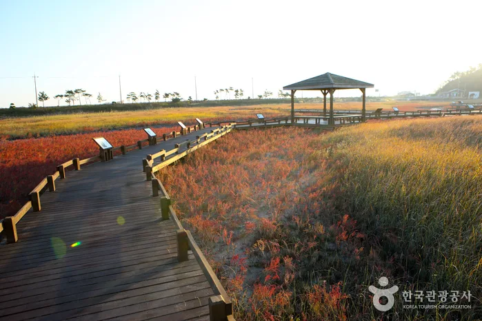 Photo: Korea Tourism Organization Photo Gallery · KOGL (Korea Open Government License)
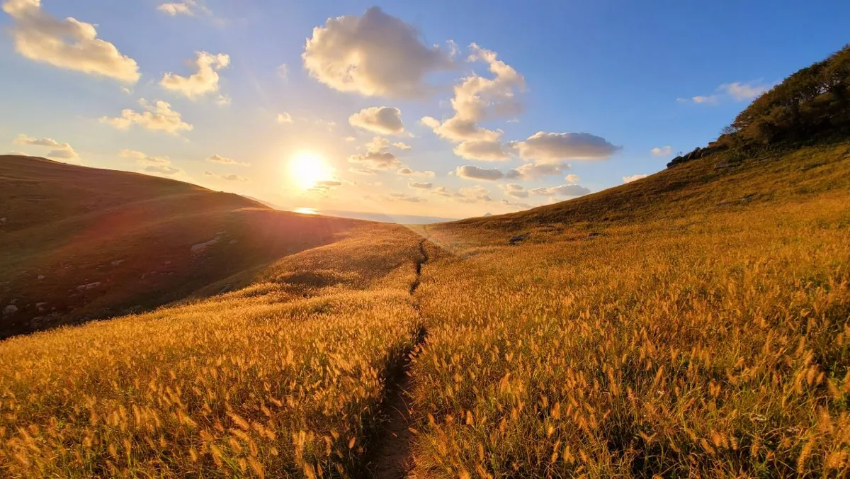
The best time to go, hands down, is spring (April–May) or fall (September–October). Mild temperatures and low humidity make long-distance riding much more pleasant, and it’s also when the colors of the salt fields and tidal flats look their most vivid.
Summer cranks the difficulty way up. You’re riding exposed stretches with almost no shade, taking direct sun the whole way, and the heat load is no joke. If you’re going to ride during this season, I strongly recommend starting early in the morning. During monsoon season and typhoon season, you get strong winds and poor visibility at the same time — that’s when the smart call is to reschedule the trip entirely.
Winter is less about the temperature and more about the sea wind. If you pick your layers based on the thermometer alone, you’ll badly miscalculate how cold it actually feels. A windproof jacket, a neck warmer, and windproof gloves are well worth having.
Here’s the essential gear:
| Gear | Notes |
|---|---|
| Helmet | Essential; wearing one is legally recommended |
| Front and rear lights | Essential at night or on overcast days |
| Flat repair kit | Spare tube, tire levers, portable pump |
| Water | No refill stations along the way — bring at least 2 bottles |
| Snacks | For stretches with no resupply points |
| Sunscreen and sunglasses | For the glare off the salt fields |
| Windproof jacket | For coastal winds, all seasons |
| Phone power bank | Map apps drain the battery fast |
Tips for International Travelers
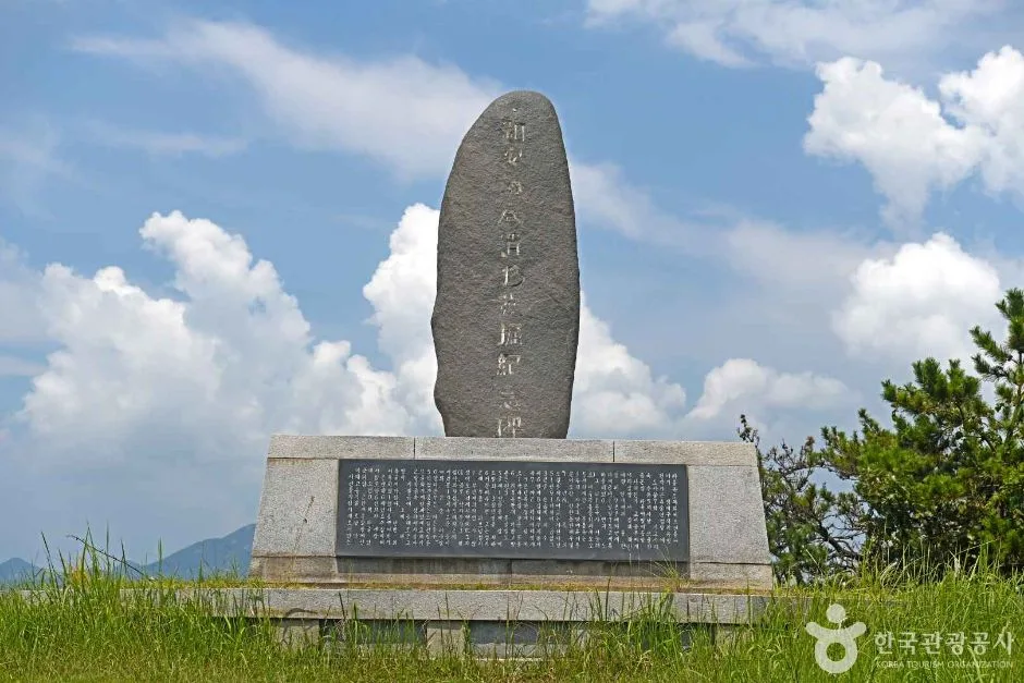 Photo: Korea Tourism Organization Photo Gallery (San 318-1, Bangchuk-ri) · KOGL (Korea Open Government License)
① The Route Name in Roman Letters The official name is the Sinan-gun (Jeungdo) Bicycle Path — Sinan-gun (Jeungdo) Bicycle Path in romanized form. Sinan-gun is the county, and Jeungdo is the island. If you need to ask for directions locally, saying “Jeungdo jajeongeo-gil” (Jeungdo bike path) will usually get the point across. Key landmarks along the way are Taepyeong Salt Farm, Ujeon Beach, and Jeungdo Bridge.
② The Certification System, in Practice — This Route Isn’t Part of It First thing you should know: this route is not part of Korea’s Cross-Country Cycling Certification program. That means no certification stamps for riding this course, and no certification centers anywhere along it.
That said, understanding how the certification system works is genuinely useful if you plan to extend your trip to other routes, so here’s how it generally operates.
- Bike Passport: This is the basic tool for cross-country certification. Your safest bet is buying one in person at a staffed certification center. The official website is essentially Korean-only, and between the foreign-card payment issues and the Korean identity verification requirements (a Korean phone number or ID), buying one from abroad ahead of time is usually a non-starter. Plan on picking one up at a staffed center on a certification route after you arrive in Korea.
- How unmanned certification centers work: The unmanned centers are red stamp booths shaped like old phone boxes, easy to spot from a distance. Inside, the stamp is chained in place — just open your passport to the right page and press the stamp down, no ink needed. There’s no staff and no payment involved, and they’re available 24 hours a day.
- Completion rewards: Finish a section and you get a certification sticker in your passport; complete all sections, or one of the designated cross-country courses, and you can receive a completion certificate and medal. Again, this only applies to routes in the certification program — keep it mentally separate from the Jeungdo course.
③ If You’re Coming Without a Bike Here are your options if you’re not bringing your own bike.
- Local rentals: Jeungdo is a tourism-oriented island, so accommodations and tourist information facilities commonly offer bike rentals. That said, the number of bikes and their condition may not be as consistent as what you’d find in a city, so I’d recommend checking with your accommodation before you visit — availability, sizes (adult vs. children’s bikes), and whether helmets are included. Rental shops on islands can vary a lot between peak and off-season.
- Ttareungi (Seoul Bike): Seoul’s public bike-share service. It has an English-language app and accepts foreign-issued cards, which makes it easy for international travelers to use. But it’s Seoul-only — you can’t use it on Jeungdo. It works well as a warm-up ride in Seoul before heading out to routes in the countryside.
④ Map Apps In Korea, Google Maps is unreliable for bike directions and often fails to reflect dedicated bike paths. Use these instead:
- KakaoMap: Has a cycling mode with detailed bike-path mapping. Supports English labels.
- Naver Map: Offers bike route navigation and a multilingual interface (English, Japanese, Chinese).
It’s worth installing both apps and setting up accounts before your trip. Also, data signal can be spotty in some stretches on the islands, so pre-loading or screenshotting maps of the area before you set out is a practical precaution. For emergencies, remember 119 (emergency and rescue), and save 1330 — the Korea Tourism Organization’s travel helpline, which offers assistance in English and other languages. It’s a handy number to have.
Other Bike Paths Nearby
- Shinan Jaeun–Imjado Bike Path, 81km One Way — about 14km away as the crow flies
- Yeongsangang Bike Path: Course, Distance, and 7 Certification Centers — about 50km away as the crow flies
- Goheung Geogeumdo–Sorokdo Bike Path: Course and Distance — about 106km away as the crow flies
📍 Sinan Jeungdo Island Bike Path: Course, Distance & Certification CentersLocation
Contact: bumseok.view [at] gmail [dot] com
Comments