Goheung Geogeumdo–Sorokdo Bike Route: Course and Distance
Cycling · Published 8/8/2026 ·
자전거길 트랙·시설 (공공데이터: 행정안전부 국토종주 자전거길 DB) · 🏆인증센터 💧급수대 🚻화장실 🔧공기주입기 · 지도 © OpenStreetMap ⤓ GPX 다운로드
At a Glance
| Metric | Rating |
|---|---|
| Course difficulty | ★★★☆☆ |
| Supplies & amenities (certification centers, water stations) | ★☆☆☆☆ |
| Certification centers | ☆☆☆☆☆ (none) |
| Seasonal difficulty — Spring | ★★☆☆☆ |
| Seasonal difficulty — Summer | ★★★★☆ |
| Seasonal difficulty — Autumn | ★★☆☆☆ |
| Seasonal difficulty — Winter | ★★★☆☆ |
※ Source: Cross-Country Bike Path database, Ministry of the Interior and Safety of Korea · seasonal ratings are rough guides
Overview
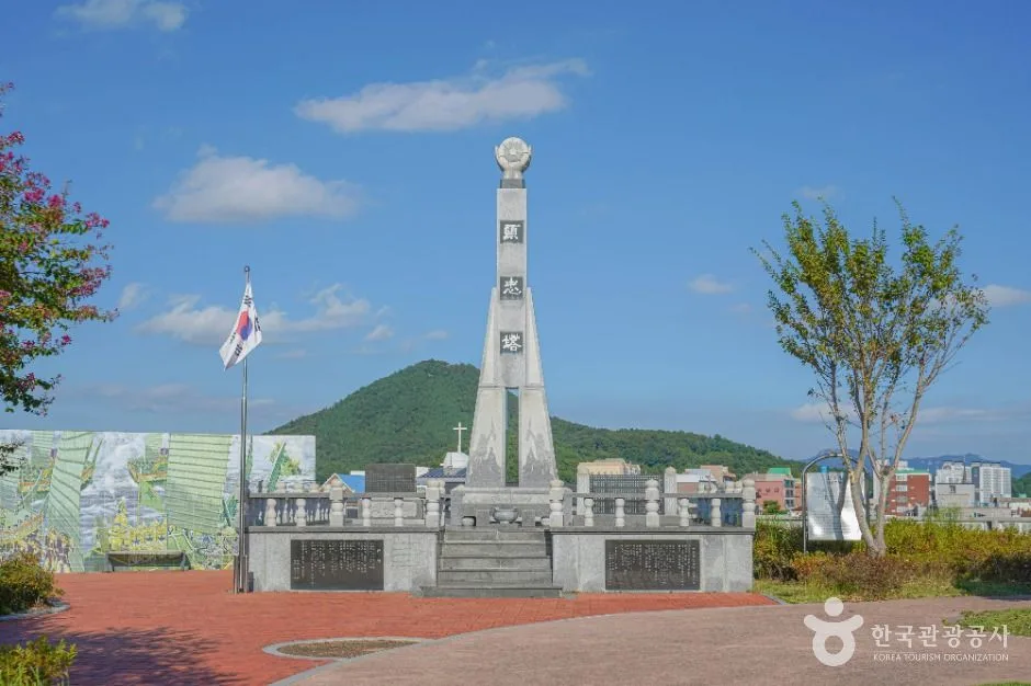 Photo: Korea Tourism Organization photo gallery (Mongneomga-neun-gil 34) · KOGL
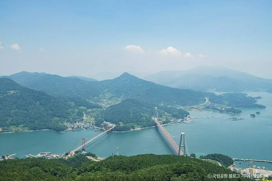
The Goheung-gun Geogeumdo–Sorokdo Bike Route sits at the southern tip of the Goheung Peninsula in Jeollanam-do, hopping from island to island across a string of bridges. It’s a coastal ride, and it feels nothing like the flat riverside paths of the Four Rivers routes. What makes this one special is the bridges themselves — you’re riding out over open water — and the short, repetitive ups and downs that show up every time the road heads inland on an island. Wherever the view opens up, the islands of Dadohae, big and small, keep drifting along in the background.
Here are the main ways to approach it.
① A one-day coastal ride. Leave in the morning, wrap up in the afternoon — this is the easiest way to do it. Just remember it’s a point-to-point route, so sort out how you’re getting back before you set off.
② An out-and-back all-dayer. Riding it in both directions puts you at roughly 98km. For riders with the legs for it, this is the simplest option going, since you never have to think about return transport. That said, all those rollers hit a lot harder on the way back, so pack plenty of water and snacks.
③ Brompton or mini-velo plus public transit. No railway runs through Goheung. Folding your bike into a bag, taking an intercity bus or a train to a nearby city, then unfolding it once you arrive — that approach suits this route particularly well.
④ One leg of a two-day South Coast trip. If you’re spending two days working your way around the Goheung Peninsula, this route makes a good centerpiece for either day one or day two.
⑤ For families and beginners, just do a section. Riding the whole thing is a lot to ask of a beginner. Better to pick one of the flat, scenic stretches near the bridges and ride it out and back.
Course Details
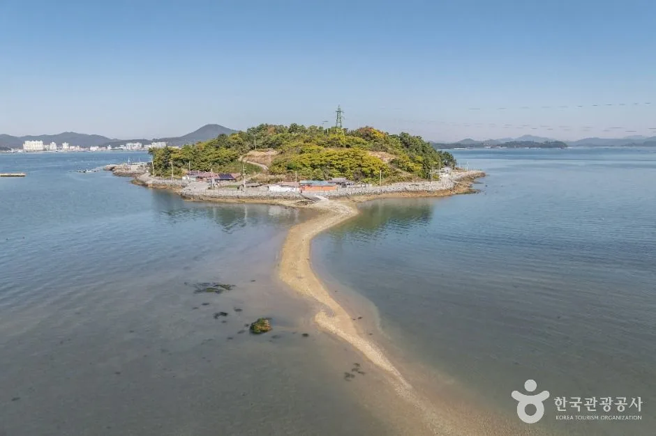 Photo: Korea Tourism Organization photo gallery (Sanghwadogil) · KOGL
This is a one-way route that starts on Geogeumdo and heads toward Sorokdo. You can ride it in reverse without any trouble, but I’d suggest finishing on the mainland side (toward Doyang-eup and Nokdong), simply because there are more options for getting home from there. It makes the planning easier.
The basic flow is: Geogeumdo coastal road → Geogeum Bridge → Sorokdo → Sorok Bridge → Nokdong Port and the Doyang-eup area. On Geogeumdo itself, you alternate between roads that hug the coast and roads that link the villages together, passing fishing hamlets, rice paddies and fields, breakwaters, and small harbors one after another. Jeokdaebong rises up in the middle of the island, so no matter which direction you’re riding, there’s a mountain silhouette in the background.
The two bridges are the highlight of this course. Up on the deck, the sea opens up completely on both sides, and on a clear day you can see the islands of the Dadohae stacked up in layers. The trade-off is that there’s absolutely nothing out over the water to block the wind, so the crosswinds hit hard. Keep a light grip on the bars, stay loose, and give yourself room to get pushed sideways as you cross.
This isn’t a riverside bike path fully separated from cars. Long stretches run alongside or share space with ordinary provincial and county roads, and on the bridges there are sections where you share space with pedestrians. The pavement is generally in good shape, but on the roads through the villages you can run into potholes, sand, fallen leaves, and fishing gear — nets and ropes.
The climbing here is the “short and frequent” kind. It’s not one long pass you grind over; it’s a steady up-and-down over the hills you meet as you follow the coastline. Shift often, and don’t push too hard early on — your later-half pace will thank you.
This route isn’t part of the national cross-country cycling certification program. So there are no stamp checkpoints along the way, which means you can stop and rest wherever you like, or detour off course as you please.
Food Around the Course
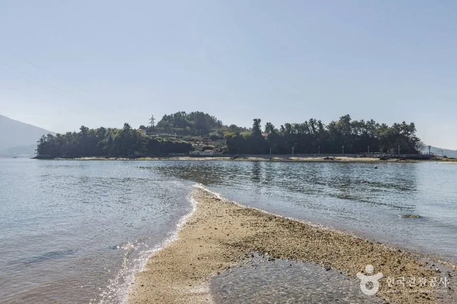 Photo: Korea Tourism Organization tourism photo gallery (Hahwado-gil) · KOGL
Goheung has both fishing villages and farmland along the South Sea coast, so it’s known for seafood and produce alike.
The best-known local specialties are yuja (citron) and pomegranate. Yuja tea made from candied citron, along with citron sweets and drinks, are the products Goheung is famous for. Grabbing a citron drink mid-ride doubles as a sugar top-up, which isn’t a bad move at all.
On the seafood side, gaetjangeo (sharp-toothed eel, also called hamo) usually gets billed as the summer delicacy, and the standard way to eat it is lightly blanched. Beyond that there are seasonal things like clams, oysters, maesaengi seaweed, and gim (laver), and since Nokdong Port is a working harbor, most of the places clustered there deal in sashimi and fish dishes. What’s available shifts with the season and the day’s catch, so rather than setting your heart on one particular dish, you’re better off going in with the attitude that you’ll eat whatever came in that day.
A warning about resupply. This is the thing to worry about most on this course. The coastal roads on the island side and the stretches before and after the connecting bridges have essentially no convenience stores or shops — long unsupported sections. According to the facility listings, there are 0 certification centers, 0 water stations, 0 restrooms, and 0 air pumps, so the course itself offers nothing in the way of rider amenities.
Shops are clustered pretty much only around Doyang-eup and Nokdong Port on the mainland side, plus the township centers on the island. Whenever you pass one of those points, fill your bottles and buy food, no exceptions. “There’ll be another one up ahead” is not a bet that pays off here. Small rural shops also tend to close early and keep irregular hours, so I wouldn’t recommend a late-afternoon start.
Supplies and Facilities
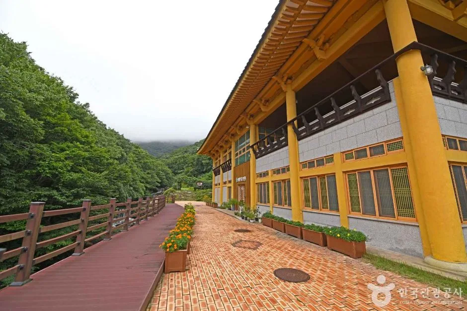 Photo: Korea Tourism Organization photo gallery (Geogeum Loop Road 1877) · KOGL
Here’s what’s available along the route.
| Facility | Count |
|---|---|
| Certification centers | 0 |
| Restrooms | 0 |
| Water stations | 0 |
| Air pumps | 0 |
In other words, this is a route where you can’t count on dedicated cycling-path amenities at all. Three strategies for dealing with that.
① Carry your own water. Two bottles as a baseline, plus another 500ml to 1L in a backpack or saddle bag during the hot months. Your refill spots won’t be water stations on the route — they’ll be village shops, facilities around the harbors, and tourist information centers.
② Use every restroom you pass. Get in the habit of stopping at public restrooms near harbors, beaches, village halls, and township centers whenever you go by one, whether you think you need to or not.
③ Repairs are entirely on you. With no air pumps anywhere, you’ll want a hand pump or CO2 cartridges, two spare tubes, tire levers, a multi-tool, and a chain link. Assume that if you flat out on the island section, there’s no bike shop nearby to bail you out.
A note on the certification passport. This route isn’t part of the certification program, so there are no stamp points to collect. Even if you’re carrying a Cross-Country Certification passport, there’s nowhere to use it on this course.
The Ride Home
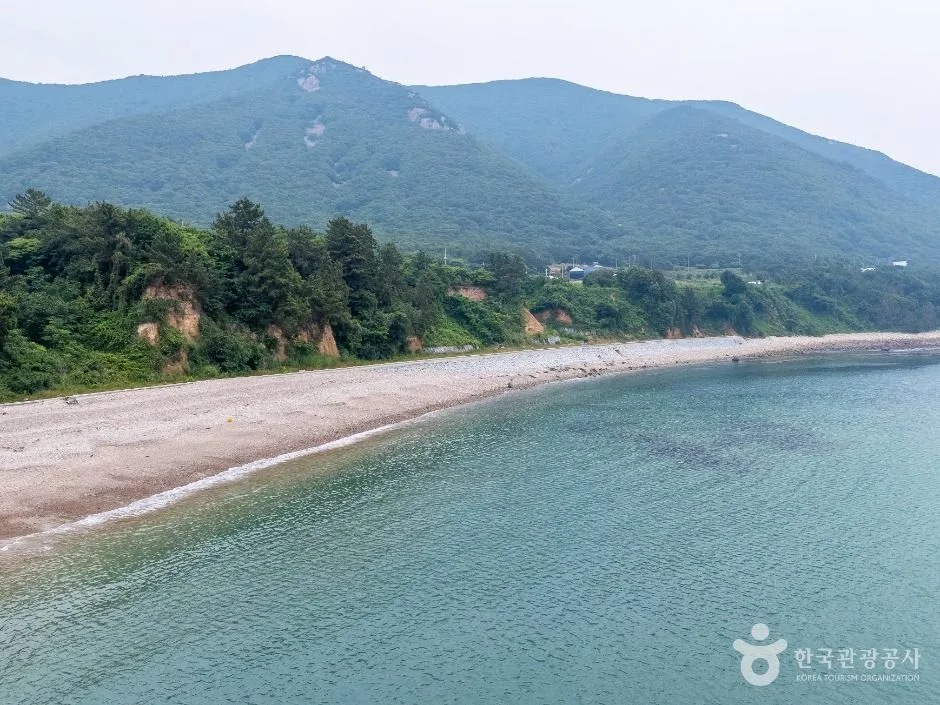 Photo: Korea Tourism Organization photo gallery (Eojeon-ri) · KOGL
This is a one-way route, so how you get back is what makes or breaks the day. Riding it out and back puts you at roughly 98km, so weigh your fitness, the time of sunset, and the weather, then pick one of the options below.
① Turn around and ride back. The surest bet. You’re not tied to anyone’s timetable, and there’s something to be said for seeing the same scenery from the opposite direction. The catch is that this course rolls up and down constantly, which makes the return leg feel longer than it is. If you’re planning the out-and-back, set a hard cutoff time for reaching the turnaround point — and if you blow past it, switch to another option, no debating.
② Take the train — except Goheung has no railway station. That’s the first thing to know. Your nearest rail access points are stations in neighboring cities and counties: Suncheon, Yeosu-EXPO, or Beolgyo on the Gyeongjeon Line. So it becomes a two-step affair: finish the ride, bus to a nearby city, then board the train.
Here’s the general picture on bringing a bike aboard. On regular trains like the Mugunghwa-ho and ITX, a folding bike that’s been folded and bagged is treated as luggage and can usually come along, and some trains and lines do have designated bike racks. On the KTX, the basic rule is that your bike must be folded and inside a dedicated bag to count as luggage — a non-folding bike can’t be loaded as is. Rules and how they’re applied change with the type of train and the season, so check Korail’s guidance before you set out and call ahead if you can. Practically speaking, packing a single bike bag opens up a lot of doors.
③ Take the bus. Goheung’s intercity and express bus hubs are Nokdong Bus Terminal and Goheung Intercity Bus Terminal. That said, loading a bike into an intercity bus’s cargo bay is at the driver’s discretion and can be refused depending on how full the seats and hold are. With a folding bike, folded and bagged gives you a much better shot; with a regular bike, take the front wheel off to cut the bulk and ask ahead. Rural and county buses are small enough that fitting a bike is often out of the question.
④ Taxi. In a small region, this is your most realistic backup. There isn’t always a vehicle standing by that can take a bike, so save the local call-taxi number before you start riding. A standard sedan taxi can’t really handle a bike, and more often than not you’ll be negotiating to pull the front wheel and put it in the trunk.
⑤ Your own car plus a one-way run. If there are two or more of you, the most efficient approach is to leave a car at the finish, drive to the start, and ride it one-way.
Where bus stop locations are available, marking the stops along the route as emergency bail-out points is worth doing. But don’t let the mere existence of a stop put you at ease — rural bus lines can run very infrequently.
Safety Notes
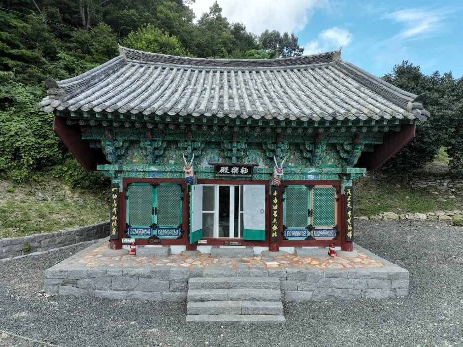 Photo: Korea Tourism Organization photo gallery (266 Geumsan Jungchon-gil) · KOGL
Shared roads and mixed traffic. Parts of this route aren’t fully separated from cars. Around the harbor and on village roads especially, trucks, farm machinery, and fishing vehicles pull out without warning. A rear-view mirror, or the habit of checking over your shoulder often, genuinely helps here.
Pedestrian sections. On the bridges to the islands and around the tourist spots, you’re sharing space with people on foot. Slow right down, give a warning with your bell or your voice, and pass with plenty of room.
Crosswinds. Side gusts on the bridges and the exposed coastal stretches are the most real hazard on this route. On windy days, drop your speed crossing the bridges — and leave the deep-section wheels at home.
Tunnel and bridge entrances. Your eyes need a moment to adjust when you ride into a dark section. Keep your rear light on even in daylight.
Ice and fallen leaves. In winter, frost and ice linger on the shaded curves of coastal roads, and the bridges freeze first of all. In autumn, wet leaves make the corners slick.
Riding after dark. Rural coastal roads have few streetlights, so it gets dark fast once the sun drops. Front and rear lights aren’t optional here, and wear something with reflective material. As a rule, it’s worth planning to be off the bike an hour before sunset.
Water and dehydration. There are no water fountains on this route, so drink before you feel thirsty. In summer, bring electrolyte tablets or a sports drink as well — and if you get a headache, chills, or a cold sweat, get into the shade immediately and stop riding.
Phone signal. Coverage can get patchy on the island sections and parts of the coast. Save the route and maps offline.
Season, Weather, and Gear
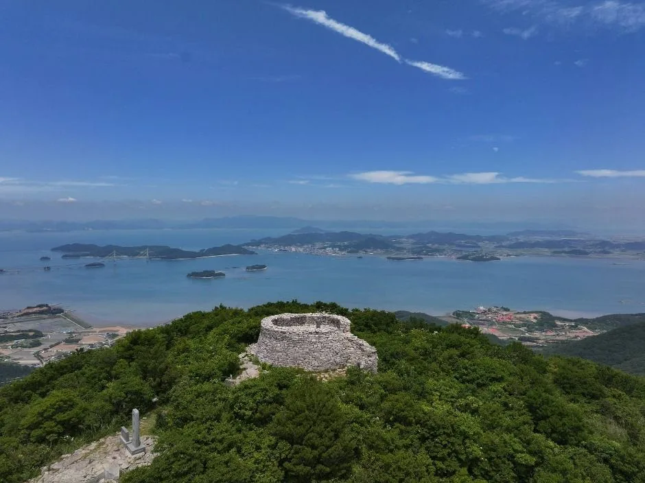 Photo: Korea Tourism Organization photo gallery (Seokjeong-ri) · KOGL
The best seasons are spring (April–May) and autumn (October–November). The temperatures are just right and the air is clear, which is when you’ll get the best views of the Dadohae archipelago.
Summer is the toughest season on this course. Much of it runs along exposed coastline with almost no shade, and you’re dealing with the south coast’s high humidity plus strong sun. There are no water stops either, so an early start and plenty of water are essential. During the monsoon season and typhoon season, high winds can close the bridges, so check the forecast.
Winter is relatively mild in terms of actual temperature — this is the south coast, after all — but sea winds, the drop in wind chill, ice on the bridges, and short daylight hours are all issues. Plan around shorter segments.
Essential gear checklist
| Category | Items |
|---|---|
| Safety | Helmet, front light, rear light, gloves, sunglasses |
| Repair | 2 spare tubes, hand pump or CO2, tire levers, multi-tool, chain link |
| Food & water | 2+ water bottles, ride food (energy bars, bananas, etc.), electrolyte supplements |
| Clothing | Windbreaker (for crosswinds and sea breeze), seasonal layers, summer sun protection |
| Other | Power bank, offline maps, ID, a little cash (for small shops that don’t take cards) |
I’d recommend packing a windbreaker no matter the season. Wind chill along the coast and out on the bridges is a different world from inland.
Tips for Foreign Travelers
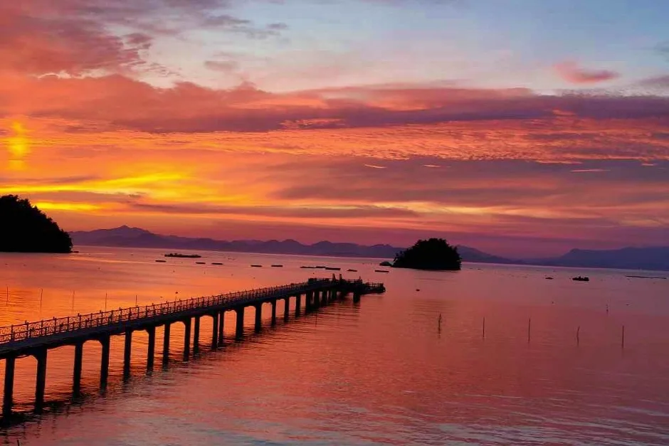 Photo: Korea Tourism Organization photo gallery (18-132 Sinchonnae-dong-gil) · KOGL
① Route name in Roman letters
- Route: Goheung-gun (Geogeumdo–Sorokdo) Bike Route
- Region: Goheung-gun, Jeollanam-do
- Key points: Geogeumdo, Geogeum Bridge, Sorokdo, Sorok Bridge, Nokdong Port, Doyang-eup
- Nearby cities: Suncheon, Yeosu, Gwangju
② A practical guide to the certification system — this route isn’t part of it
The first thing to be clear about: this route is not covered by the Korea Cross-Country Cycling Certification program. There are zero certification centers, so there’s nowhere to collect a stamp, and riding this course won’t count toward any certification totals. Approach it purely as a ride for the scenery.
If you’re curious about Korea’s certification system in general, here’s how it usually works.
- The bike passport is most reliably bought in person at a staffed certification center. The official online channel is Korean-only, and overseas-issued cards or Korea’s identity-verification requirements (local mobile number, ID) make buying one in advance from abroad genuinely difficult. Picking one up on your first day at an easy-to-reach staffed center — along the Han River, say — is the practical move.
- Unstaffed certification centers are the little red booths by the roadside that look like phone boxes. Open the door and you’ll find a stamp and an ink pad inside. You stamp the right box in your passport yourself; it’s free and available 24 hours. Some booths hold several different stamps, so check the place name and make sure you’re stamping the correct box.
- When you complete a section, a certification sticker goes into your passport, and finishing all the designated sections earns you a completion certificate and a medal. A missed stamp is very hard to make up for afterward, so on certified routes the rule is simple: stamp as you go, at every center you pass.
③ If you’re arriving without a bike
Goheung is a small rural county, so don’t expect much in the way of large-scale bike rental infrastructure. Your realistic options:
- Ask at the tourist information center or local facilities. Local tourist offices or your accommodation can sometimes point you to a bike you can rent. Worth calling ahead before you go.
- Rent in a nearby city and bring it in. Rent from a bike shop in a bigger city like Suncheon, Yeosu, or Gwangju and travel out from there. Just be sure to check the return-location conditions.
- Ttareungi (Seoul Bike) is Seoul-only. It has an English app and generally accepts overseas-issued cards, which makes it wonderfully convenient for riding in Seoul — but you can’t use it in Goheung, and you can’t take one outside the city. Think of it as your warm-up in Seoul, with regional rides planned separately.
- A folding bike is your best bet. On a one-way course like this that needs public transport at either end, a folding bike plus a carry bag is overwhelmingly the easiest setup.
④ Map apps
Google Maps’ cycling directions aren’t reliable in Korea. Bike mode works only in limited areas, and bike path data often just isn’t there. Use these instead:
- KakaoMap — has a cycling mode and an English interface. Its in-Korea routing accuracy is the most usable of the bunch.
- Naver Map — strong on cycling routes and public transport info, with English, Japanese, and Chinese support. Especially handy for checking bus timetables.
- Komoot / Ride with GPS / Strava — build your GPX file ahead of time and load it onto a cycling computer or your phone. On island stretches with weak signal, this is by far the most dependable approach.
⑤ Other practical notes
- Small rural shops are sometimes cash-only, so carry a bit of cash.
- Convenience stores (CU, GS25, 7-Eleven) are your most reliable stop for water, drinks, a quick meal, and a restroom. They’re everywhere in cities, but keep in mind they’re scarce along this course.
- Emergencies: 119 (rescue and ambulance), 112 (police). For tourist interpretation help, call 1330 — available in English, Japanese, Chinese, and other languages.
- Riding a bike under the influence is illegal in Korea, and the rule on bike paths is to keep right.
Other bike paths nearby
- Yeongsangang Bike Path: route, distance, and all 7 certification centers — about 74 km as the crow flies
- Seomjingang Bike Path: 154 km route and 8 certification centers — about 90 km as the crow flies
- Shinan Jaeundo–Imjado Bike Path: 81 km one way — about 104 km as the crow flies
📍 Goheung Geogeumdo–Sorokdo Bike Route: Course and DistanceLocation
Contact: bumseok.view [at] gmail [dot] com
Comments