Where the Dirt Trail Meets Rocky Ridges: Baekdeoksan in Gangwon
Hiking · Published 8/11/2026 ·
등산로 트랙·시설 (공공데이터: 전국등산로 공간정보) · 🚩시종점 💧음수대 👁️조망점 🏠대피소 🅿️주차장 ⚠️위험 · 지도 © OpenStreetMap ⤓ GPX 다운로드
At a Glance
| Metric | Rating |
|---|---|
| Accessibility (public transit/parking) | ★☆☆☆☆ |
| Trail difficulty | ★★☆☆☆ |
| Water/springs on the mountain | ★☆☆☆☆ |
| Overnight stay needed | ★☆☆☆☆ (a day trip is plenty) |
| Seasonal difficulty – Spring | ★★☆☆☆ |
| Seasonal difficulty – Summer | ★★★☆☆ |
| Seasonal difficulty – Fall | ★★☆☆☆ |
| Seasonal difficulty – Winter | ★★★★☆ |
※ Source: Korea Forest Service trail spatial data · accessibility and seasonal ratings are for reference only
Overview
Baekdeoksan sits right on the border between Suju-myeon in Yeongwol County and Bangnim-myeon in Pyeongchang County, Gangwon Province. Depending on which geographic dataset you check, its summit elevation is listed anywhere from 1,327m to 1,345m — a small discrepancy — though trail surveys put the highest point you actually reach on foot at 1,364m. It’s connected by ridgeline to neighboring Sajasan (1,183m), and the traverse linking the two peaks is a well-known route among hikers. The mountain is mostly soil-covered — a “flesh mountain” in Korean hiking parlance — but rocky sections start mixing in near the top, so the back half of any climb tends to feel noticeably tougher than the start. The registered trail network in the area totals 16.42km (combining several sections), which isn’t especially long, and the main routes run 4–11km one way — easily doable as a day hike. That said, the routes to the summit gain 700–860m in elevation, so this is a mountain that demands more out of your legs than its distance would suggest.
Terrain and Rock Features
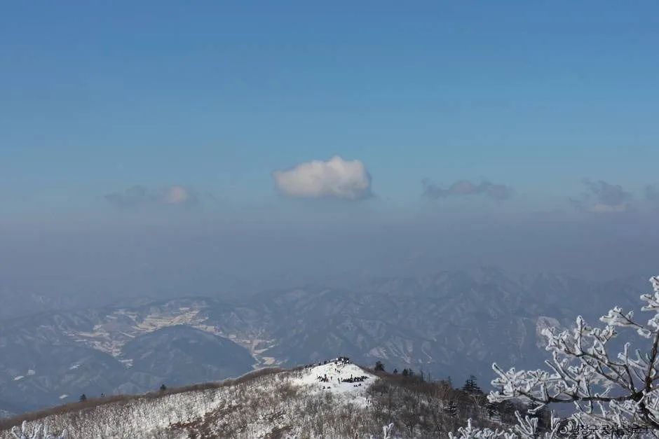
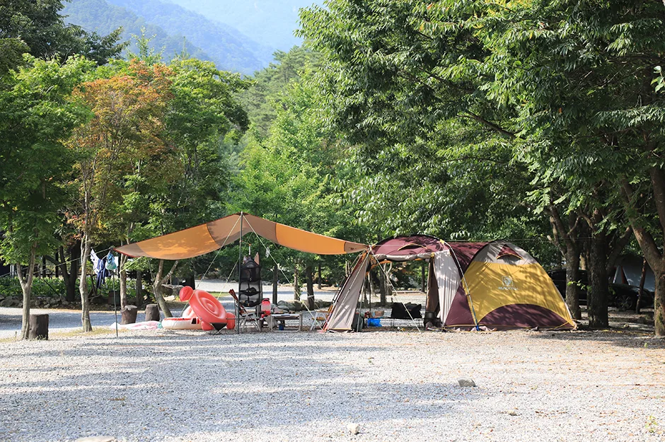 Photo: Korea Tourism Organization photo gallery (142 Baengnyeongyegok-gil, Muryeongdowon-myeon, Yeongwol-gun, Gangwon State) · KOGL Type 1
Baekdeoksan is a good example of what mountain ridges in the Yeongseo region of Gangwon look like — mostly soft, soil-covered slopes, but with rock ridges and boulder fields mixed in just before the summit. According to peak data in the public registry, Sajasan’s summit (1,183m), Baekdeoksan’s summit (recorded variously as 1,327m, 1,337m, and 1,345m depending on the survey point), and Gubongdaesan (907m) along with Gubongdaesan’s summit (922m) all sit along a single ridgeline — meaning the full traverse from Baekdeoksan to Sajasan to Gubongdaesan is substantial enough to count as a proper ridge-run. Along the surveyed route you’ll come across named rock formations like Seoltongbawi, Naktabawi (Camel Rock), and Yongbawi (Dragon Rock), which tells you the summit area isn’t just a plain dirt peak — it has its share of rock features large and small. Near the top there’s a viewpoint known as the Naktabawi (Camel Rock) overlook, which apparently gives you a view of both the ridgeline and the valley below. Toward the valley side, there’s a spot called Bineso-gol, and this section is flagged as landslide-prone terrain — consistent with the slope instability you’d expect from a valley of this kind.
Hiking Feel
Baekdeoksan offers a hike defined by contrast: a gentle, wooded approach at the start that gives way to steadily steeper terrain and rock ridges as you near the summit. Coming in via Heungwonsa Temple, the climb opens in the hushed calm of the temple forest, and the route keeps things interesting season to season — there’s a stretch where an old fallen tree has formed a natural tunnel (the Meokgol course), and another section marked by signs for its royal azalea colonies. As you get closer to the summit, you pass through rocky stretches like the낙타바위 (Camel Rock) lookout and Yongbawi Rock, where “watch your step” warnings start appearing — this is where the hike turns into real rock-scrambling, hands-on-stone terrain, and you feel the tension of it. By contrast, the route up to Sajasan from the Munjae trailhead is a gentler ridge walk that passes a helipad, so depending on which trailhead you pick, the same mountain can feel like a completely different hike. Add in the ridge foliage come autumn and the azalea blooms in early summer, and it’s a mountain that really delivers on seasonal atmosphere.
Main Trails (by Trailhead)
Trail Segment Status (Total Trail Length by Administrative District)
| Segment | Distance | Difficulty | Surface |
|---|---|---|---|
| Ungyo-ri section | 12.48km | Easy | - |
| (unnamed section) | 3.19km | Easy | - |
| Beopheung-ri section | 0.75km | Easy | - |
※ These segments are trail management divisions based on administrative districts rather than named courses, and the total of 16.42km is the combined trail length within the area. For actual hiking routes, please refer to the table below.
Summit Route Summary
| Course (trailhead → summit) | Distance | Elevation gain | Estimated time (one way) | Difficulty | Popularity |
|---|---|---|---|---|---|
| Baekdeoksan trailhead, Heungwonsa → Viewpoint | 8.18km | ↕860m | About 3 hr 29 min | ★★★★★ | ★★★☆☆ |
| Baekdeoksan trailhead, Meokgol → Summit | 11.19km | ↕826m | About 4 hr 10 min | ★★★★★ | ★★☆☆☆ |
| Baekdeoksan-ganeun-gil → Small clearing before the summit | 7.72km | ↕691m | About 3 hr 5 min | ★★★★★ | ★★☆☆☆ |
| Munjae trailhead → Sajasan summit | 4.51km | ↕427m | About 1 hr 50 min | ★★★☆☆ | ★★★★☆ |
※ Source: Korea Forest Service Trekking Support Center, Top 100 Mountains GPX data (distance, elevation, time, difficulty) · Popularity is for reference only
Course 1 — Heungwonsa Temple → Viewpoint
Waypoints: Yeongwol Public “Haengbok Bus” Stop → Simple Restroom → Heungwonsa Temple → Baekdeoksan Trailhead, Heungwonsa Temple → Seoltong Rock → Fork → Altar Site → Viewpoint → Camel Rock Viewpoint → Fall-Risk Section → Dragon Rock → Rock Before Baekdeoksan Summit
Trailhead access: The Heungwonsa approach comes in from the Sujoo-myeon side of Yeongwol-gun, and there’s a local public bus (the “Haengbok Bus”) stop confirmed near the trailhead — but given how infrequent rural bus service tends to be, checking the timetable ahead of time is a must. If you’re driving, the usual move is to park in the open lot near Heungwonsa Temple, since no dedicated trailhead parking lot has been confirmed.
Highlights & who it suits: This course starts you off on a forested path through the temple grounds, then, in its second half, strings together a run of well-known rock formations — Seoltong Rock, Camel Rock, Dragon Rock, and more. It’s probably the best route for experiencing the rocky ridgeline that makes Baekdeoksan’s summit area so appealing. The view from the Camel Rock viewpoint is outstanding, but there’s also a marked fall-risk section, so this one’s better suited to hikers who already have some experience on rocky ridges.
Course 2 — Meokgol → Summit
Route: Baekdeoksan parking lot restroom → Baekdeoksan trailhead → Meokgol → a section where a dead tree has fallen to form a natural tunnel → fork in the trail → small rest spot by a trail marker → royal azalea colony notice → closed trail section → small clearing beside the path → round bench in the clearing → another fallen dead tree → steep, dirt-surfaced section requiring caution → Baekdeoksan trailhead → Ungyo bus stop → restroom in front of the Ungyo 1-ri village hall
Getting to the trailhead: The Meokgol trailhead sits toward Ungyo-ri in Baengnim-myeon, Pyeongchang-gun. There’s an Ungyo bus stop nearby, so intercity or rural buses look usable, but since routes are sparse, it’s worth checking schedules ahead of time. There’s a restroom in front of the village hall, so you can use it before or after the hike.
Highlights & who it’s for: At 11.19km, this is the longest of the four courses, and it feels the most primeval — you pass through a section where a fallen tree has formed a natural tunnel and through a royal azalea colony. That said, closed-trail signs show up at several points, and there’s a steep dirt section that calls for care, so I’d recommend this one to hikers with plenty of stamina and time to spare, and it’s a good idea to check the latest trail-closure status beforehand.
Course 3 — Baekdeoksan Trail → Small Clearing Before the Summit
Route: Baekdeoksan Trail → Fork → Small clearing before the summit → Just before the summit → Tree before the summit → Baekdeoksan Summit → Munjae/Baekdeoksan/Binesogol Fork → Path down to Binesogol → Warning sign → Valley → Landslide-prone area → Binesogol
Trailhead access: This course doesn’t have a distinct village trailhead name — it’s simply marked as “Baekdeoksan Trail” — so in practice it seems to be used mostly as a through-hike section that connects with other courses along the ridge. Rather than public transit, your best bet is driving to the general area and continuing on foot from there.
Highlights & who it’s for: This section goes right over the Baekdeoksan summit and down toward the Binesogol valley, with the distinctive feature that after passing the summit, you get to choose your direction at the Munjae/Baekdeoksan/Binesogol fork. The descent passes through a marked landslide-prone area, so it’s best avoided during rainy weather or monsoon season. It’s a good match for hikers who want to enjoy some valley scenery along with their climb.
Route 4 — Munjae Trailhead → Sajasan Summit
Waypoints: Munjae Rest Area → Munjae trailhead → closed trail section → fork → helipad → fallen tree spot → dead tree down across the path → closed trail section → fallen dead tree → Sajasan summit → steep slope right along the path edge → 2km before Baekdeoksan
Getting to the trailhead: Munjae is the pass road connecting Yeongwol and Pyeongchang, and since Munjae Rest Area sits right at the top of the pass, getting there by car is relatively easy. I couldn’t find any dedicated public transit route, so driving or taking a taxi is the way to go.
Highlights & who it’s for: Of the four routes, this one has both the shortest distance and the smallest elevation gain, so it’s the least demanding overall. It’s mostly a gentle ridge walk that passes a helipad, but there are several closed sections and fallen dead trees along the way, so it’s worth checking for the latest conditions before you go. This route suits hikers who want a quick out-and-back to the Sajasan summit, or who plan to use it as the start or end point for a full Baekdeoksan traverse.
Difficulty, Terrain & Cautions
The highest difficulty rating in the district’s registered trail data is classified as “Easy,” but keep in mind that this figure comes from administrative-district-level trail data, and it doesn’t match the actual experience. The real summit route (via Heungwonsa Temple and Meokgol toward Baekdeoksan) rates the maximum difficulty (★★★★★) based on actual GPX measurements, so there’s a substantial gap between the official rating and what you’ll feel on your feet. Surface conditions aren’t separately logged, but the names on the trail markers make it clear the path alternates between dirt trail and rocky terrain. The Seoltongbawi, Nakdabawi, and Yongbawi sections in particular have the slipperiness typical of rock ridges, and both the Meokgol and Munjae courses carry signs warning “steep grade, dirt surface — use caution,” so watch your footing there if it’s rained recently. Public data lists zero officially designated hazard zones, but the actual GPX track does show “caution: fall risk” markers (Course 1) and a landslide-prone area near Binesogol (Course 3), so extra care is warranted in those stretches. There’s one recognized viewpoint (the Nakdabawi lookout), which stands out as the signature scenic spot on the Baekdeoksan hike. Also worth noting: both the Meokgol and Munjae courses have several “trail closed” signs in common, so it’s a good idea to check with the local government or national park office for the latest access status before you set out.
Distance and Time
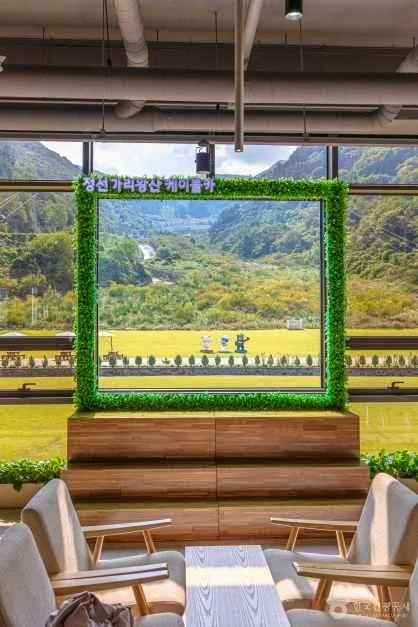
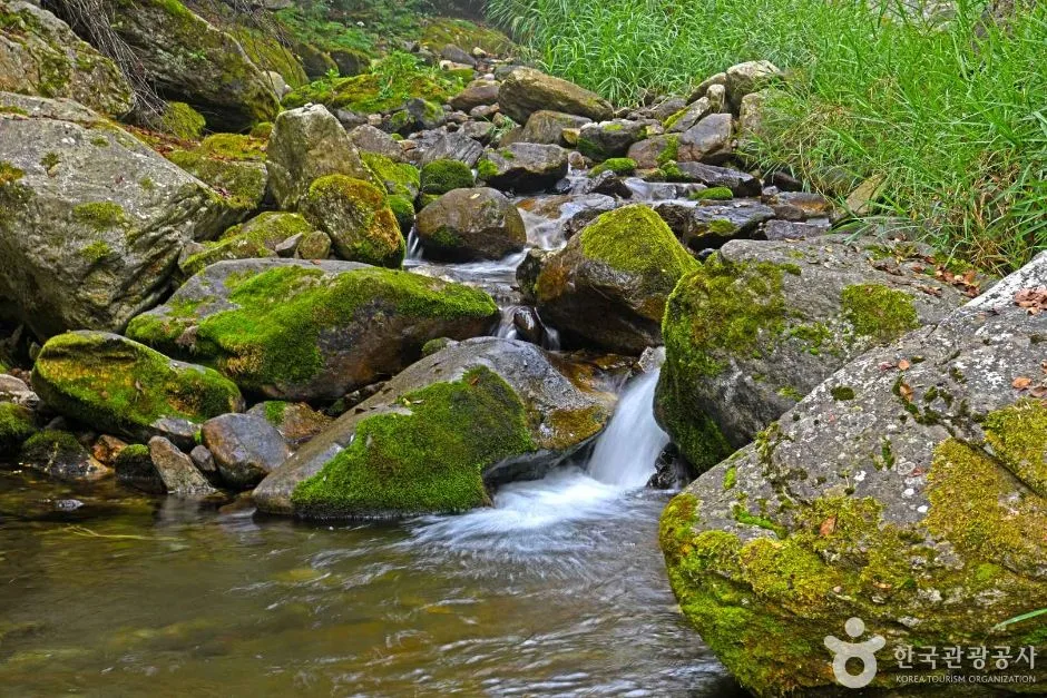 Photo: Korea Tourism Organization photo gallery (261 Wondang-ri, Pyeongchang-eup, Pyeongchang-gun, Gangwon Special Self-Governing Province) · KOGL
Baekdeoksan’s combined figures across all trails in the area come out to 419 minutes ascending and 293 minutes descending, but that’s a cumulative total across multiple sections — not the time for any single route, so don’t mistake it for that. Working from this cumulative data, the average ascent pace comes out to roughly 26 min/km, which is on the slower side compared to other mountains — and it tracks, given how many steep and rocky stretches show up on Baekdeoksan’s trails. Broken down by individual route (one-way): the Heungwonsa course runs about 3 hours 29 minutes, the Meokgol course about 4 hours 10 minutes, the Baekdeoksan-ganeun-gil course about 3 hours 5 minutes, and the Munjae–Sajasan course about 1 hour 50 minutes. These are distance-and-elevation-based estimates, so your actual time will vary depending on your fitness and how much you rest. Round trip, the Heungwonsa and Meokgol courses can easily eat up 7-8+ hours total, so an early morning start is a good idea. And since none of the routes have a confirmed shelter along the way, the norm — whichever course you pick — is to plan it as a day hike rather than an overnight.
Getting There (Public Transit & Parking)
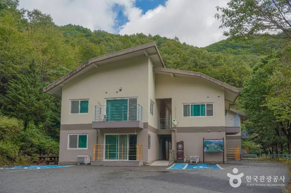
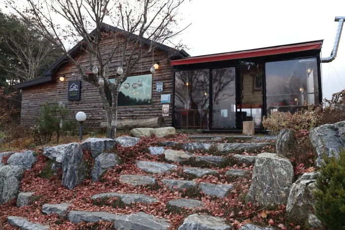 Photo: Korea Tourism Organization Photo Gallery (47-1 Deulmogogae-gil, Bangnim-myeon, Pyeongchang-gun, Gangwon Special Self-Governing Province) · Gong Gong Nuri (Korea Open Government License)
Baekdeoksan sits right on the border between Yeongwol-gun and Pyeongchang-gun in Gangwon-do, which makes it one of the trickier mountains to reach by public transit. Coming from Seoul or the greater capital area, the usual approach is to take a KTX or intercity bus to Pyeongchang (Bangnim) or Yeongwol, then transfer to a rural bus or taxi to get to whichever trailhead you’re starting from. Near the Meokgol course there’s a stop called Ungyo, so you can catch a local bus there, and near the Heungwonsa course there’s a Yeongwol Public Happy Bus stop — but the buses run infrequently, so it’s essential to check the schedule ahead of time. For the Munjae trailhead, given that it’s up on a mountain pass, driving or taking a taxi is really the more realistic option than public transit. There’s no registered parking lot on record in the public data, so hikers often end up using open lots near the trailhead or the shoulder of village access roads — just be careful not to encroach on private property or farmland. I’d strongly recommend double-checking actual road conditions and the latest routes with KakaoMap or Naver Map before you go, since Google Maps’ walking and transit directions in Korea are pretty limited and just aren’t reliable for this hike.
Season, Weather, and Gear
Baekdeoksan is known as a great mountain to hike in spring, when the azaleas and royal azaleas bloom, and in fall, during peak foliage season. In summer, there’s a landslide-prone area along the valley route (Binesegol), so it’s best to avoid hiking there during heavy rain, and the high humidity can also drain your energy faster than usual. In winter, the rocky ridge sections near the summit (Seoltongbawi, Nakdabawi, and Yongbawi rocks) and the steep dirt-trail stretches can ice over, so winter gear like crampons and gaiters is essential. Across all seasons, you’ll want to bring hiking boots, a change of clothes, a windproof/waterproof jacket, and plenty of water — since no water source has been confirmed along the trail, it’s a good idea to carry at least 1.5–2L. A headlamp is worth packing for the longer routes, and trekking poles will help on the steep sections. As for restrooms, there’s a simple one near Heungwonsa Temple, another at the Baekdeoksan parking lot, and one in front of the Ungyo 1-ri village community center — all usable before or after your hike.
Tips for Foreign Travelers
The romanized name for this mountain is “Baekdeoksan,” with the summit marked as “Baekdeoksan Summit,” and the neighboring peak Sajasan romanized as “Sajasan.” There’s no confirmed entry restriction hours or admission fee, so unlike a national park, you can visit without advance reservations or entry fees — but several trail closures have been reported, so make sure to check the local signage on site. Restrooms are limited to a few spots: a simple toilet at Heungwonsa Temple, restrooms at the Baekdeoksan parking lot, and the restroom at the Ungyo 1-ri village community center — it’s safer to use one of these before you start hiking. There are no confirmed drinking fountains along the trail, so bring your own water (bring your own drinking water — no water fountains are confirmed along the trail). For maps, I’d strongly recommend KakaoMap or Naver Map over Google Maps — both support English interfaces, so foreign travelers can use them to search for trails and get public transit directions. Since public transportation is limited in this area, it’s also worth having a taxi-hailing app (like Kakao T) ready to go. Cell signal can be weak in some sections, so download offline maps in advance, and rather than hiking solo, it’s safer to go with a companion and share your hiking plan and expected descent time beforehand.
Other Nearby Mountains
- Gongjaksan, Hongcheon — a pine-covered ridge wrapping around Gurun Reservoir — about 42km away as the crow flies
- Yongmunsan, Gyeonggi — thousand-year gingko tree and craggy rock ridges — about 67km away as the crow flies
- Taebaeksan, Gangwon — snow flowers, rime-frosted trees, and a yew ridge — about 67km away as the crow flies
📍 Where the Dirt Trail Meets Rocky Ridges: Baekdeoksan in GangwonLocation
Contact: bumseok.view [at] gmail [dot] com
Comments