Stairway to Heaven on the Baekdudaegan's Rocky Ridges: Hwangjangsan in Mungyeong
Hiking · Published 8/3/2026 ·
등산로 트랙·시설 (공공데이터: 전국등산로 공간정보) · 🚩시종점 💧음수대 👁️조망점 🏠대피소 🅿️주차장 ⚠️위험 · 지도 © OpenStreetMap ⤓ GPX 다운로드
At a Glance
| Metric | Rating |
|---|---|
| Accessibility (public transit & parking) | ★★☆☆☆ |
| Trail difficulty | ★★☆☆☆ |
| Water sources & springs on the mountain | ★☆☆☆☆ |
| Need for an overnight stay | ★☆☆☆☆ (a day trip is plenty) |
| Seasonal difficulty — spring | ★★★☆☆ |
| Seasonal difficulty — summer | ★★★☆☆ |
| Seasonal difficulty — autumn | ★★★☆☆ |
| Seasonal difficulty — winter | ★★★★★ |
※ Source: Korea Forest Service trail geospatial data · accessibility and seasonal ratings are rough guides
Overview
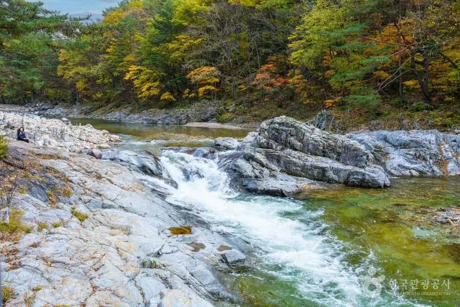 Photo: Korea Tourism Organization photo gallery (Inje-gun, Gangwon State) · KOGL
Hwangjangsan (荒場山) sits on the Baekdudaegan ridge, right on the boundary between Dongno-myeon in Mungyeong, Gyeongsangbuk-do, and Danyang-gun, Chungcheongbuk-do. The summit is officially listed at roughly 1,076m, though actual GPX measurements put the highest point on the summit ridge at 1,085m. You’ll find it south of Mungyeong Saejae, on the stretch of the Baekdudaegan that links up with Doraksan, Hwangjeongsan, and Suribong — and it has a strong “bone mountain” (골산) character, all rocky ridgelines and strange, striking outcrops. The official trail data files it under “easy,” but the main route to the summit is honestly no featherweight once you account for the distance and elevation gain. That said, it’s very doable as a there-and-back day hike.
The Mountain and Its Terrain
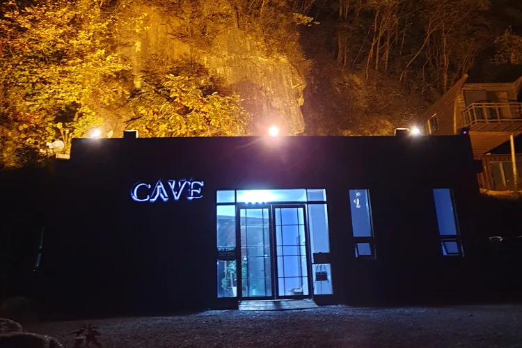 Photo: Korea Tourism Organization photo gallery (279 Ansaengdal-gil, Dongno-myeon, Mungyeong-si, Gyeongsangbuk-do) · KOGL
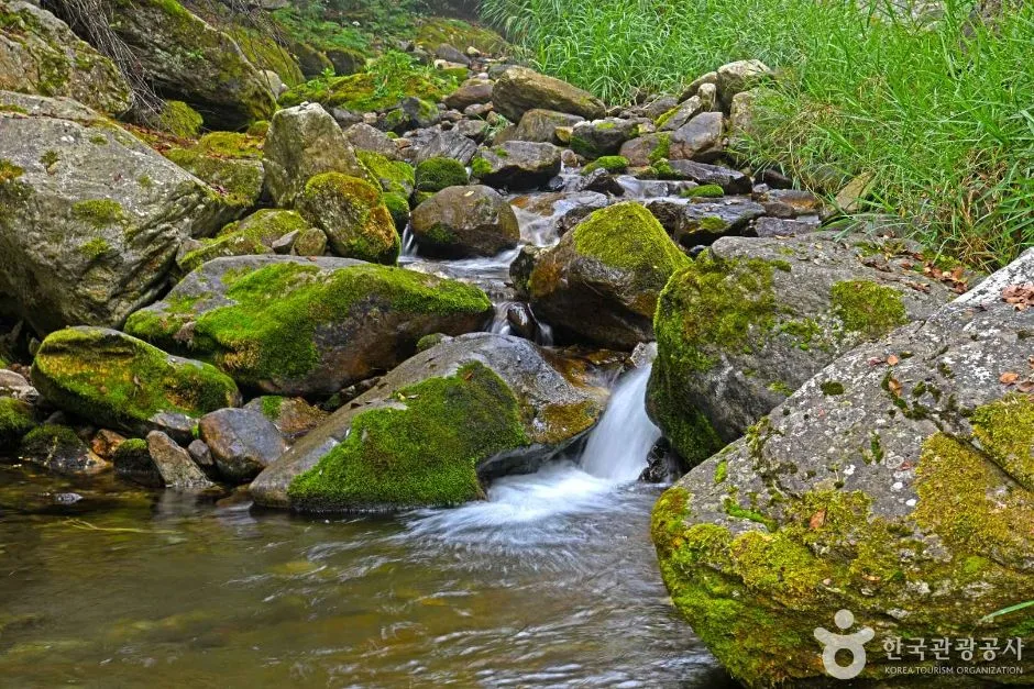
Hwangjangsan is a classic rock-peak mountain, with near-vertical cliffs and narrow rocky ridge sections scattered across the summit area and along the ridgeline. The heart of it is the ridge that runs along the Baekdudaegan crest — the terrain near the top is steep enough rock that they’ve had to install deck stairs and an observation platform. The main peak is Hwangjangsan itself at 1,076m, and nearby you’ll find a rocky peak known as Gamtubong, plus the bedrock area around Nuun Falls, both distinctive features of the landscape. Along the summit ridge there’s a punishingly steep deck section nicknamed the “Stairway to Heaven,” a nice illustration of how rock ridge and man-made structure coexist here. Overall this is a golsan — a bone mountain of rock and cliff rather than the softer soil-and-forest type — and while there is a watercourse through the valley section around Nuun Falls, it doesn’t appear to be a stream that runs full year-round.
What the Hike Feels Like
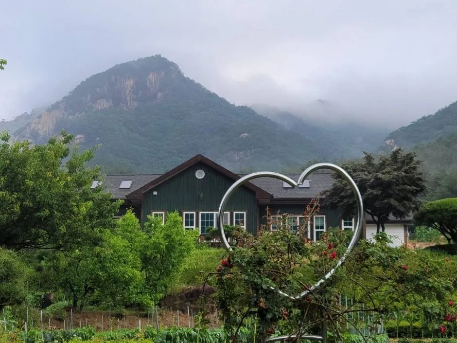 Photo: Korea Tourism Organization tourism photo gallery (2371-5 Yeoumok-ro, Dongno-myeon, Mungyeong-si, Gyeongsangbuk-do) · KOGL
From the trailhead, the first stretch is mostly forest path, and then somewhere past the midway fork the rock starts showing itself — that shift into bare stone and ridgeline is the signature rhythm of this hike. Once you pass Nuun Falls and start climbing into the summit zone, it’s slabs, ropes, and deck sections one after another, and the difficulty ramps up fast. Past the shaded rest spot near the top and the summit shelter, you reach the peak of Hwangjangsan, where the Dorak-san viewpoint and the deck observatory open up wide views of the Baekdudaegan ridgeline and the surrounding peaks. It’s known as a mountain with a strong sense of season — fresh green and wildflowers in spring, autumn colors woven along the ridge in fall. In summer, the forest sections offer enough shade to take the edge off the heat, though the rocky ridge leaves you fully exposed to the sun. In winter, ice on the rock ridge and the deck stairs changes the character of the hike completely: instead of quiet, still snow scenery, you get sections that demand real concentration.
Main Routes (by Trailhead)
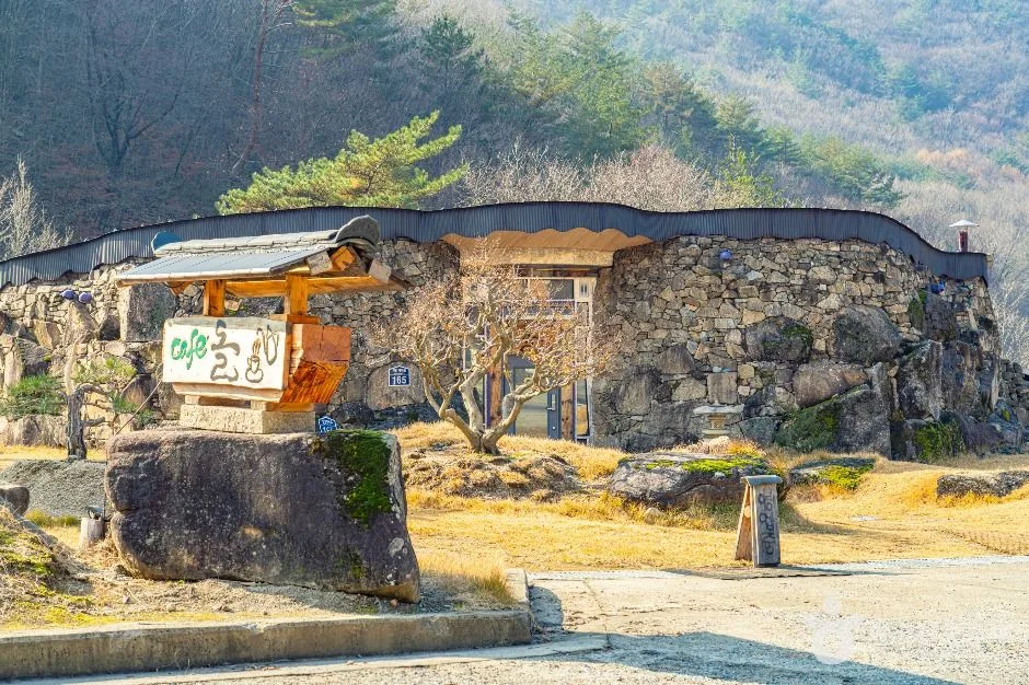 Photo: Korea Tourism Organization photo gallery (148 Seonamgyegok-ro, Daegang-myeon, Danyang-gun, Chungcheongbuk-do) · KOGL
| Route (Trailhead → Summit) | Distance | Net Elevation Gain | Est. Time (one way) | Difficulty | Popularity |
|---|---|---|---|---|---|
| Woraksan Hwangjangsan Saengdal Public Parking Lot → Shaded Rest Area Near the Summit | 5.65km | ↕582m | About 2 hr 23 min | ★★★★☆ | ★★★★☆ |
※ Source: Korea Hiking and Trekking Support Center, 100 Famous Mountains GPX data (distance, elevation, time, difficulty) · Popularity ratings are approximate
Course 1 — Saengdal Public Parking Lot → Shaded Rest Area Near the Summit
Route: Woraksan Hwangjangsan Saengdal Public Parking Lot → Saengdal 2-ri Village Hall restroom → trail junction → Hwangjangsan Park Ranger Station → Nuun Falls → shaded rest area near the summit → summit rest area → Hwangjangsan summit → Doraksan viewpoint → deck observatory → summit deck trail → Stairway to Heaven → Ansaengdal viewpoint → Waypoint 22 → Waypoint 23
Getting to the trailhead: The Saengdal Public Parking Lot sits in the Saengdal-ri area of Dongno-myeon, Mungyeong, deep enough into the mountains that there’s no realistic train or subway access. The usual public transit option is a local bus running between the Ansaengdal Bridge and Saengdal 2-ri stops, and since service is fairly infrequent, it’s worth checking the timetable ahead of time. Despite the “public parking lot” name, no registered parking facility shows up in the public data, so I’d check on-site to see whether you can actually park there and how much space there is.
What it’s like and who it suits: The route opens with village lanes and forest path, and once you pass the ranger station the real climbing begins. From Nuun Falls onward you get a proper valley feel, rock and running water woven together. Closer to the top, rocky ridgeline and deck stairs take over and the effort ramps up sharply — this is a course suited to Baekdudaegan through-hikers and anyone comfortable on rocky ridges. The Doraksan viewpoint and deck observatory near the summit open onto wide ridge views, so it also scores well with hikers who come for the scenery. That said, the steep decks and rock sections may be a lot for a beginner, so I’d recommend this one to people with some hiking experience under their belt.
Difficulty, Trail Surface, and Cautions
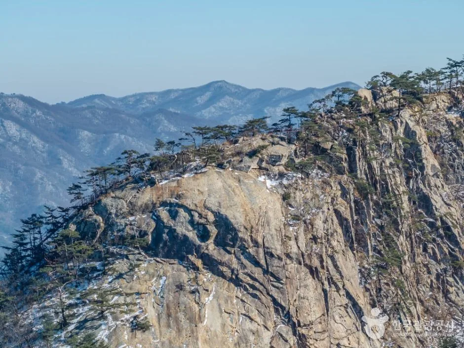 Photo: Korea Tourism Organization photo gallery (Saengdal-ri, Dongno-myeon, Mungyeong-si, Gyeongsangbuk-do) · KOGL
The highest difficulty rating registered in the local trail geospatial data is “Easy,” but that classification applies to the 3.1 km of trail within the district boundaries. The main route that actually takes you to the summit — 5.65 km with 582 m of net elevation gain — rates ★★★★☆ based on measured GPX data from the Top 100 Mountains project, and it’s no pushover. There’s no separate entry for surface conditions in the public data, but given the shape of the mountain, rock and bedrock sections clearly make up more and more of the trail the closer you get to the top. Viewpoints, hazard zones, shelters, trailheads and exit points all come back as zero in the public data, so don’t count on finding signage or anywhere to take cover. On terrain like this, the rock gets slick in the rain, and in winter, ice on the deck stairs and along the rocky ridge makes a fall a real possibility — worth extra caution.
Distance and Time Required
Based on public data that adds up every trail in the district, the numbers come out to 55 minutes going up and 38 minutes coming down, which works out to an average ascent pace of roughly 18 minutes per kilometer. But keep in mind that figure is a cumulative total for all the trails in the district — don’t mistake it for how long the main route to the summit actually takes. That route (Saengdal public parking lot → the shaded rest area near the summit, 5.65 km) works out to about 2 hours 23 minutes one way based on actual measurements. Add the descent and you’re looking at 4 to 5 hours round trip, which puts this comfortably within day-hike territory. There are no registered shelters here, so there’s not much reason to plan an overnight — though if you’re stringing together a traverse with nearby peaks like Doraksan or Hwangjeongsan, an overnight starts to make sense.
Getting There (Public Transit & Parking)
For public transit near the Saengdal trailhead on Hwangjangsan, there are stops at Ansaengdal Bridge and Saengdal 2-ri, and the usual approach is to take a local bus from either Mungyeong or Danyang. That said, this is deep mountain country — buses run infrequently and routes change more often than you’d like, so it’s worth checking KakaoMap or Naver Map for live routes and timetables before you head out. If you’re driving, you can search for Saengdal Public Parking Lot as your destination, but no registered parking facility shows up in the public data, so it’s safer to have a backup plan in mind, like roadside parking. Google Maps is often unreliable for trails and back roads in Korea’s mountain regions, so I’d recommend using the KakaoMap or Naver Map apps instead.
Season, Weather, and Gear
The easiest seasons for hiking here are spring (April–May) and fall (September–November), when you get the fresh green growth and the autumn colors. Summer offers shade through the forested sections, but on the rocky ridges you’re fully exposed to direct sun and heat, so bring plenty of water and take regular breaks. In winter, the deck stairs near the summit and the rocky ridge sections ice over fairly often, which makes crampons, gaiters, and other winter gear effectively mandatory — and if you’re a beginner, it’s worth thinking twice about a winter hike here at all. Gear to bring regardless of season: hiking boots with ankle support, trekking poles, a spare layer, a headlamp (just in case), and plenty of water. Since public data shows no drinking fountains on the mountain, packing more than enough water before you set out matters especially here.
Tips for International Travelers
Hwangjangsan (summit, 1,076–1,085 m) is romanized as written, and the main trailhead sits near the Saengdal Public Parking Lot. There’s no record of any climbing permit or entrance fee, so it looks like you can just show up — no advance reservation system like you’d find at a national park. Still, it’s worth checking the notice boards on site for the latest information. For restrooms, you can use the one at the Saengdal 2-ri Village Hall Restroom near the trailhead, but the data shows no restrooms or drinking fountains anywhere along the trail itself, so go before you set off and carry plenty of water. As for map apps, KakaoMap or Naver Map are far more accurate than Google Maps when it comes to trail information in Korea’s mountain regions — I’d strongly recommend having one of them alongside whatever you normally use. The terrain here is mostly rocky ridgeline, with no shelters or dedicated safety facilities, so hike with a partner rather than going solo, and if the weather turns bad (especially with winter ice), the safe call is to postpone.
Other Mountains Nearby
- Dosansan in Danyang, Chungbuk — autumn color creeping up the rocky ridge — about 6 km as the crow flies
- Juheulsan, home to the rope-assisted Bubong rock ridge and Mungyeongsaejae — about 16 km as the crow flies
📍 Stairway to Heaven on the Baekdudaegan's Rocky Ridges: Hwangjangsan in MungyeongLocation
Contact: bumseok.view [at] gmail [dot] com
Comments