Ropes up the Bubong rock ridge — Juheulsan, the mountain that cradles Mungyeong Saejae
Hiking · Published 8/1/2026 ·
등산로 트랙·시설 (공공데이터: 전국등산로 공간정보) · 🚩시종점 💧음수대 👁️조망점 🏠대피소 🅿️주차장 ⚠️위험 · 지도 © OpenStreetMap ⤓ GPX 다운로드
At a Glance
| Metric | Rating |
|---|---|
| Accessibility (public transit & parking) | ★★☆☆☆ |
| Trail difficulty | ★★☆☆☆ |
| Water & springs on the mountain | ★☆☆☆☆ |
| Need to stay overnight? | ★☆☆☆☆ (easy day trip) |
| Seasonal difficulty — spring | ★★☆☆☆ |
| Seasonal difficulty — summer | ★★★☆☆ |
| Seasonal difficulty — fall | ★★☆☆☆ |
| Seasonal difficulty — winter | ★★★★☆ |
※ Source: Korea Forest Service trail geospatial data. Accessibility and seasonal ratings are rough guides.
Overview
Juheulsan sits in Mungyeong, Gyeongsangbuk-do, and it’s a proper rocky-ridge mountain — the main summit, Juheul Yeongbong, tops out at 1,132m. It’s also home to Mungyeong Saejae, the gateway pass on the old Yeongnam-daero route during the Joseon dynasty, which is why the place is so well known as somewhere you can get a hike and a history lesson in the same outing. The mountain as a whole is defined by steep rocky ridges and wide-open views along the crest, but the officially registered trail sections within the park are actually classified as no harder than “easy” in the data — the approach stretches are fairly gentle. That said, the real route up to the summit area covers serious distance and elevation gain, so it’s a hike that’ll take a lot out of you. Most of the courses are still comfortably doable as a day trip.
The Lay of the Land
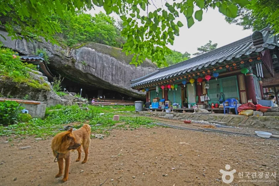
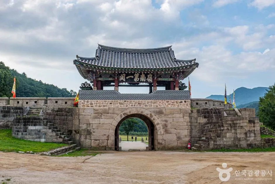 Photo: Korea Tourism Organization photo gallery (Sangcho-ri, Mungyeong-eup, Mungyeong-si, Gyeongsangbuk-do) · KOGL
Juheulsan is a mix of earthen slopes and rocky peaks — it isn’t one sharp summit but a series of peaks strung together along ridgelines. The high point is Juheul Yeongbong (1,132m), and to the south, Juheulsan’s main peak (1,103m) rises separately. Across Mungyeong Saejae pass, the Bubong (釜峰) ridge stretches out for a good long way. Bubong isn’t a single peak either but a cluster of jagged rock summits one after another — the public data alone lists Bubong Peak 6 (942m), Bubong (939m), Bubong (942m), Bubong Peak 4, Peak 3 (935m), and Peak 5 summit (943m), among others. This Bubong ridge is one stretch of strange rock formations and rocky spines after another, with plenty of sections where you’ll be pulling on ropes and handholds, and the views across the Mungyeong Saejae valley toward Juheulsan’s main peak and Juheul Yeongbong are genuinely excellent. The trail data also flags “natural rock protrusions” as a hazard attribute — meaning bedrock that juts up naturally into the trail itself — and you’ll run into these especially on the section near the Mungyeong Saejae parking lot.
What the Hike Feels Like
Most of the trailheads start out on dirt paths winding through pine forest and stands of Korean nut pine, so the early going is gentle and pleasantly shaded. Look at the actual waypoints along the course and you’ll see several small stream crossings — spots literally named things like “water crossing” and “valley crossing.” As you climb, talus fields (slopes piled with loose rock) and short rocky stretches take over, and the difficulty ratchets up bit by bit. The closer you get to the summit ridge, the more you run into rocky sections that need safety ropes, and at points called Gwanbong Viewpoint, Rock Overlook, Lookout Rock, and the like, the view opens up over downtown Mungyeong and the surrounding ridgelines. Seasonally, spring brings fresh green and wild azaleas, autumn puts color all along the ridges, summer swells the streams enough that you may get your feet wet at the water crossings, and winter ices over the rock slabs, which gives the whole place a completely different mood.
Main Routes (by Trailhead)
| Route (trailhead → summit) | Distance | Net elevation gain | Est. time (one way) | Difficulty | Popularity |
|---|---|---|---|---|---|
| Restroom by the bus stop → summit | 4.42km | ↕830m | about 2 hr 29 min | ★★★★☆ | ★★★☆☆ |
| Monorail ticket office → Rock Overlook | 14.78km | ↕886m | about 5 hr 10 min | ★★★★★ | ★★★★★ |
| Pyeongcheon 2-ri Community Center → summit | 4.8km | ↕757m | about 2 hr 28 min | ★★★★☆ | ★★☆☆☆ |
| Restroom at Maze Park entrance → Juheulsan main peak | 15.1km | ↕850m | about 5 hr 12 min | ★★★★★ | ★★★★☆ |
| Mungyeong Tourist Hotel trailhead → pine grove | 8.99km | ↕869m | about 3 hr 42 min | ★★★★★ | ★★☆☆☆ |
| Oak pest-control work site → Bubong Peak 6 viewpoint rock | 11.66km | ↕715m | about 4 hr 6 min | ★★★★★ | ★☆☆☆☆ |
※ Source: Korea Hiking and Trekking Support Center, 100 Famous Mountains GPX (distance, elevation, time, difficulty) · popularity ratings are rough guides
Course 1 — Restroom by the Bus Stop → Summit
Route: Restroom by the Bus Stop → Jigok 2-ri Bus Stop → Wolboksa Temple → Small Parking Area → Gwanbong Viewpoint → Start of Unpaved Road → Unpaved Road Continues → Panoramic View of Gwanbong’s Main Peak → End of Unpaved Section → Trailhead → Stream Crossing → Short Stairway → Trail Marker → Pine Forest Path → Fallen Tree Crossing → Safety Rope Section
Getting to the Trailhead: The Jigok 2-ri bus stop sits close to the trailhead, so you can get here by bus from downtown Mungyeong. There does appear to be a small parking area early in the course, but it isn’t big, so public transit is probably your better bet.
What It’s Like / Who It’s For: You start out on an unpaved road, then pass a temple (Wolboksa) on a gentle stretch of mountain path. From the halfway point on, it’s pine forest, a short stairway, and a section with safety ropes — a straight shot to the top. Just before you reach the summit area, the Gwanbong viewpoint opens up onto the surrounding ridgelines, which makes this a good pick if you want a taste of a real summit without a long walk to get there.
Course 2 — Electric Cart Ticket Office → Rock Overlook
Route: Electric Cart Ticket Office → Mungyeong Saejae Open Set → Jogok Spring → Restrooms → Bubong Trail Marker Stone → Mungyeong Saejae Arirang Rest Area → Rock Cave Rest Area → Korean Pine Grove → Trail Junction → Pavilion Rest Area → Ijinteo Signpost → Wooden Platform → Platform and Benches → Stream Crossing → Waypoint 22
Getting to the trailhead: The trailhead is the electric cart ticket office near the Mungyeong Saejae Provincial Park bus stop — the most popular way in, passing through the Mungyeong Saejae tourist area parking lot and ticket booth on the way. The whole zone is built up for visitors, so even first-timers won’t have trouble finding it.
Character and who it suits: Because the route opens by passing sights like the Mungyeong Saejae Open Set (a filming location for historical dramas) and Jogok Spring, the first stretch is gentle enough to feel more like a stroll than a hike. From the Bubong trail marker stone onward, though, it turns into a proper mountain path. It’s a long route with plenty to see along the way — the Rock Cave Rest Area, the Rock Overlook — which makes it a good fit for distance hikers who want to combine a bit of Mungyeong Saejae history with the views from the Bubong ridge.
Course 3 — Pyeongcheon 2-ri Village Hall → Summit
Route: Pyeongcheon 2-ri Village Hall → pavilion in front of the hall → fork → pavilion → pine forest path → merge onto forest road → surface changes to pavement → merge onto village road → path through the village → end of the paved road → actual trailhead → talus section → left toward the valley → stream crossing → trail conditions
Getting to the trailhead: There’s a Pyeongcheon 2-ri bus stop near the village hall, so you can get here by bus — but it’s most likely a rural route without frequent service, so check the timetable ahead of time. From there you’ll need to walk the village access road to reach the actual start of the trail.
Character & who it suits: You spend a good while on village roads, a forest road, and pavement before the real climbing begins, so the first stretch feels less like a mountain trail and more like a stroll through the neighborhood. Once you’re on the actual trail, though, it turns into a talus field and a climb up toward the valley, which takes a real toll on your legs. Good pick if you want quiet village scenery paired with a short push to the summit.
Course 4 — Maze Park Entrance Restroom → Juheulsan Jubong Peak
Route: Mungyeong Saejae Management Office → Confucian Scholar Statue → Electric Cart Ticket Booth → Maze Park Entrance Restroom → Mungyeong Saejae Tourist Information Center → Mungyeong Saejae Information Board → Mungyeong Saejae Gwageogil (Old Exam Road) → Joryeong First Gate → Pavilion → Trail Map → Portable Restroom → Two Benches → Korean Pine Forest Path → 2sunde → Rest Area
Getting to the trailhead: The course starts at the entrance to Mungyeong Saejae Provincial Park, where you’ll find the Mungyeong Saejae Management Office and the electric cart ticket booth. You can walk there from the Mungyeong Saejae Provincial Park bus stop. Since it’s the gateway to a tourist site, the restrooms and information facilities are reasonably well set up.
Highlights and who it’s for: This one begins on a historical walking trail that passes through Joryeong First Gate (the old exam road) before gradually turning into a proper mountain path, and it’s among the longest of the courses. Recommended for hikers who want to walk through Mungyeong Saejae’s iconic gate itself on the way up to Jubong Peak, and for anyone after a long, unhurried day of walking.
Course 5 — Mungyeong Tourist Hotel Trailhead → Pine Forest Zone
Route: Mungyeong Tourist Hotel trailhead → pine forest zone → trail condition → fork → oak habitat → pine and rock zone → wild boar traces → short scree section → scree trail → rock scramble → Teulmok Pass fork → Mungyeong viewing rock → Juheulgwanbong Peak → Juheulsan viewpoint → Bubong viewpoint
Getting to the trailhead: This course starts near the Mungyeong Tourist Hotel, so using the hotel as your landmark makes it easy to find. It also works well as a pre-dawn starting point if you stay the night nearby.
Highlights and who it’s for: The trail passes through an oak habitat and a pine-and-rock zone, and you’ll spot signs of wildlife (wild boar) along the way — a good sign that this stretch sees relatively few people. Once you’re past the Teulmok Pass fork, the viewpoints come one after another: the Mungyeong viewing rock, Juheulgwanbong Peak, the Juheulsan viewpoint, and the Bubong viewpoint. It’s a good pick for hikers who want to take in views in every direction on a single course.
Course 6 — Oak Tree Pest Control Site → Bubong Peak 6 Viewpoint Rock
Route: oak tree pest control site → trail conditions → short rock section → fallen tree → pine tree fungal colony → national point number marker → wild boar tracks → Bubong Peak 6 viewpoint rock → Bubong signpost → trail junction → rocks and trees → rock section → fixed rope section → passage beside rock → anti-fall rope
Getting to the trailhead: This trailhead is named after a forest pest control work site, so there’s no obvious bus stop or signpost to look for — it’s a relatively little-known approach. If it’s your first time, you’ll want to pin down the exact entrance on a map app beforehand.
Highlights & who it’s for: This course climbs straight up to Bubong Peak 6, the sixth peak on the Bubong ridge. The back half throws rock sections, fixed ropes, and anti-fall ropes at you one after another, giving it the highest proportion of rocky ridge of any course here. It’s a good fit for experienced hikers who want to get up close to the Bubong ridge’s striking rock formations, but I wouldn’t recommend it for beginners.
Difficulty, Trail Surface, and Cautions
There are three registered sections within the jurisdiction: an unnamed 11.4 km stretch, the Sangcho-ri section at 2.43 km, and the Mungyeong Saejae Parking Lot section at 1.18 km. All three are classified as “Easy” in the data.
| Section (by administrative district) | Length | Difficulty | Surface |
|---|---|---|---|
| (unnamed section) | 11.4 km | Easy | - |
| Sangcho-ri section | 2.43 km | Easy | - |
| Mungyeong Saejae Parking Lot section | 1.18 km | Easy | - |
※ The table above breaks down total trail length by administrative district — these aren’t actual hiking course names.
Surface details aren’t listed separately, but the Mungyeong Saejae Parking Lot section does flag “exposed natural rock” as a hazard. That means bedrock jutting up naturally through the trail bed, which gets especially treacherous when wet and ices over in winter. The trail’s spatial data records zero entries for hazard zones, viewpoints, and trailhead POIs — but that’s just what happens to be registered in this particular dataset. In practice, the course-by-course signposts I mentioned earlier point to plenty of viewpoints along the actual GPX route: Gwanbong Viewpoint, Bawi Observatory, Jomang Bawi, Mungyeong Jomang Bawi, Juheulsan Viewpoint, Bubong Viewpoint, and more. The closer you get to the summit, the more you run into rocky ridge sections along the Bubong ridgeline and near Juheul Yeongbong where you’ll need to haul yourself up on ropes. So after rain, or during frost and ice season, it’s safer to hold off on going in — or at least bring crampons.
Distance and Time
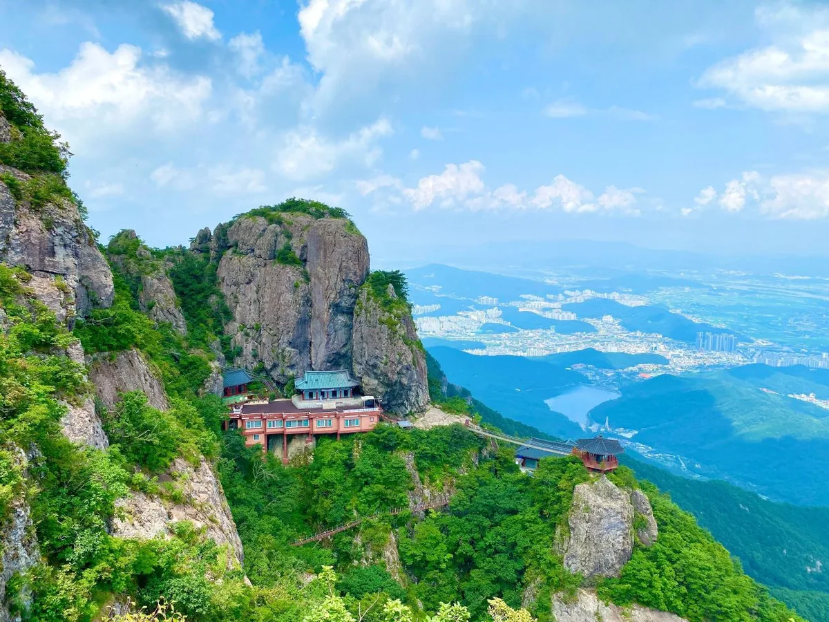
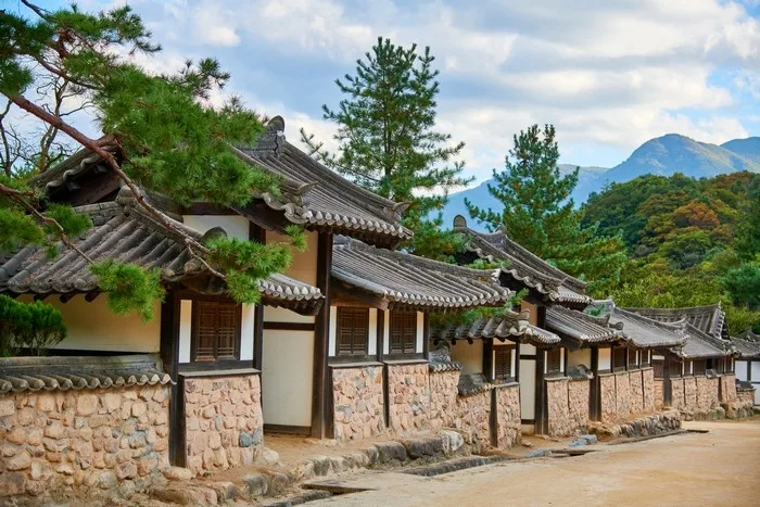 Photo: Korea Tourism Organization photo gallery (932 Saejae-ro, Mungyeong-eup, Mungyeong-si, Gyeongsangbuk-do) · Korea Open Government License
The trails within the park total 15.01 km, and the figures of 266 minutes uphill and 186 minutes downhill are cumulative totals for every section in the park — not the time for any single course. Working from those numbers, the average uphill pace comes out to roughly 18 minutes per kilometer, which is a handy yardstick for sanity-checking the estimated times I gave for each course earlier. The signature routes — the restroom beside the station to the summit, and Pyeongcheon 2-ri Community Center to the summit — run about 2 hours 30 minutes one way, easily doable as a day round trip. Courses closer to 15 km, like the electric cart ticket office to the rock overlook or the maze park entrance restroom to Juheulsan’s main peak, take around 5 hours one way, so if you’re going out and back, the usual plan is an early-morning start and a full day on the mountain. There are no registered shelters, so whichever course you pick, prepare for a day hike rather than an overnighter.
Getting There (Public Transit & Parking)
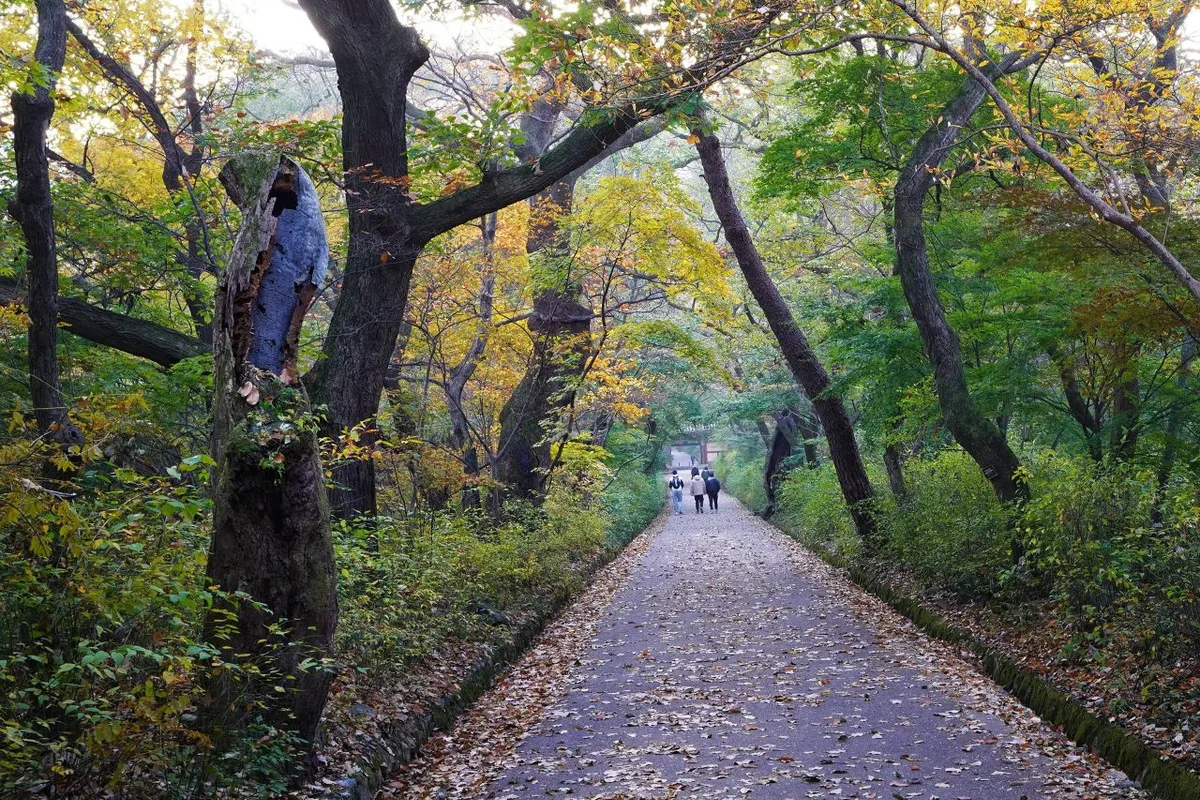
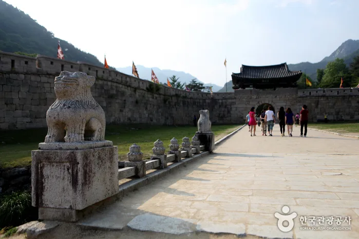 Photo: Korea Tourism Organization Photo Gallery · KOGL
The usual route to Mungyeong is an intercity bus from Seoul, East Seoul, or Cheongju to Mungyeong Intercity Bus Terminal, then a transfer to a local Mungyeong bus heading toward Mungyeong Saejae. There are bus stops near the trailheads at Jigok 2-ri, Pyeongcheon 2-ri, Mungyeong Saejae Provincial Park, and Hachori, so you can pick whichever one suits the course you’ve chosen. The area around Mungyeong Saejae Provincial Park is developed for tourism and reportedly has visitor parking, but no registered parking lot shows up in this trail dataset — so on weekends and during peak season, don’t count on finding a spot easily. For exact bus schedules and walking directions, I’d search “Mungyeong Saejae” or the individual stop names on KakaoMap or Naver Map to check in real time.
Season, Weather, and Gear
The easiest times to hike here are spring (April–May) and autumn (September–October), when you get fresh green leaves or fall colors and much less risk of ice. In summer, the streams run higher, so you may end up with wet feet at the water and valley crossings, and the scree fields can get slick after the monsoon rains — waterproof boots earn their keep. In winter, ice can build up badly on the natural rock outcrops and the rocky ridgeline of Bubong, so crampons, gaiters, and cold-weather gear are non-negotiable. There are no registered water fountains on the trail, so bringing enough water yourself is essential no matter the season, and it’s worth packing trekking poles, a spare layer, and a headlamp if you’re taking on one of the longer courses.
Tips for International Visitors
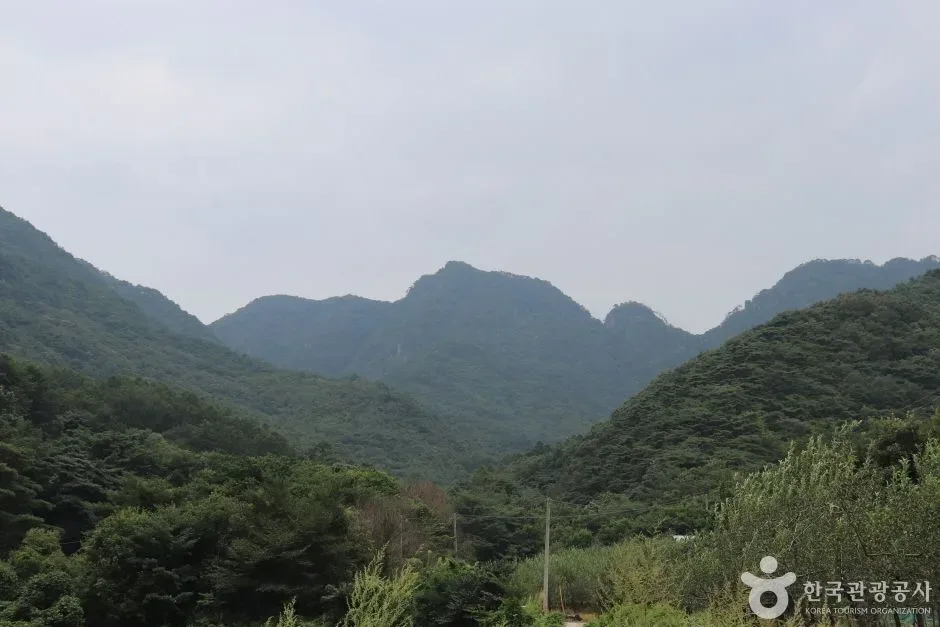
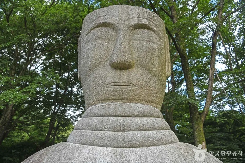 Photo: Korea Tourism Organization photo gallery (Mireuk-ri, Suanbo-myeon, Chungju-si, Chungcheongbuk-do) · KOGL
In Roman letters, the mountain is Juheulsan. Its highest peak is Juheul-yeongbong, the main peak is Juheul-bong (sometimes just Ju-bong), and the rocky ridge across the way is Bubong. As far as I can tell, the trails themselves don’t require a permit or an entrance fee, but if your route passes through Mungyeong Saejae Provincial Park, it’s worth checking with the park office for the latest information before you go. The trail data does list a few restrooms near some of the trailheads — the one beside the bus stop, the one at the Miro Park entrance, and a portable unit or two — but they aren’t spread evenly along the routes, so use one before you set off. As for water, there’s a spring called Jogok Yaksu along the route past the electric-cart ticket office, but no water points on this mountain are registered in the public trail-fountain dataset, so bring your own until you’ve confirmed on the ground that it’s safe to drink. For maps, Google Maps often gets Korean hiking trails wrong, so I’d use KakaoMap or Naver Map instead for live routing and transit info. And since this is a mountain of repeating rock ridges and rope sections, come with grippy hiking boots, gloves, and trekking poles — go with a partner rather than alone, and give yourself plenty of time for the descent.
Other Mountains Nearby
- Gumi’s Geumosan, home to Daehye Falls and the fortress ridgeline — about 79 km as the crow flies
- Daegu’s Palgongsan, a granite ridge dotted with Buddhist relics — about 101 km as the crow flies
📍 Ropes up the Bubong rock ridge — Juheulsan, the mountain that cradles Mungyeong SaejaeLocation
Contact: bumseok.view [at] gmail [dot] com
Comments