Rock Spires and Pines Along the Natural Ridge: Gyeryongsan in Daejeon and Gongju
Hiking · Published 8/2/2026 ·
등산로 트랙·시설 (공공데이터: 전국등산로 공간정보) · 🚩시종점 💧음수대 👁️조망점 🏠대피소 🅿️주차장 ⚠️위험 · 지도 © OpenStreetMap ⤓ GPX 다운로드
Total trail length and section stats for the trails in the area come from the Korea Forest Service’s hiking trail spatial data, while the distance, elevation, time, and difficulty figures for each course are based on GPX data for the 100 Famous Mountains from the Korea Hiking and Trekking Support Center.
At a Glance
| Metric | Rating |
|---|---|
| Access (public transit & parking) | ★★★☆☆ |
| Trail difficulty | ★★★☆☆ |
| Water sources & springs on the mountain | ★☆☆☆☆ |
| Need to stay overnight? | ★☆☆☆☆ (an easy day trip) |
| Seasonal difficulty – Spring | ★★☆☆☆ |
| Seasonal difficulty – Summer | ★★★☆☆ |
| Seasonal difficulty – Autumn | ★★☆☆☆ |
| Seasonal difficulty – Winter | ★★★★☆ |
※ Source: Korea Forest Service trail geospatial data · access and seasonal figures are rough guides
Overview
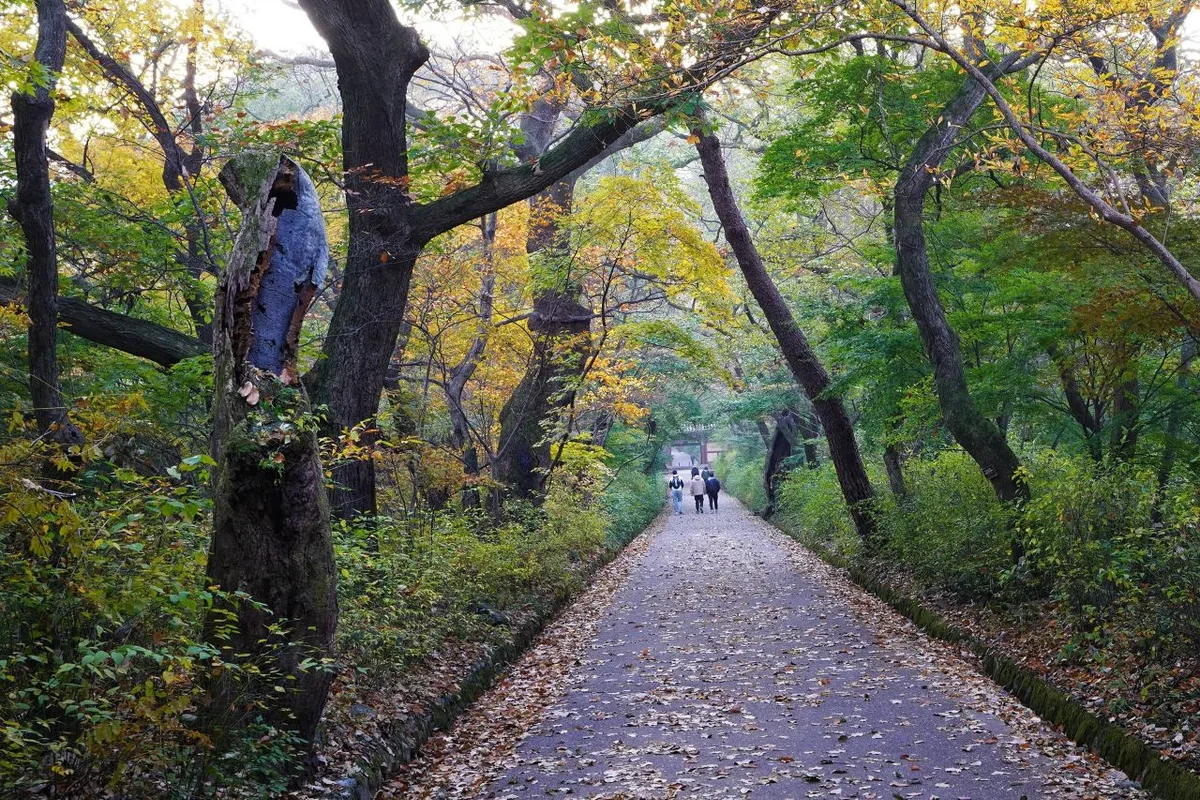 Photo: Korea Tourism Organization photo gallery (Gyeryong-myeon, Gongju-si, Chungcheongnam-do) · KOGL
Gyeryongsan is a national park spanning Daejeon Metropolitan City and the cities of Gongju, Nonsan, and Gyeryong in Chungcheongnam-do. Its ridgeline is made up of a series of rocky peaks, including Sambulbong (about 800m) and Gwaneumbong (about 785m). Most of the routes sit at a moderate difficulty level, so it’s an easy one to knock out as a day hike, and you can approach it from several directions — Donghaksa, Gapsa, and others. It draws everyone from first-timers to intermediate hikers, but the ridge near the summit has plenty of rocky sections, so don’t let your guard down.
The Mountain and Its Terrain
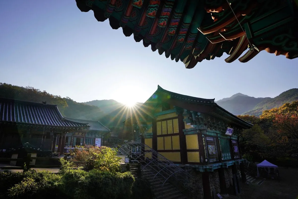 Photo: Korea Tourism Organization photo gallery (Gyeryong-myeon, Gongju-si, Chungcheongnam-do) · KOGL
Gyeryongsan is a mountain of granite peaks and ridgelines, and it gives off the feeling of what Koreans call an “aksan” — a rugged, rocky mountain. Its signature peaks include Sambulbong (somewhere around 798–800m, depending on which data you look at), Gwaneumbong (roughly 785m, though some sources list it as 768m), and Nammaetap (632m), which sits on the ridge connecting the two. The stretch of ridgeline running from Sambulbong to Gwaneumbong is known as Jayeonseongneung, and it’s well known for its scenery — strange rock formations mixed in with pine trees. The highest point on Gyeryongsan is generally given as Cheonhwangbong (about 845m), but that peak is off-limits to civilians because of military facilities, so in practice the summit area ordinary hikers can reach is the Gwaneumbong–Sambulbong area. Overall the terrain is on the steep and rough side, but since it’s a designated national park, the trails and signposts are relatively well maintained.
What the Hike Feels Like
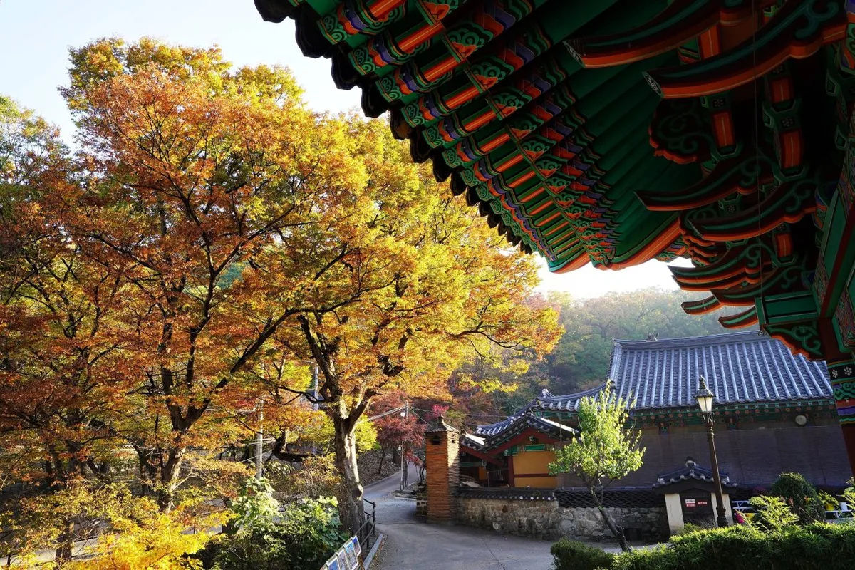 Photo: Korea Tourism Organization photo gallery (Gyeryong-myeon, Gongju-si, Chungcheongnam-do) · KOGL
Gyeryongsan gives you two very different things: dense forest trail down at the bottom, and rock terrain as you get near the ridge. The approaches from Donghaksa and Gapsa start out as gentle forest path running alongside a valley stream — genuinely pleasant walking — and then the grade steepens the closer you get to the ridge, turning into a run of rocky spines and stairs. Up on the ridge near Sambulbong and Gwaneumbong the views open up in every direction, and that wide-open panorama is exactly what you come to a national park for. Spring brings fresh green and azaleas, autumn brings foliage draped over the ridgeline, so the seasons here read loud and clear; in summer, the sound of water in the valley and the shade of the forest take the edge off the heat. In winter, the rocky sections often ice over with snow and frost, which turns the whole outing into a decidedly more serious affair.
Main Routes (by Trailhead)
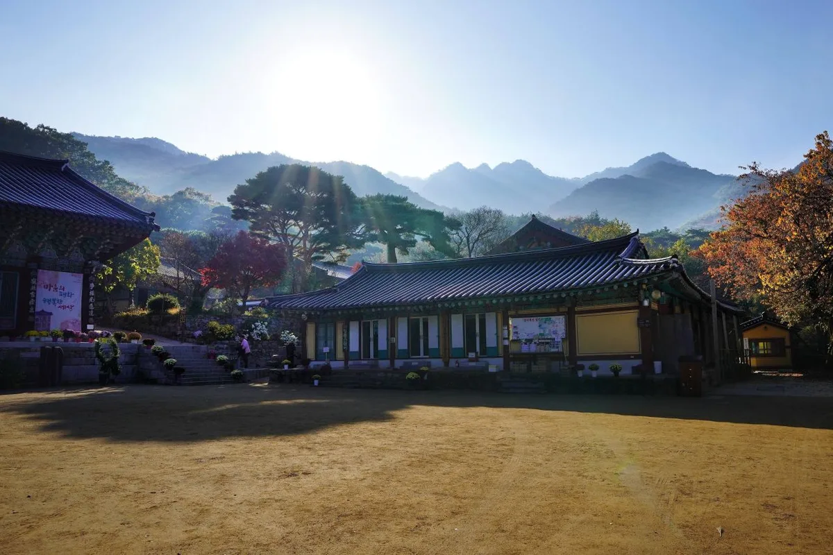 Photo: Korea Tourism Organization photo gallery (Gyeryong-myeon, Gongju-si, Chungcheongnam-do) · KOGL
| Route (trailhead → summit) | Distance | Net elevation gain | Est. time (one way) | Difficulty | Popularity |
|---|---|---|---|---|---|
| Byeongsagol entrance → Janggunbong | 5.63km | ↕665m | about 2 hr 31 min | ★★★★☆ | ★★☆☆☆ |
| Donghaksa entrance → Sambulbong, Gyeryongsan | 8.29km | ↕599m | about 3 hr 4 min | ★★★★☆ | ★★★★★ |
| Trailhead → summit | 3.87km | ↕631m | about 2 hr 1 min | ★★★☆☆ | ★★☆☆☆ |
| Gapsa entrance photo spot → Yongmun Falls viewpoint | 8.01km | ↕615m | about 3 hr 2 min | ★★★★☆ | ★★★★☆ |
| Cheonjeong trail entrance → summit | 3.12km | ↕458m | about 1 hr 33 min | ★★★☆☆ | ★★☆☆☆ |
※ Source: Korea Hiking and Trekking Support Center, GPX data for the 100 Famous Mountains (distance, elevation, time, difficulty) · Popularity ratings are rough guides only
Course 1 — Byeongsagol Trailhead → Janggunbong
Route: Byeongsagol trailhead → trail information board → signpost → Janggunbong ascent → signpost → hazard zone → Janggunbong viewpoint → Janggunbong → viewpoint → Gyeryongsan National Park location marker → Gyeryongsan National Park location sign → fork in the trail → Gatbawi three-way junction rest area → Gyeryongsan National Park location sign → rest area
Getting to the trailhead: The Byeongsagol trailhead sits on the northeast side of Gyeryongsan, and it’s a good deal less known than the approaches from Donghaksa or Bakjeongja. If you’re coming by public transit, you may need to get off at a nearby village bus stop and walk in from there — worth checking the exact route on a map app beforehand. I couldn’t find any information about a proper parking lot, so you’ll most likely end up parking along the roadside or on an open patch of ground in the village.
What it’s like and who it suits: Given that the signposts actually mark a “hazard zone,” the climb up to Janggunbong has its share of steep and exposed sections, which makes it better suited to hikers with some experience under their belt. From the summit area and the viewpoints, you get the whole Gyeryongsan ridgeline laid out in front of you — a course photographers tend to come away happy from. Recommended if you’d rather walk somewhere relatively quiet.
Course 2 — Donghaksa Temple Entrance → Sambulbong Peak, Gyeryongsan
Waypoints: Sambulbong Peak, Gyeryongsan → falling rock and slip/fall hazard → Sambulbong Peak → Sambulbong viewpoint → lookout point → scenic view → trail junction → photo zone → fall hazard → Jayeonseongneung Ridge scenic view → Jayeonseongneung Ridge lookout point → Jayeonseongneung Ridge photo spot → rock face → falling rock hazard → Eunseon Falls upper safety rest area
Getting to the trailhead: The Donghaksa Temple entrance is the best-known trailhead on Gyeryongsan, and you can reach it by bus from either the Yuseong area of Daejeon or from Gyeryong City. Most people transfer at the nearby Bakjeongja three-way intersection stop (Bakjeongja, Donghaksa/Chungnam National University direction), and there’s a separate bus stop right near Donghaksa itself, so access is pretty good overall. Since this is very much a tourist destination, there’s parking near the ticket office — though it can get crowded on peak-season weekends.
Character and who it suits: This course takes you along Jayeonseongneung Ridge, the single most iconic stretch on Gyeryongsan, and one viewpoint after another opens up along the way — the Sambulbong lookout, the Jayeonseongneung viewpoint, the photo spot. That said, the falling-rock and fall-hazard signs turn up often enough to tell you something: there’s real exposure on the rocky ridge sections, so this one suits intermediate hikers and up who are comfortable moving over rock. If you want to experience the classic Gyeryongsan scenery properly, this is the first course I’d point you to.
Course 3 — Trailhead to Summit
Getting to the trailhead: There’s no specific trailhead name in the data for this course, so pinning down the exact location is tricky. It’s likely one of the trails within Gyeryongsan National Park, but before you actually go, it’s worth double-checking the entry point against the national park’s trail guide or a map app.
What it’s like and who it suits: The distance is on the short side relative to the net elevation gain, which suggests there may be some fairly steep stretches in there. That could work well if you want to reach summit-level elevation in a short amount of time — but since the trailhead information is unclear, first-time visitors are probably better off starting with a course like Donghaksa or Gapsa, where the signage is unambiguous.
Course 4 — Gapsa Entrance Photo Zone → Yongmun Falls Viewpoint
Waypoints: Stone monument → Gapsa entrance photo zone → Gapsa ticket office → Gapsa Iljumun Gate → Gapsa Visitor Center → Gapsa Visitor Center rest area → trailhead → Yongsudae spring → fork in the trail → bench beside the nature trail → Gapsa Nature Observation Trail → Guryongam spring → Sacheonwangmun Gate → Gapsa restrooms → Buddhist goods teahouse
Getting to the trailhead: The Gapsa entrance is the main trailhead on the western side of Gyeryongsan, and most people get there by bus from the Gongju direction or by transferring at the Bakjeongja three-way junction stop (Bakjeongja, for Gapsa/Sinwonsa). There’s a bus stop near Gapsa itself, so public transit works fine, and since this is a temple access road, there’s reportedly parking available near the ticket office.
What it’s like / who it suits: This course takes you past Gapsa, a temple with real history behind it, and the big draw is getting to see temple heritage — the Iljumun and Sacheonwangmun gates — along the way. Two springs, Yongsudae and Guryongam, are marked among the waypoints, so there’s more chance of topping up your water here than on the other courses, though whether they’re actually running depends on the season and how well they’re being maintained — worth checking on the ground. Restrooms (the Gapsa facilities) are on the waypoint list too, so the amenities near the start are relatively good. Recommended for families who want a bit of nature and a bit of cultural heritage in the same outing.
Course 5 — Cheonjeong Trail Entrance → Summit
Waypoints: Junction 9 → Sun Mart → Cheonjeong Trail Entrance → Cheonjeong Visitor Center → Cheonjeong Visitor Center Entrance → Cheonjeong Visitor Center Course → Cheonjeong Visitor Center Valley → Rockfall Warning Zone → Junction 19 → Trailhead
Getting to the trailhead: The Cheonjeong trail appears to sit on the southern side of Gyeryongsan, near Nonsan and Gyeryong City, and since “Sun Mart” turns up among the waypoints, this looks like a route you pick up from the edge of a village. If you’re coming by public transit, it’s worth checking local bus routes on a map app before you set out.
What it’s like and who it suits: Of the five courses, this one has the shortest distance and the smallest net elevation gain, so it’s the least demanding of the bunch. Past the Cheonjeong Visitor Center, part of the climb follows a valley trail, which means the early going is a gentle walk through the woods. A good fit for beginner to intermediate hikers who want a taste of Gyeryongsan without committing to a full day.
Difficulty, Trail Surface, and Cautions
 Photo: Korea Tourism Organization photo gallery (Gyeryong-myeon, Gongju-si, Chungcheongnam-do) · KOGL
The total trail length within Gyeryongsan National Park (all courses combined) is 19.37 km, and here’s how those segments break down by administrative district. Bear in mind this isn’t the distance of any one specific course — it’s the sum of multiple segments inside the park, so treat it as a rough reference only.
| Segment (by administrative district) | Distance | Difficulty | Surface |
|---|---|---|---|
| Jangpyeong-dong segment | 3.95 km | Easy | - |
| (unnamed segment) | 3.48 km | Easy | - |
| Gohyeon-dong segment | 3.4 km | Easy/Moderate | - |
| Dongsang-ri segment | 3.25 km | Easy | - |
| Sangdong-dong segment | 2.77 km | Easy | - |
| Seojeong-ri segment | 2.52 km | Easy | - |
The hardest any registered segment gets in the data is “Moderate,” and there’s no detailed surface information on record. That said, as you can see from the trail markers along each course, the ridgeline near the summits — Sambulbong, the Jayeonseongneung ridge up to Gwaneumbong, and the area around Janggunbong — is dotted with signs warning about falling rocks, drop-offs, and hazardous terrain. That tells you something about granite ridge terrain: it gets a lot more slippery after rain or when it ices over in winter, so take extra care right after a downpour or during freezing weather. The public facility data lists zero designated hazard zones, viewpoints, or trailheads/exit points, but the actual on-trail markers point to several spots worth stopping for — the Janggunbong overlook, the Sambulbong view, and viewpoints and photo spots along Jayeonseongneung. Water fountains also come up as zero in the data, though the Gapsa course markers do show the Yongsudae and Guryongam spring water sites, which may or may not be usable depending on the season and how well they’re maintained. Since there’s no guarantee they’ll be running, pack your own water — it’s the safe bet. And there are zero shelters in the park, so keep in mind you won’t have anywhere convenient to take cover if the weather turns.
Distance and Time Required
 Photo: Korea Tourism Organization photo gallery (Gyeryong-myeon, Gongju-si, Chungcheongnam-do) · KOGL
The data lists 530 minutes for ascent and 368 minutes for descent across Gyeryongsan’s trails, but that’s a cumulative total for every section in the park — not the time for any single course. Converted to distance, the average ascent pace works out to roughly 27 minutes per kilometer, which tells you Gyeryongsan is less a gentle stroll and more a steady uphill grind on your legs. Course-by-course times from actual GPX tracks range from about 1 hour 33 minutes (Cheonjeong Trail) at the short end to about 3 hours 4 minutes (Donghaksa to Sambulbong) at the long end, one way. If you’re planning a round trip, figure on roughly double those numbers plus rest stops, and most Gyeryongsan courses fit comfortably into a single day. Unless you’re setting out to traverse the whole ridge, this isn’t a mountain that needs an overnight.
Getting There (Public Transit & Parking)
 Photo: Korea Tourism Organization photo gallery (Gyeryong-myeon, Gongju-si, Chungcheongnam-do) · KOGL
Around Gyeryongsan, the bus stops fan out from the Bakjeongja three-way intersection — one direction toward Donghaksa, the other toward Gapsa and Sinwonsa. The stops I could confirm are Bakjeongja (Donghaksa/Chungnam National University direction), Bakjeongja (Gapsa/Sinwonsa direction), Gapsa, and Donghaksa. The usual approach, from what I’ve read, is to transfer to a bus for your chosen direction from somewhere like Yuseong in Daejeon or the Gongju intercity bus terminal. That said, routes and service frequency do change from season to season, so check KakaoMap or Naver Map for live directions and timetables before you head out. If you’re driving, there’s reportedly parking near the Donghaksa and Gapsa ticket offices, though no separately tallied parking lots show up in the public data — expect it to get crowded on peak-season weekends, so it’s worth considering public transit as well.
Season, Weather, and Gear
 Photo: Korea Tourism Organization photo gallery (Gyeryong-myeon, Gongju-si, Chungcheongnam-do) · KOGL
Gyeryongsan is well known for its fresh spring greenery and azaleas, and for its autumn foliage, so those are the busiest seasons. In summer, plenty of the trails follow valleys, which takes the edge off the heat — though the rocky ridge sections get slick in the rain, so watch your footing. Winter often brings ice to the rocky stretches along the ridgelines, which makes crampons and gaiters essential rather than optional. For basics, bring hiking boots, a spare set of clothes, plenty of water (there are hardly any drinking fountains, so carrying your own really matters), a warm waterproof jacket, and trekking poles. Given how much of this mountain is exposed rock, boots with good grip are strongly recommended.
Tips for International Visitors
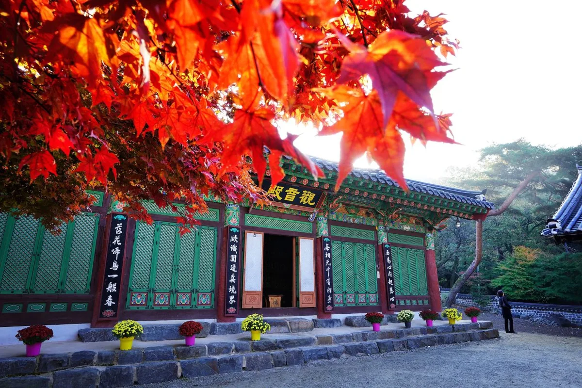 Photo: Korea Tourism Organization photo gallery (Gyeryong-myeon, Gongju-si, Chungcheongnam-do) · KOGL
In Roman letters, the mountain is written Gyeryongsan. The main peaks are Sambulbong and Gwaneumbong, and the two temple trailheads are Donghaksa and Gapsa. Gyeryongsan National Park charges no admission fee, and you don’t need a permit to use the trails — but some areas are off-limits (Cheonhwangbong and other spots near military installations), so follow the signs. There are toilets at waypoints along the Gapsa route, and reportedly near the Donghaksa and Gapsa ticket offices as well. No drinking fountains show up in the data, so bring plenty of water. For navigation, Google Maps isn’t very accurate in Korea, so it’s safer to install KakaoMap or Naver Map ahead of time and check your actual route there. On the rocky ridge sections, take the falling-rock and fall-hazard warnings on the signs seriously, and in winter especially, watch your footing on iced-over stretches.
Other Mountains Nearby
- The Baekdudaegan ridge walk that cradles Jikjisa Temple — Hwangaksan in Gimcheon — about 73 km as the crow flies
- Where white granite peaks jut skyward — Huiyangsan in Mungyeong and Goesan — about 79 km as the crow flies
- The knife-edge ridge traverse of Hwangseoksan in Geochang, Gyeongnam — about 87 km as the crow flies
📍 Rock Spires and Pines Along the Natural Ridge: Gyeryongsan in Daejeon and GongjuLocation
Contact: bumseok.view [at] gmail [dot] com
Related posts
-

Ridge After Ridge in the Yeongnam Alps: Unmunsan in Cheongdo and Miryang
-
Ropes up the Bubong rock ridge — Juheulsan, the mountain that cradles Mungyeong Saejae
-
Cheontaesan in Chungbuk: Home to Turtle Rock Ridge and Yeongguksa Temple
-
Yongbawi and Seonnyeobawi Rock Ridge, Mt. Seodaesan in Geumsan, Chungnam
Comments