Yongbawi and Seonnyeobawi Rock Ridge, Mt. Seodaesan in Geumsan, Chungnam
Hiking · Published 7/30/2026 ·
등산로 트랙·시설 (공공데이터: 전국등산로 공간정보) · 🚩시종점 💧음수대 👁️조망점 🏠대피소 🅿️주차장 ⚠️위험 · 지도 © OpenStreetMap ⤓ GPX 다운로드
At a Glance
| Metric | Rating |
|---|---|
| ① Accessibility (transit/parking) | ★★☆☆☆ |
| ② Trail difficulty | ★★★☆☆ |
| ③ Water/springs on the mountain | ★☆☆☆☆ |
| ④ Overnight stay needed | ★★☆☆☆ (one night if doing the full ridge traverse) |
| ⑤ Seasonal difficulty — Spring | ★★★☆☆ |
| ⑤ Seasonal difficulty — Summer | ★★★★☆ |
| ⑤ Seasonal difficulty — Fall | ★★★☆☆ |
| ⑤ Seasonal difficulty — Winter | ★★★★★ |
※ Source: Korea Forest Service trail spatial data · accessibility and seasonal ratings are for reference only
Overview
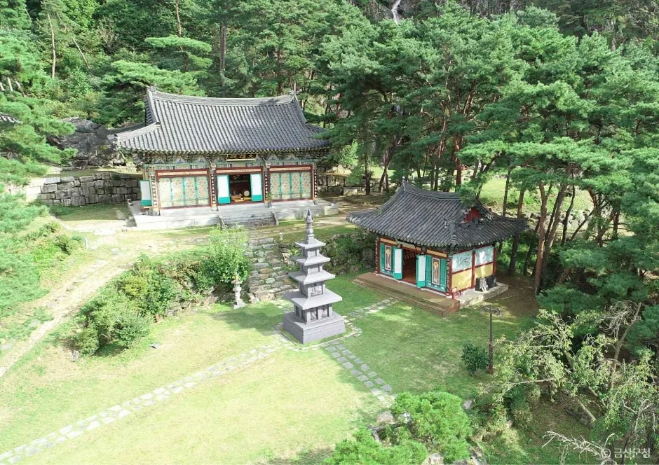 Photo: Korea Tourism Organization Photo Gallery (충청남도 금산군 추부면 개덕사길 83) · KOGL
Seodaesan (931m) sits in Geumsan County, South Chungcheong Province, and ranks among the taller peaks in the region. The summit area is dominated by rocky crags, while the mountain as a whole blends soil-covered slopes with rugged rock terrain—so depending on which trail you take, you can end up with a completely different hiking experience. Overall difficulty is moderate, but the stretch near the summit gets steep and rocky enough that you’ll want to bring both stamina and caution. The main routes can be done as a day hike, round trip included, though if you’re aiming to cover the entire trail network in the area, it’s worth planning for at least one overnight stay.
Mountain Shape and Terrain
Seodaesan’s summit rises as a jagged rock peak, and true to its name — which literally means “western tower mountain” — it looks most impressive when you view it from the west. The public data registry lists a whole cluster of named peaks and rock formations scattered across the mountain: Jebibong Peak (registered at two separate points, 539m and 546m), Janggunbawi Peak (902m), the main Seodaesan summit (931m, also logged as 904m and 930m), Bongwoori Peak (550m), Daeseongsan Peak (724m), and another Jebibong Peak (575m). As the names suggest — Janggunbawi (“General Rock”), Yongbawi (“Dragon Rock”), Seonnyeobawi (“Fairy Rock”), Sinseonbawi (“Immortal’s Rock”) — striking rock formations turn up all over the mountain, so if you follow the ridgeline you’ll run into one rock-outcrop viewpoint after another, big and small. The valley sections are comparatively gentle, but the closer you get to the summit, the steeper it gets and the more rock scrambling you’ll hit — a classic Chungcheong-region rocky-peak profile.
The Feel of the Hike
The Seosan trail starts off easy, winding through dense forest at the base, and the stretch that passes temples like Heungguksa and Hyosimsa carries a quiet, contemplative mountain-temple atmosphere. Past the midpoint, though, bare rock starts showing up more often and the slope steepens — you’ll find yourself scrambling hand-over-hand past striking rock formations like Yongbawi (Dragon Rock), Seonnyeobawi (Fairy Rock), and Sinseonbawi (Immortal Rock). Near the summit, the view opens up in every direction, and around Jomangbawi (Viewpoint Rock) especially, you get a sweeping panorama of the surrounding ridgelines and the whole Geumsan-gun area. In spring it’s fresh greenery and wildflowers, in fall the ridge turns brilliant with autumn colors, summer brings the damp air of the valley along with a fairly demanding workout, and in winter the ice on the rocky sections completely changes the character of the hike.
Main Routes by Trailhead
The summit’s highest elevation is confirmed at 927m. Based on GPX data from the “100 Famous Mountains” list, the representative routes are as follows.
| Route (Trailhead → Summit) | Distance | Elevation Gain | Est. Time (One-way) | Difficulty | Popularity |
|---|---|---|---|---|---|
| Seodaesan Dream Resort → Jebi Peak Summit | 4.65km | ↕662m | About 2h 16m | ★★★★☆ | ★★★★☆ |
| Ilbulsa Entrance → Summit | 7.16km | ↕715m | About 2h 59m | ★★★★★ | ★★☆☆☆ |
| Hwangsaemok Trail (Heungguksa Entrance) → Summit | 6.31km | ↕698m | About 2h 44m | ★★★★☆ | ★★★☆☆ |
※ Source: Korea Forest Service Trekking Support Center, 100 Famous Mountains GPX (distance, elevation, time, difficulty) · Popularity is for reference only
Course 1 — Seodaesan Dream Resort → Jebibong Summit
Route: Seodaesan Dream Resort → Dream Resort → resort info booth → resort grounds → fork in the trail → signboard → resort guide → soccer field → Seodaesan rain gauge station → scenic spot (Dragon Rock) → Seodaesan 1-2 → Seodaesan 1-3 → Jebibong Summit → scenic spot (Jebibong) → trail rest area
Getting to the trailhead: The Chubu-myeon area of Geumsan-gun, where Seodaesan Dream Resort sits, has fairly limited public transit, so most people take a bus to the nearest stop and walk in from there. If you’re driving, there’s usually open space near the resort you can park in, but there’s no officially registered trailhead parking lot, so it’s worth double-checking on a map app before you go.
What to expect, who it’s for: This course cuts through the resort grounds, passes a few man-made landmarks like the soccer field and the rain gauge station, then climbs past natural scenery — including Dragon Rock — up onto the ridge. Of the three courses, it’s the shortest in both distance and elevation gain, which makes it an easy round trip in a single day. That said, there’s still a steep stretch near the summit, so it suits hikers with a bit of experience under their belt rather than absolute beginners — a solid pick if you want to stand on the summit without spending the whole day getting there.
Course 2 — Ilbulsa Trailhead → Summit
Route: Sankkot-ro (Bogwang Bridge) → bus stop → fork → Anbogwang-ri Hyosimjeong → Waypoint 5 → Hyosimsa Deokbun School → Hyosimsa Deokbun School parking lot → restroom → Hyosimsa → Seodaesan hiking information board → emergency rescue marker → emergency rescue marker → emergency rescue marker → Seonnyeobawi (Fairy Rock) → viewpoint rock
Trailhead access: There’s a bus stop near Bogwang Bridge on Sankkot-ro, so getting here by public transit is relatively easy. The Hyosimsa Deokbun School parking lot sits right along the route, making it a handy option if you’re driving in.
Highlights & who it’s for: Of the three courses, this one has the longest distance and the biggest elevation gain, making it the toughest overall. It opens with the quiet, temple-pilgrimage feel of passing through Hyosimsa, then shifts gears in the second half with a string of rock sections — Seonnyeobawi and the viewpoint rock among them. A restroom marked along the early stretch is a nice convenience near the start, but given how physically demanding the course is as a whole, I’d recommend it mainly to hikers with plenty of experience under their belt.
Course 3 — Hwangsaemok-gil (Heungguksa Entrance) → Summit
Route: Cherry Blossom Trail Sanggok Bridge → Fork → Waypoint 4 → Seonmunsa → Hwangsaemok-gil Left Branch (Edible Plant Community Area) → Waypoint 6 → Heungguksa-ro Red Pine Trail → Hwangsaemok-gil (Heungguksa Entrance) → Hwangsaemok-gil (trail up to Heungguksa) → Heungguksa → Sinseonbawi Rock → Bawisimteo Rest Spot → Madangbawi Rock → Seodaesan Battle Memorial → Dream Resort Parking Lot
Trailhead access: This hike starts near Sanggok Bridge, and since the trail exits at the Dream Resort parking lot, it’s easy to pair with Course 1 for a loop hike back to your starting point. Driving in is a bit more convenient here than relying on public transit.
Highlights & who it’s for: You’ll pass through a stretch with some nice natural touches — the cherry blossom trail and the edible plant community area — before reaching temples like Heungguksa and Seonmunsa. The back half is dotted with wide, flat rock rest spots like Sinseonbawi and Madangbawi. Madangbawi in particular is roomy enough to really stretch out and take a break, so this course suits anyone who wants to climb at an easy pace and soak in the scenery along the way.
Difficulty, Terrain & Cautions
 Photo: Korea Tourism Organization Photo Gallery (충청북도 옥천군 장령산로 519) · KOGL
According to the Korea Forest Service’s trail geospatial data, the highest recorded difficulty rating for trails within Seosan is “moderate,” and no specific terrain surface details are listed. That said, the measured-course data for Korea’s Top 100 Mountains tells a different story: all three routes up to the summit area show a net elevation gain of over 660m and a difficulty rating of 4 to 5 stars, so the trail likely feels tougher in practice than the official rating suggests. The public data also lists zero scenic viewpoints, hazard zones, shelters, and trailhead/exit facilities — meaning you shouldn’t count on dedicated safety infrastructure or shelter spots along the way, and should plan your hike accordingly. The rocky sections near the summit and around Yongbawi, Seonnyeobawi, and Sinseonbawi rocks get considerably slicker in wet weather, and icing in winter raises the risk significantly, so extra caution is warranted there.
Distance and Time Needed
The registered trail network within the Seosan area adds up to 46.19 km total — and that’s not the length of any single route, but the combined length of every trail segment across the whole mountain. Looking at cumulative time across all these segments, you’re looking at 914 minutes going up and 633 minutes coming down, which works out to an average uphill pace of roughly 20 minutes per kilometer. That figure isn’t the time for any particular course, though — it’s just a rough average pace across the mountain’s entire trail network. For actual course-by-course timing, go with the detailed figures given earlier (about 2 hours 16 minutes to 2 hours 59 minutes, one way). The main routes run around 2 hours one way, so even a round trip is doable as a day hike. That said, if you’re linking multiple segments together for something more like a full traverse, the total distance climbs past 46 km, and at that point you’d want to plan for at least an overnight stay.
Getting There (Public Transit & Parking)
Seodaesan sits in Geumsan-gun, South Chungcheong Province, so most people get there by intercity or local bus from Daejeon or a nearby city. According to public data (TAGO), the actual bus stops near the trailhead are Seodaesan Dream Resort and Seongdang 2-ri — both useful if you’re starting from Course 1 (Seodaesan Dream Resort → Jebibong Peak). That said, buses out here run less frequently than in the city, so it’s worth checking the schedule before you head out. There’s no official trailhead parking lot listed in the public data, so drivers typically park around the Dream Resort area or in open spaces near the temple. Whether you’re going by transit or on foot, I’d recommend checking KakaoMap or Naver Map for real-time routes and bus schedules before you leave.
Season, Weather & Gear
The best seasons for hiking Seosan are spring (April–May) and fall (September–November), when you can enjoy fresh greenery or autumn foliage alongside temperatures that are just right for climbing. Summer’s a different story — the humidity from the valley combined with the heat really drains your energy, so you’ll want to plan for plenty of water and rest stops. In winter, the summit area and rocky sections ice over, making crampons and gaiters essential. As for basic gear, I’d recommend ankle-supporting hiking boots, plenty of drinking water (there are essentially no springs on the mountain, so you have to bring your own), trekking poles, a rain jacket just in case, and a change of clothes. Since there’s quite a bit of rock scrambling involved, gloves are worth packing too.
Tips for Foreign Travelers
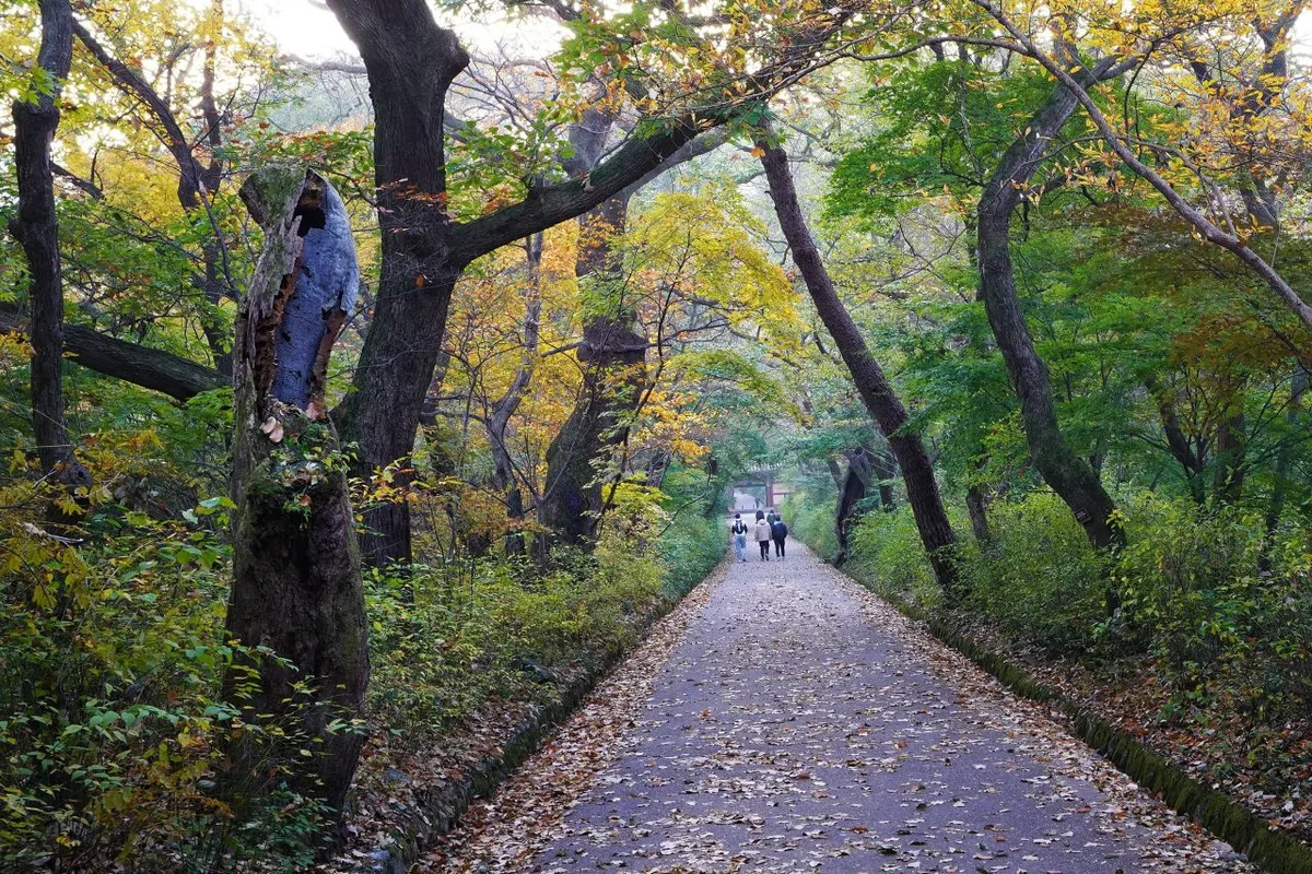
 Photo: Korea Tourism Organization Photo Gallery (충청남도 금산군 홍골1길 142) · KOGL
Seodaesan is romanized as “Seodaesan (931m),” the main trailhead—Seodaesan Dream Resort—stays the same in English, and the peak near the summit, Jebibong, can be written as “Jebibong.” There’s no known permit requirement or entrance fee, but it’s still worth double-checking with the management office or local municipality before you go, just in case. You’ll find restrooms near the parking lot of Hyosimsa Deokbun School along Course 2 (Ilbulsa entrance → summit), but there’s not much else in the way of restrooms or drinking water elsewhere on the trail, so make sure to bring enough water and take care of business before you set out. For trail navigation, KakaoMap or Naver Map are far more accurate than Google Maps here, so I’d strongly recommend using one of those two instead—and downloading the offline maps ahead of time helps a lot in the stretches where cell service gets spotty. For safety, it’s better to go with a companion than to hike solo, and given how much rocky terrain this trail has, think twice before attempting it in the rain or during winter.
Nearby Mountains Worth a Look
- Gyeryongsan (Daejeon/Gongju) — a natural ridgeline of jagged rocks and pines — about 33km away as the crow flies
- Hwangaksan (Gimcheon) — a Baekdudaegan ridge trail cradling Jikjisa Temple — about 40km away as the crow flies
📍 Yongbawi and Seonnyeobawi Rock Ridge, Mt. Seodaesan in Geumsan, ChungnamLocation
Contact: bumseok.view [at] gmail [dot] com
Related posts
-

Ridge After Ridge in the Yeongnam Alps: Unmunsan in Cheongdo and Miryang
-
Ridge After Ridge, Hugging a Reservoir: The 'Alps of Chungnam,' Cheonggyesan in Cheongyang
-
Rock Spires and Pines Along the Natural Ridge: Gyeryongsan in Daejeon and Gongju
-
A Granite Ridge Holding Thousand-Year-Old Rock-Carved Buddhas: Namsan in Gyeongju
Comments