Mungyeong's Daeyasan, Home to the Elephant Rock Ridge and Yongchu Valley
Hiking · Published 8/1/2026 ·
등산로 트랙·시설 (공공데이터: 전국등산로 공간정보) · 🚩시종점 💧음수대 👁️조망점 🏠대피소 🅿️주차장 ⚠️위험 · 지도 © OpenStreetMap ⤓ GPX 다운로드
At a Glance
| Metric | Rating |
|---|---|
| Accessibility (public transit/parking) | ★☆☆☆☆ |
| Trail difficulty | ★★☆☆☆ |
| Water sources on the mountain | ★☆☆☆☆ |
| Need an overnight stay? | ★☆☆☆☆ (easy day trip) |
| Seasonal difficulty — spring | ★★★☆☆ |
| Seasonal difficulty — summer | ★★★☆☆ |
| Seasonal difficulty — fall | ★★☆☆☆ |
| Seasonal difficulty — winter | ★★★★★ |
※ Source: Korea Forest Service trail geospatial data · accessibility and seasonal ratings are rough guides
Overview
Daeyasan (大耶山) sits right on the border between Gaeun-eup in Mungyeong-si, Gyeongsangbuk-do, and Goesan-gun in Chungcheongbuk-do — a rocky-ridge peak connected to the Johangsan and Hiyangsan spurs of the Baekdudaegan range. Sources don’t quite agree on the summit elevation; it’s generally given as somewhere in the 930–950m range, though actual measured course data puts the highest point near the top at 1,001m. It’s a rock-ridge hike where the cool, refreshing scenery of Yongchu Valley meets a parade of strange rock formations — Elephant Rock, Gate Rock, Nongbawi and more. The trail is officially rated “easy” by the local authorities, but the real summit route asks for a fair bit of stamina and attention once you factor in the distance and elevation gain. It’s an easy day hike, and most people tackle it as an out-and-back or a loop rather than a through-hike.
Ridgelines and Terrain
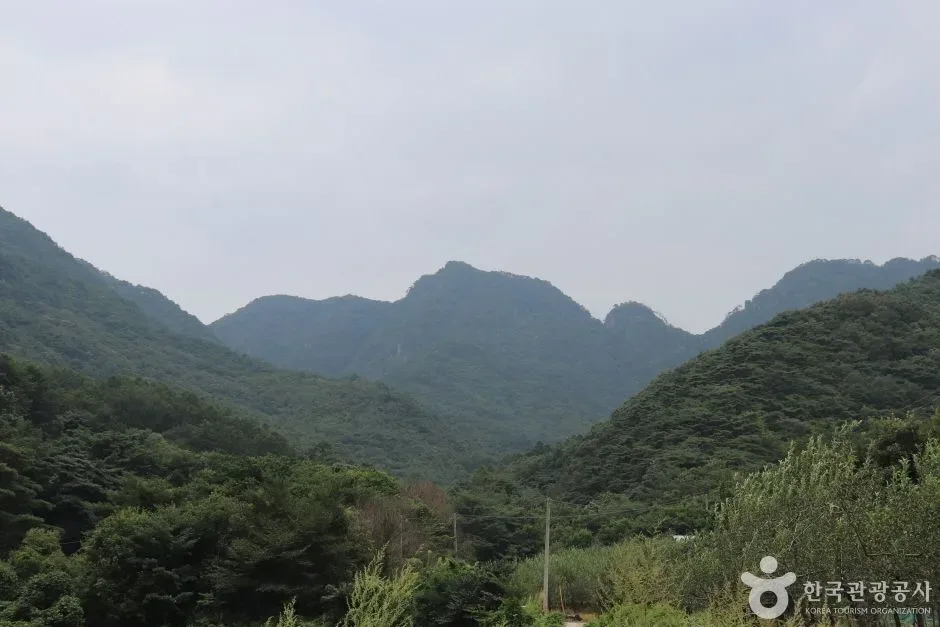
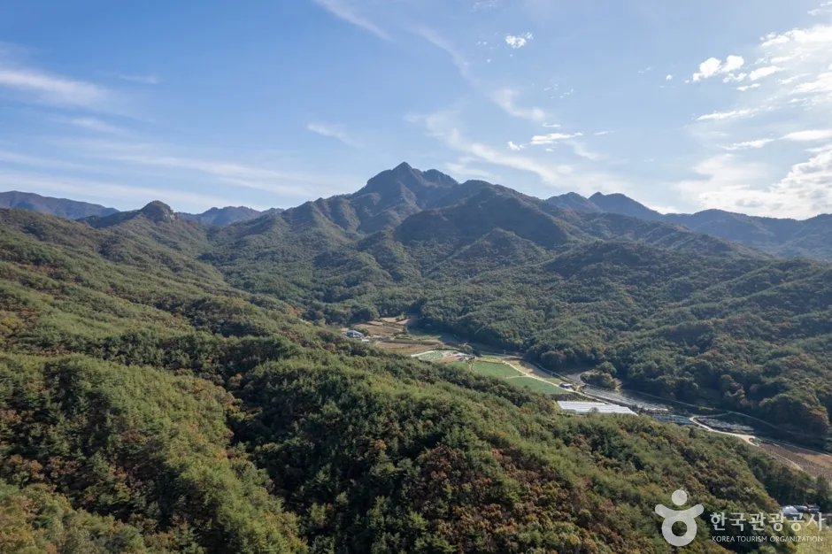 Photo: Korea Tourism Organization photo gallery (Wanjang-ri, Gaeun-eup, Mungyeong-si, Gyeongsangbuk-do) · KOGL
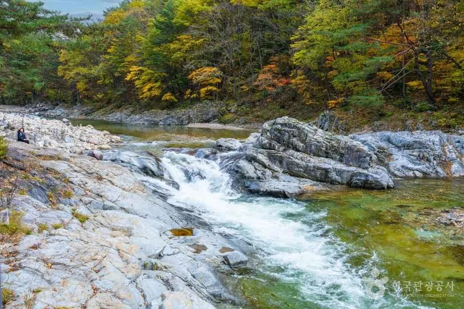
Daeyasan is a mountain where the soft, earthy feel of a soil-covered peak coexists with sharp rocky crags, and overall the granite and metamorphic rock formations are what stand out. The main peaks making up the range are the summit area of Daeyasan (listed as 952m and 942m respectively in the public peak POI data), Dundeoksan (979m) continuing to the north, and Galmobong summit (585m) on the western flank. Near the top, rocks that look exactly like their names — Elephant Rock, Nongbawi, Daemunbawi — line up along the ridge, giving you something to look at the whole way up. Down in Yongchugol valley there are pools and waterfall formations carved out by the water, plus an area of wind holes known to give off natural cold air, which is why the mountain gets credit for having a bit of everything: soil slopes, rock faces, and a proper valley.
What the Hike Feels Like
What makes Daeyasan distinctive is the way the hike unfolds: it opens on a wooded valley trail and gradually gives way to rocky ridgeline. The Yongchugol course has all the charm of valley trekking, with the sound of water alongside you the whole way, and as you climb toward the summit the rock ridge past Elephant Rock, Nongbawi, and Daemunbawi serves up genuinely thrilling stretches where you’ll be using your hands on the way up and down. From the ridge near Miljae, the view opens onto the Baekdudaegan range and off toward Johangsan, and from the viewpoint near the summit you get layer upon layer of the Songnisan ridgelines spreading out before you. It’s a mountain known for drawing especially high praise in spring, for the fresh green and wildflowers in the valley, and in autumn, for the fall colors set against the rock ridges.
Main Routes (by Trailhead)
| Route (trailhead → summit) | Distance | Net elevation gain | Est. time (one way) | Difficulty | Popularity |
|---|---|---|---|---|---|
| Yongchugol entrance restrooms → wind-hole area | 13.2km | ↕715m | About 4 hr 30 min | ★★★★★ | ★★★☆☆ |
| Rescue marker post → viewpoint near Daeyasan summit | 8.58km | ↕648m | About 3 hr 14 min | ★★★★★ | ★★★★★ |
| Daeyasan Visitor Center → Wolyeongdae | 8.65km | ↕605m | About 3 hr 10 min | ★★★★★ | ★★★★☆ |
※ Sources: Korea Hiking and Trekking Support Center 100 Famous Mountains GPX (distance, elevation, time, difficulty) · Popularity ratings are for reference only
Course 1 — Yongchugol Entrance Restroom → Punghyeol (Wind Hole) Zone
Waypoints: Hakcheonjeong Pavilion → Yongchugol entrance restroom → Mudangso Pool → Daeyasan Natural Recreation Forest → Daeyasan Natural Recreation Forest parking lot → trail fork → rest area inside Daeyasan Natural Recreation Forest → snake and venomous insect warning sign → Dundeoksan trail map → Dundeoksan trail marker post → national point number marker → rescue marker post → Dundeoksan trail marker post and national point number sign → path toward Dundeoksan → mountain location sign
Getting to the trailhead: Hakcheonjeong Pavilion and the Yongchugol entrance are generally reached from the Wanjang-ri area of Gaeun-eup, Mungyeong. The Daeyasan Natural Recreation Forest is nearby, so if you’re driving, the usual move is to park in the recreation forest lot. By public transit, the standard approach is to take a rural bus from downtown Mungyeong toward Wanjang-ri and then walk in.
Character and who it suits: This is the longest of the three courses and has the biggest net elevation gain, so it takes a real toll on your legs. The early stretch follows the Yongchugol valley past pools like Mudangso, which gives you the full valley-trekking atmosphere, and the section through the Daeyasan Natural Recreation Forest feels almost like a gentle stroll under the shade of the forest. That said, the latter half along the ridge toward Dundeoksan is marked mostly by trail posts, so it’s better suited to hikers with some experience under their belt — or anyone willing to take on the distance in exchange for a quiet mountain path.
Course 2 — Rescue Marker Post → Viewpoint Near Daeyasan Summit
Route: Rescue marker post → trail signpost → Miljae Pass → junction → Elephant Rock → Nongbawi Rock → viewpoint near Daeyasan summit → Daemunbawi Rock (front) → Daemunbawi Rock (rear) → fall-hazard marker post → fall-hazard warning → viewpoint near Daeyasan → Daeyasan summit → Waypoint 40 → Jungdaebong viewpoint
Getting to the trailhead: Since the route goes over Miljae Pass, this looks like a stretch that climbs up to the ridge from one of the valley access roads on the Mungyeong side. There’s no public-data listing for transit or parking here that I could confirm, so it’s worth checking KakaoMap or Naver Map before you go to see where the access road actually is and whether parking is an option.
What it’s like, and who it’s for: Of the three courses, this is the classic summit route — the one that takes in all of Daeyasan’s signature landmarks: Elephant Rock, Nongbawi, and Daemunbawi. Once you’re over Miljae Pass the rocky ridge really begins in earnest, and on the stretch past the front and back of Daemunbawi you’ll actually pass a “fall-hazard marker post” and then a “fall-hazard” sign back to back — that’s how steep and rocky it gets, the kind of terrain where you’re using hands as much as feet. The views from the viewpoint near the summit and from the Jungdaebong viewpoint are excellent, so it’s a great course for photos. I’d recommend it to hikers with at least some experience on rocky ridgelines.
Course 3 — Daeyasan Visitor Center → Wolyeongdae
Route: Daeyasan Visitor Center → Daeyasan Yongchu Parking Lot → restroom → trail marker → national point number → Waypoint 13 → trail junction → rest area → Dundeoksan trail marker → mountain location sign → Daeyasan viewpoint → viewpoint → rescue post marker → national point number and trail marker → Sonnyeo Magwi Tongsi Rock
Getting to the trailhead: Both the Daeyasan Visitor Center and the Daeyasan Yongchu Parking Lot show up as surveyed waypoints on the trail markers, which makes this the most accessible of the three courses. There’s a restroom near the visitor center, and if you’re driving, the usual move is to start from the Yongchu parking lot. By public transit, the known approach is to take a Mungyeong city bus, get off at a nearby stop, and walk the rest of the way.
What it’s like and who it suits: This course starts at the visitor center, weaves between valley and ridge, passes well-known rock formations like Sonnyeo Magwi Tongsi Rock, and finishes at Wolyeongdae. Two viewpoints are confirmed along the way (the Daeyasan viewpoint and one simply labeled “viewpoint”), so there’s plenty to look at as you walk. Compared with the previous two courses, the early going is easier and the facilities (restrooms and so on) are in place — which makes it a solid pick if it’s your first time on Daeyasan, or if you want to use it as your way back down.
Difficulty, Trail Surface, and Cautions
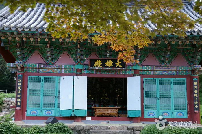
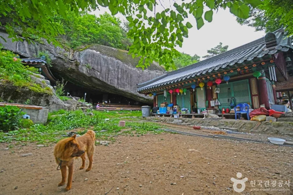 Photo: Korea Tourism Organization Tourism Photo Gallery (205-182 Samsong-gil, Cheongcheon-myeon, Goesan-gun, Chungcheongbuk-do) · KOGL
Based on the total trail length within the district (5.26 km for the Wanjang-ri section plus 4.85 km for an unnamed section, 10.11 km combined), the data lists the maximum difficulty as “Easy.” But that rating covers every trail in the administrative district as a whole — and when you run the actual summit-area routes (the structural marker post, Yongchugol, and visitor support center courses) against measured GPX data, they all come out at maximum difficulty (★★★★★). There’s no separate entry for trail surface, but you can guess from the names of the waypoints along the way — Elephant Rock, Nongbawi, Daemunbawi, Sonnyeo Magwitongsi Rock — that the summit area is heavy on rocky ridges and scrambles, which means real caution about slipping in the rain and ice in winter. The public data records zero hazard-area POIs and zero viewpoint POIs, yet the measured waypoints turn up a “fall hazard marker post” and a “fall hazard” sign in the Daemunbawi section, and Course 3 has two viewpoints — “Daeyasan Viewpoint” and simply “Viewpoint.” So the viewpoints and the tricky stretches are both out there on the ground. Shelters: zero. Trailheads and exit points: two. Worth keeping in mind that you’ll be hiking with no emergency shelter to fall back on.
Distance and Time
Add up every officially registered stretch in the area (the Wanjang-ri section plus one unnamed section), and the data gives a total of 253 minutes going up and 176 minutes coming down — which works out to an average ascent pace of roughly 25 minutes per kilometer. That’s a cumulative figure across several separate sections, though, so don’t mistake it for the time on any one course. For actual summit routes, go by the measured-course table above: about 3 hours 10 minutes to 4 hours 30 minutes one way. All three routes come to somewhere around 6 to 9 hours round trip, which makes them comfortably doable as a day hike — as long as you start early and leave yourself plenty of daylight for the descent. There are zero shelters in the area, so there’s no infrastructure for an overnight trip; planning on a single-day hike is the norm here.
Getting There (Public Transit & Parking)
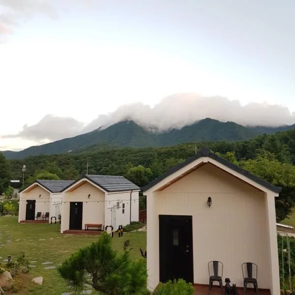 Photo: Korea Tourism Organization photo gallery (1290 Daeya-ro, Gaeun-eup, Mungyeong-si, Gyeongsangbuk-do) · KOGL
Daeyasan sits out in the Gaeun-eup area of Mungyeong, so getting there by train isn’t really an option. If you’re going by public transit, the usual route is to transfer at either Mungyeong Intercity Bus Terminal or the Gaeun intercity bus stop onto a rural bus heading toward Wanjang-ri. Word is the buses don’t run all that often, though, so check the timetable before you set out. Public data doesn’t turn up any registered bus stop or parking POIs nearby, but the surveyed course does show “Daeyasan Yongchu Parking Lot” as a point near the trailhead — so if you’re driving, that’s usually the place to punch into your navigation. For the exact approach road and live transit info, I’d recommend KakaoMap or Naver Map, which are much stronger on Korean mapping (Google Maps is often unreliable for public transit and smaller roads within Korea).
Season, Weather, and Gear
Daeyasan is a mountain where valleys and rocky ridges come together, so the best times to hike it are widely considered to be spring (April–May), for the fresh greenery and wildflowers, and autumn (October–November), for the fall colors. Summer lets you enjoy the cool of Yongchugol Valley, but be careful in wet weather — the water level in the valley can rise fast, and the rocky ridge sections get slippery. In winter, ice forms easily on the ridge sections near the summit, so crampons, gaiters, and other winter gear are essential. For any hike here, it’s worth bringing hiking boots, trekking poles, and gloves (you’ll be grabbing hold of rock on the ridge sections). There are no confirmed springs or water fountains anywhere in the area, so pack plenty of water.
Tips for International Visitors
Daeyasan is written as “Daeyasan” in the Roman alphabet, and the main landmarks appear with English glosses alongside them: Yongchu Valley (용추계곡), Wolyeongdae (월영대), Miljae Pass (밀재), Daemunbawi (대문바위). Since this isn’t a national park but an ordinary hiking area, I couldn’t find any permit requirement or entrance fee system — though it’s worth checking the signboards on site or local government notices for the latest information when you visit. There are toilets at the Yongchugol trailhead (Course 1) and near the Daeyasan Visitor Support Center (Course 3), but the data shows no springs or drinking fountains anywhere on the mountain, so bring all the water you’ll need. For maps, KakaoMap or Naver Map beat Google Maps here, and both have English interfaces, so international visitors can use them without trouble. The summit routes include rocky ridge sections and stretches marked with fall warnings, so I’d recommend hiking with company rather than solo — and since phone signal drops out in places, it’s safest to share your hiking plan with someone before you set off.
Other Mountains Nearby
- Huiyangsan in Mungyeong and Goesan, with its white granite crags — about 8 km as the crow flies
- Juheulsan, home of the rope-assisted Bubong ridge and the Mungyeong Saejae pass — about 18 km as the crow flies
📍 Mungyeong's Daeyasan, Home to the Elephant Rock Ridge and Yongchu ValleyLocation
Contact: bumseok.view [at] gmail [dot] com
Related posts
-
Ropes up the Bubong rock ridge — Juheulsan, the mountain that cradles Mungyeong Saejae
-
Stairway to Heaven on the Baekdudaegan's Rocky Ridges: Hwangjangsan in Mungyeong
-
Cheontaesan in Chungbuk: Home to Turtle Rock Ridge and Yeongguksa Temple
-
White Granite Peaks Rising Over Huiyangsan, Between Mungyeong and Goesan
Comments