Granite Ridges and Ancient Temples: Daegu's Palgongsan
Hiking · Published 7/18/2026 ·
등산로 트랙·시설 (공공데이터: 전국등산로 공간정보) · 🚩시종점 💧음수대 👁️조망점 🏠대피소 🅿️주차장 ⚠️위험 · 지도 © OpenStreetMap ⤓ GPX 다운로드
At a Glance
| Metric | Rating |
|---|---|
| Accessibility (Transit/Parking) | ★★☆☆☆ |
| Course Difficulty | ★★☆☆☆ |
| Water Availability | ★☆☆☆☆ |
| Overnight Stay Needed? | ★☆☆☆☆ (Easily done in a day) |
| Difficulty - Spring | ★★★☆☆ |
| Difficulty - Summer | ★★★★☆ |
| Difficulty - Fall | ★★★☆☆ |
| Difficulty - Winter | ★★★★☆ |
※ Source: Korea Forest Service trail data. Accessibility and seasonal difficulty are estimates.
Overview
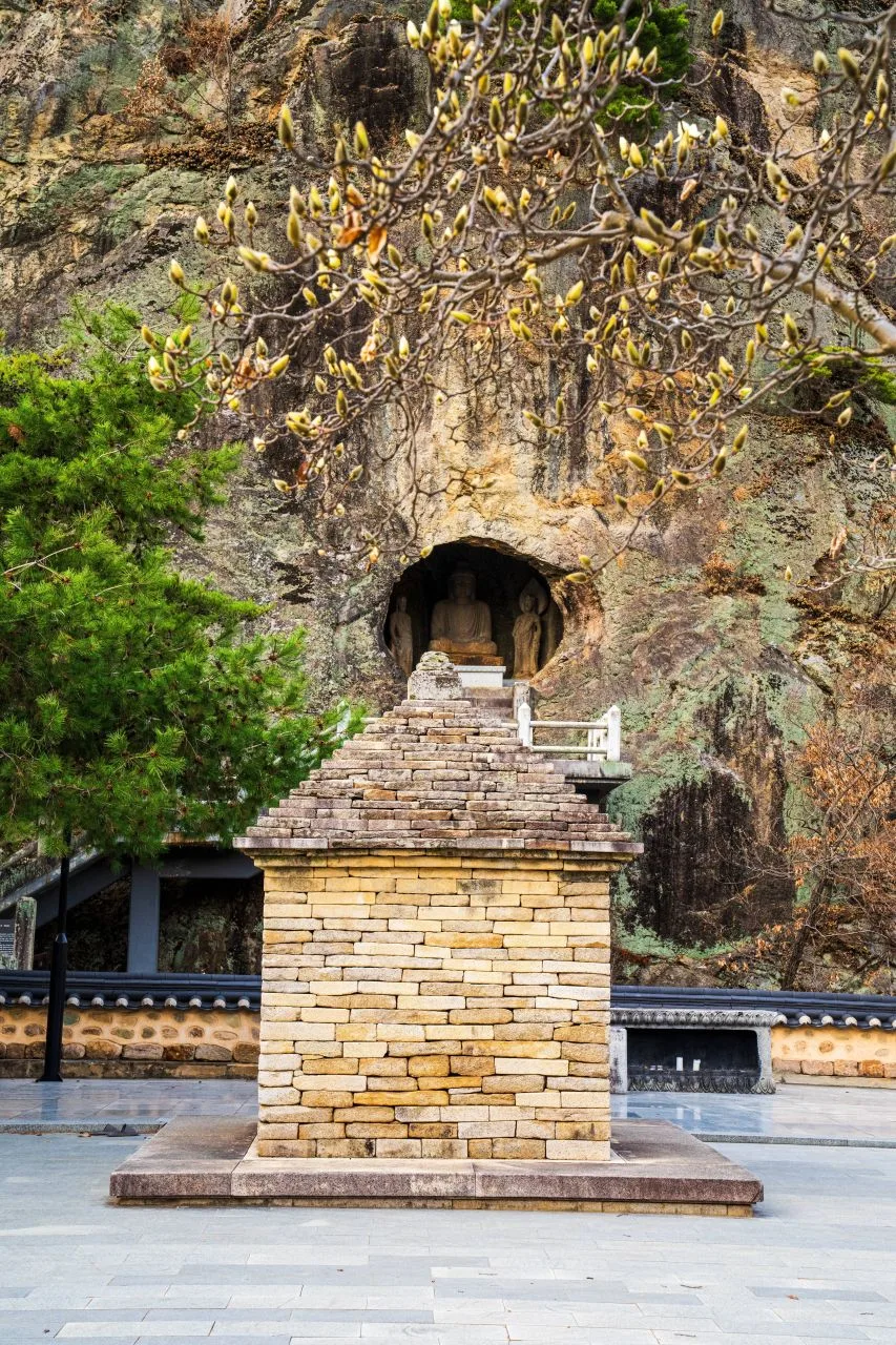 Photo: Korea Tourism Organization Photo Gallery (Bugye-myeon, Gunwi-gun, Daegu) · Public Nuri
Palgongsan is one of those iconic mountains near Daegu, stretching across several areas including Dong-gu, Gunwi, Yeongcheon, and Gyeongsan. You might notice slightly different elevations depending on which map you consult; some records list the highest point at about 1,204m, while others label the main peak, Birobong, at 1,220m. The terrain offers a beautiful mix of gentle, earthy slopes and rugged granite ridges. Most standard routes to the summit cover about 4.5 to 8.7km one way, typically taking anywhere from 2 hours 15 minutes to 3 hours 20 minutes—easily manageable for a day hike. Since the difficulty can vary quite a bit depending on the path you choose, there’s a wide range of options, from gentle, pilgrimage-style trails to more advanced routes featuring rocky ridges and steep cliffs.
Terrain and Topography
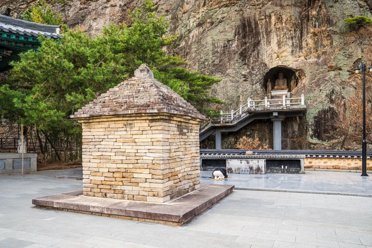 Photo: Korea Tourism Organization Photo Gallery (Bugye-myeon, Gunwi-gun, Daegu Metropolitan City) · Gonggong Nuri
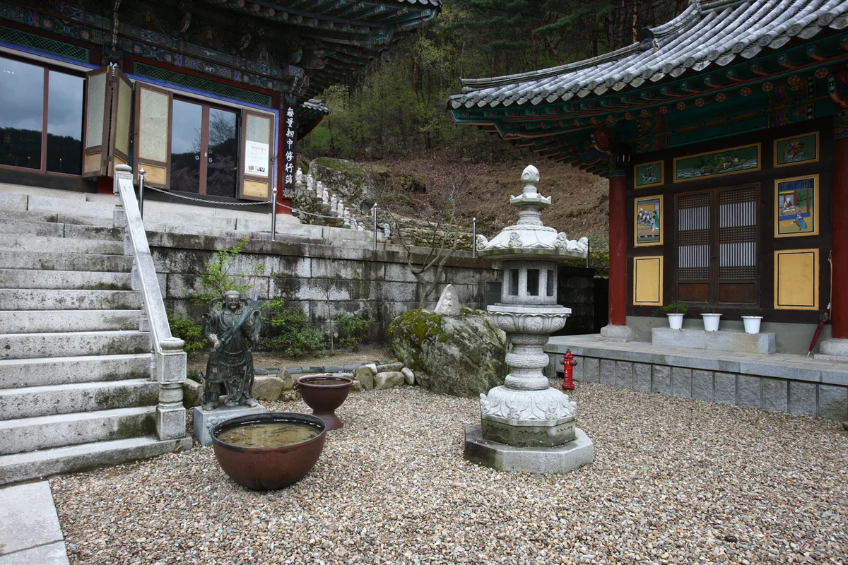
Palgongsan features a unique mix of typical soil-covered ridges and rugged granite peaks. According to the peak data, the main summit—Birobong (1,220m)—is connected via a ridgeline to Dongbong (1,193–1,194m, including the 1,189m designation) and Seobong, with other peaks like Yeombulbong (1,133m), Sillimbong (828m), and Geojesan (502m) rounding out the mountain’s silhouette. You can see the rocky nature of the terrain in the names of various waypoints near the summits, such as Naktabong (Camel Peak) and Gi-i Amseok (Odd Rock Formations), which point to the exposed ridgelines found throughout the area. To make things even more interesting, historic Buddhist sites like Donghwasa Temple and Gatbawi (Gwanbong) are nestled in the foothills, meaning the natural landscape is deeply intertwined with its rich religious and historical heritage.
The Vibe of the Hike
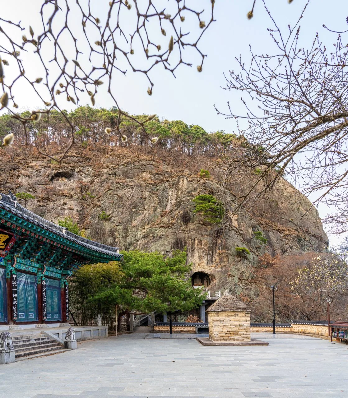 Photo: Korea Tourism Organization Photo Gallery (Bugye-myeon, Gunwi-gun, Daegu) · KOGL
Depending on your route, the experience of hiking Palgongsan can change quite a bit. The lower sections, especially those winding through temples like Donghwasa, are relatively gentle and heavily shaded by lush forests of pine and broadleaf trees. But as you approach the ridgeline, the terrain shifts between rugged granite outcrops and wide-open vistas. Some paths, like the Wonhyo Way designed for contemplation, feature foot-washing stations, pavilions, and inspirational signage—making them feel more like a peaceful trek than a strenuous climb. On the flip side, routes involving steep climbs or rocky scrambles can be quite intense, with sharp inclines and frequent warnings about falling rocks or cliffs.
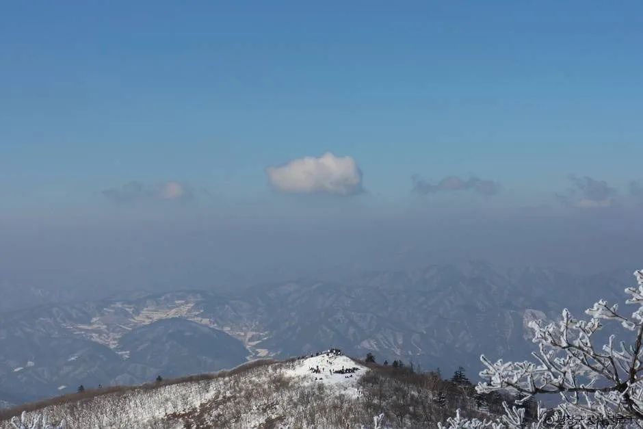
The mountain is also beautiful in every season: fresh greenery and azaleas in the spring; the soothing sound of mountain streams in the summer; stunningly colorful ridges in the autumn (which is a legendary spot for fall foliage in the Daegu area); and snow-dusted peaks or frost in the winter.
Main Routes (by trailhead)
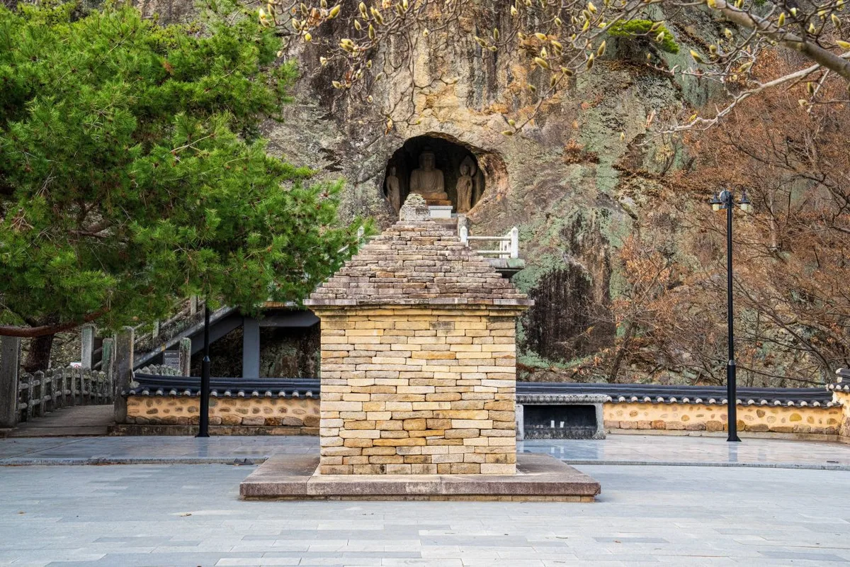 Photo: Korea Tourism Organization Photo Gallery (Bugye-myeon, Gunwi-gun, Daegu) · KOGL
| Route (Trailhead → Summit) | Distance | Elevation Gain | Est. Time (One Way) | Difficulty | Popularity |
|---|---|---|---|---|---|
| Bus Stop → Kkalttak Pass Summit Shelter | 8.67km | ↕721m | Approx. 3h 22m | ★★★★★ | ★★★★☆ |
| Wonhyo Path Entrance → Sky Garden Observatory | 7.08km | ↕621m | Approx. 2h 48m | ★★★★☆ | ★★★★☆ |
| Donghwasa Entrance Parking Lot → Summit | 6.54km | ↕693m | Approx. 2h 47m | ★★★★☆ | ★★★★★ |
| Trailhead → Mangpokdae | 7.94km | ↕789m | Approx. 3h 18m | ★★★★★ | ★★★☆☆ |
| Shelter → Summit Viewpoint | 8.5km | ↕704m | Approx. 3h 18m | ★★★★★ | ★★☆☆☆ |
| Birobong (via Odojae) → Seonginbong Peak | 8.31km | ↕686m | Approx. 3h 13m | ★★★★★ | ★★☆☆☆ |
| Junction 4 → Summit Trail Sign 113 | 7.19km | ↕737m | Approx. 3h 2m | ★★★★★ | ★★☆☆☆ |
| Sutaegol Valley → Seobong Peak | 4.52km | ↕678m | Approx. 2h 16m | ★★★★☆ | ★★★★☆ |
※ Source: Korea Mountain & Trekking Support Center 100 Famous Mountains GPX (Distance, Elevation, Time, Difficulty) · Popularity is for reference only
Course 1 — Bus Stop → Kkaldak-gogae Summit Shelter
Route: Bus Stop → Junction → Restroom → Kkaldak-gogae Summit Shelter → Rock Formations → Rockfall Hazard Zone → Scenic Overlook on Rocks → Sillimjeong Pavilion → Naktabong Peak → Rockfall Hazard Zone → Scenic Overlook → Path to the Rock-carved Buddha → Palgongsan Rock-carved Buddha → Tree in a Rock Crevice → Scenic Overlook on Deck Stairs
Trailhead Access: Since the trailhead is right next to the bus stop, this is a very transit-friendly route. There are several Daegu city buses that run toward the Palgongsan area, so I’d recommend checking KakaoMap or Naver Map to confirm your exact stop and route.
Features & Recommended For: This course winds through beautiful Buddhist heritage sites, including Naktabong Peak and the Palgongsan Rock-carved Buddha. Just a heads-up: you’ll encounter rockfall hazard signs twice along the way, so be extra cautious of loose rocks if it’s been raining. Also, as the name “Kkaldak-gogae” (the “breathless pass”) suggests, there are long, steep stretches. This one is definitely for hikers who feel confident about their cardio!
Course 2 — Wonhyo Pilgrimage Trail Entrance → Sky Garden Observatory
Waypoints: Restroom → Wonhyo Pilgrimage Trail Information Center → Junction 4 → Wonhyo Pilgrimage Trail Entrance → Rest Area → Signpost → Foot-washing Station → Location Marker → Inscriptions → Cheongun Pavilion → Lookout Point → Pit Toilet → “Standing on the path once walked by Wonhyo” → Junction 17 → Odoam Entrance
Getting There: The Wonhyo Pilgrimage Trail is a meditative trekking route nestled on the northern slopes of Palgongsan. It’s generally much easier to reach by car than via public transit, so I’d suggest checking a map app beforehand to pinpoint the exact entrance and parking situation.
Features & Recommendations: With elements like foot-washing stations, Cheongun Pavilion, and thoughtful inscriptions scattered throughout, the atmosphere feels much more like a “walking pilgrimage” than a strenuous climb. The absolute highlight is the view from the Sky Garden Observatory. Since it’s mostly gentle dirt paths, it’s a great option for families or anyone new to trekking.
Course 3 — Donghwasa Entrance Parking Lot → Summit
Via: Parking Lot → Restroom → Shelter → Kkaldak Pass (Steep Climb) → Scenic Views → Location Signpost → Fork in the Road → Donghwasa Entrance Parking Lot → Snack Shop & Parking Lot → Sightseeing Spots → Donghwaji Reservoir
The Approach: We’ll be starting from the entrance to Donghwasa, one of Palgongsan’s most iconic temples. Since the Daegu subway doesn’t reach this far out, most people typically take a local city bus, but there is a parking lot right at the entrance, so it’s actually quite easy to access by car.
Features & Recommendations: With the Donghwaji reservoir and various amenities like snack shops clustered right at the start, it’s a very easy way to get your bearings. However, once you hit the “Kkaldak” section, the incline picks up significantly—it’s your classic “temple-to-summit” trek. I’d highly recommend this to anyone visiting Palgongsan for the first time.
Course 4 — Trailhead to Mangpokdae
Route: Restroom → Parking Lot → Trailhead → Palgongsan Visitor Center (Chisan District) → Junction 8 → Directional Sign → Chisan Valley → Clearing → Junction 15 → Mangpokdae → Inside Mangpokdae (Sigu) → Chisan Falls → Trail Entrance → Junction 23 → Junction 25
Getting There: The starting point is the Chisan District Visitor Center toward Yeongcheon. Since it’s a bit of a haul from downtown Daegu, I’d definitely suggest driving. There should be some parking available near the visitor center.
Highlights & Who It’s For: This route winds along the Chisan Valley, offering beautiful scenery with spots like Chisan Falls and Mangpokdae. It’s a popular choice for summer hikes, but just a heads-up: if it’s been raining, the water can rise quickly and the currents can get quite strong. It’s an ideal pick for anyone who loves trekking through mountain valleys.
Course 5 — Shelter → The Summit View
Route Overview: Shelter → Suryungbongsan-gye Marker → Restroom → Rock Face → Rock Climbing Danger Zone → Junction 14 → Waterfall → Cliff Warning → Old Tree Bench → Junction 18 → View of the Summit → Summit Viewpoint → Palgongsan Ridge → Village Scenery → Bizarre Rock Formations
The Approach: This stretch features historical markers like the Suryungbongsan-gye stone, adding a nice touch of history to the hike. Just a heads-up: definitely check your map app before you head out for the most up-to-date info on parking and public transit.
Features & Recommended For: With signs like “Rock Climbing Danger Zone” and “Cliff Warning” popping up frequently, this is an advanced route with a lot of rocky ridges and steep drops. But it’s definitely worth the effort—the unique rock formations and those sweeping views of the Palgongsan ridge are absolutely stunning.
Course 6 — Birobong toward Odojae → Seonginbong
Waypoints: Birobong (toward Odojae) → Giwa → Seonginbong
Access: This section is essentially a ridge-traversing route that continues from the area around Birobong, the main peak of Palgongsan. Because it’s designed for a continuous trek along the ridge, you’ll usually find people approaching this as part of a larger loop rather than starting here on its own. You’ll probably want to double-check specific transportation and parking info depending on your starting point.
Features & Recommendations: There isn’t a ton of information on the waypoints, but the name “Giwa” (which means roof tile) offers a little hint of the old building sites that once stood here. It’s a great section to use as part of a longer traverse connecting Birobong and Seonginbong.
Difficulty, Terrain, and Safety
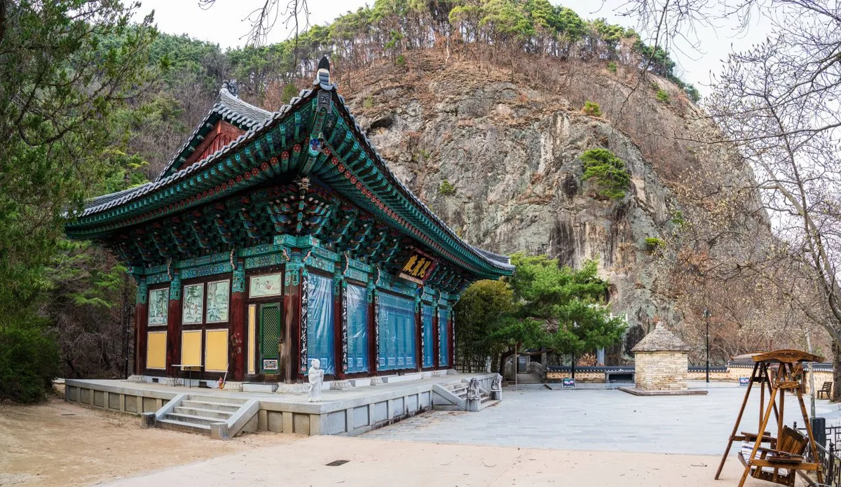 Photo: Korea Tourism Organization Gallery (Bugye-myeon, Gunwi-gun, Daegu) · Gonggonuri
The local hiking trail database lists four sections by administrative district, and according to the data, the maximum difficulty is labeled as “Easy.” There is no specific information regarding terrain surface provided in the registry.
| Section | Distance | Difficulty | Terrain |
|---|---|---|---|
| Songcheon-ri Section | 2.41km | Easy | - |
| (Unnamed Section) | 1.67km | Easy | - |
| Daeseong-ri Section | 1.4km | Easy | - |
| Sikcheon-ri Section | 1.28km | Easy | - |
It is important to note that this “Easy” rating only applies to the lower-altitude sections registered in the system; it’s a far cry from the actual trek to the summit. Based on my GPX measurements from the “100 Famous Mountains” data, most of the summit routes involve an elevation gain between 600m and 800m, which puts the real-world difficulty at a much more intense ★★★★☆ to ★★★★★ level.
Regarding facilities, the official spatial data shows zero registered water fountains, shelters, hazard zones, viewpoints, or trailheads/exits. Essentially, you should assume there are no officially recognized facilities on-site. However, my GPX logs through the summit routes revealed several things not captured in the official data: multiple restrooms, two rockfall hazard zones (on Course 1), and areas with climbing risks or steep cliff-side warnings (on Course 5). There is a clear gap between the official statistics and what you’ll actually encounter on the ground. Please keep in mind that rocky sections can be incredibly slippery when icy, and you should be especially cautious of rockfall-prone areas right after rain.
Distance and Travel Time
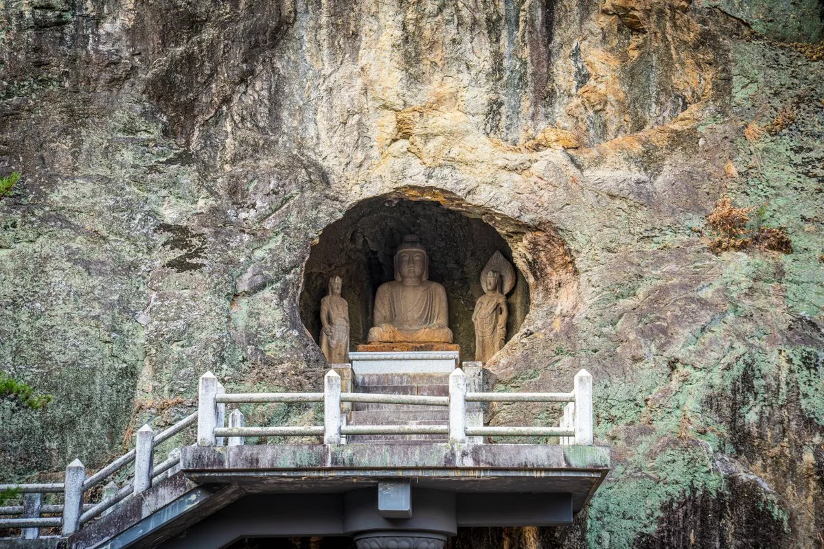 Photo: Korea Tourism Organization Photo Gallery (Bugye-myeon, Gunwi-gun, Daegu Metropolitan City) · KOGL
The total trail length of 6.76km is the sum of all four sections introduced earlier, not a single continuous course. Based on this total length, the recorded ascent takes 120 minutes and the descent takes 84 minutes, which works out to an average ascent pace of about 18 minutes per kilometer. Just a heads-up: since these figures represent the entire area, please don’t mistake them for the time it takes to complete a single specific course.
For actual summit climbing, you might find the GPX-based estimates from the “100 Famous Mountains” list more helpful; most representative courses take between 2 hours 15 minutes and 3 hours 22 minutes one way. Unless you’re planning a full round trip or a traverse, these are all very manageable as day hikes. Since there aren’t any registered shelters, I’d definitely recommend sticking to a day trip rather than planning an overnight stay. However, if you decide to link multiple courses together for a full traverse, your total time could easily exceed 6 hours. In that case, I’d suggest giving yourself plenty of breathing room—perhaps by starting right after sunrise.
Getting There (Public Transit & Parking)
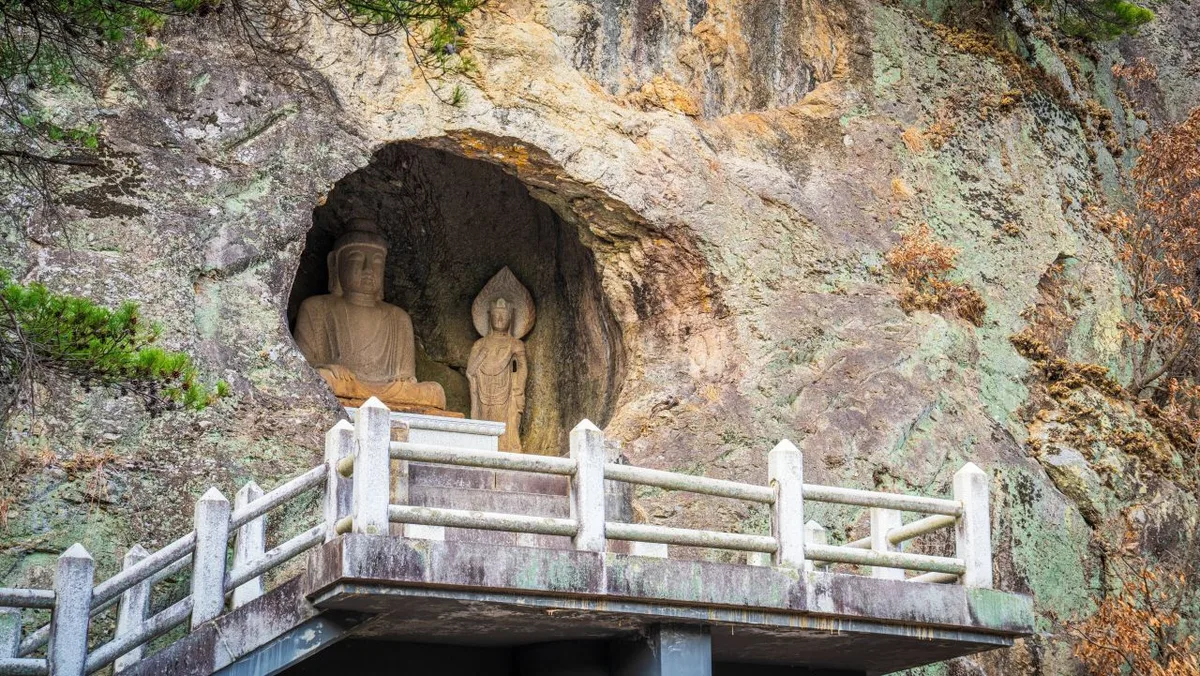 Photo: Korea Tourism Organization Photo Gallery (Bugye-myeon, Gunwi-gun, Daegu Metropolitan City) · Gonggong Nuri
Since the Daegu subway doesn’t go directly to the Pal-gongsan area, you’ll mostly be relying on local buses. For those planning to take the Donghwasa course, you can use the “Donghwasa Ipgu” (Donghwasa Entrance) stop as your primary reference point. Since routes to Gatbawi, Pagyesa, and Sutaegol all use different bus lines, I highly recommend checking KakaoMap or Naver Map in real-time to confirm the best stops and transfers for your specific route.
As for parking, official trail data shows zero registered facilities. However, in reality, there is a “Donghwasa Entrance Parking Lot” along Course 3 and some parking space near the Chisan District Visitor Center for Course 4. Essentially, while there are informal parking spots near the main temple entrances and visitor centers, they aren’t officially designated as part of the hiking trail infrastructure. Just a heads-up: expect things to get pretty crowded on weekends and during peak seasons!
Season, Weather, and Gear
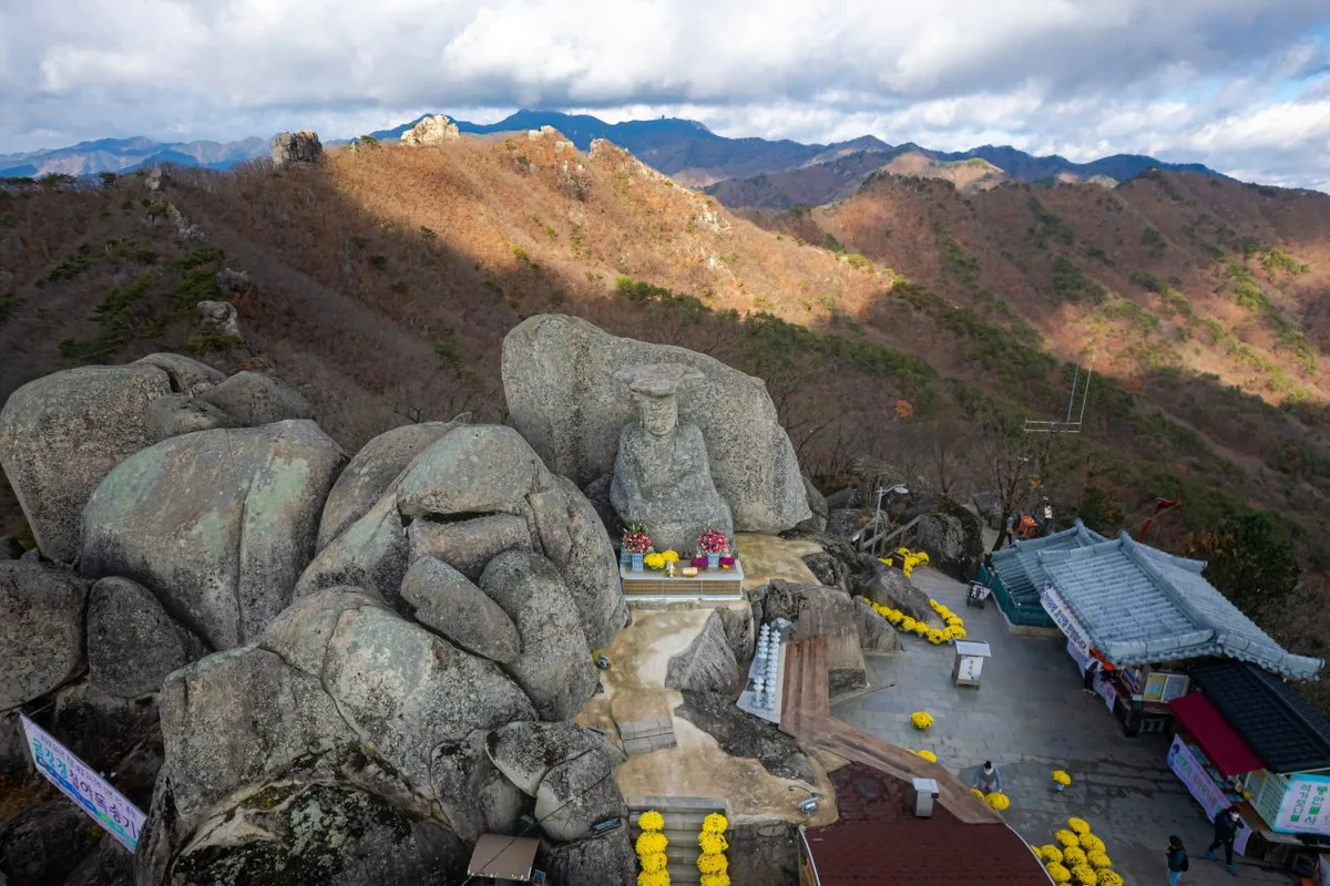 Photo: Korea Tourism Organization Photo Gallery (Wachon-myeon, Gyeongsan-si, Gyeongsangbuk-do) · Gonggong Nuri
For hiking Palgongsan, I’d say spring (April–May) and autumn (October–November) are the sweet spots—the temperature and views are usually just right. Summer can be quite refreshing if you head toward the valley trails like Chisan Valley, but do keep an eye on the humidity and those sudden thunderstorms. Winter can be a whole different story; icy ridges and frost often pop up, which can make the hike feel much more demanding than you might expect.
As for gear, I’d definitely recommend sturdy, ankle-supporting boots. Since you won’t find much in the way of water stations on these trails, make sure to pack plenty—aim for at least 1–1.5L per person. You’ll also want rain gear and a change of clothes to deal with sudden showers or rocky sections. In the winter, don’t forget your crampons, gaiters, and warm gloves. If you’re hitting routes with a lot of rocky terrain, a good pair of gloves and a headlamp (just in case your descent takes longer than planned) are highly recommended. And for those summer treks, sunscreen and bug spray will definitely be your best friends.
Tips for Foreign Travelers
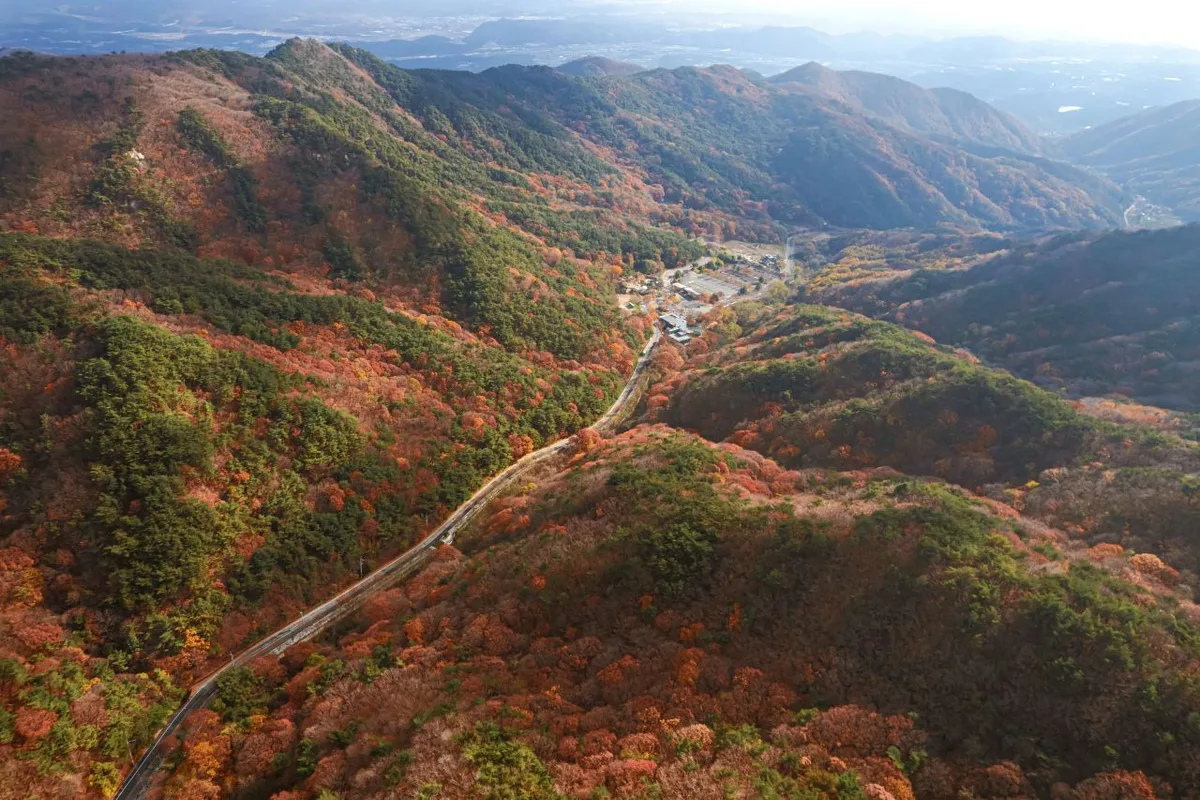 Photo: Korea Tourism Organization Photo Gallery (Wachon-myeon, Gyeongsan-si, Gyeongsangbuk-do) · Gongkonuri
The mountain is spelled “Palgongsan” in Romanized text, with the main peak known as “Birobong” and its representative temple being “Donghwasa.” There aren’t any special permits or entrance fees required to hike the mountain, but please follow local signage when visiting the temple grounds. One heads-up: there are 0 registered drinking fountains, so you’ll definitely need to bring enough water before you head out. You can find restrooms at the trailheads and near various rest areas, so it’s best to use them before you start your trek.
When it comes to navigation, Google Maps can be pretty unreliable for walking and public transit in Korea. I highly recommend downloading KakaoMap or Naver Map to get accurate, real-time routes and bus stop information. For your safety, please follow all signs warning of falling rocks or cliffs. Also, make sure your phone is well-charged—in an emergency, you’ll need to dial 119. Just a note: routes like Course 1 and Course 5 have frequent warnings for rockfalls or steep cliffs, so I’d suggest those only to hikers with plenty of experience.
Other nearby mountains
- Ulsan’s Sinbulsan: Silver grass plains and rocky ridges — approx. 61km as the crow flies
- Gwangju’s Mudeungsan: Stone pillars lined up like a folding screen — approx. 179km as the crow flies
- Seoul’s Gwanaksan: Sawtooth ridges and Yeonjudae peak — approx. 220km as the crow flies
📍 Granite Ridges and Ancient Temples: Daegu's PalgongsanLocation
Contact: bumseok.view [at] gmail [dot] com
Comments