Deokhangsan, Samcheok: Karst Ridges Cradling Hwanseon Cave
Hiking · Published 8/9/2026 ·
등산로 트랙·시설 (공공데이터: 전국등산로 공간정보) · 🚩시종점 💧음수대 👁️조망점 🏠대피소 🅿️주차장 ⚠️위험 · 지도 © OpenStreetMap ⤓ GPX 다운로드
At a Glance
| Metric | Rating |
|---|---|
| Accessibility (public transit/parking) | ★★☆☆☆ |
| Trail difficulty | ★★☆☆☆ |
| Water/springs on the mountain | ★★★☆☆ |
| Overnight stay needed? | ★☆☆☆☆ (a day trip is plenty) |
| Seasonal difficulty - Spring | ★★☆☆☆ |
| Seasonal difficulty - Summer | ★★★☆☆ |
| Seasonal difficulty - Fall | ★★☆☆☆ |
| Seasonal difficulty - Winter | ★★★★☆ |
※ Source: Korea Forest Service trail geospatial data · accessibility and seasonal ratings are for reference only
Overview
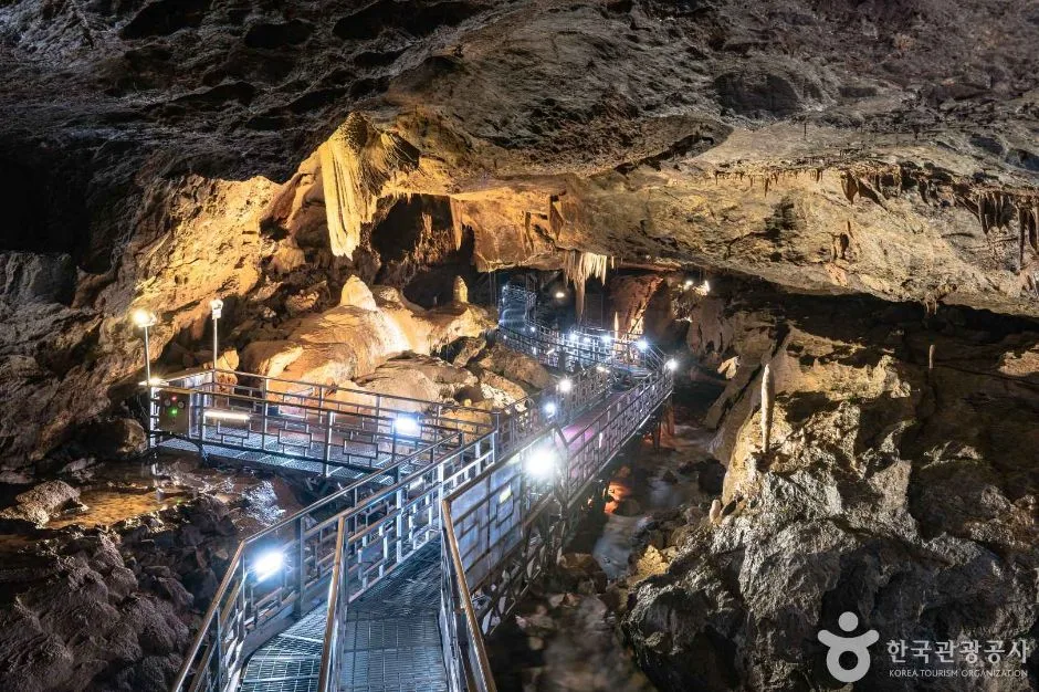 Photo: Korea Tourism Organization Photo Gallery (800 Hwanseon-ro, Singi-myeon, Samcheok-si, Gangwon Special Self-Governing Province) · KOGL Type 1
Deokhangsan (德項山) is a mountain in Samcheok, Gangwon Special Self-Governing Province, with a summit elevation of 1,059m, connected by ridgeline to the nearby Jigaksan-Hwanseonbong peak (1,056m). It’s part of the Baekdudaegan range, and the area around the summit features rocky ridges and karst (limestone) terrain. Down at the base of the mountain lies the Daeri cave zone, home to nationally designated natural monuments like Hwanseon Cave and Daegeum Cave. Overall, the mountain is mostly a gentle, soil-covered peak, but the final push to the summit involves a steep elevation gain that demands real stamina, and difficulty varies quite a bit depending on the route you choose. Most routes are easily doable as a day hike.
Rugged Terrain and Landscape
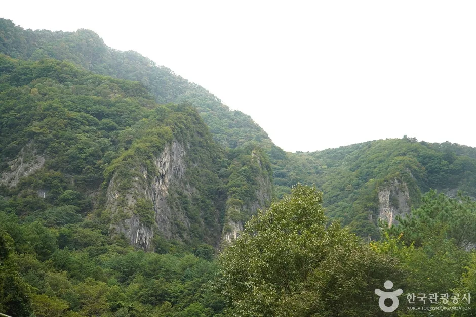 Photo: Korea Tourism Organization Tourism Photo Gallery (Daegi-ri, Singi-myeon, Samcheok-si, Gangwon Special Self-Governing Province) · KOGL Type 1
Deokhangsan is, on the whole, a soil-covered mountain with gentle ridgelines, but its summit area and surroundings tell a different story — karst topography has left striking rock formations and limestone cliffs exposed all over the upper reaches. The main peaks are Deokhangsan’s summit (1,059m) and its neighbor, Hwanseonbong on Jigaksan (1,056m), and the two are linked by a connecting ridge, so a traverse-style hike between them is entirely doable. Down at the foot of the mountain, the Daei-ri area is one of Korea’s densest clusters of limestone caves — Hwanseon Cave among them — and these caves are basically a showcase of the mountain’s geology. According to actual recorded course data, some hiking routes reach a maximum elevation of 1,111m, which likely corresponds to a viewpoint along the ridge near Deokhangsan’s summit or a stretch of trail heading toward Hwanseonbong.
The Feel of the Hike
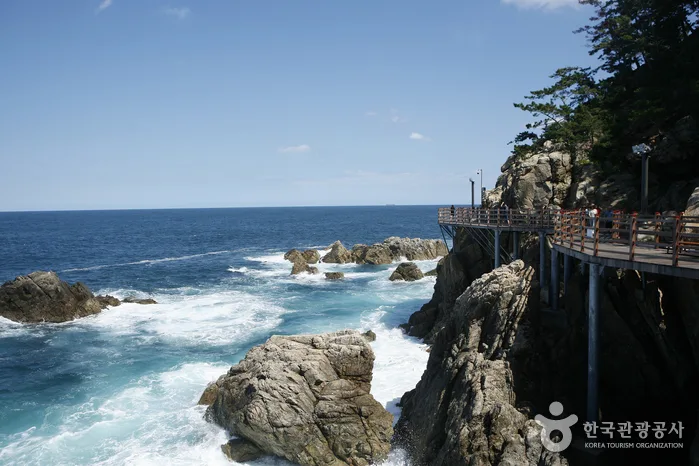 Photo: Korea Tourism Organization Photo Gallery (800 Hwanseon-ro, Singi-myeon, Samcheok, Gangwon Special Self-Governing Province) · KOGL
The typical Deokhangsan hike starts out along a valley trail before gradually giving way to steeper mountain paths. The stretch following Daei Valley up the mountain is a cool, pleasant one, with the sound of rushing water mingling with dense forest. As you gain elevation, ridge sections and rocky outcrops start alternating, making for a fairly demanding climb. Once you’re near the summit, the view opens up, and you’ll come across spots where you can take in the surrounding ridgelines and the overall shape of the mountain range. Seasonally, it’s known for the cool air and lush greenery of the valley in summer, the ridge foliage in fall, and the rime ice and frost flowers near the summit in winter. That said, keep in mind that the summit route has a substantial elevation gain and includes some steep sections, so it does take a real physical toll.
Main Trails (by Trailhead)
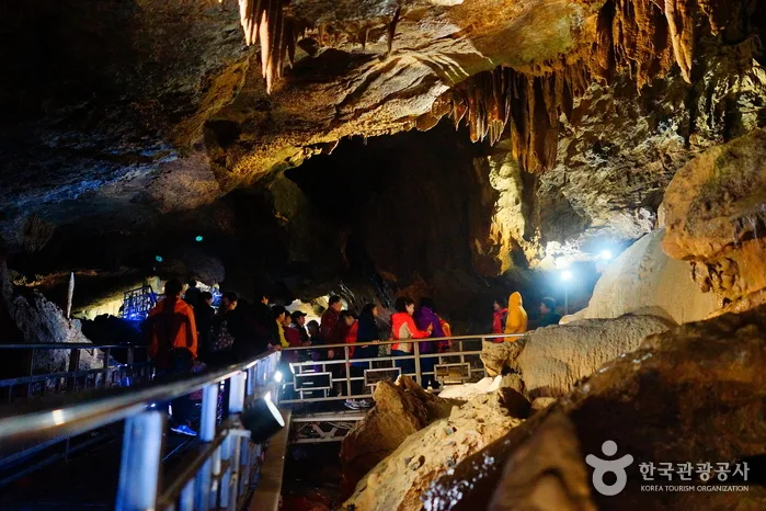 Photo: Korea Tourism Organization Photo Gallery · KOGL
| Trail (trailhead → summit) | Distance | Elevation Gain | Est. Time (one-way) | Difficulty | Popularity |
|---|---|---|---|---|---|
| Trailhead restroom → Viewpoint | 6.21km | ↕749m | ~2h 48min | ★★★★★ | ★★★★☆ |
| Deokhangsan trailhead, Oenamugol → Deokhangsan summit | 5.15km | ↕366m | ~1h 54min | ★★★☆☆ | ★★★☆☆ |
Source: Korea Mountain & Trekking Support Center, Top 100 Mountains GPX data (distance/elevation/time/difficulty) · Popularity is a rough guide only
Course 1 — Trailhead Restroom → Overlook
Route: Valley restaurant row → Waypoint 1 → Daei Valley → Hwanseongul cable platform → small clearing → 4 benches → restroom before the trailhead → Seonnyeo Falls → protected tree → rest area before Hwanseongul → Golmal → restroom by the monorail platform → Hwanseongul → fork → overlook
Getting to the trailhead: The trailhead for this course is near the Daeri Hwanseongul tourist area, and most people get there by city bus or car from downtown Samcheok heading toward Daeri. Being a tourist destination, the access road is well maintained, but there’s no bus stop listed in the data for the immediate area, so if you’re relying on public transit, it’s worth double-checking the schedule ahead of time. There’s one parking lot in the area, shared by both Hwanseongul sightseers and hikers.
Highlights & who it’s for: The early stretch feels more like a scenic tour than a hike, with Daei Valley, Seonnyeo Falls, and Hwanseongul cave all lined up one after another, so you get sightseeing and hiking in one go. That said, the climb from Hwanseongul up to the overlook gains 749m in elevation, which is a serious physical demand, and the course is rated at the highest difficulty level overall — so it’s really better suited to hikers who already have some experience under their belt. If you want valley, cave, and views all in one outing, this is a course worth considering.
Course 2 — Deokhangsan Trailhead (Oenamugol) → Deokhangsan Summit
Waypoints: Yesu-won Bus Stop → Deokhangsan Trailhead, Oenamugol → Fork in the trail → Waypoint 10 → Waypoint 13 → Scenic Overlook → Deokhangsan Summit → Before the Rest Area → Cliff Edge → Fallen Tree → Middle of the Wooden Bridge → Restroom
Getting to the trailhead: The Oenamugol trailhead has a signpost referencing “Yesu-won Bus Stop,” which suggests there’s some small bus stop nearby, but it’s likely a local route with pretty limited service, so driving your own car is the more practical option. If you’re coming from downtown Samcheok, it’s worth checking KakaoMap or Naver Map beforehand for current road conditions and the latest transit info.
Highlights & who it’s for: With a net elevation gain of 366m, this course is noticeably gentler than Course 1, following a fairly straight ridge line up to the Deokhangsan summit. That said, waypoint names like “Cliff Edge” and “Scenic Overlook” hint at sections where you’ll need to watch your footing across rocky ridges and steep drop-offs. Once you’re at the top, though, the views make it worth the effort. This route suits hikers whose main goal is simply reaching the summit, or anyone who just wants to focus on the hike itself without too many detours.
Difficulty, Terrain, and Cautions
Based on public data covering all registered trail segments in the district, the highest difficulty rating comes out as “Easy” — but that figure lumps together the whole network, including the loop paths and casual walking trails. The actual summit route, as the table above shows, swings much wider, topping out at ★★★★★. There’s no separate surface-condition data listed, but given the karst terrain and rocky ridgelines near the top, I’d expect a fair number of exposed rock sections — worth being extra careful on when it’s rained. As for facility POIs, both hazard zones and designated viewpoints come up as zero, so there’s no official signage marking danger spots or lookout points. That said, the actual trail markers along the route do flag terrain features like “great view here” or “cliff edge” — so keep an eye on the signposts as you go. Three water points are listed, all labeled “spring water,” and on Course 1 (the long-distance route) these double as good spots to refill. There’s just one parking area and six trailhead/exit points registered, so while you’ve got some flexibility in choosing a course, the access infrastructure itself is fairly limited.
Distance and time
Deokhangsan’s trail network adds up to a total of 15.09 km across its various routes, and no matter which one you pick, it’s an easy day hike you can finish comfortably. The main summit route, Course 1 (from the trailhead restroom to the lookout point), takes about 2 hours 48 minutes one way, while Course 2 (from Oenamu Valley to the Deokhangsan summit) runs roughly 1 hour 54 minutes one way — and if you’re doing a round trip, it’s smart to pad your schedule beyond that. For reference, the cumulative data across the whole trail network logs 269 minutes going up and 186 minutes coming down, which works out to an average uphill pace of about 18 minutes/km. Keep in mind that figure isn’t the time for any single specific route — it’s an average pooled across the entire trail network — so for planning an actual route, you’re better off going by the one-way times in the table above.
Getting There (Public Transit & Parking)
Deokhangsan is located in Samcheok, Gangwon Special Self-Governing Province. If you’re coming from Seoul or elsewhere in the greater metro area, the usual route is to take a KTX or an intercity bus toward Samcheok or Donghae, then transfer at Samcheok Bus Terminal to a local bus heading toward Daeri or Docheon. That said, public data doesn’t show any registered bus stops near the trailhead itself, so getting there by transit alone can be pretty inconvenient — I’d recommend driving if you can. There’s one parking lot listed in the area, near the Hwanseongul cave tourist site, which seems to serve both hikers and cave visitors alike. For the most accurate, up-to-date directions, KakaoMap or Naver Map are your best bet — I wouldn’t rely on Google Maps here, since it tends to get walking routes wrong in Korea’s mountain areas.
Season, Weather & Gear
The best seasons for hiking Deokhangsan are spring and fall, when temperatures are mild and the views are at their best. Summer hikes can actually be pretty pleasant thanks to the course running alongside Daeigyegok Valley, but be careful — heavy rain can swell the stream and make the rocky ridge sections slippery. Winter is a different story: ice and snow near the summit crank up the difficulty considerably, so crampons and cold-weather gear are a must. Across all seasons, you’ll want hiking boots, trekking poles, plenty of water (there’s a spring along the way, but it’s smarter to bring your own rather than count on it), a rain jacket or waterproof shell, and — if you’re taking the long route (Course 1) — a headlamp just in case.
Tips for Foreign Travelers
Deokhangsan is romanized as “Deokhangsan,” and the nearby Hwanseongul cave is written as “Hwanseon Cave.” The trail itself doesn’t require any special permit or entrance fee, but if you plan to visit Hwanseon Cave, which is a waypoint on Course 1, you’ll need to pay a separate admission fee — it’s worth confirming the details on-site. Restrooms are available at several points along the routes, including “restroom before the trailhead,” “restroom next to the monorail platform,” and the “restroom” on Course 2, so you shouldn’t run into much trouble there. There are also three natural spring water spots you can use along the way, though it’s safer to double-check their exact locations with a map app. For navigation, KakaoMap or Naver Map will serve you much better than Google Maps in Korea’s mountainous areas. For safety, check the weather and whether there’s likely to be ice before you head out, and if you’re taking a route like Course 1 — with a big elevation gain and a long duration — make sure to plan your descent with plenty of buffer time.
Other nearby mountains
- Taebaek Mountain in Gangwon, famous for its snow-covered trees and rime-frosted ridge — about 24km as the crow flies
- Garipwang Mountain in Jeongseon, Gangwon, home to a primeval moss valley and waterfalls — about 43km as the crow flies
📍 Deokhangsan, Samcheok: Karst Ridges Cradling Hwanseon CaveLocation
Contact: bumseok.view [at] gmail [dot] com
Related posts
-
Sweeping Grassy Ridges and 360° Views: Mt. Gyebangsan in Pyeongchang, Gangwon
-
Granite ridge views right on the edge of the city: Seoul's Bukhansan
-
Ridgeline Meadows of Royal Azalea and Silver Grass: Hwangmaesan in Hapcheon and Sancheong
-
Snow Blossoms and Frost-Coated Yew Ridges: Taebaeksan in Gangwon
Comments