Granite ridge views right on the edge of the city: Seoul's Bukhansan
Hiking · Published 7/5/2026 ·
등산로 트랙·시설 (공공데이터: 전국등산로 공간정보) · 🚩시종점 💧음수대 👁️조망점 🏠대피소 🅿️주차장 ⚠️위험 · 지도 © OpenStreetMap ⤓ GPX 다운로드
At a Glance
| Category | Rating |
|---|---|
| Accessibility (Transit & Parking) | ★★★★☆ |
| Trail Difficulty | ★★★☆☆ |
| Water Access (Springs/Streams) | ★★★★☆ |
| Overnight Stay? | ★★★★★ (Easily a day trip) |
| Spring | ★★★★★ |
| Summer | ★★★☆☆ |
| Fall | ★★★★★ |
| Winter | ★★☆☆☆ |
- Source: Korea Forest Service trail data. Note: Accessibility and seasonality ratings are estimates.
Overview
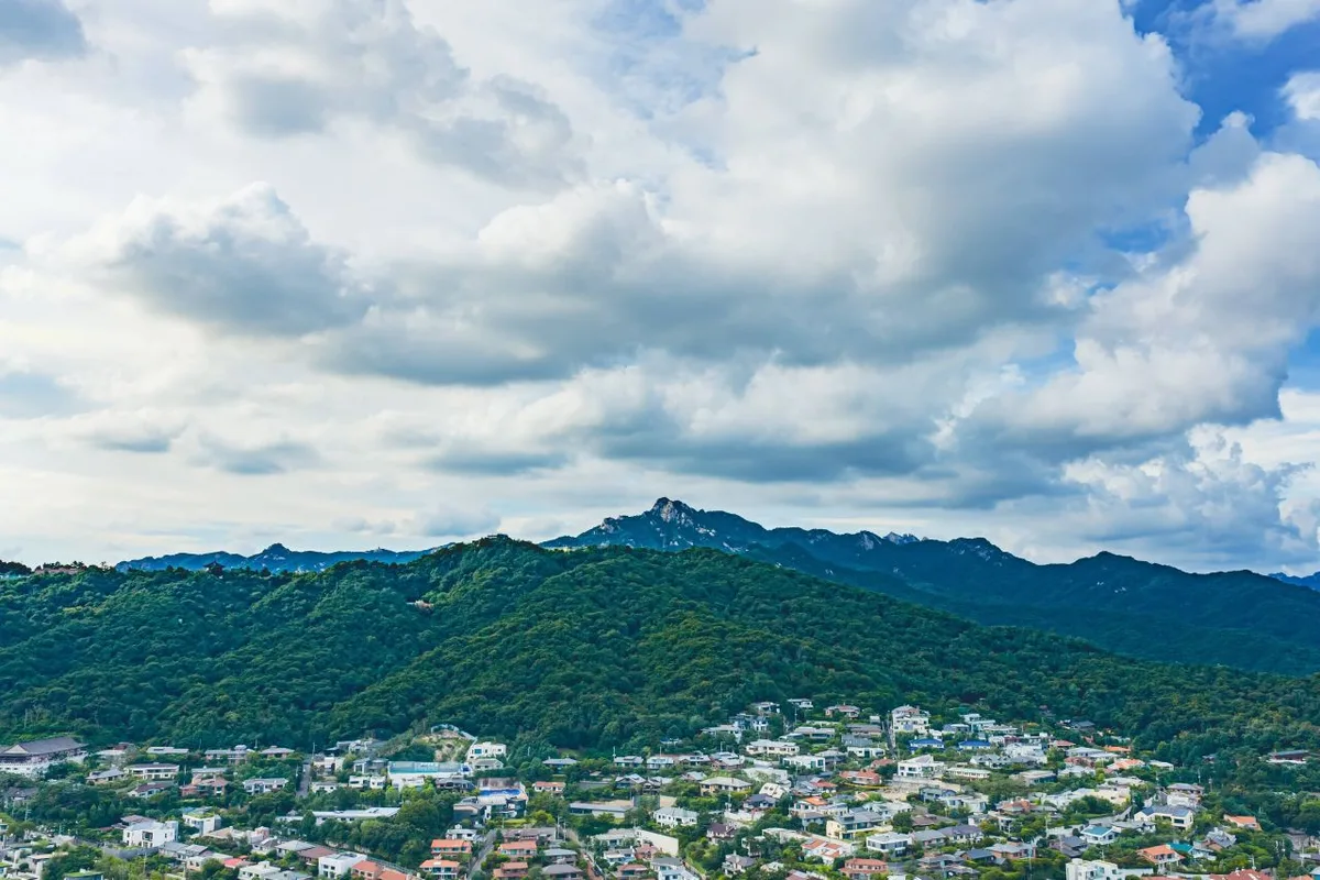 Photo: Korea Tourism Organization Photo Gallery (Jeongneung-dong, Seongbuk-gu, Seoul) · Gonggong Nuri
Bukhansan is one of those iconic mountains that sits right on the doorstep of Seoul and Goyang. Its highest point reaches about 834m, with the granite peak of Baegundae being its most famous summit. Even though it’s tucked right into the heart of the metropolitan area, you’ll find a rugged landscape of rocky peaks and deep valleys. The accessibility is also fantastic—you can reach the trailhead using nothing but the subway and local buses.
Now, while it’s officially rated as “moderate” difficulty, don’t let that fool you. Most of the routes leading toward the summit involve a vertical gain of over 600m, which can be quite a workout. With total trail lengths across its various paths totaling 17.47km and no mountain shelters to be found, it is definitely a mountain best enjoyed as a day hike, regardless of which route you pick.
Terrain and Topography
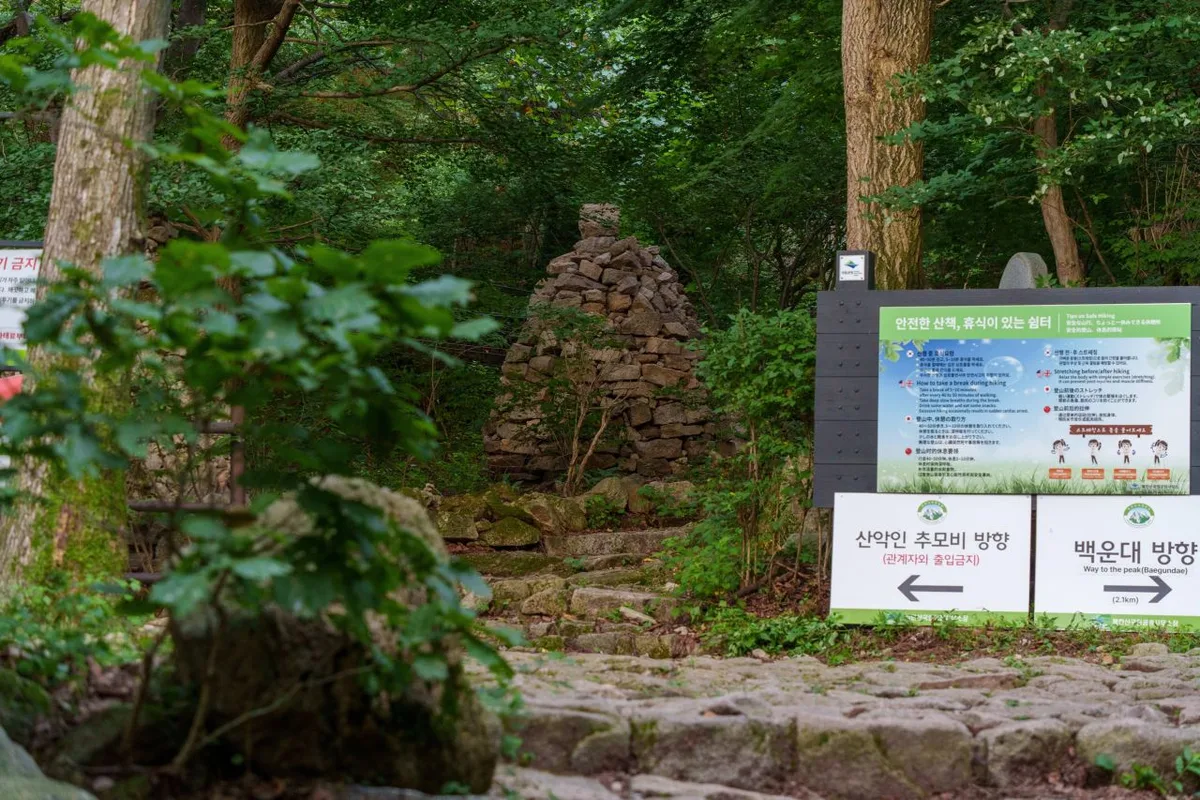 Photo: Korea Tourism Organization Photo Gallery (Bulgwang-dong, Eunpyeong-gu, Seoul) · Gonggonuri
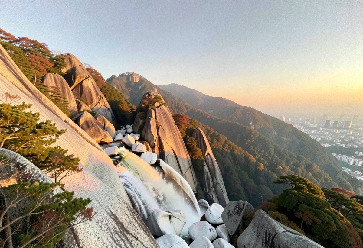
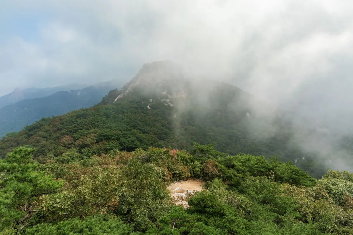
Bukhansan is a textbook granite mountain, characterized by those smooth, white rock peaks that stretch along its ridges. Since the main peak, Baegundae, forms a triangle with Insubong and Manggyeongdae, the mountain was historically known as Samgaksan (meaning “Triangle Mountain”). If you look at the major peaks recorded in public data, you’ll see Sidanbong (604m), Samobawi (548m), Samgakjeombong (545m), Uibong (539m), and Jingwanbong (531m) rising up all along the ridge. There are also lower peaks in the 388m to 472m range that form various side ridges. This means it’s not just a “climb to the top and leave” kind of mountain; there’s so much joy in hiking the ridges that connect these various peaks and old fortress walls.
The terrain is split quite distinctly between the gentle forest paths through the valleys at the bottom, and the exposed rock slabs and handrail-heavy sections near the summits. As you climb out of the valley to hit the ridge, the view suddenly opens up to reveal these massive granite peaks. It’s a pretty dramatic shift in scenery as you gain elevation.
The Feel of the Hike
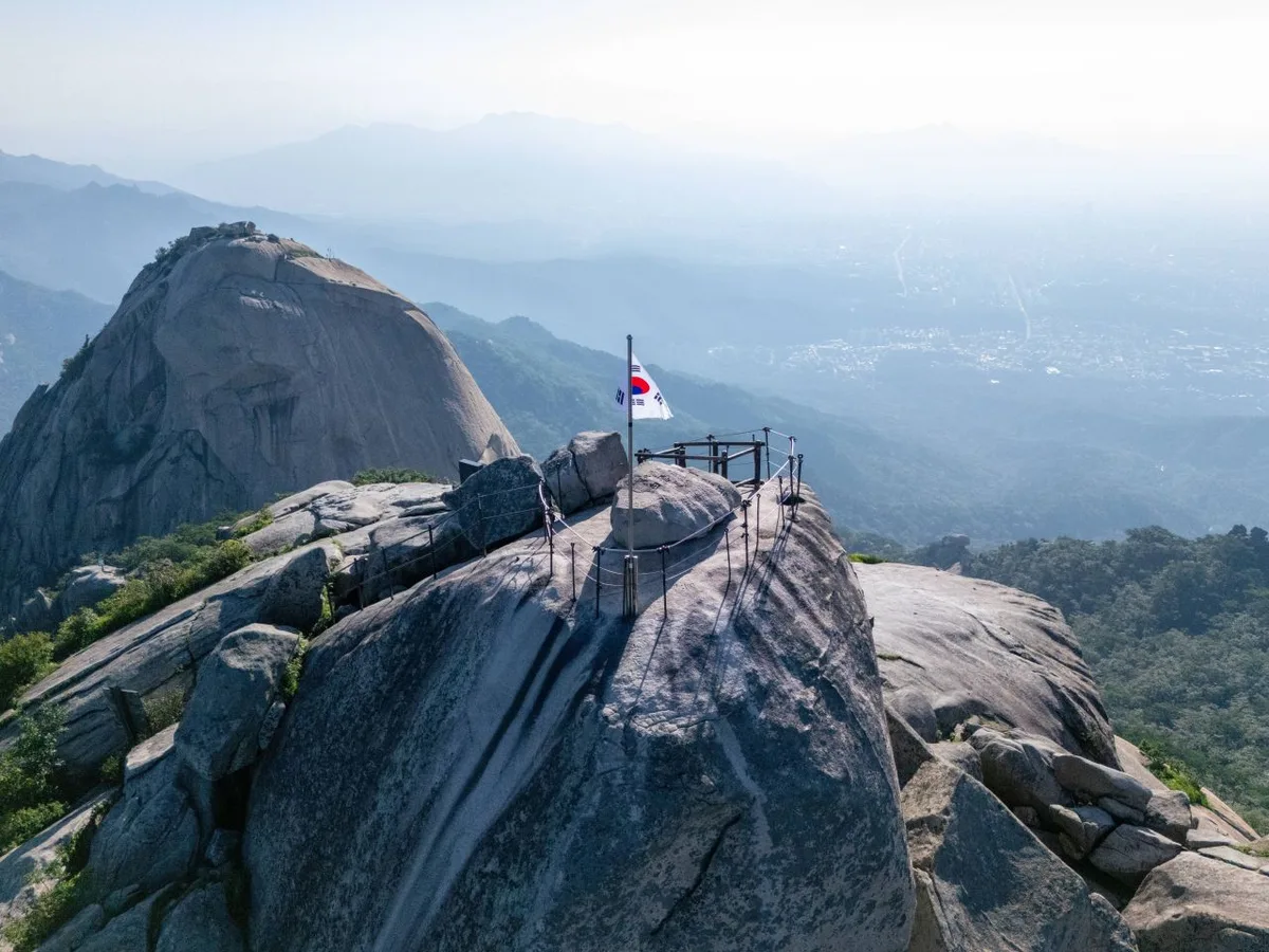 Photo: Korea Tourism Organization Photo Gallery (Bulgwang-dong, Eunpyeong-gu, Seoul) · Public Nuri
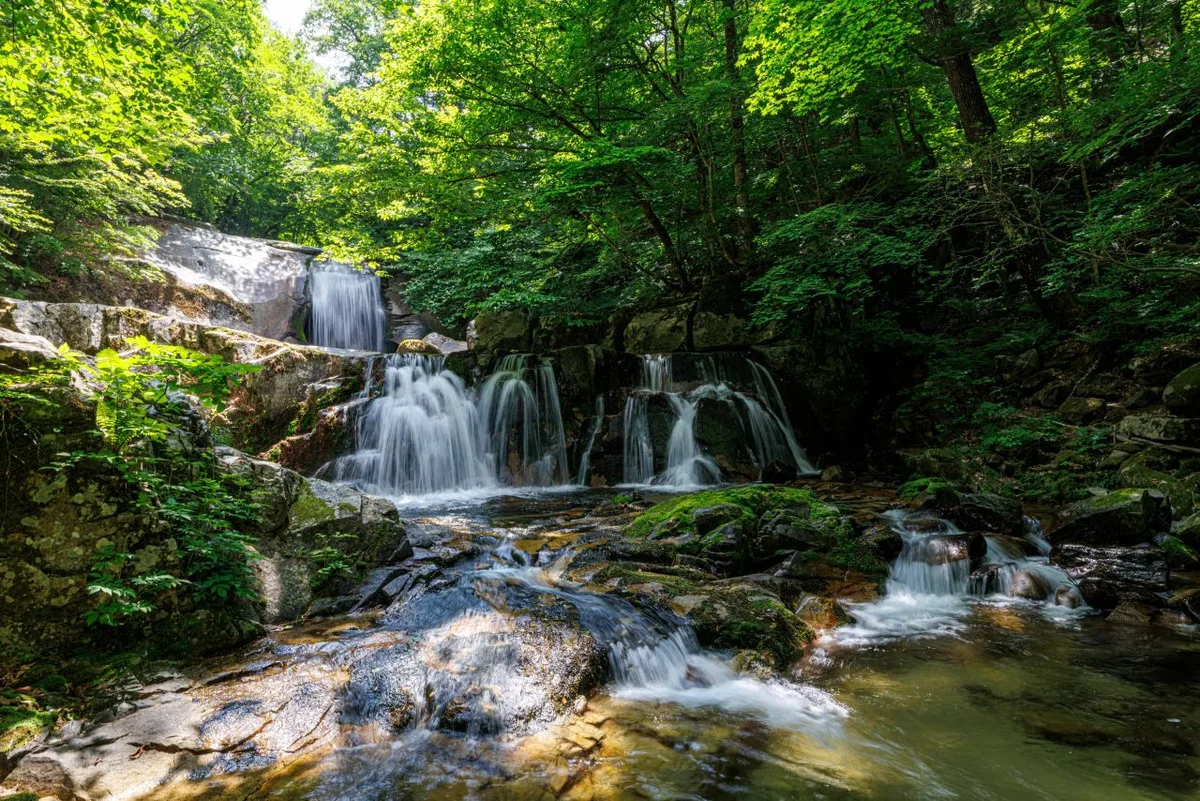
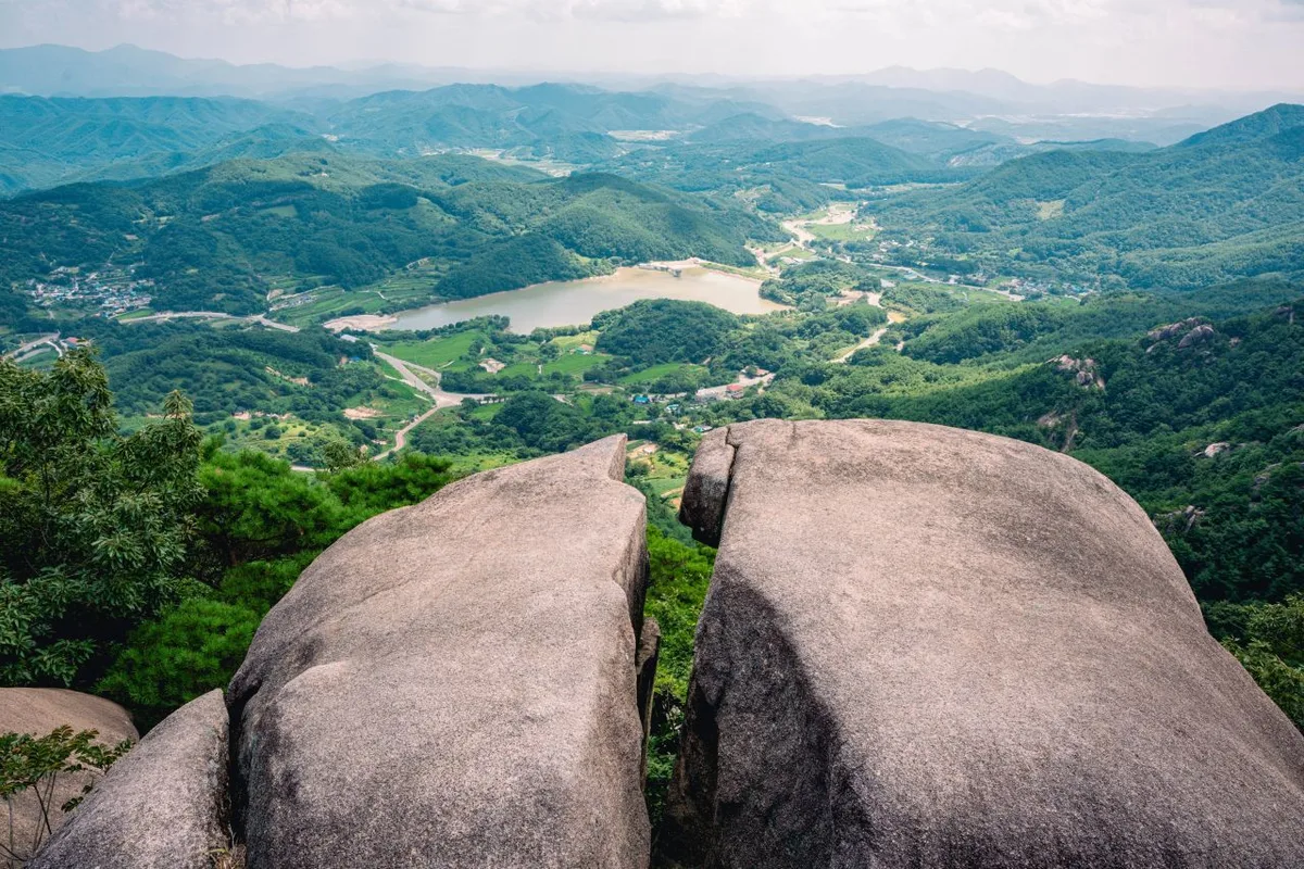
From the trailhead to the mid-way point, you’ll find yourself wandering through thick forests of oak and pine that provide plenty of shade, making for a nice, easy stroll. If you take the valley route, it’s incredibly refreshing to hike to the sound of running water, passing waterfalls and mountain springs along the way. But don’t get too comfortable; as you approach the summit, the vibe shifts entirely. You’ll run into rocky climbs that require a bit of scrambling, exposed bedrock, and sections with steel railings or stairs. Once you hit the ridge, though, it all pays off. You get a sweeping view of downtown Seoul and even out toward Dobongsan—being able to enjoy such a vista so close to the heart of the city is really the greatest charm of hiking Bukhansan. The scenery changes beautifully with the seasons: spring brings fresh greenery and azaleas in the valley, while autumn offers gorgeous foliage along the ridges. Just a heads-up for winter hikers—the rocks and ice can definitely ramp up the difficulty level.
Main Routes (By Trailhead)
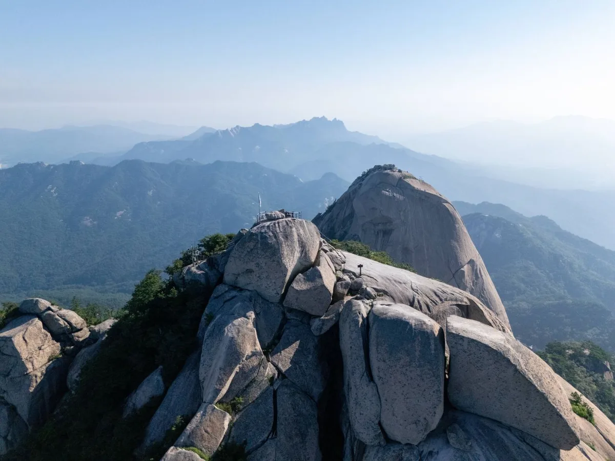 Photo: Korea Tourism Organization Photo Gallery (Bulgwang-dong, Eunpyeong-gu, Seoul) · KOGL
| Route (Trailhead → Summit) | Distance | Elevation Gain | Est. Time (One Way) | Difficulty | Popularity |
|---|---|---|---|---|---|
| Entrance → Summit | 8.09km | ↕745m | Approx. 3h 16m | ★★★★★ | ★★★☆☆ |
| Sagimakgol → Summit | 12.02km | ↕670m | Approx. 4h 7m | ★★★★★ | ★★★☆☆ |
| Junction → Summit | 8.38km | ↕607m | Approx. 3h 6m | ★★★★★ | ★★★☆☆ |
| Bukhansanseong Entrance → Baegundae Peak | 9.21km | ↕671m | Approx. 3h 25m | ★★★★★ | ★★★★★ |
| Seonun Hut → Dongjangdae | 9.66km | ↕611m | Approx. 3h 26m | ★★★★★ | ★★★★☆ |
| Junction → Summit | 7.83km | ↕602m | Approx. 2h 58m | ★★★★☆ | ★★★★☆ |
| Junction → Summit | 7.57km | ↕601m | Approx. 2h 54m | ★★★★☆ | ★★★☆☆ |
| National Grid Reference → Nahanbong Peak | 6.73km | ↕654m | Approx. 2h 46m | ★★★★☆ | ★★☆☆☆ |
※ Source: Korea Hiking & Trekking Support Center 100 Famous Mountains GPX (Distance, Elevation, Time, Difficulty) · Popularity ratings are for reference only.
Route 1 — Trailhead → Summit
Waypoints: Parking Lot → Guksadang Shrine → Restroom → Trailhead → Fork in the Path → Bukhansan National Park Information Center → Rest Area → Emergency Contact (119) for Wildfires/Accidents → Trail Marker → Rest Area for Safe Hiking & Breaks → Emergency Contact (119) for Wildfires/Accidents → Lookout Point → First Aid Kit → Fire Extinguisher → Rockfall Hazard
Getting There: The trailhead area is well-equipped with a parking lot, Guksadang Shrine, and restrooms, making it a great spot to get your gear sorted before you start the climb. If you’re using public transit, the common way is to take a local bus to the stop near the trailhead and walk in from there. I’d recommend double-checking a map app for the exact bus stop location before you head out.
Characteristics & Recommendations: With a net elevation gain of 745m, this is one of the steeper climbs among the actual summit routes. The initial section consists of forest paths and rest areas, so it’s not too taxing at first. However, as you climb higher, you’ll encounter sections with rockfall risks. This route is best suited for those who are confident in their stamina and prefer a direct, no-nonsense approach to the summit.
Course 2 — Sagimakgol → Summit
Waypoints: Sagimakgol → Pajujip → Super (Shindo Food) → Sagimak Park Ranger Station → Restroom → Junction (Note: No trail toward Sagimakgol) → Perimeter Trail Distance Marker → Butim Rock → Signpost → Valley → National Geographic Location Marker → Hidden Valley Lower Waterfall → Shelter → Hidden Waterfall Lower Waterfall
Getting to the Trailhead: The trailhead at Sagimakgol is quite easy to reach, with a bus stop located nearby. After passing through the local village shopping area, you’ll head past the park ranger station and restrooms to begin climbing up alongside the valley.
Notes & Recommendations: At 12.02km, this is the longest of the summit-bound routes—perfect if you want to spend more time wandering through valleys and past waterfalls. Since it’s a bit of a trek, you’ll want to keep an eye on your pace. It’s an ideal choice for anyone looking for a more leisurely hike to truly soak in the forest and the sound of running water.
Course 3 — The Fork to the Summit
Route: The Fork → Cheonsu Falls → Cheonsu Restroom → Fire Extinguisher Shelter → Yeongcheon Mineral Spring → Ssangjulgi Mineral Spring → Bogukmun Shelter → Frequent Winter Ice Zones → Induam → Hyungjebong Viewpoint → Dongryeong Falls → Nameless Shelter → Pyeongchang Park Guard Post Restroom → Pyeongchang Park Guard Post → Gamramsan Prayer House
Getting There: This route connects toward the Pyeongchang and Hyungjebong areas. Typically, you’d catch a city bus from the downtown residential area and then walk in to reach the trailhead. You can also find restrooms at Cheonsu and the Pyeongchang Park Guard Post down below.
Highlights & Tips: This is a lovely, water-rich route that winds through the Yeongcheon and Ssangjulgi mineral springs, with a great view waiting for you at the Hyungjebong viewpoint. Just a heads-up: one of the waypoints is specifically marked as a “frequent winter ice zone,” so you’ll definitely want to watch your step if you’re out there in the winter.
Course 4 — Bukhansanseong Entrance → Baegundae Peak
Route: Bukhansanseong Entrance → Bukhansanseong Paid Parking → Information Center → Bukhansanseong Restroom → Junction 5 → Wildflower Area → Sugujeong Restroom → Seoamsa Temple → Junction 9 → Bukhannae History Museum-side Restroom → Borisa Temple → Gaeyeon Falls → Junction 16 → Daedongsa Mineral Spring → Daedongsa Temple
Getting There: The Bukhansanseong Entrance is the most iconic starting point for Bukhansan. It’s well-equipped with an information center, paid parking, and restrooms. Plus, since there are plenty of city buses running right to the entrance, getting here via public transit is a breeze.
The Vibe & Who It’s For: This is the classic, direct route straight up to Baegundae Peak. It offers a great mix of everything—historic fortress walls, temples, valleys, and mountain springs—making it a solid choice for anyone hitting Bukhansan for the first time. Since there are restrooms scattered along the way, it’s also a very practical option for families or international visitors.
Course 5 — Seonunsanjang → Dongjangdae
Waypoints: Seonunsanjang → Hallelujah Prayer Retreat Parking Lot → Junction → Junction Shelter → Bukhansan Jongbawi Rock → Butimbawi Shelter → Crossing Shelter → Doseon Dawon (Tea Garden) → Ui-gwangjang Restroom → Baegundae Visitor Center → Doseonsa Signboard → Doseonsa Restroom → Yongammun Park Ranger Station → Valley Shelter → Kim Sanggung Saritap (Kim Sanggung Jeonggwangsa Saritap)
Access: This route connects to the Ui/Doseonsa area, passing by the Ui-gwangjang restroom and the Baegundae Visitor Center. It’s quite easy to reach via public transit from northern Seoul.
Highlights & Who It’s For: The trail leads toward the Dongjangdae fortress wall ridge, where you’ll find cultural landmarks like Doseonsa Temple and the saritap pagoda. Since there are plenty of shelters scattered along the way, it’s a perfect choice for those who like to take frequent breaks or anyone looking to soak in the views of the historic ridge-line walls.
Course 6 — Junction → Summit
Waypoints: Junction → Jeongneung Visitor Center → Cheongsuru → 1st Rest Area → 2nd Rest Area → Cheongsuchen Spring → Stone Pagoda → Sambongsa Rest Area → Fitness Trailhead Rest Area → Yeongchwicheon → Yeongchwisa Temple → Yeongchwisa Five-story Stone Pagoda → Yeongchwisa Sweet Water Spring → Yeongchwisa Restroom → Seoul City Viewpoint
Access: This route starts from the Jeongneung Visitor Center. Since it’s located so close to residential areas, getting there by city bus is a breeze. There’s also a restroom available at the trailhead.
Features & Recommendations: With an elevation gain of 602m and a one-way hike of under three hours, this is a relatively easygoing route compared to other summit climbs. It features plenty of water stops—like the Cheongsuchen and Yeongchwisa springs—and ends at a viewpoint overlooking Seoul. I’d definitely recommend this to anyone looking for a great city view without the soul-crushing ascent.
Difficulty, Terrain, and Precautions
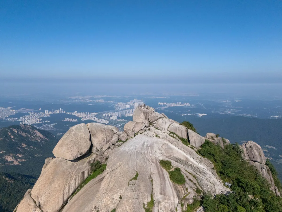 Photo: Korea Tourism Organization Photo Gallery (Bulgwang-dong, Eunpyeong-gu, Seoul) · KOGL
The following table shows the registered sections within the district (based on administrative boundaries). This covers a total length of 17.47km across several segments; please note that each row represents a section divided by administrative neighborhood rather than a single continuous hiking trail.
| Section (by administrative neighborhood) | Distance | Difficulty | Terrain |
|---|---|---|---|
| Hongeun-dong Section | 8.33km | Easy/Moderate | Dirt |
| Seodaemun-gu Hongeun 2-dong Section | 2.04km | Easy | Dirt |
| Seodaemun-gu Hongeun 1-dong Section | 1.27km | Easy | Dirt |
| Seodaemun-gu Hongeun-dong Punglim I-won Apt - Hongeun-dong Section | 1.22km | Easy | Cement |
| Seodaemun-gu Hongeun-dong Pobangteo 1-gil Section | 0.97km | Easy/Moderate | Dirt |
| Seodaemun-gu Hongeun Jungang 1-gil Section | 0.75km | Easy/Moderate | Dirt |
| Seodaemun-gu Hongeun-dong, behind Hongeun Kukdong Apt Bldg 102 Section | 0.7km | Easy | Dirt |
| Seodaemun-gu Hongeun-dong Hongeun Jungang 3-gil Section | 0.42km | Easy | Cement/Dirt |
※ Note: The table above shows registered sections divided by administrative neighborhood; it represents the total length within the area rather than specific hiking trail names.
Based on the data, the highest difficulty is “Moderate,” and you’ll mostly be walking on dirt, cement, or a mix of both. While the lower paths are relatively easy to walk, just a word of caution: dirt trails get slippery when it rains, and the granite rock at the summit can become incredibly slick when wet. The data also flags certain “rocky areas” as danger zones, and with five specific hazard points noted (such as warning signs, bridge risks, or hazardous trees), please make sure to check the trail signs. On the bright side, there are 36 viewpoints, so you’ll have plenty of spots to soak in the scenery along the ridge. You can also find water at five different spring-fed fountains. One thing to keep in mind, though: there are zero shelters. You’ll want to plan your trek carefully, as there’s no indoor place to duck into if you get caught in bad weather or find yourself out after dark.
Distance and Timing
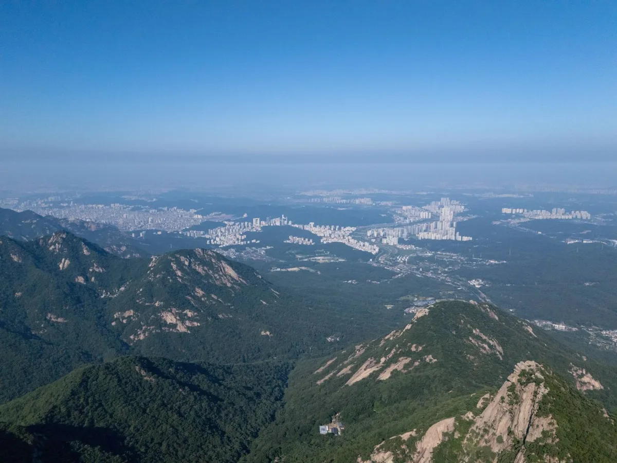 Photo: Korea Tourism Organization Photo Gallery (Bulgwang-dong, Eunpyeong-gu, Seoul) · KOGL
Since there are no mountain shelters on Bukhansan and the total length is 17.47km, any of the routes are perfectly doable as a day hike. Actual ascent times to the summit range from about 2 hours 46 minutes (National Grid Point → Nahanbong) to roughly 4 hours 7 minutes (Sagimakgol → Summit). Even when factoring in the return trip and breaks, most routes can easily be completed within a single day.
Just as a heads-up: the data shows a total cumulative time of 342 minutes up and 204 minutes down, but this is the combined total for all sections joined together, not the time for a single route. That said, you can derive an average ascent pace of about 20 minutes per km from these numbers, which is a handy way to estimate your own travel time. You can simply multiply this pace by the distance of your chosen route; for example, on an 8km trail, you might expect an ascent of roughly 2.5 to 3 hours. Of course, your actual time will vary depending on your personal fitness and how crowded the rocky ridges at the summit might be.
Getting There (Public Transit & Parking)
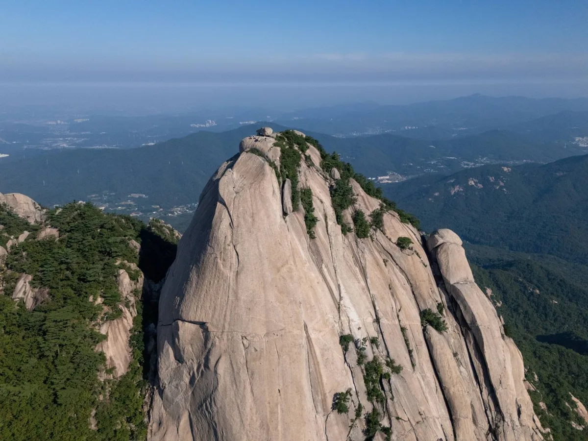 Photo: Korea Tourism Organization Photo Gallery (Bulkwang-dong, Eunpyeong-gu, Seoul) · Gonggonuri
Bukhansan is actually quite easy to access thanks to Seoul’s subway and bus networks. The typical way to get there is to take the subway to a nearby station and then transfer to a local bus heading toward the trailhead. Based on available data, the confirmed bus stops near the trailhead are Hyoja 2-tong, Sagimakgol, Bukhansan-dong Military Training Center, and Hyoja Police Station. The Sagimakgol stop is especially convenient, as it connects directly to the trailhead for Course 2.
As for parking, things are a bit of a contradiction. While official data from the Korea Forest Service shows zero registered parking lots in the area, the signposts for Course 4 do mention “Bukhansan Fortress Paid Parking.” If you’re driving, please keep in mind that parking availability varies depending on the trailhead, so it’s a good idea to check before you head out. For both public transit and parking, I highly recommend checking real-time routes on KakaoMap or Naver Map (Google Maps can be a bit hit-or-miss with walking and transit directions here in Korea).
Season, Weather, and Gear
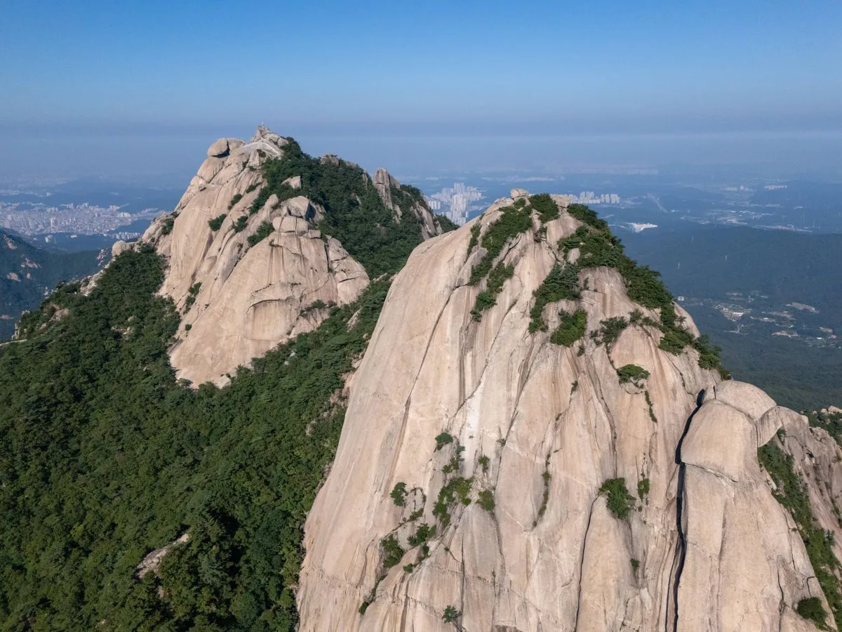 Photo: Korea Tourism Organization Photo Gallery (Bulgwang-dong, Eunpyeong-gu, Seoul) · Gonggonuri
The best seasons to visit are spring (April–May), when the greenery is fresh and azaleas are in bloom, or autumn (October–November) to see the stunningly colorful ridges. Summer can be refreshing thanks to the cool valleys, but you’ll need to watch out for heatwaves, sudden showers, and rushing mountain streams. Winter can be much more challenging due to icy rock surfaces at the summit and biting winds. Specifically, Course 3 is marked with signs as a “frequent icing area” during winter, so be extra careful if you’re hiking in the cold.
Regarding essential gear, a solid pair of hiking boots with good grip is a must. You’ll encounter plenty of granite slabs and metal railing sections near the summit, so you need to be prepared for slippery spots. While there are water fountains available, they might not work depending on the season or weather, so please bring enough water to stay hydrated. For winter, pack crampons and windproof/insulated clothing; for summer, focus on UV protection and hydration. Since there are so many great viewpoints, a good camera or a light windbreaker will also come in handy.
Tips for International Travelers
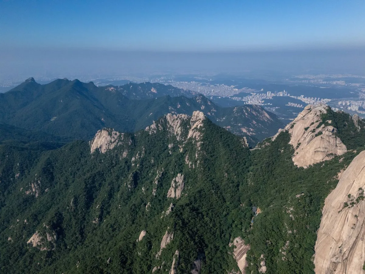 Photo: Korea Tourism Organization Photo Gallery (Bulgwang-dong, Eunpyeong-gu, Seoul) · Gongkonuri
- Key Locations (Romanized): Bukhansan · Baegundae Peak (approx. 834m) · Bukhansanseong Ipgu (Main Entrance) · Sagimakgol · Doseonsa direction · Jeongneung.
- Permits & Fees: No special permits or entrance fees are required to access the trails. However, please keep in mind that some trailhead parking lots (such as the Bukhansanseong Paid Parking Lot on Course 4) do charge a fee.
- Restrooms & Water: You’ll find restrooms at most major trailheads and along the valley routes (e.g., Bukhansanseong, Cheongsu, Pyeongchang Park, and Yeongchwisa restrooms). While there are five identified mountain springs/fountains, water flow is not guaranteed, so please be sure to carry your own drinking water.
- Map Apps: Google Maps can be quite unreliable for walking routes and public transit in Korea. I highly recommend using KakaoMap or Naver Map instead.
- Safety: The rockier sections are the primary danger zones, with five specific risk points identified. On rocky ridges or in areas prone to falling rocks and ice, please follow all signage. Since there are no mountain shelters, plan your schedule so that you finish your descent before dark. On the bright side, there are 36 different viewpoints along the ridges where you can safely soak in the sweeping views of Seoul.
Other nearby mountains
- Gwanaksan: Hiking Routes, Difficulty & Duration — approx. 18km linear distance
📍 Granite ridge views right on the edge of the city: Seoul's BukhansanLocation
Contact: bumseok.view [at] gmail [dot] com
Comments