Mudeungsan: Gwangju’s dramatic stone pillars, lined up like a grand folding screen
Hiking · Published 7/5/2026 ·
등산로 트랙·시설 (공공데이터: 전국등산로 공간정보) · 🚩시종점 💧음수대 👁️조망점 🏠대피소 🅿️주차장 ⚠️위험 · 지도 © OpenStreetMap ⤓ GPX 다운로드
At a Glance
| Metric | Rating |
|---|---|
| Accessibility (Public Transit/Parking) | ★★☆☆☆ |
| Trail Difficulty | ★★☆☆☆ |
| Water Availability (Springs/Fountains) | ★★★☆☆ |
| Is an overnight stay needed? | ★☆☆☆☆ (A day trip is plenty) |
| Seasonal Difficulty – Spring | ★★☆☆☆ |
| Seasonal Difficulty – Summer | ★★★☆☆ |
| Seasonal Difficulty – Autumn | ★★☆☆☆ |
| Seasonal Difficulty – Winter | ★★★★☆ |
※ Source: Korea Forest Service trail data. Note: Accessibility and seasonal ratings are estimates.
Overview
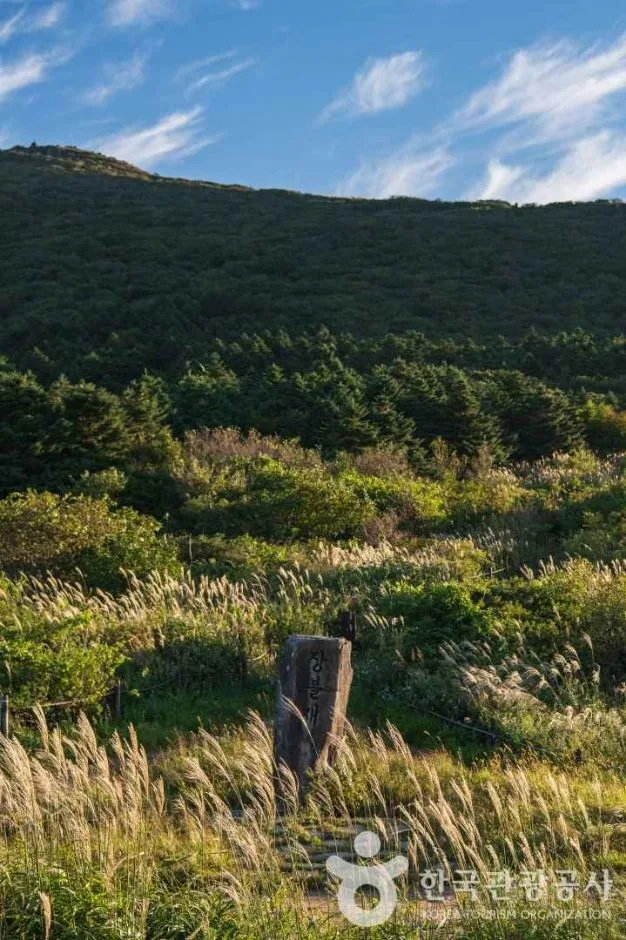 Photo: Korea Tourism Organization Photo Gallery (Hwasun-gun, Gwangju/Jeollanam-do) · KOGL
Mudeungsan is a mountain that spans Gwangju (Dong-gu and Buk-gu) and Hwasun County in Jeollanam-do, serving as the representative national park of the Honam region. Since the very top is restricted due to military communication facilities, hikers can only make it as far as the stunning columnar joint areas, such as Seoseokdae and Ipseokdae.
The total length of all trails in the area is 13.55km (this is the sum of various sections, not a single route), and while the Forestry Service officially classifies the difficulty as “Easy,” that doesn’t tell the whole story. Based on GPX data from the “100 Famous Mountains” lists, typical routes to the summit area cover 5–9km one way with an elevation gain of 450–780m. It’s quite a workout, but it’s definitely manageable for a solid day hike.
Landscape and Terrain
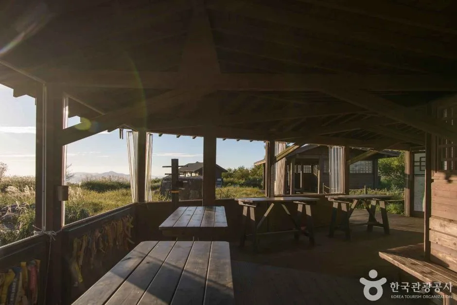 Photo: Korea Tourism Organization Photo Gallery (Hwasun-gun, Gwangju Metropolitan Area) · Gongkonuri
Mudeungsan is a pretty unique landscape, where massive rock peaks and striking columnar joint formations are layered over gentle, earthy ridges. Near the summit, Seoseokdae and Ipseokdae feature stone columns that stand like a natural screen. The area is widely known for its scenic and scientific significance, which led to its designation as a National Geopark.
According to public data, some of the major peaks include Manyeonbong (628m), Nueebong (1084m), Naktabong (938m), Anyangsan (876m), Manyeonsan (687m), Wonhyobong (583m), and Jungmeorijae (617m, though sometimes recorded as 613m). Based on my GPX measurements for this specific route, the highest point we’ll reach is 1120m. While Cheonwangbong (about 1187m) is technically the mountain’s highest peak, access is restricted due to telecommunications facilities, so most hikers treat the area around Seoseokdae as their practical summit. The scree slopes of Jigong-neodeul and the rocky terrain around Gyubongam are also defining features of this mountain.
The Hiking Experience
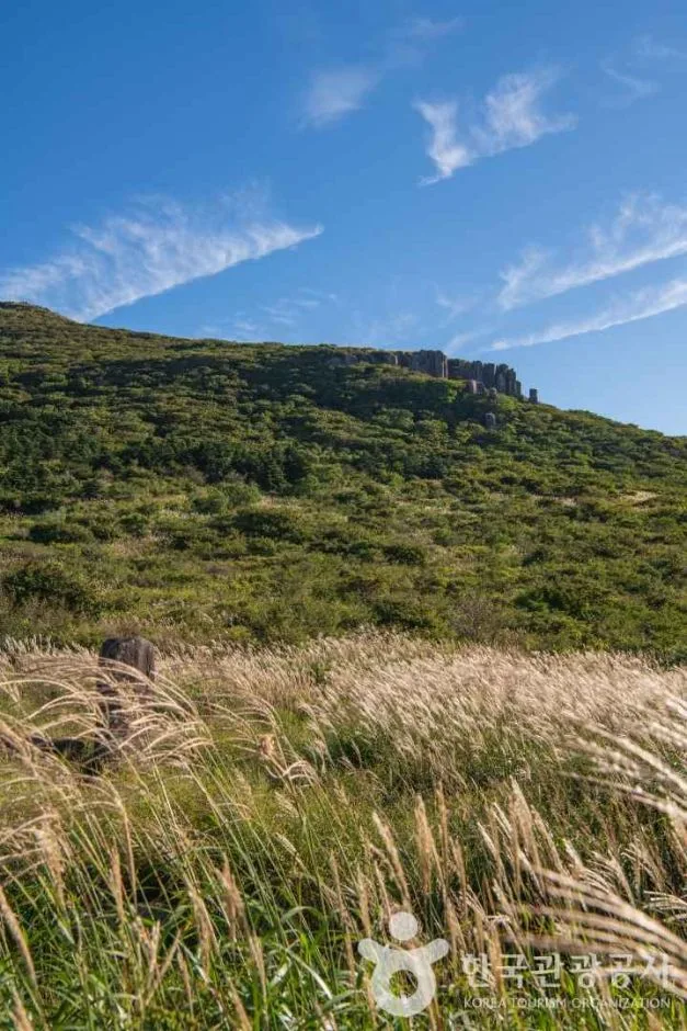 Photo: Korea Tourism Organization Photo Gallery (Hwasun-gun, Gwangju Metropolitan City) · Gonguuri
The hike starts off pretty easy, with dirt paths winding through lush cypress and deciduous forests along gentle ridges. But as you gain altitude, the difficulty definitely picks up with more scree and rocky terrain. Near Jungbong and Jangbuljae, the silver grass fields and open ridge views really capture the essence of the season. Then, around Seoseokdae and Ipseokdae, you’re treated to expansive views of stunning columnar rock formations. While the silver grass and autumn colors are beautiful in the fall, the frozen ridges and rime ice in winter are truly something else.
Major Routes (by trailhead)
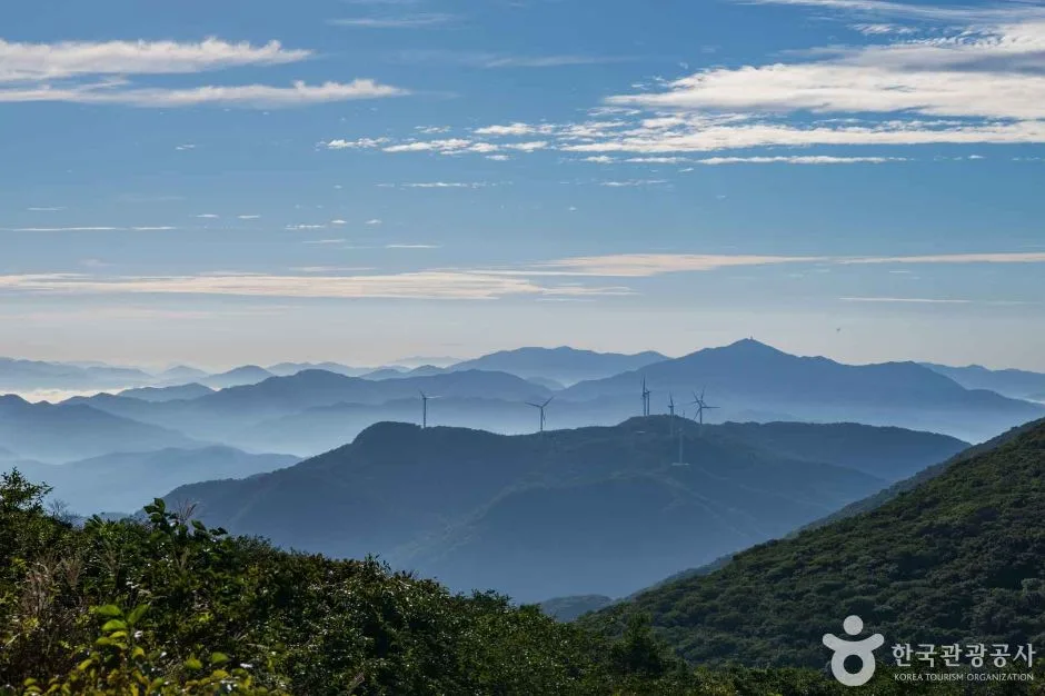 Photo: Korea Tourism Organization Photo Gallery (Hwasun-gun, Jeonnam/Gwangju) · Gonggonuri
| Route (Start → Destination) | Distance | Elevation Gain | Est. Time (One Way) | Difficulty | Popularity |
|---|---|---|---|---|---|
| Wonhyosa Entrance Bus Stop → Wonhyo Branch Rescue Team | 6.75km | ↕734m | Approx. 2h 55m | ★★★★★ | ★★★★☆ |
| Dowon Village Parking Entrance → Ipseokdae | 7.73km | ↕775m | Approx. 3h 13m | ★★★★★ | ★★★☆☆ |
| Junction → Summit | 6.79km | ↕610m | Approx. 2h 43m | ★★★★☆ | ★★☆☆☆ |
| Wonhyosa Entrance → Summit | 9.39km | ↕576m | Approx. 3h 18m | ★★★★★ | ★★★★☆ |
| Deulgukhwa Village (Sumanri 3-gu Stop) → Seoseokdae | 8.21km | ↕591m | Approx. 3h 02m | ★★★★☆ | ★★★☆☆ |
| Mudeungsan Jeungsimsa → Jungbong | 7.72km | ↕768m | Approx. 3h 13m | ★★★★★ | ★★★★★ |
| Junction → Summit | 5.49km | ↕452m | Approx. 2h 08m | ★★★☆☆ | ★★☆☆☆ |
| Jeungsimsa Entrance → Summit | 8.35km | ↕761m | Approx. 3h 21m | ★★★★★ | ★★★★★ |
※ Source: Korea Hiking & Trekking Support Center 100 Famous Mountains GPX (Distance, Elevation, Time, Difficulty) · Popularity is for reference only.
Route 1 — Wonhyosa Entrance Bus Stop → Wonhyo Branch Mountain Rescue Team
Via: Wonhyosa Parking Lot → Mudeungsan Rest Area → Wonhyosa Entrance Bus Stop → Wonhyosa Parking Lot Restroom → Songdo Mountain Hut → Mudeungsan Gaja → Fork in the road → Wonhyosa Junction Restroom → Wonhyo Branch Information Center → Wonhyo Branch Mountain Rescue Team → Wonhyo Water Station → Wonhyo District Restaurant Area → Cypress Forest → Kkomakjae → Steep Ascent
Getting to the Trailhead: You can catch a local bus heading toward Wonhyosa and hop off at the entrance stop, then just walk in from there. There is parking available nearby, but it can get pretty hectic during peak season, so I’d recommend sticking to public transit if you want to avoid the headache.
The Vibe & Who It’s For: The route starts off easy, winding through the cypress forest and the local dining area on gentle dirt paths. But don’t let that fool you—once you hit Kkomakjae, the terrain turns into a series of steep climbs. It’s the perfect choice for those who want to enjoy a relaxing forest stroll before switching gears into a proper, heart-pumping hike.
Course 2 — Dowon Village Parking Entrance → Ipseokdae
Route via: Dowon Village Visitor Parking → Dowon Village Parking Entrance → Dowon Village Information Board → Fork in the road → Dowon Exploration Support Center → Restrooms → Dowon Village–Gyubongam Signpost → Shelter → National Grid Point → Gyubongam → Gyubongam Prayer Site → Rocks at the entrance of Gyubongam → Jigong-neodeul (Rock field) → Seokbulam Hermitage → Signpost in front of Seokbulam
Access: Using the Dowon Village visitor parking lot is essentially your only way in. You’ll definitely want to drive here; public transportation isn’t really an option for this route.
Features & Recommended For: This course winds through rocky landscapes like Gyubongam and the Jigong-neodeul rock field, offering a beautiful mix of serene temple views and rugged terrain. It’s quite a workout due to the distance and elevation changes, so it’s ideal for anyone looking to combine a peaceful mountain temple atmosphere with a proper rocky scramble.
Course 3 — Junction → Summit
Waypoints: Junction → Dowon Village Jangbuljae Signboard → Rest Area → National Geographic Location Number → Dowon Village–Jangbuljae Section Signpost → Viewpoint below Jungbong Peak → Dowon Campsite No-Entry Zone → Neoraekbawi Yongso Signboard
Getting There: Since this section starts from a junction halfway through another trail, there isn’t a clearly defined “start point” or bus stop. Most people end up approaching it via the access road toward Dowon Village.
The Vibe & Recommendations: This is a short, efficient little stretch where you can soak in the ridge views from the viewpoint below Jungbong Peak. It’s perfect for those combining it with other trails or anyone working with a tight schedule.
Course 4 — Wonhyosa Entrance → Summit
Route: Fork in the road → National Location Number → Rest Area → Old Path Section 2 Signpost → Jungbong Love Trail → Silver Grass Photo Zone → Jungbong Silver Grass Viewpoint → Rockfall Warning Area → Icy Section → Mudeungsan Ice Rock → Signpost → Neutjae Rest Area → Wonhyosa Entrance Gate → Wonhyosa Entrance
Access: You can reach the trailhead via the same bus toward Wonhyosa used for Course 1.
Features & Recommendations: This route takes you through lovely silver grass photo zones and offers great views of Jungbong, but keep an eye out—there are rockfall warning areas and icy patches (like the Mudeungsan Ice Rock) that require extra caution, especially in winter. If you’re looking to catch those stunning autumn silver grass views, this is definitely the route for you.
Course 5 — Sumanri 3-gu Bus Stop (Wild Chrysanthemum Village Entrance) → Seoseokdae
Route: Sumanri Wild Chrysanthemum Village Visitor Parking → Sumanri 3-gu Bus Stop (Village Entrance) → Sumanri Wild Chrysanthemum Village → Village Parking Lot Restroom → Junction → Trailhead Info Sign → Deulgukhwa Village–Jangbuljae Waymarker → National Grid Reference Point → Rest Area → Ridge Viewpoint → Royal Azalea Colony → Rockfall Warning Zone → Steep Slope/Rockfall Risk Area → Baekma Ridge Trail → Ridge Rock Waymarker
Getting to the trailhead: You can easily walk right in after hopping off at the Sumanri 3-gu bus stop, or you can use the dedicated visitor parking lot nearby.
Highlights & Recommendations: This is a ridge-style course that winds through beautiful royal azalea colonies and the Baekma Ridge Trail, making it a real favorite during the spring bloom. Just a heads-up: there are steep sections with rockfall risks, so please be extra careful if you’re out in the rain.
Route 6 — Mudeungsan Jeungsamsa → Jungbong
Via: Mudeungsan Jeungsamsa → Junction → Obang Training Center → Dangsan Tree Wind Shelter → Dangsan Tree → Dangsan Tree Restroom → Wild Boar Caution Zone → Jungmeorijae Ascent Shelter → Lightning-Prone Area → Jungbong Peak → Jungbong Heliport → KBC Transmitter → Donghwasa Site Shelter → Neutjae Observatory → Eroded Trail Section
Getting There: The Jeungsamsa area is widely known as one of the most convenient trailheads to reach from downtown Gwangju via city bus, and there is also a parking lot available nearby.
Features & Who It’s For: This is a quintessential route that local hikers love, winding through the forest around Jeungsamsa Temple and past the old Dangsan trees toward Jungmeorijae and Jungbong Peak. Just a heads-up: since the path includes lightning-prone areas, I’d recommend heading back down if summer thunderstorms roll in. Because it’s so accessible and offers such a classic experience, it’s my top pick for first-time visitors.
Difficulty, Terrain, and Safety Precautions
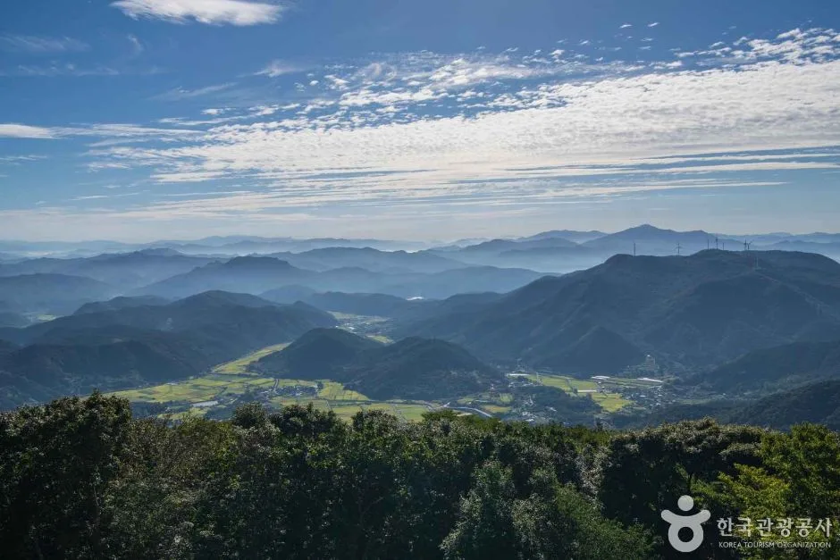 Photo: Korea Tourism Organization Photo Gallery (Hwasun-gun, Gwangju/Jeonnam) · Gongkonuri
The registered sections (categorized by administrative district rather than specific trail names) are as follows:
| Section (by Administrative District) | Total Length | Difficulty | Terrain |
|---|---|---|---|
| Mudori Section | 5.87km | Easy | Clayey |
| Mudorigol Angogae–Mudori Jeolgol Section | 5.4km | Easy | Clayey |
| Togyori Section | 2.28km | Easy | Clayey |
While the Forestry Service lists the difficulty as “Easy,” keep in mind that this only applies to the lower-altitude sections. If you follow the actual GPX route up to the summit, the sheer elevation gain and distance push the difficulty level to a much tougher ★★★★★. The terrain is mostly clay-based, so it gets incredibly slippery when it rains—definitely something to watch out for. You’ll also encounter specific hazard signs along the way, including rockfall warnings (Courses 4 and 5), steep slope risks (Course 5), icy sections/Mudeungsan Ice Rock (Course 4), and lightning-prone areas (Course 6). There are also some steep, eroded sections on Course 6, so you should definitely check the ground if it’s been raining. There is only one confirmed water station (Wonhyo Branch drinking water area). Since there aren’t many registered shelters or specific danger/viewpoint POIs, I’d suggest relying on the physical signs and information centers for guidance.
Distance and Timing
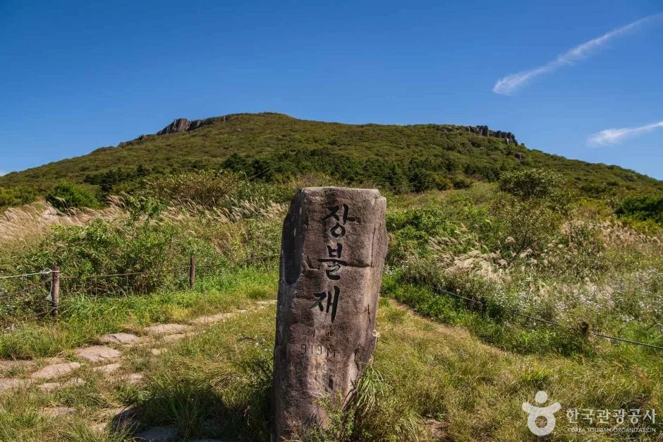 Photo: Korea Tourism Organization Photo Gallery (Hwasun-gun, Gwangju-Jeonnam Integrated Special City) · KOGL
If we use the cumulative ascent of 239 minutes and descent of 170 minutes as a baseline (keep in mind these are totals for the entire route, not a single leg), the average ascent pace comes out to about 18 minutes per kilometer. Since most summit-bound courses are roughly 5–9 km one way with an elevation gain of 450–780m, you’re looking at a one-way trip of anywhere from 2 hours to about 3 hours and 20 minutes. For a full round trip, you might spend 6 to 8 hours on the trail, so I’d definitely recommend an early start. That said, there aren’t any mountain shelters, and since the total distance is only 13.55 km, it’s still very much doable as a single-day hike.
Getting There (Public Transit & Parking)
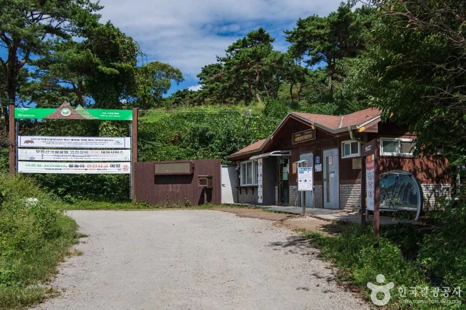 Photo: Korea Tourism Organization Photo Gallery (Hwasun-gun, Gwangju Metropolitan Area/Jeonnam) · KOGL
In downtown Gwangju, you’ll find that most people rely on local buses rather than the subway. If you’re heading toward Wonhyosa, you can use the “Mudeungsan National Park (Wonhyosa)” stop. For those going toward Jeungsimsa, the standard way is to catch a bus heading to the Jeungsimsa district. If you’re aiming for Suman-ri, you’ll want to hop off at the Deulgukwha Village Entrance (Suman-ri 3) stop. Since bus routes and schedules can change depending on when you head out, I’d definitely recommend checking real-time routes on KakaoMap or Naver Map before you leave.
As for parking, official public data shows zero registered lots (while there are some small local spots near Dowon Village and Suman-ri, they’re quite limited), so I’d highly suggest sticking to public transit during weekends or peak seasons.
Season, Weather, and Gear
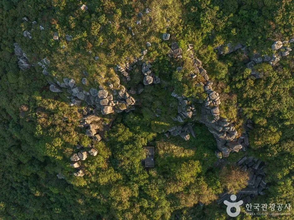 Photo: Korea Tourism Organization Photo Gallery (Hwasun-gun, Gwangju/Jeonnam Metropolitan Area) · Gonggong Nuri
Spring brings beautiful azaleas, while autumn offers stunning silver grass and fall foliage, making them definitely the best seasons to hit the trails. Just a heads-up for summer: certain areas are prone to lightning strikes, so if you see thunderstorms in the afternoon forecast, it’s much safer to avoid a climb or head back down early. In winter, you’ll definitely run into icy patches and frozen rock sections, so don’t forget your crampons, gaiters, and other winter essentials. Since the terrain is quite clay-heavy, it can get really slippery right after a rain shower—I’d definitely recommend having sturdy hiking boots and trekking poles ready. And of course, no matter the season, always make sure to pack plenty of water and snacks.
Tips for Foreign Travelers
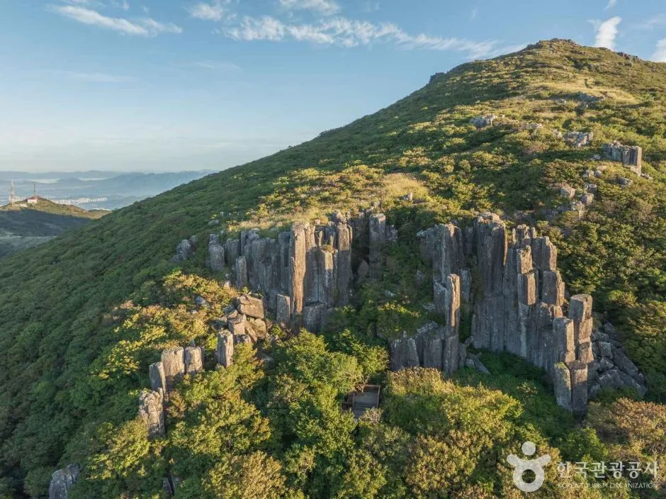 Photo: Korea Tourism Organization Photo Gallery (Hwasun-gun, Gwangju/Jeonnam) · KOGL
The mountain is spelled “Mudeungsan” in English, and the must-see spots are definitely Seosokdae, Ipseokdae, and Jungbong. Since it’s a National Park, you won’t need any special permits or entrance fees, but just a heads-up: some parts of the summit are off-limits due to communication facilities.
For restrooms, you can find them at the Wonhyosa parking lot, the Wonhyosa junction, the Dowon Visitor Center, the Sumanri Wild Chrysanthemum Village parking lot, and near the old Dangsan tree. As for water, there is one drinking fountain at the Wonhyo branch office, but since water sources are pretty sparse overall, I’d strongly suggest packing plenty of your own to stay safe.
One thing to keep in mind: Google Maps can be quite unreliable with hiking trails here in Korea, so I’d highly recommend using KakaoMap or Naver Map instead. You’ll also see signage for falling rocks, icy sections, and lightning-prone areas—please make sure to follow those instructions. Finally, since there aren’t really any shelters out on the trails, it’s vital to plan your descent so you’re heading back down well before sunset.
Other Nearby Mountains
- Gwanaksan Hiking Guide: Courses, Difficulty & Duration — approximately 118km straight-line distance
📍 Mudeungsan: Gwangju’s dramatic stone pillars, lined up like a grand folding screenLocation
Contact: bumseok.view [at] gmail [dot] com
Comments