Danyang's Doraksan in Chungbuk: Autumn Colors the Rocky Ridge
Hiking · Published 8/3/2026 ·
등산로 트랙·시설 (공공데이터: 전국등산로 공간정보) · 🚩시종점 💧음수대 👁️조망점 🏠대피소 🅿️주차장 ⚠️위험 · 지도 © OpenStreetMap ⤓ GPX 다운로드
At a Glance
| Metric | Rating |
|---|---|
| Accessibility (public transit/parking) | ★★☆☆☆ |
| Trail difficulty | ★★☆☆☆ |
| Water/springs on the mountain | ★☆☆☆☆ |
| Overnight stay needed | ★★☆☆☆ (1 night if doing the full traverse) |
| Seasonal difficulty — Spring | ★★★★☆ |
| Seasonal difficulty — Summer | ★★☆☆☆ |
| Seasonal difficulty — Fall | ★★★★★ |
| Seasonal difficulty — Winter | ★★☆☆☆ |
※ Source: Korea Forest Service trail spatial data · accessibility/seasonal ratings are for reference only
Overview
Doraksan (道樂山) sits in Danyang County, North Chungcheong Province. Its summit tops out at roughly 985 meters — public data lists the official elevation as 987m, though you’ll often see it introduced as around 964m, so there’s a bit of discrepancy depending on the source. The mountain is best known for its views over the Danyang Eight Scenic Views and the Seonam Valley area (Sangseonam, Jungseonam, Hasseonam). Overall it has a rugged, rocky ridge character, yet the public trail-difficulty rating tops out at “easy,” meaning the approach routes themselves are relatively gentle. That said, the actual summit stretch involves a substantial net elevation gain, so it doesn’t feel as easy as the rating suggests — it’s a mountain you can reach by public transit and knock out comfortably as a day hike.
Terrain and Landscape
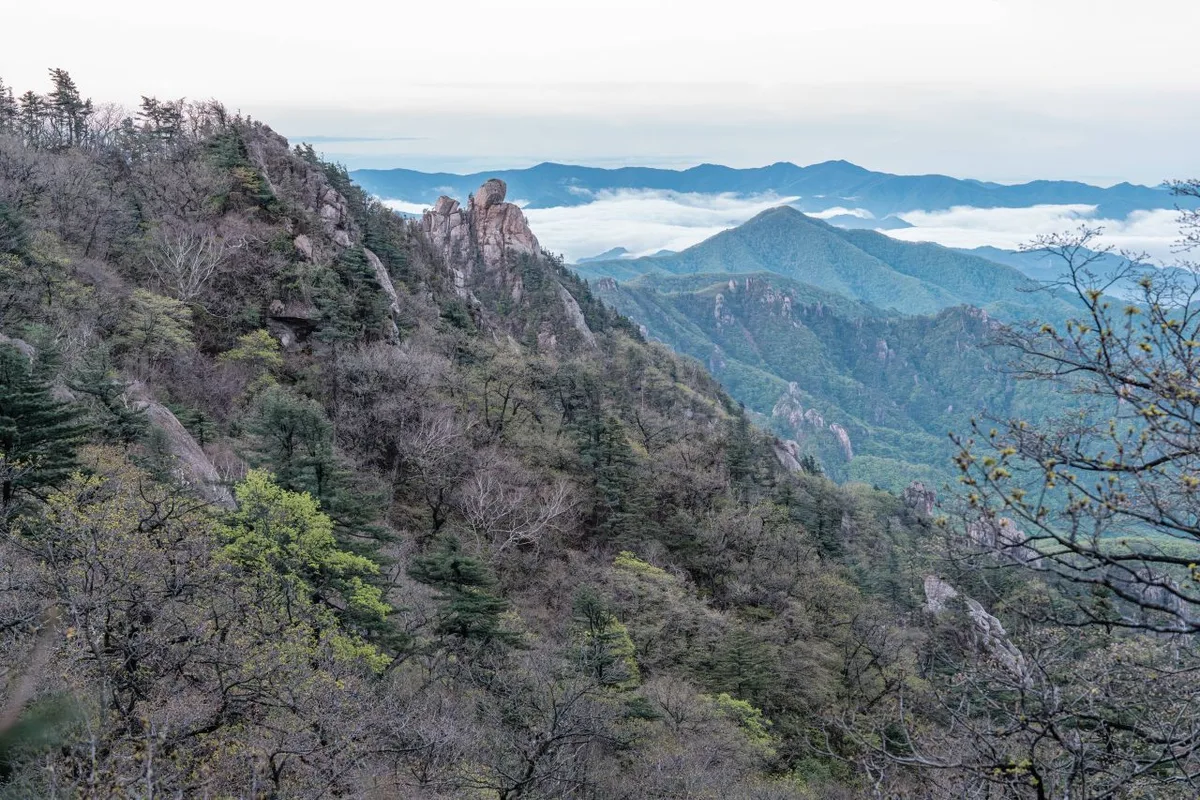
Doraksan is a classic “bone mountain” (골산, golsan) — the kind whose ridgeline is strung with rocky peaks big and small rather than soft, soil-covered slopes. The peaks listed in the public data include Hyeongbong (911m), Doraksan itself (987m), Sinseonbong (938m), Chaeunbong (892m), Geombong (848m), Doraksan Peak 964 (932m), Sangseonambong (659m), and Jebong (843m) — all strung along a single ridge, which is what makes a traverse-style rock-ridge hike possible here. The higher you climb, the more the granite and limestone outcrops take over, while down in the valley, Seonam Valley keeps its clear streams and pools running. That contrast — bare rock up top, cool water down below — is really what defines the mountain’s character.
What Climbing It Feels Like
The trail starts out gentle, following the Sangseonam Valley through easy woods, with the sound of the stream keeping you company as you climb. Past the midpoint, rocky terrain starts to take over, and near Sangseonam Peak the ridgeline finally opens up, giving you a clear view of the mountain chains around Danyang. The stretch connecting Hyeongbong and Jebong is where things get properly tense — it’s classic knife-edge rock scrambling, with sections where you need your hands as much as your feet, so the difficulty spikes for a bit. Once you’re up on the summit of Doraksan, though, the ridges open out in every direction and it’s pure exposure and views — in autumn especially, the fall colors against the rocky peaks make this one of the best lookout stretches around.
Main Courses (by Trailhead)
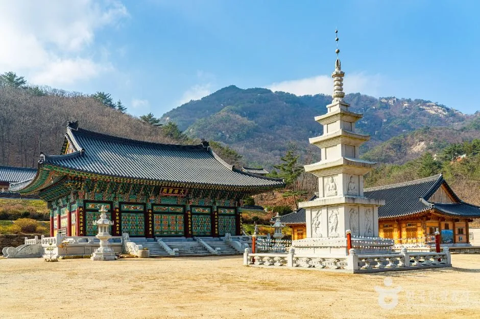 Photo: Korea Tourism Organization Photo Gallery (423 Hwangjeong-ri, Daegang-myeon, Danyang-gun, North Chungcheong Province) · Open Public Data License
| Course (trailhead → summit) | Distance | Net elevation change | Est. time (one-way) | Difficulty | Popularity |
|---|---|---|---|---|---|
| Bus stop Gasan-2-ri → Sangseonam Peak (Doraksan summit) | 6.62km | ↕692m | approx. 2 hr 49 min | ★★★★☆ | ★★★★☆ |
※ Source: Korea Forest Service Hiking & Trekking Support Center’s Top 100 Mountains GPX data (distance, elevation, time, difficulty) · Popularity rating is for reference only
Course 1 — Gasan-2-ri Bus Stop → Sangseonam-bong (Doraksan Summit)
Route: Gasan-2-ri bus stop → Sangseonam parking area → fork → Sangseonam → Seonamgarden restaurant → viewpoint → Sangseonam-bong → scenic overlook → rock formations → Jebong → Hyeongbong → photo spot → Doraksan → lightning-risk zone → Sinseonbong
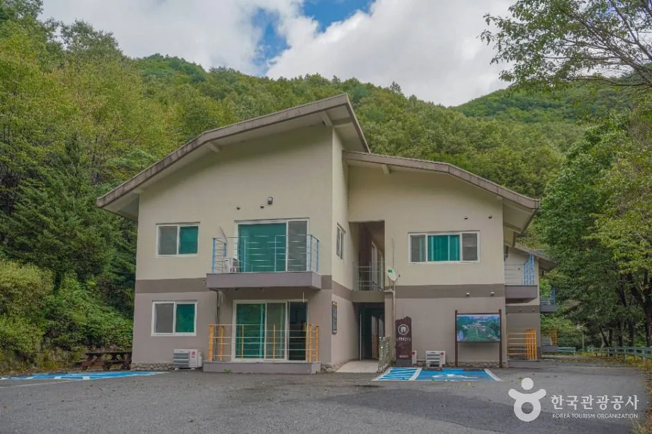
Getting to the trailhead: The Gasan-2-ri bus stop sits close to the trailhead, so most hikers get there by city bus from downtown Danyang. Schedules and routes can change, so it’s worth double-checking on KakaoMap or Naver Map before you go. There’s no dedicated parking lot registered in the public data for this stretch, so if you’re driving, plan to check on-site around the entrance to the Sangseonam valley — there’s usually an open area or signage that indicates where parking is allowed.
Highlights & who it suits: The early stretch up the Sangseonam valley is a gentle path winding alongside forest and stream — more of a warm-up than a challenge. Past Sangseonam-bong, though, the trail alternates between rocky ridgelines and open viewpoints, and the rock section between Hyeongbong and Jebong can be fairly demanding for beginners — this part’s better suited to hikers who already have some experience scrambling over rock. Since the route continues past the Doraksan summit all the way to Sinseonbong, it’s a through-hike best suited to people looking to combine rock-ridge scrambling with big views along the way.
Difficulty, Terrain & Cautions
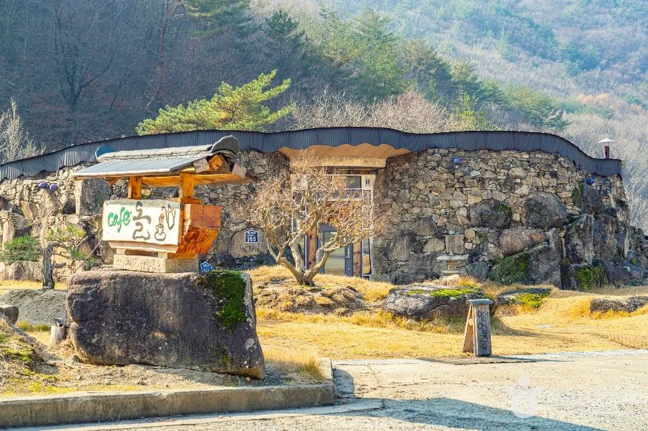 Photo: Korea Tourism Organization photo gallery (148 Seonamgyegok-ro, Daegang-myeon, Danyang-gun, Chungcheongbuk-do) · KOGL
According to the public data, the trails within Dorak-san’s registered zone top out at “easy” difficulty — but that rating covers the entire registered zone (by administrative district), not the actual summit route. Once you factor in the elevation gain and rocky terrain on the real path to the top (Gasan 2-ri → Sangseonam-bong), it feels considerably tougher than “easy” suggests. There’s no separate surface-condition data listed, but as mentioned earlier in the terrain overview, rock and bedrock sections become more frequent the higher you climb, so watch your footing — rocks can get slick after rain or on dewy mornings. In winter, icing on the rock sections raises the risk of slips, so it’s worth bringing crampons or similar traction gear.
The public data’s trail-facility POI list shows zero entries for viewpoints, water stations, shelters, and hazard zones — meaning there are no separately registered facilities marked on the map. That said, actual GPX track logs do show a viewpoint near Sangseonam-bong and a lightning-hazard zone between Dorak-san and Sinseon-bong marked as waypoints. So even without official signage, keep an eye on changing weather (especially summer thunderstorms) through that stretch.
The registered sections by administrative district total seven, as listed below. Keep in mind these are aggregated trail lengths by administrative zone, not individual named hiking courses.
| Section (by administrative district) | Total Length | Difficulty | Surface |
|---|---|---|---|
| (no section name) | 16.29km | Easy | - |
| Bangseong-ri section | 3.86km | Easy | - |
| Hoejeong-dong section | 3.78km | Easy | - |
| Deokgye-dong section | 3.69km | Easy | - |
| Ganam-ri section | 2.79km | Easy | - |
| Yongam-ri section | 2.12km | Easy | - |
| Dorak-san Ice Wall | 0km | - | - |
Distance and Time
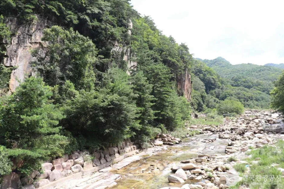 Photo: Korea Tourism Organization photo gallery (790 Seonam-gyegok-ro, Sangseonam, Danyang-gun, Chungcheongbuk-do) · KOGL Type 1
The route that leads to the summit area (Gasan 2-ri bus stop → Sangseonam Peak) runs 6.62 km one way with a net elevation gain of 692 m, and the estimated one-way time is about 2 hours 49 minutes. Round trip, you’re looking at roughly 5 hours, so this route on its own works fine as a day hike. That said, the total registered trail length within Doraksan’s boundaries adds up to 32.53 km across 7 sections combined — that’s a sum of multiple segments, not the distance of any single course. The public data also lists a cumulative time of 585 minutes ascending and 401 minutes descending for the entire trail network within the mountain, but again, that’s an aggregate across all sections, not the time for one particular route — easy to mix up, so worth flagging. Converting that cumulative figure into a pace works out to roughly 18 minutes/km on average going uphill, which is a useful reference point suggesting Doraksan’s trails are generally on the gentle side overall. If you’re planning to link several sections together into a full traverse, it may not be doable in a single day, so it’s worth considering an overnight itinerary instead.
Getting There (Public Transit & Parking)
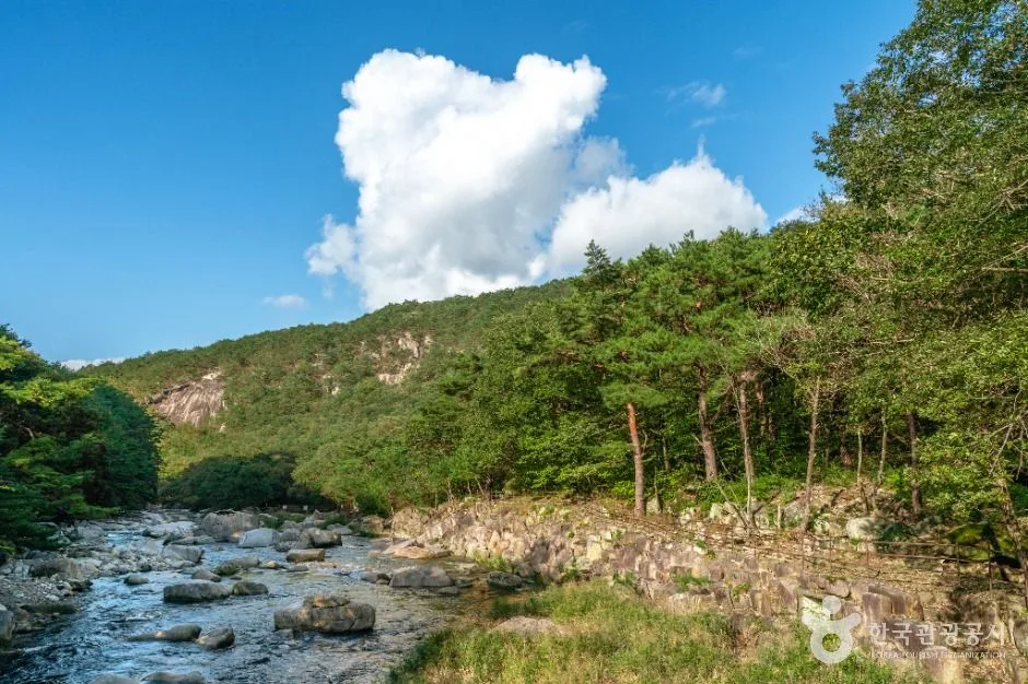 Photo: Korea Tourism Organization photo gallery (Sanseong-ri, Danseong-myeon, Danyang-gun, Chungcheongbuk-do) · KOGL Type 1
There’s a bus stop, Gasan 2-ri, near the trailhead for the summit route, so you can get there by city bus from downtown Danyang. The usual route into Danyang is an intercity or express bus from Seoul’s Dong-Seoul Terminal or Cheongnyangni, or a KTX/Mugunghwa train to Danyang Station or the Danyang bus terminal, then a transfer to a local city bus from there. Bus routes and schedules change from time to time, so it’s worth checking real-time transit directions on KakaoMap or Naver Map before you head out. If you’re driving, there’s no officially registered parking lot in the public data, so check a map app in advance for informal parking near the entrance to Sangseonam Valley, or just follow whatever the nearby restaurants or facilities suggest.
Season, Weather & Gear
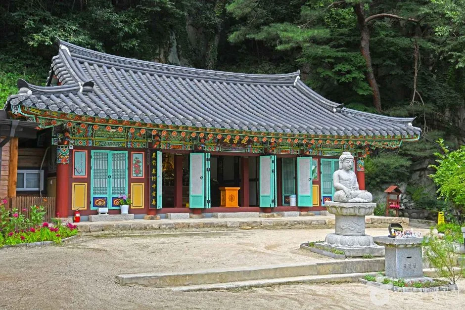 Photo: Korea Tourism Organization Photo Gallery (42 Sainam 2-gil, Daegang-myeon, Danyang-gun, Chungcheongbuk-do) · KOGL
Dorak-san is at its best in spring and fall, and autumn in particular is the season most people recommend — the combination of rocky peaks and fall foliage makes for some really striking views. In summer, the heat can be brutal, and afternoon thunderstorms aren’t uncommon, so keep a close eye on the weather, especially when crossing the lightning-exposed stretch between Dorak-san and Sinseonbong mentioned earlier. In winter, the rock sections ice over and get slippery, so it’s worth carrying crampons and gaiters. As for the basics that apply year-round: ankle-supporting hiking boots, trekking poles, a change of clothes, and plenty of water. Since there don’t appear to be any springs or water stations on the mountain, make sure to bring enough drinking water before you set out.
외국인 여행자 팁
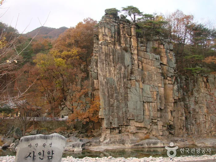 사진: 한국관광공사 관광사진 갤러리 · 공공누리
Doraksan’s romanized name is “Doraksan,” and Gasan 2-ri, the trailhead for the summit-loop course, is written “Gasan 2-ri.” Sangseonam, which the trail passes through, romanizes as “Sangseonam,” while nearby peaks around Doraksan include Sinseonbong, Hyeongbong, and Jebong. I couldn’t confirm any separate permit requirement or entrance fee, but it’s still worth checking the on-site signage for the latest info, just to be safe. Public data doesn’t list any restrooms or drinking water facilities directly along the trail, so plan on using the restaurants and shops near the Gasan 2-ri trailhead or the Sangseonam parking area, or just bring enough water with you. Google Maps tends to be unreliable for Korean hiking trails, so I’d strongly recommend installing KakaoMap or Naver Map instead to check the actual trail route and public transit info. There are rocky ridge sections on this route, so in rain or icy conditions there’s real risk of slipping — check the weather ahead of time and don’t push a hike you’re not comfortable with.
Nearby Mountains
- Juheulsan, with its rope-climbing Bubong ridge and Mungyeong Saejae pass — about 20km direct distance
- Huiyangsan (Mungyeong/Goesan), where white granite peaks rise up — about 32km direct distance
📍 Danyang's Doraksan in Chungbuk: Autumn Colors the Rocky RidgeLocation
Contact: bumseok.view [at] gmail [dot] com

Comments