Ocheon Bike Path: Route, Distance, and Certification Centers
Cycling · Published 7/31/2026 ·
자전거길 트랙·시설 (공공데이터: 행정안전부 국토종주 자전거길 DB) · 🏆인증센터 💧급수대 🚻화장실 🔧공기주입기 · 지도 © OpenStreetMap ⤓ GPX 다운로드
At a Glance
| Metric | Rating |
|---|---|
| Course difficulty | ★★★★☆ |
| Supplies & facilities (certification centers, water stations) | ★★★★☆ |
| Certification centers (5) | ★★★★☆ |
| Seasonal difficulty — spring | ★★☆☆☆ |
| Seasonal difficulty — summer | ★★★★★ |
| Seasonal difficulty — autumn | ★★☆☆☆ |
| Seasonal difficulty — winter | ★★★★☆ |
※ Source: Ministry of the Interior and Safety, Cross-Country Bike Trail database · Seasonal ratings are rough guides
Overview
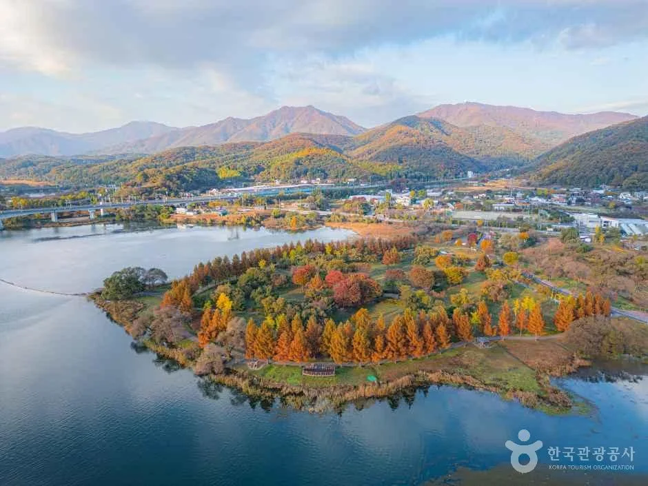
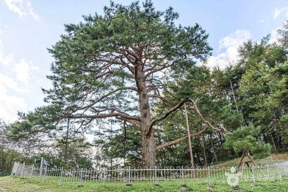 Photo: Korea Tourism Organization photo gallery (42 Jeokseok 2-gil, Yeonpung-myeon, Goesan-gun, Chungcheongbuk-do) · KOGL
The Ocheon Bike Path is exactly what the name says — a route that strings together five waterways. It follows the Dalcheon, Seonghwangcheon, Bogangcheon, Mihogang, and Musimcheon in turn, starting in the hills of Goesan in Chungcheongbuk-do, passing through Jeungpyeong and Cheongju, and dropping down to where it meets the Geumgang in Sejong. Of all the cross-country bike paths, this one gets described as the closest thing to the “inner life of inland Korea” — instead of the wide-open straightaways you get along a big river, you’re riding past rice paddies and villages, old bridges, and wetlands with egrets standing in them.
Because the terrain runs downstream the whole way, riding from Yeonpung in Goesan toward Sejong means the descents outnumber the climbs. Go the other direction and it’s the same distance, but it feels noticeably harder. If this is your first time, start at Yeonpung.
There are basically four ways to approach it.
- One-day full ride: Leave Yeonpung at dawn and reach Hapgang Park in Sejong before sunset. If you’re an intermediate rider or better, this is well within reach.
- Two days, one night: Splitting the route with an overnight in downtown Cheongju is the most practical option. Cheongju has lodging, restaurants, and bike shops all in one place, so you can shake off day one and cruise to the finish on day two.
- Minivelo or folding bike + public transit: Ride a Brompton or other folding bike as far as a point with rail or bus access — Cheongju, Jeungpyeong, Jochiwon — and save the rest for another trip. This does the most to solve the biggest headache with a one-way route: getting back.
- Family and beginner sections: The Musimcheon area in Cheongju and the lower Mihogang are close to flat with good pavement, which makes a 20–30 km out-and-back a great family outing.
This route is also the connecting spine between the Saejae Bike Path and the Geumgang Bike Path. If you’re planning the full cross-country ride, consider it essential.
Course Details
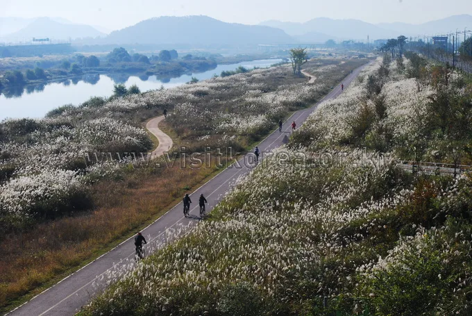
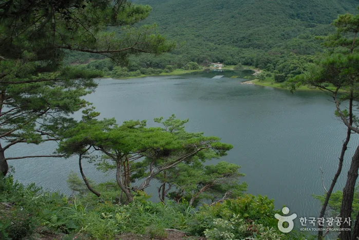 Photo: Korea Tourism Organization photo gallery · KOGL
The route starts at the Yeonpung Rest House checkpoint in Yeonpung, Goesan County. It’s a mountain trailhead close to the foot of Ihwaryeong Pass, so the morning air has a chill to it, and right from the start you get a gentle downhill run along the upper reaches of the Dalcheon. The stretch that follows the valley mixes riverside bike-only path with farm roads and village lanes, so you don’t get the endless straightaways of the big-river routes. What you get instead is the fun of the scenery changing every time you cross a bridge.
The first waypoint is the Goegang Bridge checkpoint. It’s close to downtown Goesan, which makes it the first real place to restock. From there, following the Seonghwangcheon and Bogangcheon toward Jeungpyeong, the surface noticeably improves into proper bike-only path, with a run of riverside parks and sports facilities alongside.
Past Jeungpyeong, once you merge onto the Mihogang, the character of the course changes completely. A dedicated path runs dead straight beside the wide river, and the Baengno Park checkpoint sits in a wetland stretch where egrets and herons gather. There’s almost no shade here, which makes it the toughest section in summer — but in spring and fall it’s the prettiest part of the whole route.
Branching off the Mihogang and heading into central Cheongju, the Musimcheon checkpoint is waiting. It’s a streamside bike path cutting through the city center, so there are plenty of pedestrians and runners, and cherry trees line the way for a long stretch. From here you rejoin the main Mihogang and head downstream to the finish at the Hapgang Park checkpoint, right at the confluence where the river meets the Geumgang. Two rivers coming together makes for a wide-open view, and you can carry straight on from here onto the Geumgang Bike Path.
Food Along the Way
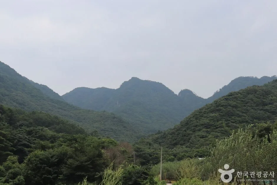 Photo: Korea Tourism Organization photo gallery (35 Ipseok 1-gil, Yeonpung-myeon, Goesan-gun, Chungcheongbuk-do) · KOGL
The route runs through the heart of inland Chungbuk, which is proper local-food country. Rather than singling out specific restaurants, here’s a rundown of what the area is generally known for.
- Around Goesan: Olgaengi-guk, a soup made with freshwater snails, is the region’s best-known hangover cure. It’s light and easy on the stomach, which makes it a good lunch mid-ride. In summer you’ll see daehak sticky corn everywhere; come autumn it’s Goesan chili peppers and pickled vegetables.
- Around Jeungpyeong: This area is known for growing ginseng, so samgyetang and other ginseng dishes tend to be what you’ll spot. There are convenience stores and small restaurants scattered around the riverside park.
- Around Cheongju: This is where you’ll find the most dining options on the whole course. Grilled meat and baekban spots around the traditional market are the usual go-to, and cafés and convenience stores are thick on the ground too. If you’re staying overnight, this is the place to have a proper meal.
- Around Sejong and Bugang: Being right next to the Geum River, freshwater maeuntang is roughly what the area is known for. That said, the finish at Hapgang Park is parkland — not a restaurant district.
⚠️ Warning: stretches with no resupply: Convenience stores thin out badly on the mountain and farmland section between Goesan and Jeungpyeong, and along the bike-only path in the middle reaches of the Mihogang. Around Baengno Park in particular you can ride a dozen-plus kilometres without passing a single shop. Top up on water and ride food in downtown Goesan, Jeungpyeong, and Cheongju before you set off — don’t skip it. And on Sundays or early in the morning, plenty of rural shops simply won’t be open.
Supplies & Facilities
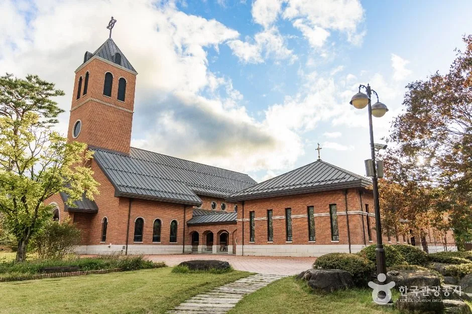 Photo: Korea Tourism Organization photo gallery (14 Jungang-ro Hongmun 2-gil, Yeonpung-myeon, Goesan-gun, Chungcheongbuk-do) · KOGL
| Facility | Count | How you’ll use it |
|---|---|---|
| Certification centers | 5 | Stamps, plus de facto rest stops and waypoints |
| Restrooms | 29 | Fairly well spaced along the whole route |
| Water fountains | 2 | Seriously lacking — bring your own water |
| Air pumps | 9 | Topping off tire pressure before and mid-ride |
The number to notice here is just two water fountains. Twenty-nine restrooms sounds generous, but a restroom is not a drinking fountain. Plan on getting your water from convenience stores, village shops, and restaurants — and please don’t set off with a single 500ml bottle. In summer, you’re much safer carrying at least two liters on you, or nailing down specific resupply points ahead of time.
The nine air pumps are spread out well enough that you can check your pressure right after you start and again partway through. That said, the pumps may only fit certain valve types (Presta or Schrader), so bringing an adapter that matches your valves is the safer bet.
The certification program and your passport
This route is part of the Cross-Country Bike Route certification program. You carry a certification passport (a bike travel passport) and collect a stamp at each certification center; get all five and you’ve officially completed the Ocheon Bike Path section. The stamps sit inside the booths at each center, and the ink can dry out or the impression can come out faint, so press down firmly and get it right in one go. If you haven’t gotten hold of a passport yet, a common workaround is to stamp a piece of paper or the back page of a notebook for now and transfer it into the official passport later to have it counted.
The Ride Home
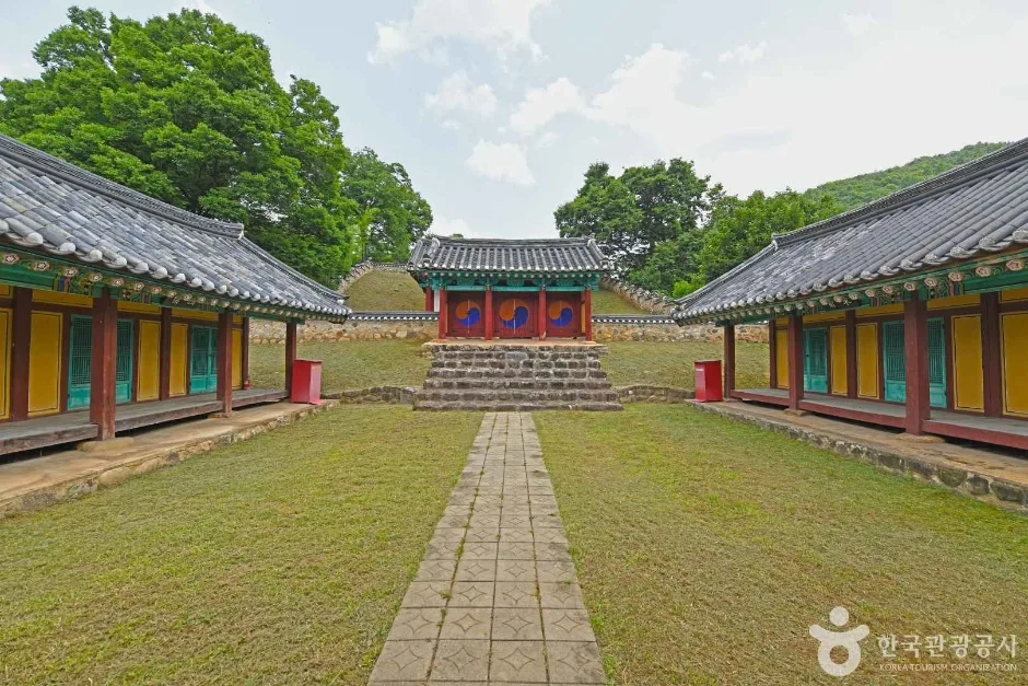 Photo: Korea Tourism Organization photo gallery (40-2 Hyanggyo-ro, Yeonpung-myeon, Goesan-gun, Chungcheongbuk-do) · KOGL
Since this is a one-way route, planning your way back is half the job. Two things to understand up front: the finish at Hapgang Park sits on the riverside on the outskirts of Sejong, and the start at Yeonpung is a mountain village with no rail line anywhere near it.
① By train (the realistic option)
The closest rail hub to the finish is Osong Station. KTX trains stop there, and you can also catch conventional Chungbuk Line services, so it covers both getting home toward Seoul or Busan and moving around inland Chungbuk. Bugang Station, served by conventional Gyeongbu Line trains, and the stations toward Jochiwon are workable alternatives too.
Here’s roughly how bikes are handled on board:
- Conventional trains (Mugunghwa-ho, ITX-class): fairly relaxed about bikes. Some services run a car fitted with bike racks, and in that case you need to book the bike slot (rack space) separately. On trains without racks, you’ll be expected to fold the bike or pull the front wheel and pack it in a proper bike bag.
- KTX: safest to assume a fully assembled bike simply won’t get on. Generally the only thing allowed is a folding bike, folded and bagged as luggage.
So if you’re riding the route on a full-size road bike or MTB and it doesn’t fold, I’d work out your return timetable around the conventional train services first. Bike-carriage rules and whether a given train actually has racks change with the season and the trainset, so it’s worth checking your specific train on the Korail booking system before you set off.
② If you have to get back to the start (Yeonpung)
If you left a car in Yeonpung, this is the trickiest scenario. The usual route back is a two-step affair:
- Finish → ride or otherwise get to Osong Station or downtown Cheongju (under your own power, or via Sejong BRT and city buses)
- Take a conventional Chungbuk Line train toward Chungju → from Chungju, catch an intercity or rural bus that goes via Suanbo into Yeonpung
Intercity and rural buses can refuse to load a bike at the driver’s discretion. With a full-size bike that doesn’t fold, expect that you may well get turned away. Which is why, in practice, a lot of riders don’t leave a car in Yeonpung at all — they base themselves in Cheongju or Osong, then travel out to Yeonpung early in the morning to start. Do it that way and you can head straight home by train or bus the moment you finish.
③ Riding back the way you came (out and back)
Retrace the whole route and you’re looking at roughly 210 km round trip. On top of that, the return leg runs downstream to upstream, so it feels considerably harder than the numbers suggest. Only consider it if you’re planning at least two days and one night, and you’ve got serious fitness in the bank. It’s an appealing choice for riders with long-distance brevet experience, but I wouldn’t recommend it to beginners or intermediate riders.
④ Just keep riding instead
The finish connects straight into the Geum River bike path, so instead of turning around you can carry on south toward Daejeon, Gongju, or Buyeo and wrap up at a rail station with better connections. If you’re working through the Cross-Country route, this is the most efficient option by far.
Bus stops are spaced fairly close together through the Sejong and Cheongju sections, so they’re handy reference points if you need to bail partway.
Safety & Cautions
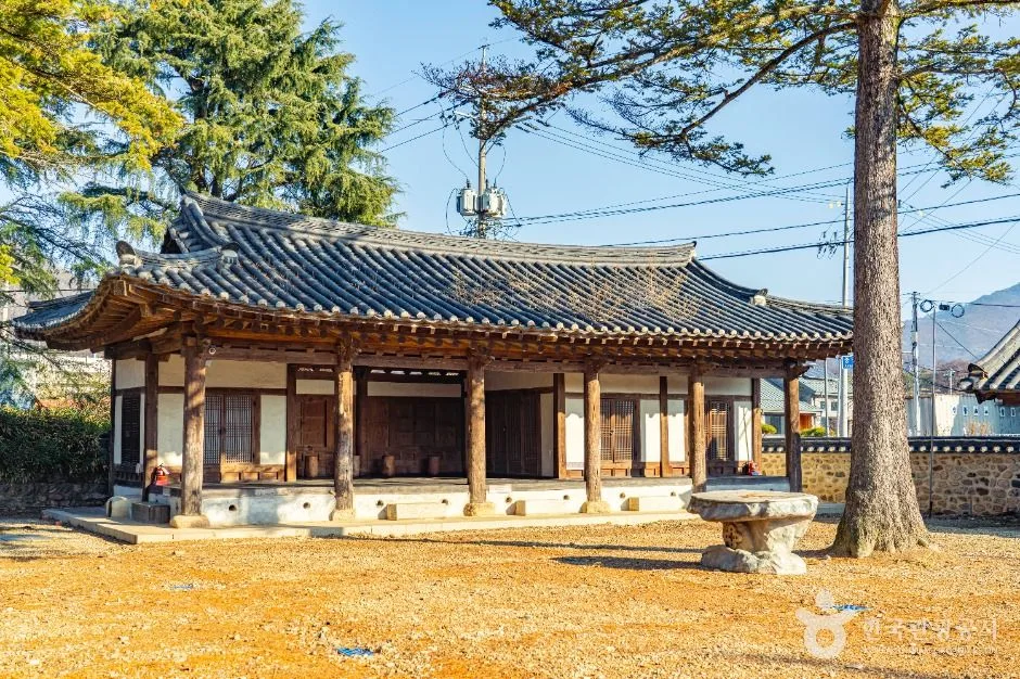 Photo: Korea Tourism Organization photo gallery (44 Jungang-ro, Yeonpung-myeon, Goesan-gun, Chungcheongbuk-do) · KOGL
- Shared-road sections: Not every stretch is a dedicated bike path. You’ll be mixing village roads, farm tracks, and shared traffic lanes. Where farm machinery and trucks are moving, slow down and keep an eye on what’s coming up behind you.
- Pedestrian traffic: The Musimcheon stretch in Cheongju and the riverside park in Jeungpyeong both feel more like walking paths than bike routes. Use your bell, keep your speed down, and leave the earbuds out.
- Bridge approaches and detours: Every point where streams merge brings sharp turns and bollards. These are especially dangerous at night or riding into low sun.
- Ice: In winter, shaded riverside sections and bridge approaches can stay frozen even in the middle of the day.
- Night riding: Most of the riverside sections have no streetlights. Once the sun goes down you’re essentially riding in the dark, so a headlight and taillight aren’t optional — they’re required.
- Water and dehydration: There are only two water points on this route. Don’t wait until you’re thirsty; get in the habit of drinking on a schedule.
- Wildlife and wetlands: Slow down through the heron habitat so you don’t startle the birds.
Season, Weather, and Gear
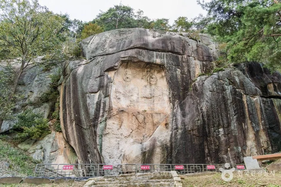 Photo: Korea Tourism Organization tourism photo gallery (Wonpung-ri, Yeonpung-myeon, Goesan-gun, Chungcheongbuk-do) · KOGL
The best windows are April–May and mid-September through mid-October. Spring, when cherry blossoms blanket the Musimcheon, and autumn, when the Mihogang is ringed by golden rice paddies, are this route at its absolute peak.
- Summer (June–August): The hardest time to ride it. The Mihogang stretch has almost no shade and the radiant heat off the pavement is brutal. During monsoon season the riverside sections can flood or be closed off, and afternoon downpours are common. An early-morning start and a midday break aren’t optional.
- Winter (December–February): The headwind coming off the river bites, and there’s a risk of ice. On the plus side, the air is clear and the views are the best you’ll get all year.
- Wind: A headwind blowing along the river will eat your legs faster than any climb. Check the wind direction before you set out, and if it’s against you, dial back your target pace.
Essential Gear
| Category | Items |
|---|---|
| Safety | Helmet, front light, rear light, gloves, sunglasses |
| Repair | 2 spare tubes, patch kit, tire levers, mini pump, multi-tool, valve adapter |
| Food & water | At least 2 bottles of water, energy bars/bananas or similar, salt or electrolyte tablets |
| Other | Power bank, a little cash (for rural shops), windbreaker, certification passport |
Tips for International Travelers
① Route Name (Romanization)
- Route: 오천자전거길 — Ocheon Bike Path (Ocheon = “five streams”)
- Start: 연풍레스트하우스 — Yeonpung Rest House (Goesan-gun, Chungbuk)
- End: 합강공원 — Hapgang Park (Sejong City)
- Certification centers: 연풍레스트하우스 (Yeonpung Rest House) · 괴강교 (Goegang Bridge) · 백로공원 (Baengno Park) · 무심천 (Musimcheon) · 합강공원 (Hapgang Park)
- Connecting routes: 새재자전거길 (Saejae Bike Path), 금강자전거길 (Geumgang Bike Path)
② A Practical Guide to the Certification System
This route is part of Korea’s Cross-Country Cycling Certification program. Here’s how it actually works on the ground.
- Getting a bike passport: The official online store is Korean-only, and buying one from abroad is a headache — foreign-issued credit cards usually fail, and the site wants a Korean phone number or resident registration number for verification. The realistic option is to buy one in person at a staffed certification center. The larger staffed centers (the main hubs on the Hangang, Geumgang, and Nakdonggang routes, for example) sell them for a small fee, and one passport covers every route in the country. I’d suggest picking one up on your first ride after landing in Korea, before anything else.
- How to use an unstaffed center: Most certification centers have nobody there. Look for a small booth that looks like a red telephone box — that’s it. Open the door and you’ll find a rubber stamp engraved with the local place name, plus an ink pad. Find the right box for that center on your passport’s route page and press down firmly, once. If the ink has dried out, try rubbing the stamp around on the pad a few times; if it still won’t take, snap a photo with both the booth and your bike in frame as backup.
- Completion rewards: Fill in every center on a route and you get a section-completion sticker. String enough routes together to meet the cross-country or Grand Slam requirements and you can claim a completion certificate and medal. This is normally handled by having your passport checked at one of the designated staffed centers.
③ If You’re Arriving Without a Bike
- Cheongju, Sejong, and other urban stretches sometimes have private rental shops and riverside park rental stands. That said, finding a bike in this area that’s actually suited to a 105 km ride is not easy.
- The practical approach is to rent a touring bike in Seoul and bring it down by train, folded or partly disassembled. There are outfits in Seoul that rent out road and touring bikes by the day.
- Seoul’s public bike share, Ttareungyi, has an English app and accepts foreign cards, but it only works within Seoul city limits — you can’t use it on this route. Think of it as a warm-up for the Hangang stretch in Seoul, nothing more.
- If you need to move a bike anywhere in the country, shipping it ahead by parcel freight to your destination accommodation is a common trick here.
④ Navigation
- Google Maps’ cycling directions are not reliable in Korea. Bike mode isn’t properly supported, so it’ll either route you onto car roads or fail to find a route at all.
- Use bike mode in KakaoMap or Naver Map instead. Both have English interfaces and both reflect Korea’s actual bike path data. Searching in Korean is more accurate than romanization, so it’s worth copying the Korean names of the certification centers above and keeping them handy.
- If you ride with a GPS cycling computer, the surest bet is to download the route’s GPX track from Strava, Komoot, or RideWithGPS and load it in advance. The cross-country routes are marked with a blue line and painted road signage, so in practice, just following the markers gets you almost everywhere you need to go.
- Mobile data: Grab a SIM or eSIM at the airport when you land. Coverage is generally good even along the river sections.
Other Bike Paths Nearby
- Saejae Bike Path: Route, Distance, and All 7 Certification Centers — roughly 39 km as the crow flies
- Namhangang Bike Path: Route, Distance, and Certification Centers — roughly 60 km as the crow flies
📍 Ocheon Bike Path: Route, Distance, and Certification CentersLocation
Contact: bumseok.view [at] gmail [dot] com
Comments