Ara Bike Path: Complete Guide to the Route, Distance, and Certification Centers
Cycling · Published 7/22/2026 ·
자전거길 트랙·시설 (공공데이터: 행정안전부 국토종주 자전거길 DB) · 🏆인증센터 💧급수대 🚻화장실 🔧공기주입기 · 지도 © OpenStreetMap ⤓ GPX 다운로드
At a Glance
| Metric | Rating |
|---|---|
| Course difficulty | ★★☆☆☆ |
| Amenities (certification centers, water stations) | ★★★☆☆ |
| Certification centers (3) | ★★★☆☆ |
| Spring difficulty | ★☆☆☆☆ |
| Summer difficulty | ★★★☆☆ |
| Fall difficulty | ★☆☆☆☆ |
| Winter difficulty | ★★★☆☆ |
※ Source: Ministry of the Interior and Safety National Bicycle Route DB · seasonal ratings are for reference only
Overview
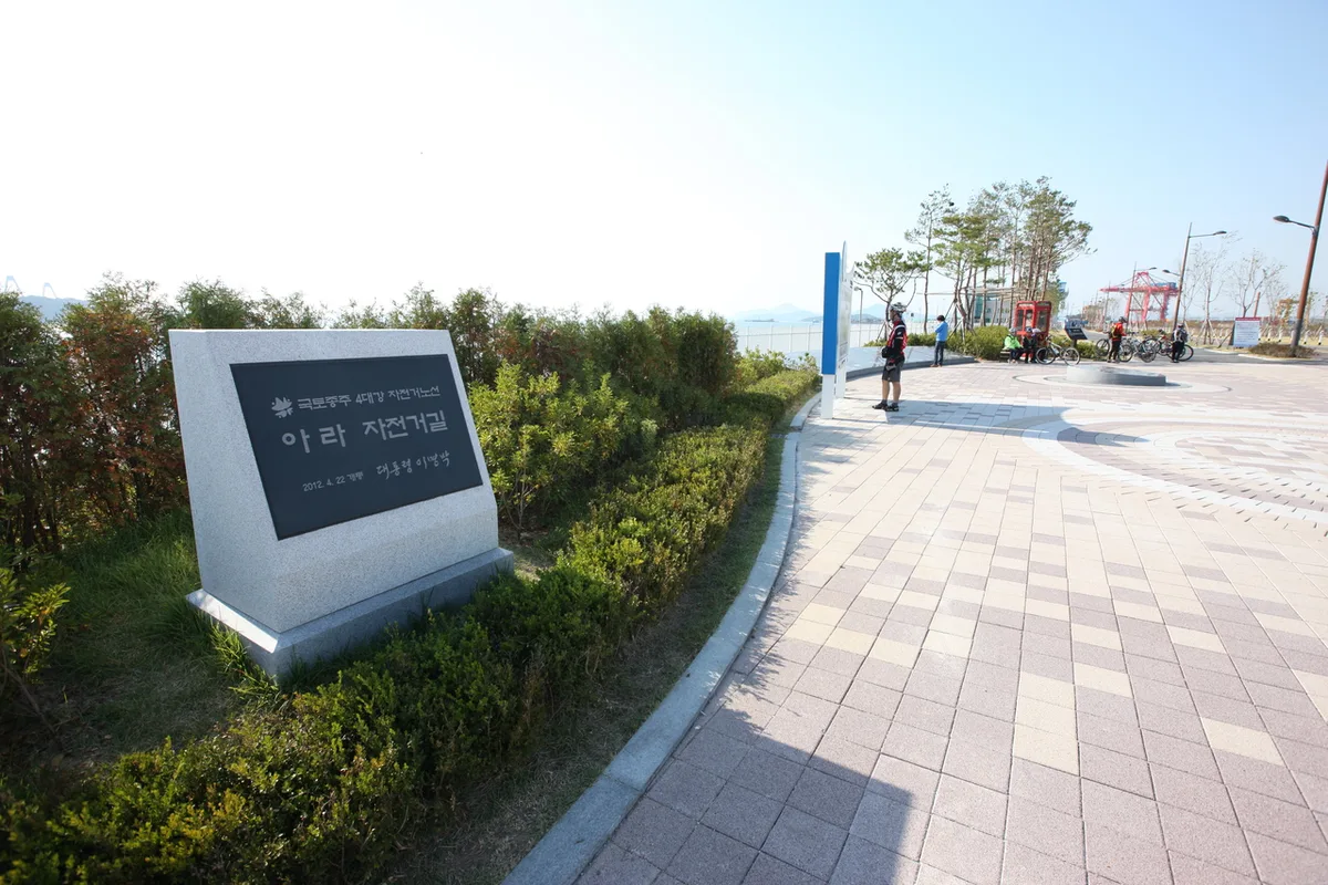 Photo: Korea Tourism Organization photo gallery (Incheon Metropolitan City) · KOGL
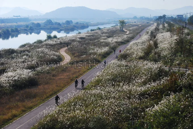
The Ara Bike Path (아라자전거길, Ara Jajeongeo-gil) runs along the Gyeongin Ara Waterway, the flat channel that links the West Sea at Incheon to the Han River in Seoul. It’s a one-way, riverside route with a clear sense of direction — you start with a sea breeze and end up following the Han River — so there’s a real satisfaction in knowing exactly where you began and where you finished. Most of the path is a dedicated bike lane running straight alongside the waterway, with almost no hills and generally even pavement, which makes it an easy full ride even for beginners or anyone getting back in the saddle after a long break.
There are basically two ways to make use of it.
- A day-trip out-and-back ride: since it’s 21km one way, you can start from either Jeongseojin or the Han River side, ride to the far end, and loop back — a solid day outing. Even with a few breaks along the way, half a day is plenty.
- The opening leg of a cross-country ride, or a link to a longer route: the Ara Bike Path is part of the official cross-country certification network. Connect it at the Ara Han River Lock to the Han River Bike Path and then the South Han River Bike Path, and you’ve got the starting stretch of the cross-country route all the way to Busan — making it a great “gateway” ride for stamping your first certification passport.
You can also adapt it in other ways — bring a folding bike like a Brompton or a mini-velo, take public transit to one end, and ride the route one-way only; or, if you’re out with family or beginners, just do a short stretch of the flat sections.
Course Info
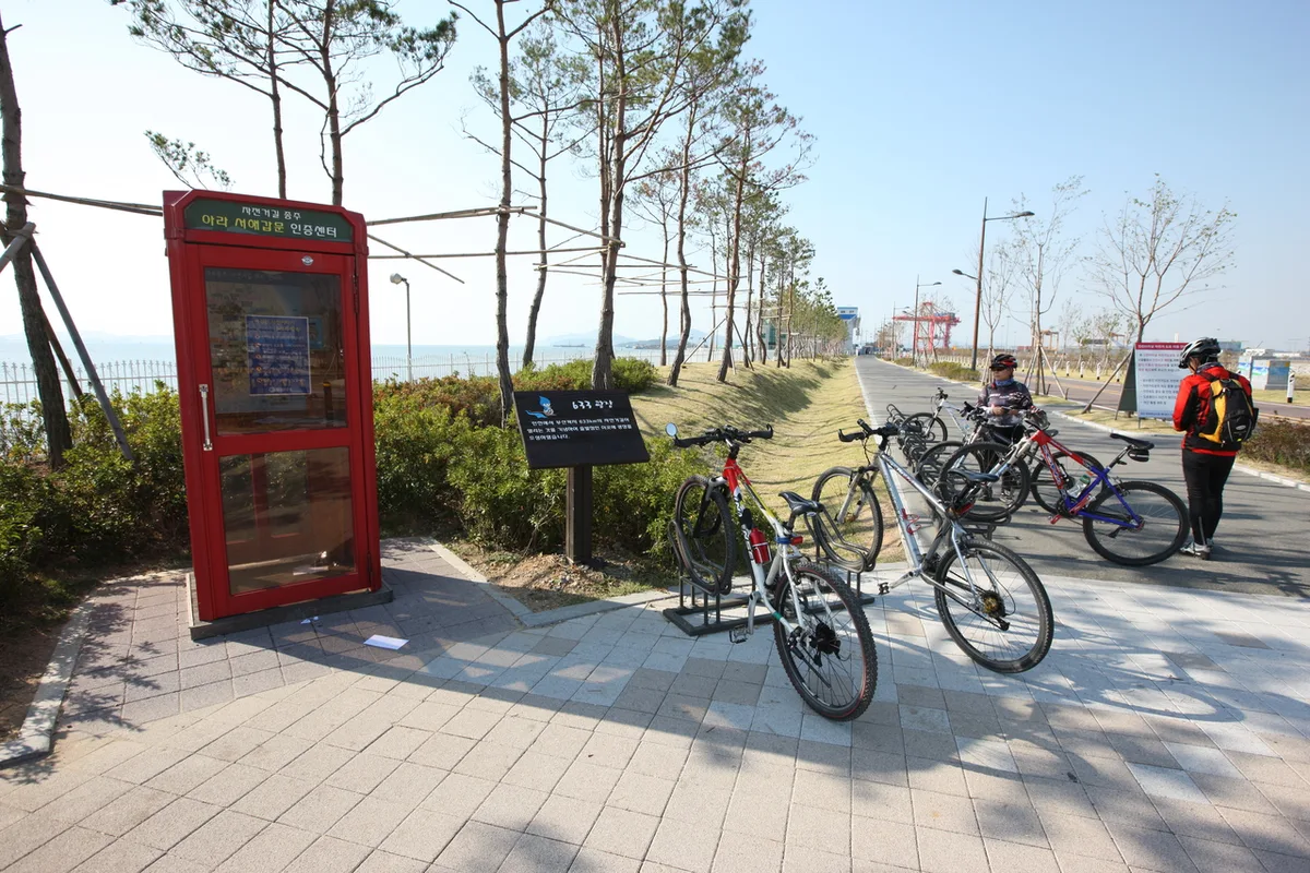 Photo: Korea Tourism Organization Photo Gallery (Incheon) · Public Nuri
The route runs between two ends: Jeongseojin (Ara Seohae Gapmun), where it meets the West Sea near Incheon, and Ara Hangang Gapmun, where it meets the Han River in Seoul. Between the two lock gates runs the Gyeongin Ara Waterway, a dead-straight artificial canal, with a dedicated bike path running along the banks on either side — so you end up riding right alongside the water the whole way.
Starting from the Jeongseojin side, you begin with the West Sea, the lock gate, and wide-open sky at your back, then gradually move inland past the Ara Tower observatory and along the canal. Go the other direction from Ara Hangang Gapmun, and you start with the refreshing view of where the Han River meets the waterway, heading out toward the sea. Since almost the entire route is a flat, dedicated bike path running beside the canal, you rarely have to deal with car traffic, and the bridges crossing the water plus the lock structures make handy landmarks, so there’s little chance of losing your way.
Being a certified route, there are certification centers built into the flow of the course. The Jeongseojin (Ara Seohae Gapmun) Certification Center at the sea end and the Ara Hangang Gapmun Certification Center at the river end bookend the route, and three more certification centers are spaced along the way, so you can stamp your way through as you complete the ride. The lock gates at both ends are landmarks in their own right, each with a spacious plaza and sculptures, making them great spots to knock out your start/finish stamps and grab a photo while you’re at it.
Local Food Along the Way
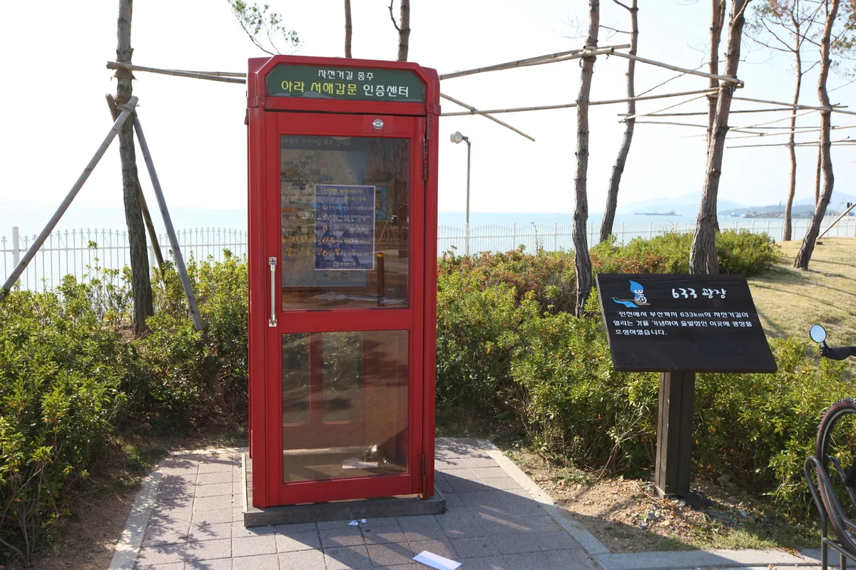 사진: 한국관광공사 관광사진 갤러리 (인천광역시) · 공공누리
The Ara Bike Path runs through Incheon’s Seo-gu and Gyeyang districts on one end and Gimpo/Seoul’s Gangseo area on the other, so it’s really the two cities bookending the route — not the trail itself — where your food options open up. Around Incheon, you’ll typically find local specialties like jjolmyeon (chewy cold noodles), “washbasin” naengmyeon (served in an oversized bowl), and multembeong (monkfish stew), plus the jjajangmyeon lineage that grew out of the local Chinese community. Over on the Gimpo/Gangseo side, you’re more likely to run into everyday staples — home-style baekban meals, gukbap, and bunsik joints. Rather than chasing a specific restaurant, I’d just plan to ride into whichever downtown you finish near and try whatever that area’s known for.
One thing worth flagging: the canal-side stretch itself is basically a supply desert. Once you get past the locks and observation decks, convenience stores and restaurants thin out fast, so it’s smart to stock up on water and snacks at either end of the trail, or near the locks, before you head out. On hot days especially, don’t skimp on supplies before you set off.
Supplies & Amenities
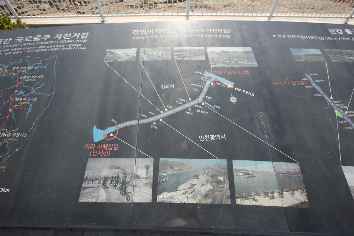 Photo: Korea Tourism Organization Photo Gallery (Incheon Metropolitan City) · KOGL Type 1
Here’s the facility breakdown: 3 certification centers, 16 restrooms, 1 water station, and 0 air pumps. With 16 restrooms, the route is fairly generously spaced out for a riverside course, so it’s easy to time your breaks and bike checks. That said, there’s only one water station and no air pumps along the way, so bring plenty of your own drinking water, and definitely pack a portable pump and puncture repair kit in case of flats or low tire pressure.
Since this is a certified route, you’ll want to use the certification passport (the cyclist’s travel booklet). Stamp it at the three certification centers along the way to log your completion — at staffed centers you get stamped at the counter, while at unstaffed ones you stamp it yourself at the stamp booth provided. The certification centers at each end — Jeongseojin (Ara Seohae Lock) and Ara Hangang Lock — serve as your start and finish stamps.
Return trip
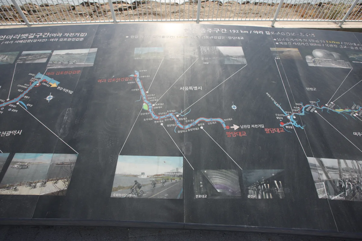 Photo: Korea Tourism Organization photo gallery (Incheon Metropolitan City) · Gongnuri
This route runs 21km one way, so even the full round trip only comes out to about 42km — nothing that’s going to wreck you in a single day out. That means there’s no need to overthink getting back afterward: the simplest plan is just to retrace your route to where you started. And since it’s mostly flat, riding it twice doesn’t spike the fatigue the way a hillier course would.
Safety Notes
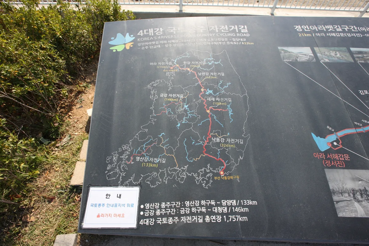 Photo: Korea Tourism Organization Photo Gallery (Incheon Metropolitan City) · KOGL
Most of the route is on a dedicated bike path, but around the locks, the observation deck, and the parks you’ll hit shared sections where cyclists and pedestrians mix — slow down and give pedestrians the right of way there. Since the trail runs along open water with little shade, summer riding means real risk from radiant heat off the pavement plus direct sun, so watch out for dehydration and heat exhaustion. There’s only one water station on the whole route, so drink often and plan your refill stops ahead of time. In winter and early spring, watch for lingering ice on bridges and shaded stretches — slow down through those. Visibility drops near the lock structures and around early morning or dusk, so run your front and rear lights, and a reflective vest is a good idea if you’re riding at night.
Season, Weather, and Gear
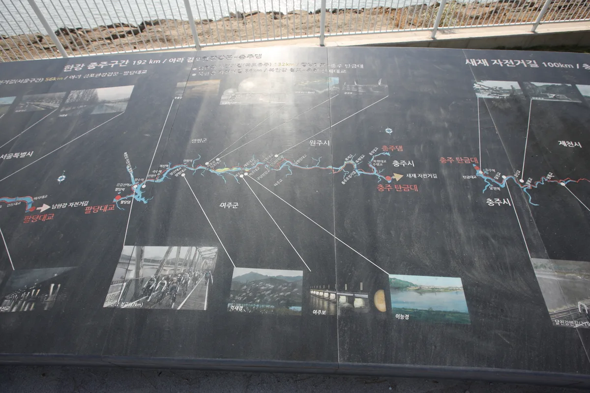 Photo: Korea Tourism Organization photo gallery (Incheon) · KOGL Type 1
The best seasons for this ride are spring and fall, when the wind and temperatures are mild. That’s when the flat course really shines, and even beginners will find it a comfortable ride. In summer, the exposed riverside stretch means heat and strong sun can wear you down fast, so plan around early mornings or evenings and bring plenty of water. Winter brings sharp river winds and the occasional icy patch, so dress warm and watch your footing — or rather, your tires. Since headwinds along the river and canal sections can pick up out of nowhere at any point in the day, it’s worth picking which direction you ride based on the wind and how your legs are feeling — it makes the whole trip a lot easier.
As for gear, the non-negotiables are a helmet, front and rear lights, a puncture repair kit with a portable pump, and plenty of water. There’s no air pump station anywhere along this route, so that portable pump earns its keep. Beyond that, sunscreen, a light windbreaker, gloves, and a quick snack will cover you no matter what season you’re riding in.
Tips for International Travelers
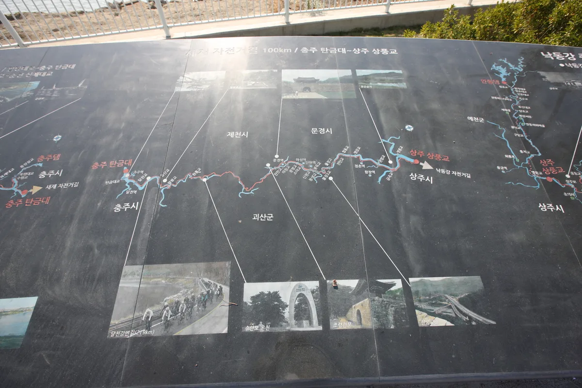 Photo: Korea Tourism Organization Photo Gallery (Incheon Metropolitan City) · KOGL
① Route name: This course is the Ara Bike Path (아라자전거길), running between Jeongseojin / Ara Seohae Gapmun (정서진·아라서해갑문, the West Sea end) and Ara Hangang Gapmun (아라한강갑문, the Han River end). The waterway as a whole is signed as the Gyeongin Ara Waterway (경인아라뱃길).
② A practical guide to the certification system (this route is part of it): Korea’s bike-path certification system lets you record your completed routes with stamps.
- You buy the certification passport (Bike Passport) in person at a staffed certification center. The official certification website is essentially Korean-only, and between the foreign-card issues and Korean ID verification requirements, buying one in advance from abroad is basically not workable. Your best bet is just to pick one up at a staffed center once you’ve arrived in Korea.
- The unmanned certification booths look like little red British-style phone booths, each stocked with a stamp and ink pad. Just stamp the box for that route in your passport. These booths are usually accessible around the clock, so you can get your stamp regardless of staffed-office hours.
- Finish a section and you’ll get a certification sticker to add to your passport; complete an entire route — like the full cross-country course — and you’ll typically receive a completion certificate and medal. The Ara Bike Path is the starting leg of that longer route.
③ If you didn’t bring a bike: If you don’t have your own bike, renting locally is the way to go. In the Seoul area, the public bike-share system Ttareungi is everywhere, and since it has an English-language app and accepts foreign cards, it’s fairly easy for visitors to use. That said, public bikes are better suited to getting around the city than to a long-distance ride, so if you’re planning a proper full-course ride, you’re better off renting a road or hybrid bike from a private rental shop.
④ Map apps: Google Maps often gets bike directions wrong in Korea. Switching to bike mode on KakaoMap or Naver Map will give you much more accurate guidance on dedicated bike paths and certification center locations. Both apps support an English interface, and searching with the romanized place names given above should make it easy to find your way.
📍 Ara Bike Path: Complete Guide to the Route, Distance, and Certification CentersLocation
Contact: bumseok.view [at] gmail [dot] com
Comments