Mount Muhak in Changwon: Overlooking Masan Bay Like a Dancing Crane
Hiking · Published 7/24/2026 ·
등산로 트랙·시설 (공공데이터: 전국등산로 공간정보) · 🚩시종점 💧음수대 👁️조망점 🏠대피소 🅿️주차장 ⚠️위험 · 지도 © OpenStreetMap ⤓ GPX 다운로드
At a Glance
| Metric | Rating |
|---|---|
| Accessibility (transit/parking) | ★★★☆☆ |
| Trail difficulty | ★★☆☆☆ |
| Water/springs on the mountain | ★☆☆☆☆ |
| Overnight stay needed | ★★☆☆☆ (needed for the full traverse) |
| Seasonal difficulty - Spring | ★★★☆☆ |
| Seasonal difficulty - Summer | ★★★★☆ |
| Seasonal difficulty - Fall | ★★★☆☆ |
| Seasonal difficulty - Winter | ★★★★★ |
※ Source: Korea Forest Service trail spatial data · accessibility and seasonal ratings are for reference only
Overview
 Photo: Korea Tourism Organization photo gallery (68 Dongseobuk 10-gil, Masanhappo-gu, Changwon, Gyeongsangnam-do) · Gongu Nuri
Muhaksan straddles Masanhappo-gu and Masanhoewon-gu in Changwon, Gyeongsangnam-do, looking down over the city of Masan and Masan Bay to the south. Its summit is usually given as around 761m, though the GPX data from this hike puts the highest point in the summit area at 785m — the 761–785m spread you’ll see across different course logs just comes down to which peak or viewpoint near the top each one used as its endpoint. The name is said to come from the shape of a crane spreading its wings to dance, and for the people of Masan the mountain has long served as their guardian peak (jinsan), drawing hikers year-round. Most routes to the summit area run about 6–7 hours round trip, making it an easy one-day hike.
Mountain Shape and Terrain
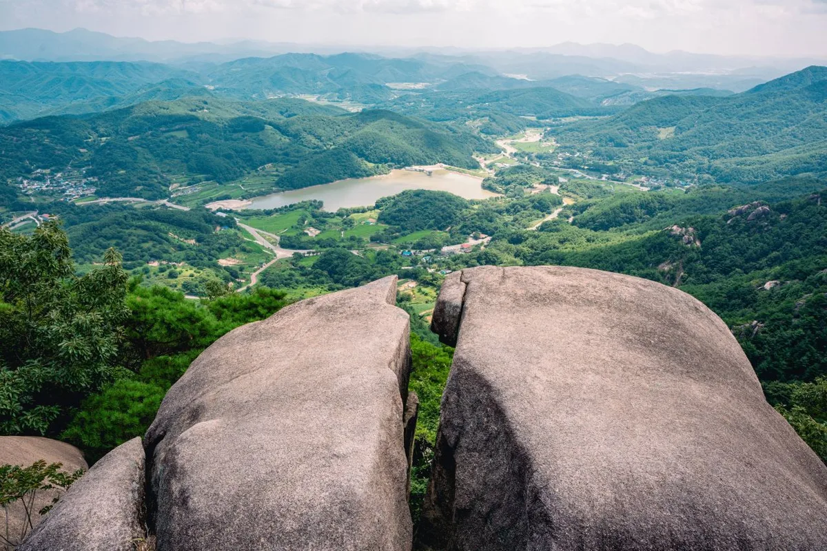
Mulhaksan has that dual character you find on a lot of Korean mountains — gentle, soil-covered ridgelines lower down that give way to sharp rock ridges higher up. Rock formations like Sipjabawi (Cross Rock) and Seomajigi become more prominent as you climb toward the summit, and a string of peaks large and small — Hakbong (鶴峰), Jungbong (482m), Sirubong, and the Bonghwasan summit — line the ridge along the way. Coming up from the Seowongok side, you start out on fairly gentle dirt trail through valleys and pine forest, but as you get closer to the ridge, rocky sections and steep climbs start trading off with each other. Near the top there are several spots where the view opens up over Masan Bay, the city, and even out toward Jinhae Bay — which is a big part of why this mountain has a reputation for keeping the views coming the whole way up.
Feel of the Climb
 Photo: Korea Tourism Organization Photo Gallery · KOGL
The lower section mostly starts off gentle — shaded forest trail with an easy grade you can practically stroll up. But past the midpoint, rocky slopes and steep pitches start piling up, and the difficulty jumps noticeably. Once you’re up on the ridge, the view opens wide, with stretches where Masan’s downtown and the sea spread out below you again and again — the kind of payoff that makes the climb feel more than worth it. In spring, azaleas and fresh green foliage color the ridgeline; in autumn, it’s the fall leaves — the seasonal character really stands out. Summer brings heavy humidity that makes the heat feel worse than it looks on paper, while winter can ice over the rocky sections near the summit, so the whole character of the hike shifts noticeably from season to season.
Major Courses (by Trailhead)
 Photo: Korea Tourism Organization photo gallery (17-1 Odongnam 2-gil, Masanhappo-gu, Changwon, Gyeongsangnam-do) · Public Nuri
| Course (trailhead → summit) | Distance | Elevation gain | Estimated time (one way) | Difficulty | Popularity |
|---|---|---|---|---|---|
| Ducheok trailhead → Muhaksan summit | 8.27km | ↕666m | ~3 hrs 11 min | ★★★★★ | ★★★★★ |
| Wongye → Sirubong | 9.48km | ↕721m | ~3 hrs 34 min | ★★★★★ | ★★☆☆☆ |
| Masan Girls’ Middle School (trailhead) → summit | 8.08km | ↕687m | ~3 hrs 10 min | ★★★★★ | ★★★★☆ |
| Seowongok entrance → Hakbong | 6.85km | ↕671m | ~2 hrs 50 min | ★★★★☆ | ★★★★★ |
| Trail entrance → mid-course observation deck | 7.1km | ↕662m | ~2 hrs 53 min | ★★★★☆ | ★★★☆☆ |
| Jungni Station entrance → summit | 9.8km | ↕671m | ~3 hrs 34 min | ★★★★★ | ★★★☆☆ |
※ Source: Korea Hiking & Trekking Support Center’s Top 100 Mountains GPX data (distance, elevation, time, difficulty) · Popularity ratings are for reference only
Course 1 — Ducheok Trailhead → Muhaksan Summit
Route: Ducheok → Ducheok trailhead → Goguryeo → Muhaksan information board → rest area/exercise park → parking lot → rest area → fork in the trail → restrooms → Muhaksan trail master map → Seomajigi rest area → Masan Harbor viewpoint → viewpoint → Muhaksan summit → viewpoint/rest area
Getting to the trailhead: The Ducheok bus stop is close to the trailhead, so you can get there by city bus. No official registered parking lot has been confirmed, so public transit is the better bet over driving.
Highlights and who it’s for: This is the classic route up Muhaksan, running pretty much straight to the summit. Along the way you’ll pass an exercise park and rest area early on, then Seomajigi, with several viewpoints — including one looking out over Masan Harbor — popping up before you reach the top. It’s a good pick if this is your first time on Muhaksan, or if a great summit view is what you’re really after.
Course 2 — Wongye → Sirubong
Route: Wongye → village lot (informal parking/open area) → unmarked trail (non-designated section) → fork → Naeseowongye Village → rest area → sports park/rest area → Sirubong → wooded rest stop → restrooms → meeting plaza rest area → rest area/sports park → viewpoint → octagonal pavilion rest area → Bonghwasan summit
Trailhead access: You can walk in from the Wongye bus stop. There’s a small village lot that doubles as parking, but it’s not big, so expect it to fill up during peak season.
Highlights & who it’s for: This is one of the longer, higher-elevation-change courses in the whole set — a ridge-traverse route that takes you over both Sirubong and the Bonghwasan summit. Part of it runs through a section marked “no trail” on the signposts, so if it’s your first time out here, definitely check the map before you go. Best suited for hikers who are confident in their stamina.
Course 3 — Masan Girls’ Middle School (trailhead) → Summit
Route: Masan Girls’ Middle School → Masan Girls’ Middle School (trailhead) → no nearby dedicated parking → rest area → restroom → fork → sports park/rest area → Bonghwa Spring → spring → no fork → Seomajigi rest area → Nulcheonsaem Spring → Nulcheonsaem rest area → Mugoktap Spring → Mugoktap Spring rest area
Getting to the trailhead: The Masan Girls’ Middle School bus stop sits right next to the trailhead, so it’s an easy trip by public transit — but as the trail markers themselves note, there’s no dedicated parking nearby.
Highlights & who it’s for: Of the six courses, this stretch has the most spring names — Bonghwa Spring, Nulcheonsaem Spring, Mugoktap Spring — and feels much more like a neighborhood walking-and-exercise course close to downtown living areas. That said, whether the springs are actually usable for drinking water depends on the season and upkeep, so it’s safer to bring your own water rather than count on them.
코스 4 — 서원곡입구 → 학봉
Waypoints: Seowongok-ipgu trail entrance → Seowongok public parking lot → restroom → fork → Hakbong entrance → octagonal pavilion rest area → viewpoint → Hakbong viewpoint → Hakbong → Gounddae → Sipjabawi (Cross Rock) → Wanwol-dong fork rest area → Jungbong → Daegoksan-Muhaksan fork rest area → no further forks
Trailhead access: There’s a Seowongok-ipgu bus stop right at the entrance, and this is the only one of the six courses where a public parking lot (Seowongok Public Parking Lot) actually shows up on the trail signs — so getting here by car is noticeably easier than on the other routes.
Highlights & who it’s for: This course strings together Muhaksan’s signature rock formations — Gounddae, Sipjabawi, and more — one after another, with viewpoints packed in close together, including the standout Hakbong viewpoint. It also runs shorter in both distance and time than the other five courses, making it a great pick if you want to hit Muhaksan’s best scenery in a single day without committing to a longer hike.
Course 5 — Trailhead → Mid-Point Overlook
Route: Fork → Rest area → Baekunsa Parking Lot → Restroom in front of Baekunsa → Baekunsa Temple → Trailhead → Baekunsa-ipgu Octagonal Pavilion → Forest Fire Watch Post → Muhaksan Prayer Center Spring → Deungnamu Mountain Lodge Spring → Mid-Point Overlook → Angae Spring → Angae Rest Area → Daegoksan Peak → Daegoksan Viewpoint
Getting to the trailhead: Baekunsa Parking Lot is marked on the trail signage, so you can park there if you’re heading in via the temple. No dedicated bus stop info could be confirmed, so if you’re relying on public transit, you may need to walk in from a nearby stop.
Highlights & who it’s for: This route heads toward Daegoksan, passing Baekunsa Temple along the way, with a string of place names tied to the forest fire watch post and various springs. It’s better suited to hikes focused on the views around Daegoksan and the mid-point overlook rather than chasing the summit itself, and it’s also a nice pick for anyone who wants to take in the temple grounds along the way.
Course 6 — Jungni Station Entrance to Summit
Waypoints: Jungni Station → Jungni Station parking lot → Naeseo Post Office → Jungni Station entrance → fork in the trail → rest area → Majae Pass → small parking area at the Majae Pass entrance → Witgusulgol Village
Getting to the trailhead: Jungni Station is a regular stop on the Gyeongjeon railway line, so you can take the train and walk the rest of the way to the trailhead. There are two confirmed parking options nearby — the Jungni Station parking lot and a small lot at the Majae Pass entrance.
Highlights & who it suits: At 9.8km, this is one of the longer courses, and it runs along a ridge that crosses Majae Pass — better suited to experienced hikers looking to do a ridge traverse or mix up their descent route than to a simple out-and-back to the summit. What sets this course apart is that you can start hiking right from the train station.
Difficulty, Terrain & Cautions
 Photo: Korea Tourism Organization Tourism Photo Gallery (288 Haean-daero, Masanhappo-gu, Changwon-si, Gyeongsangnam-do) · Korea Open Government License
According to the local trail data, the top difficulty rating is listed as “easy” — but that’s based on the aggregated totals by administrative district (see table below), not on any single route. In practice, the individual courses leading up to the summit mostly clock in at ★★★★☆ or higher, so the trail feels noticeably tougher than the official rating suggests. There’s no separate surface-condition data on record, but going by place names that keep showing up on the trail markers — Seomajigi, Sipjabawi (Cross Rock), Gowoondae — the ridgeline near the summit looks like it mixes rocky/rock-ridge stretches in with the dirt path. Watch your footing in the rain or during leaf-fall season.
As for facility POIs, the official trailhead point data shows zero scenic viewpoints, water fountains, shelters, or hazard zones on record — meaning there are no separately designated or maintained shelters or hazard-area markers. That said, the actual course marker data does turn up a number of named viewpoints — Masan Harbor viewpoint, Hakbong viewpoint, Daegoksan viewpoint — plus quite a few named spring/well spots: Bonghwa Yaksuteo, Nulcheon Spring, Mugoktap Spring, Angae Spring, Muhaksan Prayer Center Spring, and Deungnamu Mountain Lodge Spring. These are just names hikers have come to use among themselves, though — they’re not officially registered or managed facilities, so you should definitely bring your own water. Restrooms do show up on the trail markers for the Ducheok, Wongye, Masan Girls’ Middle School, Seowongok, and Baegunsa courses, so they’re available near several of the trailheads.
| Section | Distance | Difficulty | Terrain |
|---|---|---|---|
| (unnamed section) | 38.82km | Easy | - |
| Jisan-dong section | 7.01km | Easy | - |
| Hwanggeum-dong section | 5.04km | Easy | - |
| Icheon-dong section | 3.8km | Easy | - |
| Manchon-dong section | 3.72km | Easy | - |
| Yeonho-dong section | 3.69km | Easy | - |
| Samdeok-dong section | 3.64km | Easy | - |
| Beommul-dong section | 2.25km | Easy | - |
※ The table above reflects total trail length aggregated by administrative district, not any single named hiking course.
Distance and Time
 Photo: Korea Tourism Organization photo gallery · KOGL
The total length of hiking trails in the district comes to 69.93 km — but that’s the sum of every registered section across the Muhaksan area, not the distance of any single course. Records show a cumulative 1,248 minutes for ascending all registered sections and 861 minutes descending, which works out to an average ascending pace of about 18 minutes per km. That figure isn’t the time for any specific course, though — it’s just a reference number based on the cumulative total across the whole district, so for actually planning a hike, you’re better off going with the one-way estimates for each course in the “Main Courses” table above (roughly 2 hours 50 minutes to 3 hours 34 minutes). All six courses are one-way figures, so if you’re doing a loop or an out-and-back, plan on roughly 1.8 to 2 times the one-way time. Most of the courses can be done round-trip in a single day, so Muhaksan works perfectly well as a day hike. That said, if you’re aiming to link up the entire district network (all 69.93 km) in one go, that’s not realistic to knock out in a day — better to plan for an overnight stay or longer.
가는 길(대중교통·주차)
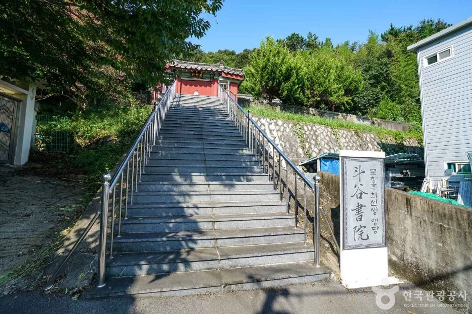 Photo: Korea Tourism Organization photo gallery (54 Ducheok-gil, Duchok-dong, Masanhoewon-gu, Changwon-si, Gyeongsangnam-do) · Public Nuri
There’s no separate metro system serving the Masan-Changwon area, so city buses are your main option for getting there. Bus stops near the trailheads include Ducheok, Naeseo Elementary School, Wongye, Lotte Mart, Masan Girls’ Middle School, Samhaksa, and Seowongok-ipgu — just pick the one closest to whichever trailhead you’re starting from. Jungni Station is a regular rail stop on the Gyeongjeon Line, so you can also get there by Mugunghwa-ho train and walk the rest of the way to the trailhead. As for parking, the trail signage lists only a handful of options — the Seowongok public parking lot, Baekunsa Temple parking lot, Jungni Station parking lot, and a small lot at the entrance to Majae Pass. Most other trailheads don’t seem to have any designated parking, so I’d recommend taking public transit if you can. For real-time directions and stop locations, KakaoMap or Naver Map will serve you better than Google Maps, since they’re much more reliable with Korean place names.
Season, Weather & Gear
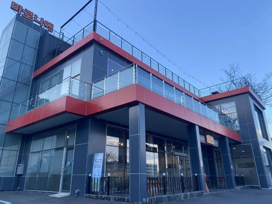 Photo: Korea Tourism Organization Photo Gallery (8 Wanwolseo 2-gil, Wanwol-dong, Masanhappo-gu, Changwon, Gyeongsangnam-do) · KOGL
The best times for hiking here are spring (April–May) and fall (September–November), when temperatures are mild and you get the bonus of seasonal scenery — azaleas in spring, autumn foliage later on. Summer is a different story: the heat and humidity really sap your energy, so it’s worth starting early and drinking more water than you think you need. If it’s been raining, I’d just skip the hike altogether — the rock sections turn slick and aren’t worth the risk. Winter brings its own hazard, with ice forming easily along the summit ridge and rocky stretches, so gaiters and crampons are pretty much non-negotiable that time of year. Whatever the season, though, some things you’ll want every time: proper hiking boots, trekking poles, a wind-and-waterproof jacket, a headlamp, a change of clothes, and plenty of water — I’d bring at least 1.5 to 2 liters per person, since there’s no drinking fountain registered anywhere on the mountain.
Tips for Foreign Travelers
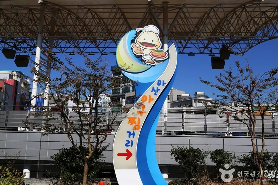 Photo: Korea Tourism Organization Photo Gallery (18 Eosijang 6-gil, Namseong-dong, Masanhappo-gu, Changwon-si, Gyeongsangnam-do) · KOGL
Muhaksan is a low mountain on the outskirts of Changwon, in Gyeongsangnam-do. In Romanized form, the peak itself is written “Muhaksan Peak,” and the main trailheads are typically rendered as Duchcheok, Wonggye, Masan Yeojung (Masan Girls’ Middle School), Seowongok-ipgu, and Jungni Station. It’s not a national park but a local community mountain, and as far as I could find, there’s no permit required and no entrance fee — you’re free to just show up and climb. Restrooms are available near the trailheads for the Duchcheok, Wonggye, Masan Yeojung, Seowongok, and Baegunsa routes, but there don’t appear to be any registered water fountains along the way, so bring your own bottled water. Google Maps tends to be unreliable for Korean hiking trails, so once you’re there, I’d recommend installing KakaoMap or Naver Map instead — they give you real-time route and public transit info. For safety, plan to finish your descent before dark, and since cell signal gets spotty along the ridgeline, it’s worth saving an offline copy of the map beforehand.
Nearby Mountains
- Busan’s Godangbong Ridge, along the Geumjeongsanseong Fortress Walls — about 46 km away as the crow flies
- Jaeyaksan in Miryang, with its Frost Valley and Sajapyeong silver grass plateau — about 54 km away as the crow flies
- Sinbulsan in Ulsan, known for its silver grass fields and rocky ridgeline views — about 57 km away as the crow flies
📍 Mount Muhak in Changwon: Overlooking Masan Bay Like a Dancing CraneLocation
Contact: bumseok.view [at] gmail [dot] com

Comments