Silver Waves of Silvergrass Ringed by Hwawangsanseong Fortress: Hwawangsan in Changnyeong
Hiking · Published 8/3/2026 ·
등산로 트랙·시설 (공공데이터: 전국등산로 공간정보) · 🚩시종점 💧음수대 👁️조망점 🏠대피소 🅿️주차장 ⚠️위험 · 지도 © OpenStreetMap ⤓ GPX 다운로드
At a Glance
| Metric | Rating |
|---|---|
| Accessibility (public transit & parking) | ★★☆☆☆ |
| Trail difficulty | ★★★☆☆ |
| Water sources on the mountain | ★☆☆☆☆ |
| Overnight stay needed? | ★★☆☆☆ (yes, if you do the full traverse) |
| Difficulty by season — spring | ★★★☆☆ |
| Difficulty by season — summer | ★★★★☆ |
| Difficulty by season — autumn | ★★☆☆☆ |
| Difficulty by season — winter | ★★★★☆ |
※ Source: Korea Forest Service trail geospatial data · accessibility and seasonal ratings are rough guides
Overview
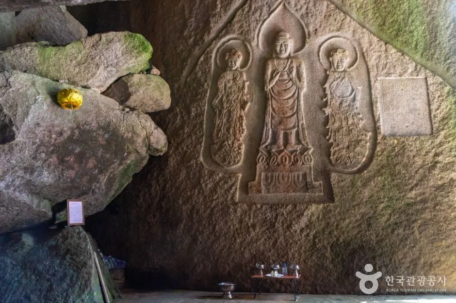
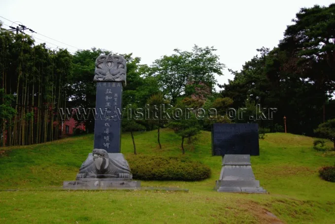 Photo: Korea Tourism Organization tourism photo gallery (Jeonnam-Gwangju Integrated Metropolitan City) · KOGL
Hwawangsan (火旺山, Hwawangsan) sits in and around Changnyeong-eup in Changnyeong-gun, Gyeongsangnam-do. Its summit is generally listed at 785m, though actual trail survey data puts the highest point near the top at 783m. What makes this mountain famous — especially as an autumn silver grass trekking destination — is the combination of the broad summit basin blanketed in silver grass fields and Hwawangsanseong Fortress (a designated Historic Site). Several trailheads offer routes of roughly 6 to 11km to the summit, and the difficulty is classified as “moderate” in the data, so beginners and intermediate hikers can knock it out in a day. That said, the climb up to the summit silver grass fields is a steady, unrelenting uphill, and it takes more out of your legs than you might expect.
The Lie of the Land
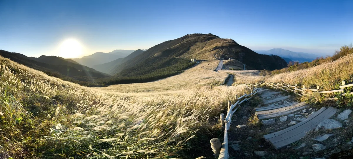
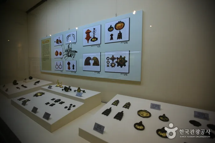 Photo: Korea Tourism Organization photo gallery · KOGL
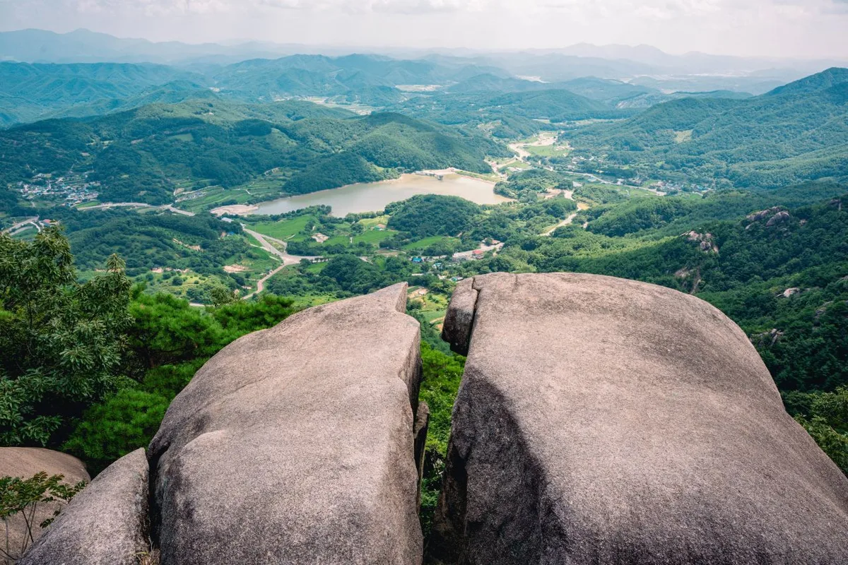
Hwawangsan has an unusual bit of geography going for it: the summit opens out into a broad plain of silver grass, and that plain sits inside the walls of the old Hwawangsan Fortress. Around the top, rocky ridges surface here and there — features that go by names like Byeongbung Rock (the “Folding Screen”), the Big Stone Face, and Dolphin Rock, along with assorted craggy outcrops — so the mountain has the character of both an earth mountain and a rock mountain at once. The main peaks run along a connecting ridge: the Hwawangsan summit (785m) at the center, plus Hwawang Jimaek (745m), the Baebong summit, and the neighboring Gwallyongsan summit. Head toward Gwallyongsan and you’ll also take in the celebrated temple Gwallyongsa (觀龍寺) and the strange rock formations near Yongseondae. Lower down, the slopes are dotted with Silla- and Gaya-era sites — the Gyo-dong and Songhyeon-dong tomb clusters in Changnyeong, Mokmasanseong Fortress, and more — spread widely enough that long stretches of the hiking trail double as a walk through history.
What the Hike Feels Like
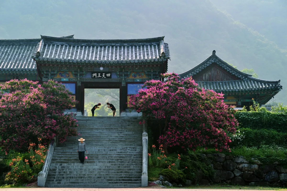
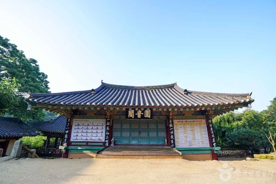 Photo: Korea Tourism Organization photo gallery (171 Hwawangsan Gwallyongsa-gil, Changnyeong-eup, Changnyeong-gun, Gyeongsangnam-do) · KOGL
The trailhead starts out gently — a pine forest path winding past temples like Changhwasa and Doseongam. From the midpoint up, though, granite ridgeline alternates with viewpoints, and that’s where your legs start to notice. As you near the summit the trees fall away and Hwawangsanseong Fortress and the vast silver grass field open up all at once. It’s exposed terrain that takes the wind head-on, which makes the seasons feel unusually vivid here. In spring, azalea colonies flush the ridge red; in autumn, waves of silver grass shimmer against the old fortress walls to create what’s arguably the signature fall scene in Changnyeong. Summer is the harder sell — the ridge sections offer almost no shade, so you’re out under the sun for a long stretch. And in winter, wind whips across both the grass field and the rocky ridge, dropping the wind chill considerably.
Main Routes (by Trailhead)
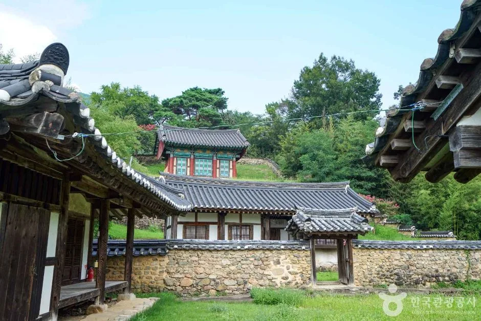 Photo: Korea Tourism Organization photo gallery (115 Wolmisangwol-gil, Goam-myeon, Changnyeong-gun, Gyeongsangnam-do) · KOGL
| Route (trailhead → summit) | Distance | Net elevation gain | Est. time (one way) | Difficulty | Popularity |
|---|---|---|---|---|---|
| Gyodong Tumuli (trailhead) → summit | 6.75km | ↕651m | approx. 2 hr 46 min | ★★★★☆ | ★★★★☆ |
| Sangwol Village Hall → Hwawangsan summit | 7.75km | ↕656m | approx. 3 hr 2 min | ★★★★★ | ★★☆☆☆ |
| (Trailhead and exit) Okcheon Ticket Office parking lot → Gwallyongsan summit | 11.07km | ↕572m | approx. 3 hr 43 min | ★★★★★ | ★★★★☆ |
| Jahagok Ticket Office → Hwawangsan summit | 9.13km | ↕625m | approx. 3 hr 19 min | ★★★★★ | ★★★★★ |
| San-gwa Gureum Arae → Baebong summit | 3.55km | ↕615m | approx. 1 hr 55 min | ★★★☆☆ | ★★★☆☆ |
※ Source: Korea Hiking and Trekking Support Center, GPX data for the 100 Famous Mountains (distance, elevation, time, difficulty) · Popularity ratings are for reference only
Course 1 — Gyodong Tumuli (trailhead) → Summit
Route: Changhwasa Temple → Gyodong Tumuli (trailhead) → Changnyeong Museum parking lot → Changnyeong Gyodong Tumuli → Mongmasanseong Fortress → viewpoint → stone cairn → fork in the trail → Hwawangsanseong Fortress → rest area → exercise park/rest area → restrooms → Changnyeong Songhyeon-dong Tumuli
Getting to the trailhead: This trailhead sits close to downtown Changnyeong, so you can reach it on foot from the Changnyeong Intercity Bus Terminal or with a short local bus ride. The Changnyeong Museum parking lot is available too, which makes it easier to get to by car than most of the other trailheads.
What it’s like / who it suits: Right from the start, the trail overlaps with the historical walking route past the Gyodong and Songhyeon-dong tumuli, so it’s a great fit if you want to combine a hike with a bit of history. You’ll pass the old fortress ruins at Mongmasanseong, and the viewpoint gives you a look down over the town of Changnyeong. Between that and the easy access, it’s a solid pick for an out-and-back day trip.
Course 2 — Sangwol Village Hall → Hwawangsan summit
Route: Sangwol Village Hall → rest area → Bangok Historic House → small parking area → trail junction → Hwawangsan Story Trail information board → pine forest → Hwawangsan → viewpoint → Hwawangsan summit → Hwawangsanseong Fortress and silver grass field → protected tree
Getting to the trailhead: There’s a bus stop near Sangwol Village, but service isn’t frequent — this is a rural village access road, after all — so driving yourself or taking a taxi is the easier option here. The small parking area doesn’t hold many cars, so be aware it can fill up on busy weekends.
Character and who it suits: This comes out as the hardest course in the data. It takes you past Bangok Historic House and through a pine forest, then climbs along the Hwawangsan Story Trail — a fairly quiet route overall. Good for anyone who wants to skip the crowded popular courses and have the mountain to themselves, though with the longest distance and biggest elevation gain of the five, you’ll want to factor in the extra effort.
Course 3 — Okcheon Ticket Office Parking Lot (start and finish) → Gwallyongsan Summit
Route: Parking lot restroom → Rest area, exercise equipment → Okcheon Ticket Office parking lot → Changnyeong-gun Tourist Information Center → Bus stop → Okcheon Ticket Office parking lot (start and finish) → Artificial waterfall → Parking lot → Trail map → Restroom → Hwawangsan Story Trail information board → Okcheon Valley → Big Rock Face → Trail open, but closed during pine mushroom harvest season → Trail closed
Getting to the trailhead: The Changnyeong-gun Tourist Information Center and a bus stop sit right next to the trailhead, which makes this one of the easiest courses to reach by public transit. Drivers have it good too, thanks to the Okcheon Ticket Office parking lot. And since the start and finish are the same spot, planning a loop hike is straightforward.
What it’s like and who it suits: This is a valley course, passing Okcheon Valley, the artificial waterfall, and the Big Rock Face, with a cool, shaded forest path early on. It’s the longest of the five courses and runs all the way to the summit of Gwallyongsan, so it’s best suited to hikers who are confident in their fitness. Do check ahead before you go — sections can be closed off during the autumn pine mushroom harvest season.
Course 4 — Jahagok Ticket Office → Hwawangsan Summit
Route: Jahagok Ticket Office → sports park and rest area → restrooms → Changnyeong-gun Tourist Information Center → parking lot → Hwawangsan trail map → Sangwa Gureumarae → trail junction → Doseongam Hermitage → rest area → viewpoint → Hwawangsan Summit → Baebong Summit → Byeongpungbawi (Folding Screen Rock) → Hwawang Ridge
Getting to the trailhead: This is the most prominent trailhead of the lot, with both the Changnyeong-gun Tourist Information Center and a parking lot right there. Signage is thorough — there’s a Hwawangsan trail map and plenty of markers — so even first-timers won’t have trouble finding their way. It’s an easy trip from downtown Changnyeong, and by all accounts it’s the most-used starting point for a Hwawangsan hike.
What it’s like and who it suits: The trail passes Doseongam Hermitage and, past the summit, keeps going to Baebong Summit, Byeongpungbawi, and the Hwawang Ridge — so it works whether you just want an out-and-back to the top or a full ridge traverse. With the signage as good as it is, this is the course I’d recommend without hesitation to anyone visiting Hwawangsan for the first time.
Course 5 — Sangwa Gureum Arae → Baebong Summit
Route: Sangwa Gureum Arae → Jiung Sanjang → viewpoint → junction → Baebong Summit → no junction → strange rock formations → Dolgorae Bawi (Dolphin Rock) → rest area → restrooms → sports park/rest area → spring
Getting to the trailhead: It’s a short access road that passes a private spot called Jiung Sanjang, so rather than public transit, most people either walk in from the Jahagok side or drive.
What it’s like / who it suits: This is the shortest of the five courses in both distance and time, which makes it a good pick when you don’t have much of a day to spare and just want to get up to Baebong and back. The focus here is the rock scenery — the odd, jagged formations and Dolphin Rock — so it suits anyone after a short, punchy hike.
Difficulty, Trail Surface, and Cautions
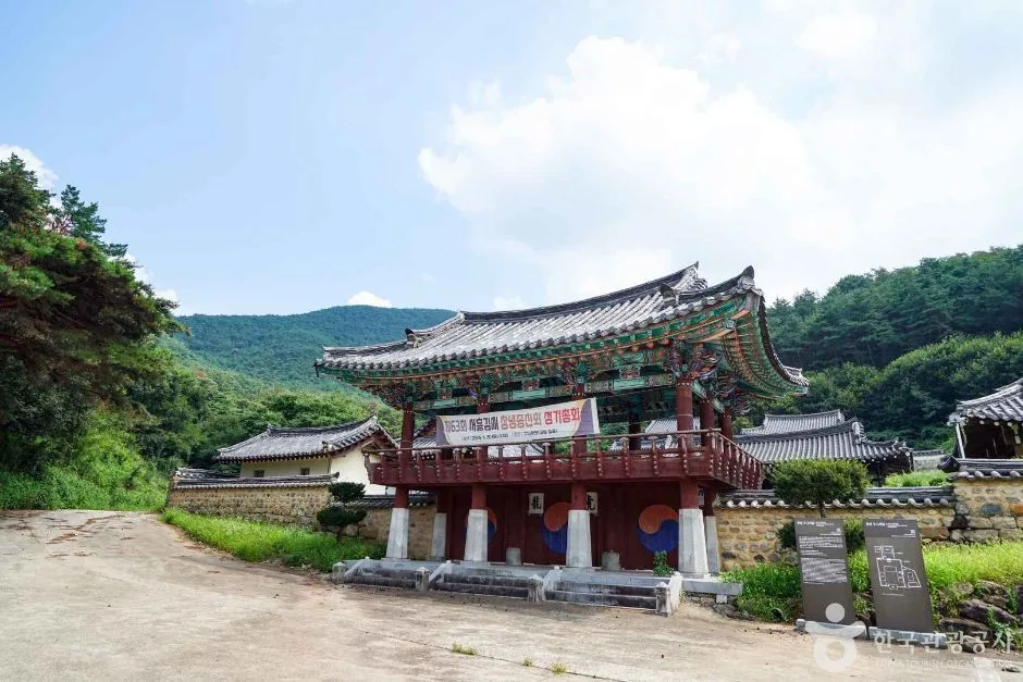 Photo: Korea Tourism Organization photo gallery (506-30 Changmil-ro, Goam-myeon, Changnyeong-gun, Gyeongsangnam-do) · KOGL
| Section (by administrative district) | Total length | Difficulty | Surface |
|---|---|---|---|
| (unnamed section) | 16.94km | Easy | - |
| Okcheon-ri section | 13.34km | Easy/Moderate | - |
| Gyo-ri section | 2.39km | Easy | - |
| Malheul-ri section | 1.67km | Easy | - |
| Songhyeon-ri section | 1.48km | Easy | - |
※ The table above breaks down the total length of Hwawangsan’s trails within Changnyeong-gun (35.82km) by administrative district, not by individual named hiking courses.
Surface materials aren’t tallied separately by section, but the course signpost data keeps turning up names like Byeongbung Rock (Folding Screen Rock), the Big Stone Face, assorted craggy formations, and Dolgorae Rock (Dolphin Rock) — a good sign that the summit area and the ridgeline include stretches of exposed rock. Six viewpoints are logged along the course, so the views open up at several places as you walk the ridge, and zero spots are registered as hazard areas. That said, after rain or during winter freezes you’ll want to watch your footing on the rocky sections, and part of the Okcheon ticket-booth course is closed during the pine mushroom harvest season — so if you’re visiting in autumn, check ahead without fail.
Distance and Time Required
Adding up every trail section in the district gives 664 minutes uphill and 463 minutes downhill. Divide that by the total distance of 35.82km and you get an average ascent pace of roughly 19 minutes per kilometer — a useful reference figure for estimating one-way times on individual courses (keep in mind this is a cumulative total, not the time for any one course). Actual measured one-way times range from about 1 hour 55 minutes on the short end (the Baebong summit course) to about 3 hours 43 minutes on the long end (the Gwallyongsan summit course). Most courses come in somewhere around 4 to 7 hours round trip, so they work fine as day hikes. But if you’re planning a full traverse linking several peaks together, bear in mind that the total length within the district reaches 35.82km and there don’t appear to be any shelters along the way — so give yourself room and plan for at least one overnight.
Getting There (Public Transit & Parking)
 Photo: Korea Tourism Organization photo gallery (170 Hwawangsan-ro, Changnyeong-gun, Gyeongsangnam-do) · KOGL
Near the Hwawangsan trailheads you’ll find bus stops including Dowon Apartments, Solteo Line Apartments, Songhyeon Intersection, Sangwol Village, Okcheon, Changnyeong Girls’ Middle & High School, and Changnyeong Girls’ Middle School — the usual approach is to transfer to a local bus at the Changnyeong Intercity Bus Terminal. Changnyeong has no KTX or metro station, so the route I’d recommend is taking an intercity bus from a nearby city like Busan, Daegu, or Masan to Changnyeong Terminal, then a bus or taxi to the trailhead. Official records don’t show many parking lots near the trails, but the signpost data for the Jahagok Ticket Office and Okcheon Ticket Office courses includes parking space alongside a tourist information center, so these two trailheads are relatively easy to reach by car. For exact bus timetables, service intervals, and real-time walking or driving routes, I’d suggest checking KakaoMap or Naver Map.
Season, Weather, and Gear
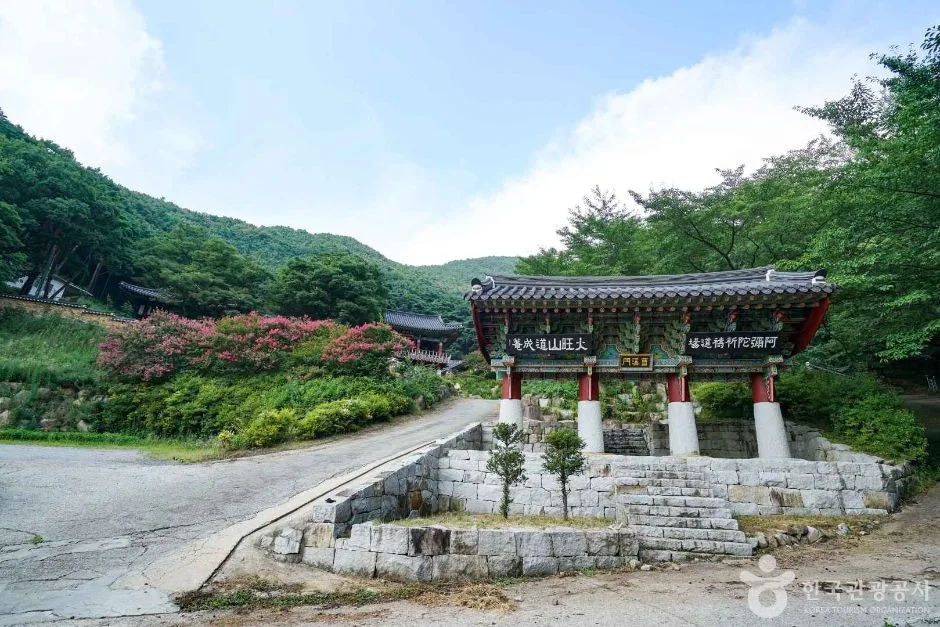 Photo: Korea Tourism Organization photo gallery (147 Jahagok-gil, Changnyeong-eup, Changnyeong-gun, Gyeongsangnam-do) · KOGL
Hwawangsan is famous for azaleas in spring and silver grass in autumn, so those two seasons draw the biggest crowds. It’s especially well known for the silver grass burning event around the first full moon of the lunar year — which means trail closures and whether the event is actually happening can vary depending on when you go, so check before heading out. In summer, the silver grass plateau at the top and the ridgeline offer almost no shade, leaving you fully exposed to the sun, and there aren’t really any water fountains to speak of, so bring plenty to drink. In winter, strong wind and ice on the rocky ridge sections and the summit grassland stack up to make the hike feel considerably harder than it looks, so crampons and windproof gear are a must. For basics, pack hiking boots, a change of clothes, an insulated or windproof jacket (late autumn through winter), plenty of water, sun protection (summer), and crampons and gaiters (winter).
Tips for International Visitors
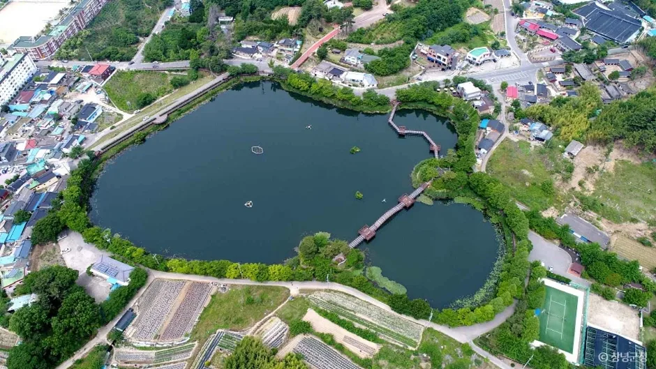 Photo: Korea Tourism Organization photo gallery (159 Gyo-ri, Changnyeong-eup, Changnyeong-gun, Gyeongsangnam-do) · KOGL
In Roman letters, the mountain is written Hwawangsan (Mt. Hwawang), and the main trailheads are Jahagok Ticket Office and Okcheon Ticket Office. Neighboring Gwallyongsan and Gwallyongsa Temple can be labeled that way too. A few spots are still called “ticket offices,” but whether anyone’s actually collecting an entrance fee — and how much — varies by season, so check before you go. No separate hiking permit is normally required. Restrooms show up at several trailheads, including Jahagok, the Okcheon parking lot, and near the Gyodong Ancient Tombs, but I found almost no drinking-water points on the trails themselves, so bring your own water without fail. For navigation, Google Maps often gives inaccurate walking and public-transit directions inside Korea, so I’d recommend using KakaoMap or Naver Map instead. On the safety side, there are no officially registered hazard zones here, but watch your footing on the rocky ridge sections, note that parts of the mountain close in autumn during pine mushroom harvesting season, and give yourself plenty of margin on the descent so you’re down before sunset.
Other Mountains Nearby
- Granite boulder fields and azalea colonies: Biseulsan in Daegu — about 18 km as the crow flies
- Overlooking Masan Bay like a dancing crane: Muhaksan in Changwon — about 36 km as the crow flies
- Ridge upon ridge in the Yeongnam Alps: Unmunsan in Cheongdo and Miryang — about 37 km as the crow flies
📍 Silver Waves of Silvergrass Ringed by Hwawangsanseong Fortress: Hwawangsan in ChangnyeongLocation
Contact: bumseok.view [at] gmail [dot] com
Comments