Twin Peaks Ridge and Stunning Fall Foliage on Myeongjisan
Hiking · Published 8/4/2026 ·
등산로 트랙·시설 (공공데이터: 전국등산로 공간정보) · 🚩시종점 💧음수대 👁️조망점 🏠대피소 🅿️주차장 ⚠️위험 · 지도 © OpenStreetMap ⤓ GPX 다운로드
At a Glance
| Metric | Rating |
|---|---|
| Accessibility (transit/parking) | ★★☆☆☆ |
| Trail difficulty | ★★★☆☆ |
| Water/springs on the mountain | ★☆☆☆☆ |
| Overnight stay needed | ★☆☆☆☆ (a day trip is plenty) |
| Seasonal difficulty — Spring | ★★★☆☆ |
| Seasonal difficulty — Summer | ★★★☆☆ |
| Seasonal difficulty — Fall | ★★★☆☆ |
| Seasonal difficulty — Winter | ★★★★☆ |
※ Source: Korea Forest Service trail spatial data · accessibility and seasonal ratings are for reference only
Overview
 Photo: Korea Tourism Organization Photo Gallery (Gapyeong County, Gyeonggi Province) · KOGL Type 1
Myeongjisan (明智山) sits in the Bukmyeon area of Gapyeong County, Gyeonggi Province, with a summit elevation of around 1,280m — one of the taller peaks in the province. It’s got a mix of soil trails and rocky ridgelines, and the main routes to the top run 8–12km one way with a cumulative elevation gain of over 900m, so it’ll take a real toll on your legs. The official trail-data difficulty rating is “medium,” but the measured stats on the standard routes up to the summit area put it solidly in the top difficulty bracket (★★★★★) — this is more of a mountain for people with some hiking mileage under their belt than a first-timer’s pick. That said, even with the longer distance, it’s still very doable as a day hike from start to finish.
Terrain and Landscape
 Photo: Korea Tourism Organization Photo Gallery (Gapyeong County, Gyeonggi-do) · KOGL
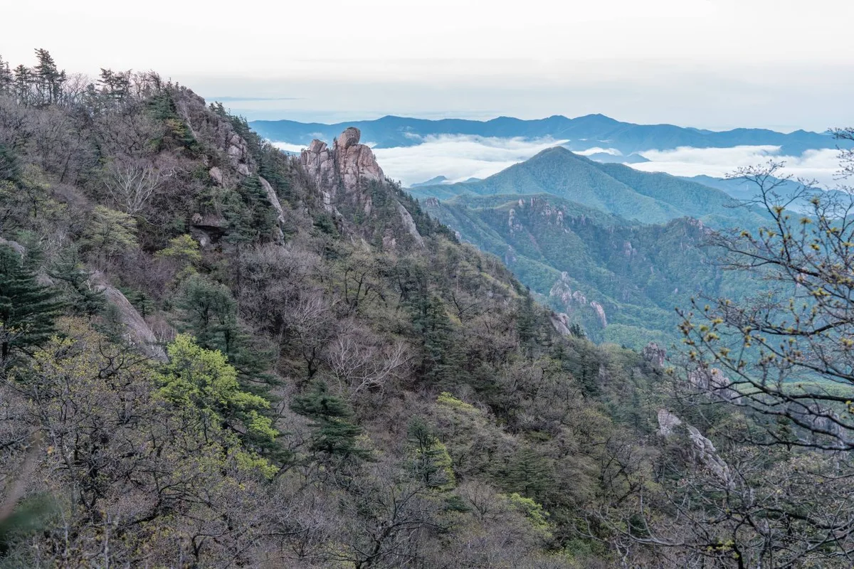
Myeongjisan is, at its core, a classic “soil mountain” with gentle ridgelines, though rocky sections crop up around the summit area and various peaks along the way. The summit itself is actually split into two: Myeongji Peak 1 (listed as 1,228m or sometimes 1,247m on the summit marker) and Myeongji Peak 2 (1,231m, with the nearby Peak 1250 marked separately at 1,226m) — so you’ll see slightly different elevation figures depending on the source. This discrepancy likely comes from the gap between where the summit marker and triangulation point sit versus the actual highest point measured by GPX (around 1,281m). The most accurate way to think of Myeongjisan is not as a single summit but as twin peaks, Myeongji 1 and Myeongji 2, rising side by side. Myeongjisan isn’t a standalone mountain either — it sits at the center of a ridge system that runs west to Yeoninsan (summit 1,110m), Gangssibong (820m), and Bareungolbong (814m), and south to Songaksan (Songhwabong, 724m). This is why it’s often mentioned together as the “Myeongjisan–Yeoninsan traverse,” one of the region’s signature ridge hikes. The valley section along Myeongji Valley (Myeongjicheon stream) has well-developed waterfalls and pools, making it a popular summer spot for wading and cooling off, while higher up the ridge you’ll pass through Korean white pine groves, oak forests, and finally scrub and grassy patches near the summit.
The Feel of the Hike
 Photo: Korea Tourism Organization Photo Gallery (Gapyeong-gun, Gyeonggi-do) · Korea Open Government License
From trailhead to summit, the hike moves through three distinct stretches, each with its own character. The early section follows Myeongji Valley on a gentle forest path, where the sound of the stream mingles with dense stands of Korean white pine and oak — plenty of shade, and honestly one of the easier stretches of walking you’ll find. Past the midpoint, though, the climb turns noticeably steeper, alternating between rocky dirt trail and stretches of bare rock, and this is where you really start to feel it in your legs. Once you’re near the top, the view opens right up — the ridgelines toward Myeongjisan and Yeoninsan unfold like a panorama, and the autumn foliage here is well known enough that the area near Myeongji’s second peak regularly shows up as a favorite spot for fall color photos. Altogether it’s a hike of sharp contrasts — an easy valley stroll up front giving way to a steep ridge scramble at the end — so it pays to pace yourself and save some energy for the second half.
Main Trails (by Trailhead)
 Photo: Korea Tourism Organization Photo Gallery (Gapyeong-gun, Gyeonggi-do) · KOGL
| Trail (trailhead → summit) | Distance | Elevation Gain | Est. Time (one-way) | Difficulty | Popularity |
|---|---|---|---|---|---|
| Fork → Myeongji Peak 1, viewed from Myeongji Peak 2 | 8.43km | ↕1062m | ~3 hr 53 min | ★★★★★ | ★★★☆☆ |
| Baekdun-ri terminal bus stop → Myeongji Peak 3 | 8.97km | ↕931m | ~3 hr 48 min | ★★★★★ | ★★★★☆ |
| Myeongjisan entrance → Sahyangbong Peak | 11.92km | ↕1026m | ~4 hr 41 min | ★★★★★ | ★★★★★ |
※ Source: Korea Forest Service Hiking & Trekking Support Center, “100 Famous Mountains” GPX data (distance, elevation, time, difficulty) · Popularity is a rough reference
Course 1 — Gallim-gil (Fork) → Myeongjisan Peak 1 as Seen from Peak 2
Route: Fork → Myeongjisan Seungcheonsa Temple → Myeongji Waterfall (national point number marker) → Myeongji Waterfall → valley trail to Myeongji Peak 2 → communications tower → autumn foliage near Myeongji Peak 2 → Myeongjisan Peak 1 as seen from Peak 2 → Myeongjisan summit view
Getting to the trailhead: The starting point for this course, the “fork,” is where the trail splits toward Myeongjisan Seungcheonsa Temple and Myeongji Waterfall. It’s generally reached on foot from the Myeongjisan-ipgu (trail entrance) side. Since there doesn’t seem to be a specific bus stop name tied to this exact spot, the usual approach is to take a bus from downtown Gapyeong to a stop in the Myeongjisan area, then continue on foot from there.
Highlights & who it’s for: The valley stretch past Myeongjisan Seungcheonsa Temple and Myeongji Waterfall is the scenic draw early on, and the real climbing kicks in once you pass the communications tower and start up the ridge. The heart of this course is the view from Myeongji Peak 2 looking across at Myeongji Peak 1 (the summit) — and the autumn foliage here is said to be especially beautiful, making this a great pick if you want to take in a temple, a waterfall, and fall colors all in one hike. That said, it’s fairly demanding on the legs, with a steep climb continuing past the communications tower.
Course 2 — Baekdun-ri Bus Terminal → Myeongji Peak 3
Route: Baekdun-ri Bus Terminal → exit at Baekdun-ri Bus Terminal → fork in the trail → ecological protection sign → Myeongjicheon Stream → creek → automatic rain gauge → Myeongji Peak 3 → wildflowers → Myeongji Peak 2 → Myeongjicheon Falls → Camping Villa → restroom at Baekdun-ri Bus Terminal
Getting to the trailhead: As the name suggests, you can start hiking right from the Baekdun-ri bus terminal, which makes this the least transit-dependent of the three courses. There’s a restroom near the stop (the one at Baekdun-ri Bus Terminal), so you can use it before or after your hike.
Highlights and who it’s for: You start right at the bus stop and follow Myeongjicheon Stream for a while, then the real climbing kicks in around the automatic rain gauge, with a ridge-style route that takes you over Myeongji Peak 3 and then Peak 2 in succession. The stream valley is supposed to be rich with wildflowers, so this is a good starting point if you want to combine some flower-spotting (spring through fall) with your hike — or if you’re planning a longer traverse toward Yeoninsan and Gangssibong.
Course 3 — Myeongjisan Entrance → Sahyangbong
Waypoints: Myeongjisan entrance → Anseongjip → public restroom → Myeongjicheon stream → tourist info map → Myeongjisan general trail guide → nature study center → rest area → red pine grove → fork in the trail → Sahyangbong → wildflowers near Sahyangbong → Jangmakbong → wildflowers near Myeongjisan → Myeongjisan wildflowers
Getting to the trailhead: This is essentially the front-door entrance to Myeongjisan, with a tourist info map and the mountain’s general trail guide posted right there, so even first-timers should have no trouble finding the way in. There’s a public restroom at the entrance too, handy for a stop before you set off.
Character & who it’s for: Of the three courses, this one’s the longest — about 11.92km one way — but the early stretch is a gentle forest path through the nature study center and the red pine grove, so you can ease into the climb gradually. Since the route runs up over Sahyangbong and Jangmakbong on the way to the summit, you cross several minor peaks along the way, which keeps things from feeling monotonous — but the overall time is long, so you’ll want an early start and enough stamina in reserve. This is the one to pick if you want the full, classic Myeongjisan experience, or if you’ve got plenty of time to spare.
난이도·노면·주의
 Photo: Korea Tourism Organization photo gallery (Gapyeong County, Gyeonggi Province) · Public Nuri
According to the Korea Forest Service’s trail spatial data, the highest officially listed difficulty for trails within Myeongjisan is “medium,” and there’s no separate surface-condition info on record. That said, the three routes that actually climb to the summit run over 900m of cumulative elevation gain and 8-12km in distance based on measured GPX tracks, which works out to a ★★★★★ (advanced) difficulty rating. The mismatch makes sense once you consider that the district-level statistics lump in the gentle lowland approach sections too, while the actual summit routes get brutally steep toward the end. As for surface conditions, the lower valley sections are generally known to be a mix of dirt and rock, with granite bedrock showing up more as you climb toward the upper ridgeline — so watch your footing, especially when it’s raining. On the facilities side, the trail spatial data shows zero designated hazard zones, zero registered viewpoints, and zero water fountains, with a total of six registered trailheads/exit points. In other words, you should basically assume there are no marked shelters, observation decks, or water facilities. In winter, ice on the rocky ridge sections raises the risk of slipping badly, so crampons are a must.
Distance and Time
 Photo: Korea Tourism Organization Photo Gallery (Gapyeong, Gyeonggi Province) · KOGL
The total registered trail length within Myeongjisan (a combined figure across multiple sections, not the distance of any single route) comes to 22.31 km. According to the data, hiking every section within the mountain cumulatively would take 598 minutes going up and 418 minutes coming down — which works out to an average uphill pace of roughly 27 minutes per kilometer. That pace isn’t the time for any one course, though — it’s an average across all the sections combined — so for actual course-by-course times, the table given earlier (about 3 hours 48 minutes to 4 hours 41 minutes, one way) is the number to go by. Doubled for a round trip, you’re looking at somewhere around 7.5 to 9+ hours, so plan on an early start and make sure you’ve got plenty of daylight to work with. Myeongjisan has no shelter, so it’s not really set up for an overnight hike — but it’s a mountain you can comfortably knock out in a single day.
Getting There (Public Transit & Parking)
 Photo: Korea Tourism Organization Photo Gallery (Gapyeong-gun, Gyeonggi-do) · Public Nuri
Near Myeongjisan, you’ll find bus stops at Baekdun-ri terminus, Yangji-maeul, Myeongjisan-ipgu, and Seonbawi. The usual route from Seoul or elsewhere in Gyeonggi is to take the Gyeongchun Line or the ITX-Cheongchun train to Gapyeong Station, then transfer at the Gapyeong bus terminal to a local county bus heading toward Myeongjisan (bound for Baekdun-ri or Jeokmok-ri). These local buses don’t run very often, so it’s worth checking the timetable before you head out. According to trail geospatial data, there are no registered public parking lots in the area, so if you’re driving, you may end up relying on roadside parking or a private lot — best to check ahead. For the most accurate, up-to-date routes and stop locations, search “Myeongjisan-ipgu” or “Baekdun-ri Bus Terminus” on KakaoMap or Naver Map.
Season, Weather & Gear
 Photo: Korea Tourism Organization photo gallery (Gapyeong-gun, Gyeonggi-do) · Korea Open Government License
Myeongjisan is best known for its autumn foliage season (roughly mid-to-late October), with the maple colors around Myeongji Peak 2 being especially worth the trip. In summer, the falls and pools along Myeongji Valley draw crowds for a dip, but there are no registered drinking-water stations along the trail itself — so if you’re hiking in summer, bring plenty of water (1.5–2 liters or more). In winter, the ridge near the summit and the rocky sections ice over easily, making crampons and gaiters essential; heavy snowfall can also add significantly to your hiking time. Across all seasons, you’ll want proper hiking boots, trekking poles, a change of clothes, and a headlamp (this is a long course, so plan for the possibility of a delayed descent) — with crampons, gaiters, and windproof gear added for winter.
Tips for Foreign Travelers
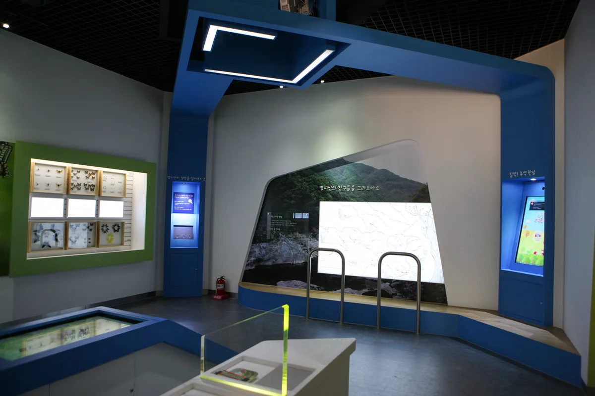 Photo: Korea Tourism Organization photo gallery (Gapyeong-gun, Gyeonggi-do) · Public Nuri License
Myeongjisan is romanized as “Myeongjisan” or “Myeongji-san,” and it helps to know the main trailhead names when communicating with locals — “Myeongjisan-ipgu” (명지산입구, the mountain’s entrance) and “Baekdun-ri Bus Terminal” (백둔리 버스종점) are the two you’ll hear most. There’s no indication of a permit requirement or entrance fee, so it seems to be freely accessible like most public mountains in Korea, but it’s still worth checking the on-site signage for any recent notices. Restrooms are available at the public facility near Myeongjisan-ipgu and at the Baekdun-ri bus terminal, but there’s nothing along the trail itself — no restrooms, no water fountains — so take care of business and fill up your water bottle before you set out. As for maps, Google Maps tends to lose accuracy in Korea’s mountainous areas, so it’s better to use KakaoMap or Naver Map to check the actual trail routes and public transit connections. Given how long the course runs and how steep the final stretch gets, it’s worth deciding on a turnaround or descent time in advance so you’re not still on the mountain after dark — and bring a phone charger/power bank and a headlamp just in case.
Nearby Mountains Worth Checking Out
- Hwaaksan in Gyeonggi’s Gapyeong, with its Gamaso Valley and Jaja Rock ridge — about 7km away as the crow flies
- Unaksan in Pocheon, Gyeonggi, with its Nunssseop Rock and Byeongpung Rock crags — about 13km away as the crow flies
- Samaksan in Chuncheon, its granite ridge sawtoothing above Uiam Lake — about 15km away as the crow flies
📍 Twin Peaks Ridge and Stunning Fall Foliage on MyeongjisanLocation
Contact: bumseok.view [at] gmail [dot] com
Comments