Baegam Mountain's Baekhak Peak Ridge Under Fall Colors, Jeonnam
Hiking · Published 8/9/2026 ·
등산로 트랙·시설 (공공데이터: 전국등산로 공간정보) · 🚩시종점 💧음수대 👁️조망점 🏠대피소 🅿️주차장 ⚠️위험 · 지도 © OpenStreetMap ⤓ GPX 다운로드
At a Glance
| Metric | Rating |
|---|---|
| Accessibility (public transit/parking) | ★★☆☆☆ |
| Trail difficulty | ★★☆☆☆ |
| Water/springs on the mountain | ★☆☆☆☆ |
| Overnight stay needed? | ★☆☆☆☆ (a day trip is plenty) |
| Seasonal difficulty — Spring | ★★☆☆☆ |
| Seasonal difficulty — Summer | ★★★☆☆ |
| Seasonal difficulty — Fall | ★★☆☆☆ |
| Seasonal difficulty — Winter | ★★★★☆ |
※ Source: Korea Forest Service trail geospatial data · accessibility and seasonal ratings are for reference only
Overview
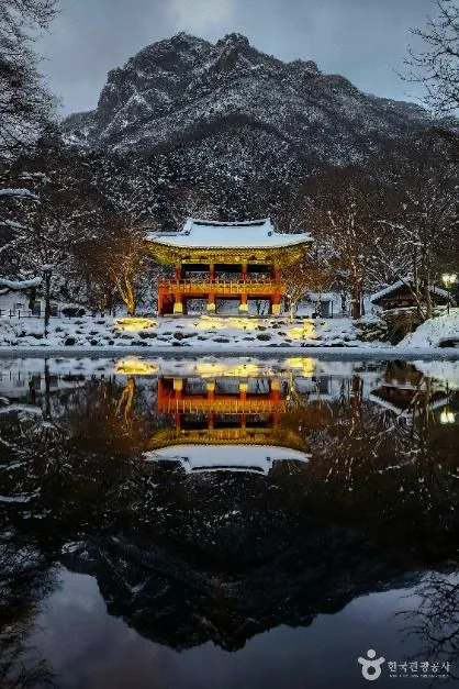 Photo: Korea Tourism Organization Photo Gallery (Baegyangsa Temple, Bukha-myeon, Jangseong-gun, Jeollanam-do) · Public Nuri
Baegamsan rises along the border between Jangseong-gun in Jeollanam-do and Sunchang-gun/Jeongeup-si in Jeollabuk-do, forming the northern section of Naejangsan National Park. Its summit, Sangwangbong, actually shows up as two different figures — 769m and 772m — in the registered trail geospatial data; for this post I’ll go with 772m. The whole mountain sits within national park territory and is home to the thousand-year-old temple Baegyangsa, which is why it’s so well known as a place where you can combine a temple visit with a hike. The trail database lists the toughest registered section as just “easy,” but the routes that actually connect to the summit area run 8–10km with 480–620m of elevation gain, so don’t underestimate the toll a round trip will take on your legs. A day hike is entirely doable — just start early.
Terrain and Ridgeline
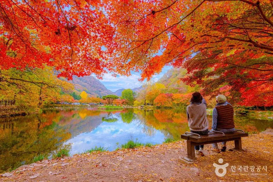 Photo: Korea Tourism Organization Tourist Photo Gallery (Bukha-myeon, Jangseong-gun, Baekyangsa Temple) · KOGL Type 1
Baekamsan shows off a mix of gentle earthen ridgelines and sharp rocky crests. From the summit, Sangwangbong (769–772m), the ridge runs south to Baekhakbong (recorded at two points, 669m and 678m) — a stretch of rocky peaks said to be named for its resemblance to a crane spreading its wings, forming a screen-like backdrop behind Baekyangsa Temple. Sajabong (748m) makes up another leg of the ridge, and further south, along the Gatbawi section, sits the distinctively shaped Gatbawi summit rock (668m), named for its resemblance to a gat (traditional Korean hat) — one of the mountain’s signature rock formations. Overall, the summit area and ridgelines are dense with rocky crests and viewpoint rocks, while the valleys and slopes are mostly earthen terrain covered in broadleaf forest.
What the Hike Feels Like
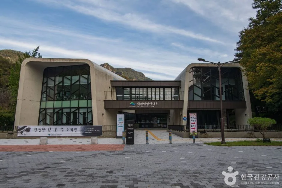 Photo: Korea Tourism Organization Photo Gallery (Bukha-myeon, Jangseong-gun, Jeollanam-do) · KOGL
Most routes here start out in the woods. Coming from the Baekyangsa side, you begin on an easy, almost stroll-like trail shaded by nutmeg trees, oaks, and other broadleaf cover, and as you climb, the trees open up to views of Baekhakbong’s rocky ridgeline. The Namchang Valley side leans more into stream-side hiking — you’ll pass Monggye Falls and spend a good stretch of the walk with the sound of water beside you — while the route from the cedar trailhead up to Gatbawi has a real edge of tension to it, with an exposed, fall-risk stretch near the end before you reach the summit lookout. Seasonally, spring brings fresh green leaves and running water, summer means deep foliage and valley exploring, and autumn foliage is what the mountain is best known for above all else. In winter, snow and ice coat the rocky ridge sections, giving the whole hike a completely different character.
Main Trails (by Trailhead)
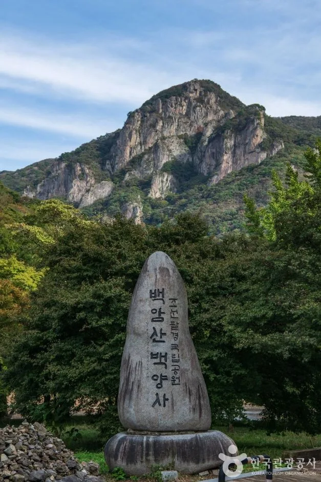 Photo: Korea Tourism Organization Photo Gallery (Bukha-myeon, Jangseong-gun, South Jeolla Province) · Korea Open Government License
| Trail (Trailhead → Summit) | Distance | Elevation Gain | Est. Time (one-way) | Difficulty | Popularity |
|---|---|---|---|---|---|
| Gain Minbak Village Entrance → Baekhakbong Peak | 10.09km | ↕617m | About 3 hr 33 min | ★★★★★ | ★★★★☆ |
| Cheongnyangwon Entrance → Summit | 8.16km | ↕504m | About 2 hr 53 min | ★★★★☆ | ★★★☆☆ |
| Samnamu → Gatbawi Peak | 8.35km | ↕481m | About 2 hr 53 min | ★★★★☆ | ★★★☆☆ |
※ Source: Korea Forest Service Hiking & Trekking Support Center’s Top 100 Mountains GPX data (distance, elevation, time, difficulty) · Popularity is for reference only
Course 1 — Gain Homestay Village Entrance → Baekhakbong
Route: Baekyang Trail Center → trail signage → Iljumun restrooms → fork → rest area → Gain Homestay Village entrance → Gain restrooms → Baekyang waterside path → museum restrooms → Baekyangsa Museum → Baekyangsa parking lot → Baekamgol nature trail → emergency rescue box → nature trail photo spot → nature trail rest area
Getting to the trailhead: The Baekyangsa approach is this mountain’s main gateway, and most hikers get here either by city bus from the Jangseong direction or by driving straight to the Baekyangsa parking lot. Since Baekyangsa itself is a well-known tourist destination in its own right, the access roads tend to be pretty clearly marked and well maintained.
Highlights & who it’s for: Starting from the Baekyang Trail Center, this course takes you through the Baekyangsa temple grounds, past the museum, and onto the nature trail. The first half is a gentle forest walk that doubles as a temple visit, but things get more serious in the back half as the trail climbs toward the Baekhakbong rock ridge. Of the three courses, this one has the longest distance and the biggest elevation gain, so it suits hikers who are confident in their stamina — or anyone who wants to take in both the scenery of Baekyangsa and the summit views in one go.
Course 2 — Cheongnyangwon Entrance → Summit
Waypoints: Namchang National Park parking lot → Sangol Pension → Swim Café & Pension → Sagyejeol Pension → Namgyeongsan Prayer House → Namchang Trail Center → Monggye Falls trailhead info → Fork in the trail → Location marker Baegam 13-13 → Trail sign → Location marker Baegam 13-12 → Falling rock caution → Monggye Falls → Hazard zone → Location marker Baegam 13-10
Approach to the trailhead: This trailhead sits on the Namchang Valley side, and hikers typically enter from the Sunchang direction, using the Namchang National Park parking lot as their starting point. With several pensions clustered nearby, this is also an area where you could easily pair the hike with an overnight stay.
Highlights and who it suits: The defining feature here is the long streamside stretch early on, passing Monggye Falls. The trail markers note falling-rock caution and hazard zones right around the falls, so extra care is needed just after rain. This is a course that’ll appeal to anyone who loves hiking alongside the sound of running water.
Course 3 — Cedar Grove → Gatbawi Peak
Waypoints: Cedar grove → Park Nature Preservation Zone → Fork in the trail → Cedar Growth Monitoring Site → Rigida pine → Simple shelter → Emergency first-aid box → Fall risk area → Gatbawi front viewpoint → Fall caution area → Gatbawi → Gatbawi peak → Gatbawi observation deck view → Turtle Rock → Wildflowers
Getting to the trailhead: This trailhead cuts through a cedar grove, and right at the entrance you’ll pass through a designated Park Nature Preservation Zone, so you’re moving through a protected stretch of nature from the very start. Access info for this route is a bit harder to come by than for the other two courses, so it’s worth checking your map app ahead of time to get your bearings.
Highlights and who it’s for: This course winds through cedar and Rigida pine forest before climbing up to Gatbawi Peak in the second half, and the tension really ramps up on that final rocky ridge — enough that the trail markers flag “fall risk” and “fall caution” twice along the way. In exchange, you get a concentrated stretch of scenery: the view in front of Gatbawi, the view from the Gatbawi observation deck, and Turtle Rock all cluster together here, making this a solid pick for hikers who love rock-face views and photo ops.
Difficulty, Terrain & Cautions
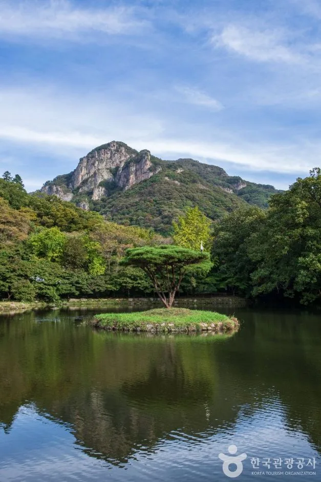 Photo: Korea Tourism Organization Photo Gallery (Bukha-myeon, Jangseong-gun, Gwangju) · KOGL
| (unnamed section) | 14.71km | Easy | - | | Waya-ri section | 4.95km | Easy | - |
※ The table above reflects trail geodata organized by administrative district (section) rather than by named hiking course — the region’s total trail length of 19.66km is tallied here as two administrative sections, not as trail names.
While the highest difficulty rating among the officially registered administrative sections shows as “Easy,” the three GPS-measured routes leading to the summit area have vertical gains of 480–620m, putting them at a ★★★★☆ to ★★★★★ difficulty — so the actual experience is considerably tougher than the official rating suggests. No separate surface-condition data is listed (-), but the waypoint names along the GPS-tracked routes flag rockfall hazard (Course 2, near Monggye Falls), danger zone (Course 2, near Monggye Falls), and fall risk / fall caution (Course 3, near Gatbawi) — meaning caution is genuinely warranted around the falls’ rockfall area and the rocky ridge near Gatbawi. Two scenic viewpoints appear along the measured route on Course 3 — the view in front of Gatbawi and the view from the Gatbawi lookout — and it’s especially wise to slow down through the rockfall section right after rain and across the rocky ridge during icy conditions.
Distance and Time Estimates
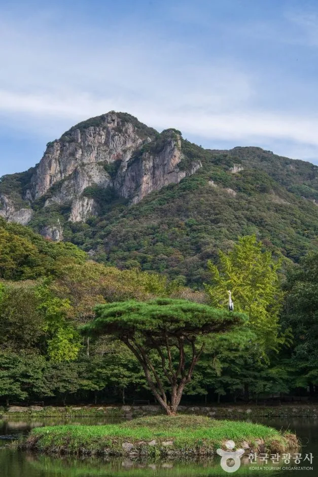 Photo: Korea Tourism Organization Photo Gallery (Bukha-myeon, Jangseong-gun, Jeollanam-do) · KOGL Type 1
The total trail length within the area is 19.66 km, but that’s the sum of all the routes combined — not the length of any single course. Likewise, the 375-minute ascent and 264-minute descent figures are cumulative totals across every trail in the area, so it’s worth not mistaking them for the time it takes to hike just one route. Dividing that distance into the ascent time gives an average pace of roughly 19 minutes per kilometer. Using that pace as a baseline, the three summit-area courses — each running 8 to 10 km one-way — work out to roughly 2 hours 53 minutes to 3 hours 33 minutes one-way. For a round trip, including rest breaks, you’re generally looking at somewhere around 6 to 8 hours. All three routes are well within day-hike range — this isn’t a mountain that calls for an overnight stay. That said, Course 1 (from the Gain Minbak Village entrance to Baekhakbong Peak), with a one-way time of over 3 hours, is best started early in the morning if you’re doing the round trip.
Getting There (Public Transit & Parking)
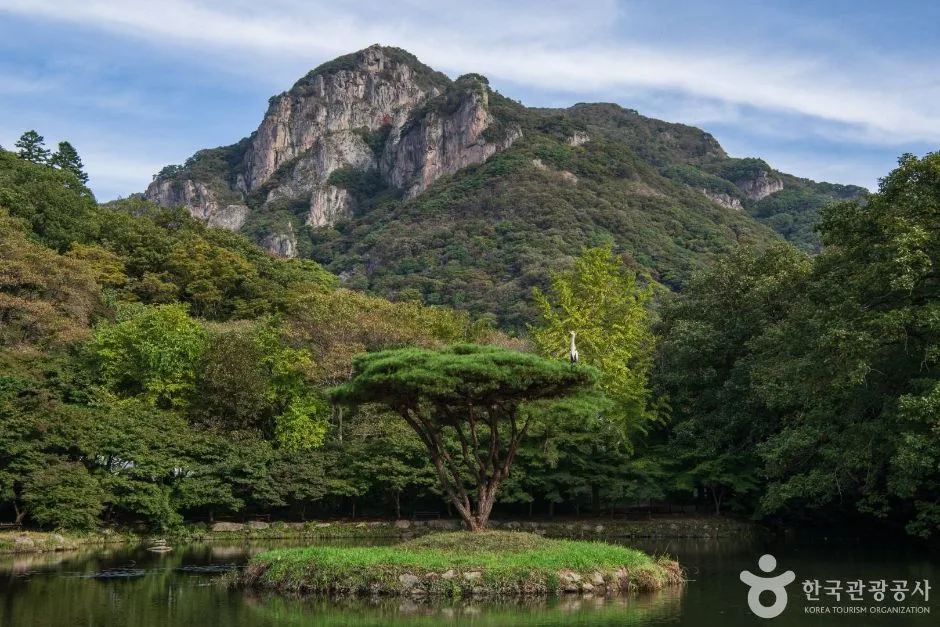 Photo: Korea Tourism Organization photo gallery (Bukha-myeon, Jangseong-gun, Gwangju/Jeonnam integrated special city area) · KOGL Type 1
For the Baekyangsa-side trailhead, the usual approach is to start from Jangseong Station — where KTX and Mugunghwa trains stop — and then catch a city bus bound for Baekyangsa from either the Jangseong Intercity Bus Terminal or Jangseong Station itself. Taking an intercity bus from Gwangju is another common option. The Namchang Valley/Monggye Falls trailhead is typically reached via the Sunchang-gun side, and the Samnamu trailhead is also accessed by passing through a nearby village. That said, the trail’s geospatial data doesn’t include any registered bus stops or parking lots for this mountain area, so before you head out, please search “Baekyangsa,” “Namchang National Park parking lot,” or “Monggye Falls” on KakaoMap or Naver Map to confirm the actual route, current transit schedules, and whether parking is available.
Season, Weather & Gear
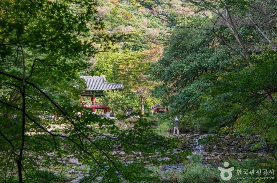 Photo: Korea Tourism Organization photo gallery (Bukha-myeon, Jangseong-gun, Jeollanam-do) · Public Nuri
Fall (roughly late October to early November) is when Baekyangsa’s foliage really shines, and that’s when crowds show up in force. Spring, around April, is worth the trip too — fresh green leaves paired with Monggye Falls running fuller from the seasonal rains. Summer brings cool valley trails, but right after heavy monsoon downpours, watch for rockfall and hazard zones near Monggye Falls. In winter, ice tends to form along the summit ridge and the rocky sections near Gatbawi Rock, which bumps up the difficulty considerably — so crampons, gaiters, and other cold-weather/anti-slip gear are a must. Across all seasons, plan on hiking boots, trekking poles, plenty of water (the trail info doesn’t show any drinking fountains along the route, so you’ll need to carry all the water you need), emergency food, and rain gear.
Tips for Foreign Travelers
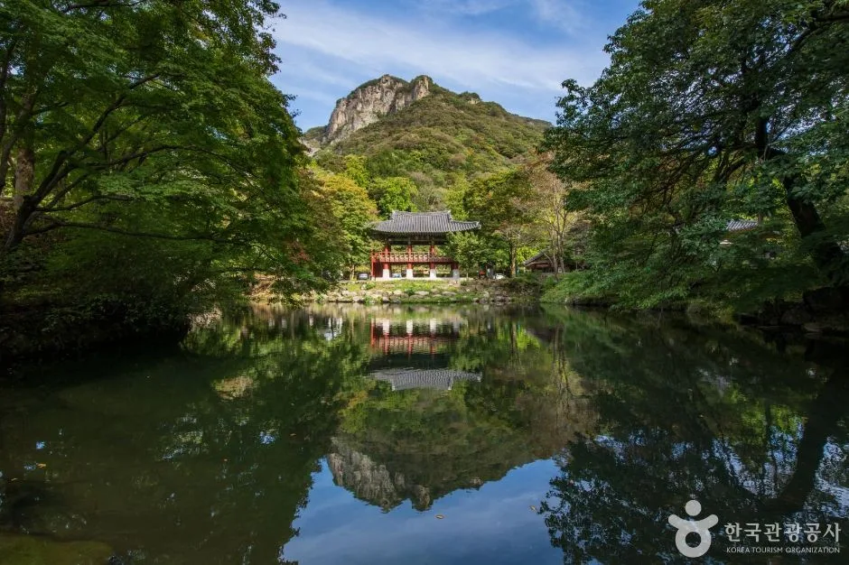 Photo: Korea Tourism Organization Photo Gallery (Bukha-myeon, Jangseong-gun, Jeollanam-do) · KOGL
Here are the romanized names of the main landmarks: Baegamsan (백암산), Sangwangbong (상왕봉), Baekhakbong (백학봉), Gatbawi (갓바위), Baekyangsa Temple (백양사), and Monggyepokpo Falls (몽계폭포). This mountain lies within Naejangsan National Park, and since South Korea abolished national park entrance fees entirely in May 2023, you generally won’t need to pay to enter — though it’s worth checking the posted signage for any details specific to visiting the Baekyangsa temple grounds. Restrooms are available near the Baekyang Visitor Center, the Iljumun Gate, Gain, and the museum, but there don’t appear to be any registered drinking water stations along the trail, so it’s smart to bring plenty of water with you. As for navigation, Google Maps tends to be unreliable for walking directions in Korea, so I’d recommend using KakaoMap or Naver Map instead. On the safety front, the actual trail data flags a rockfall-prone section near Monggyepokpo Falls and a fall-risk area near Gatbawi — so if you’re hiking right after rain or during icy conditions, slow down through those stretches, and it’s better to go with a companion than to hike them solo.
Other Nearby Mountains
- Rock pillars lined up like a folding screen, Mudeungsan (Gwangju) — about 39km direct
📍 Baegam Mountain's Baekhak Peak Ridge Under Fall Colors, JeonnamLocation
Contact: bumseok.view [at] gmail [dot] com

Comments