Running the Imjin River in Paju — DMZ Peace Trail Course 10
Running · Published 8/15/2026 ·
러닝 코스 트랙 (공공데이터: 한국관광공사 두루누비) · 지도 © OpenStreetMap ⤓ GPX 다운로드
At a Glance
| Metric | Rating |
|---|---|
| Accessibility (public transit) | ★★★☆☆ |
| Course difficulty | ★★★☆☆ |
| Surface (evenness) | ★★★★☆ |
| Seasonal running — Spring | ★★★★☆ |
| Seasonal running — Summer | ★★☆☆☆ |
| Seasonal running — Autumn | ★★★★★ |
| Seasonal running — Winter | ★★☆☆☆ |
※ Source: field-measured GPX from Durunubi, Korea Tourism Organization · seasonal ratings are approximate
Overview
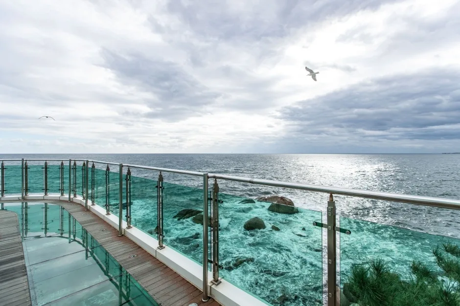
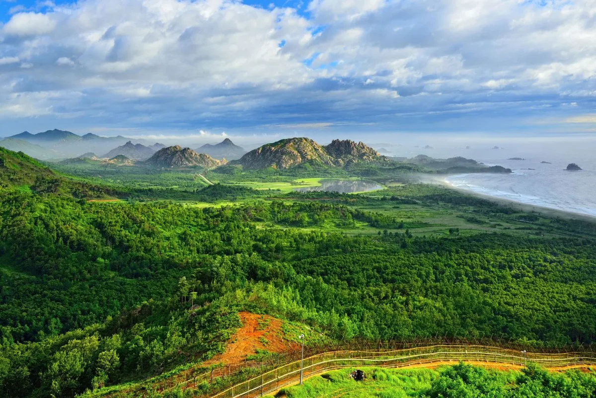 Photo: Korea Tourism Organization photo gallery (Goseong-gun, Gangwon-do) · KOGL
DMZ Peace Trail Course 10 (Romanized: DMZ Pyeonghwaui-gil 10-kose) is a border-area route you walk or run along the Imjin River area of Paju-si, Gyeonggi-do. This isn’t mountain trail running — it’s a flat, riverside running course that alternates between river, fields, village lanes, and farm roads. Elevation change amounts to gentle undulation, topping out at 82m, with just 4.5m of cumulative gain per kilometer. In other words, there’s no long climb to punish your legs, so you can hold one steady rhythm from start to finish.
The appeal here is the quiet. Unlike running an urban stream path, you barely have to dodge people and bikes, and the wide-open sightlines make it easy to focus on your pace. The tradeoff is thin coverage of amenities, so this is a route you’ll enjoy more if you prep for it like a training session rather than a day trip.
How to use it
- Weekend long run / marathon LSD training — Long stretches run uninterrupted by traffic lights and intersections, which suits low-heart-rate long slow distance work. It works well as the weekend long session for anyone training for a full or half marathon.
- Morning jog + travel running — Tack an early-morning run onto an itinerary that takes in Imjingak and Paju’s other peace-related sights, and you get the border landscape to yourself before the tour buses arrive. For runners visiting from abroad, this is the kind of route that gets remembered as “the most unusual run I did in Korea.”
- Beginner run-walk intervals — The flat surface makes a run-five-walk-one pattern easy on the body. And since you can simply turn back halfway instead of pushing on, the distance is entirely yours to set.
- A benchmark course for intervals and tempo runs — With almost no elevation change, your pace data doesn’t get skewed. Run the same stretch repeatedly and it becomes a solid baseline for tracking how your pace is developing.
Course Details
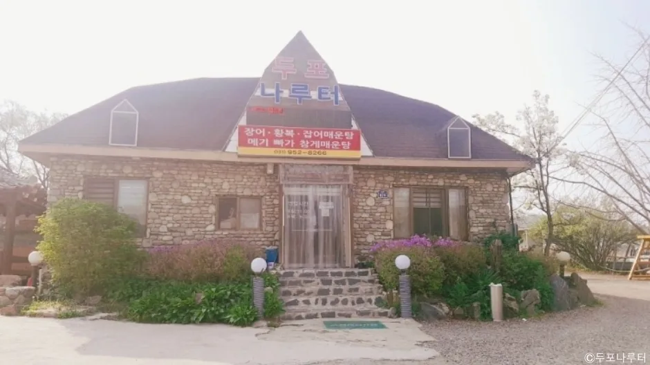 Photo: Korea Tourism Organization tourism photo gallery (829 Yulgok-ro, Paju-si, Gyeonggi-do — Dupo Ferry Landing) · KOGL
This is essentially a riverside running course that tracks the Imjin River the whole way. You start at the trailhead, pass through paved village roads and farm tracks, then follow a path that runs alongside the river until you reach the end point. The main waypoints are the river viewpoints and the village stretch, with straight runs cutting between farm fields here and there.
The surface is a mix of three things. First, asphalt and concrete paving, which you’ll meet most often through the village and farm-road sections. Second, dirt and natural surface, which can get patchy and muddy after rain. Third, decking and boardwalk-style improved sections — easy on the feet, but slick when wet. One pair of road shoes handles the whole combination just fine, though a little extra grip makes the dirt sections feel more stable.
The scenery changes dramatically with the seasons. Spring brings the river and new green shoots, autumn the golden fields and reeds, winter a frozen river and dry, bare land. There’s very little forest to block your view, so the sky opens up wide — that’s what makes this route distinctive.
Getting There (Access & Transport)
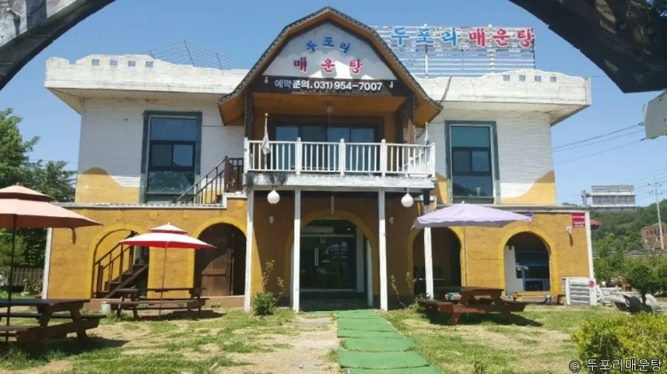 Photo: Korea Tourism Organization photo gallery (833 Yulgok-ro, Papyeong-myeon, Paju-si, Gyeonggi-do) · KOGL
By train — Coming from Seoul, the usual approach is to take the Gyeongui-Jungang Line out to northern Paju (toward Munsan), then finish the trip to the trailhead by local bus or taxi. Train frequency and last-train times shift with the season and the day of the week, so check a real-time app before you head out.
By bus — The handiest reference points near the trailhead are the Jangpa 1-ri and Maeulhoegwan (village hall) stops. Keep in mind that rural routes often run far apart. Some lines only make a handful of trips a day, so the real key to this course isn’t figuring out how to get there — it’s checking the time of the last bus home first.
By taxi — Taking a taxi from the station to the trailhead is the surest bet. Near the far end of the course, though, flagging down an empty cab can be tough, so it’s worth asking your driver on the way in how to get back, or having a ride-hailing app ready to go.
By car — If you’re driving, park with the village’s narrow lanes and farm machinery in mind. Avoid roadside spots that would block residents or get in the way of farm work — use a wide open area or a designated parking space instead. Since this is a point-to-point course, leaving your car at the start means you’ll need a plan for getting back to it from the finish (running it as an out-and-back, taxi, or bus).
Running Pace & Section Strategy
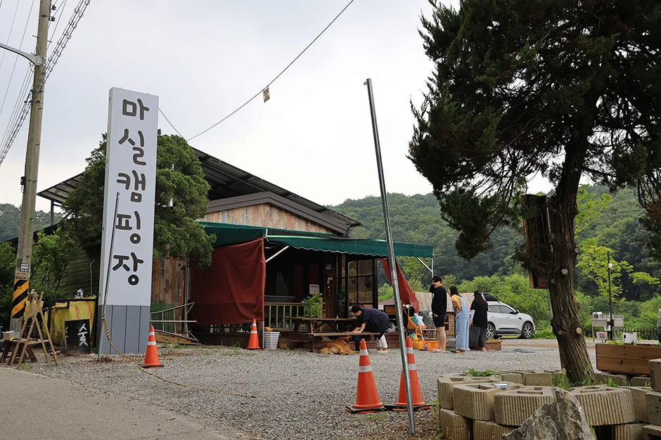 Photo: Korea Tourism Organization photo gallery (271 Guksa-ro, Jeokseong-myeon, Paju-si, Gyeonggi-do) · KOGL
There’s almost no elevation change on this course, so holding the same pace from start to finish is about as close to right as it gets. That said, the surface shifts from pavement to dirt to boardwalk, and your rhythm naturally wobbles at those transitions — so it’s worth paying attention to keeping your cadence steady every time the footing changes.
| Level | Target pace | Strategy |
|---|---|---|
| Beginner | 7:30–8:30/km, or run-walk | Repeat 5–6 min running + 1 min walking. Don’t be afraid to call it and turn back at the halfway point |
| Intermediate | 6:00–6:30/km | Hold back to a conversational pace for the first half, then ease it down bit by bit over the last 3 km — a negative split |
| Advanced | 4:40–5:20/km | Use the straightaways as tempo-run segments, easing off only through the village and crossing sections |
For section strategy, it helps to think of the course in thirds. The opening third is where you loosen up, so don’t get greedy; through the middle, lock in your pace where the views open up; and in the final third, finish according to whatever’s left in the tank. For hydration, the rule of thumb is a sip every 20–25 minutes, or every 3 km — and the real key is drinking before you feel thirsty.
The out-and-back option — this is a point-to-point course, so returning to the start makes it 19.2 km round trip. That’s close to half-marathon distance, which makes it a great LSD session. If you’re going for the full round trip, the safest approach is a proper out-and-back: leave a pack with water and snacks — or your car — at the start as a base, top up at the turnaround, and head back out. Run only half and turn around and you’ve got roughly a 9.6 km round-trip session, so you can flex the distance to match how you’re feeling that day.
Water, Supplies, and Restrooms
 Photo: Korea Tourism Organization photo gallery (270 Jangnam-ro, Jangnam-myeon, Yeoncheon-gun, Gyeonggi-do) · KOGL
Come prepared with the mindset that this isn’t a city riverside path dotted with drinking fountains and convenience stores every few hundred meters. Don’t assume any particular facility will be there when you need it — plan around self-sufficiency as your baseline.
- Water — Head out with a 500ml soft flask or water in a running belt. For a round trip or a hot day, you’ll want 1L or more, or a plan to refill at the turnaround.
- Electrolytes and snacks — If you’re planning 10km or more, it’s worth bringing at least one of the following: electrolyte tablets, a gel, or salt candy.
- Restroom before you start — Taking care of it at your starting point — the station, the bus terminal — is by far the surest strategy. Plan on the assumption that you’ll use a restroom on the course if there is one, and go without if there isn’t.
- Timing your resupply — When you’re passing through a village stretch and spot a shop or a vending machine, top off your water right there, even if you don’t need it yet. This is the kind of road where you have no idea when the next chance will come.
- A little cash — Some of the smaller shops may not take cards, so a bit of cash in your pocket makes life easier.
Safety Notes
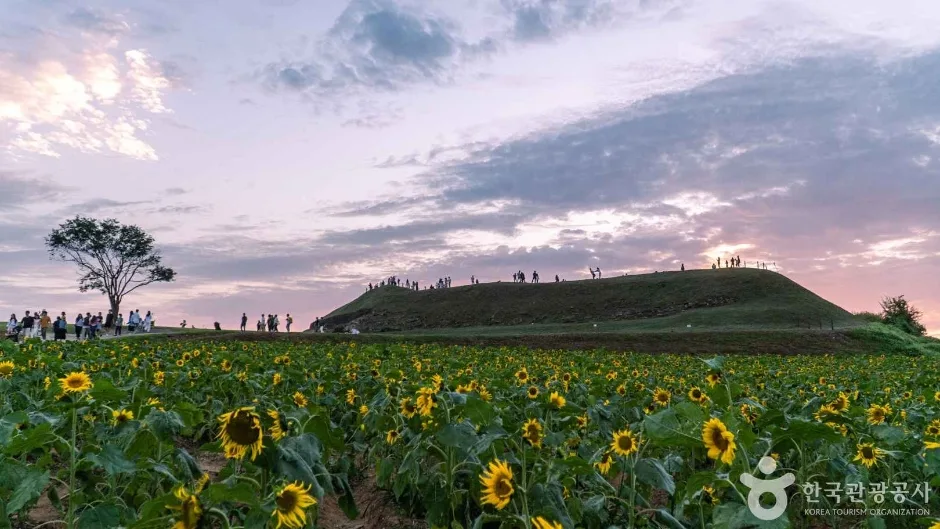 Photo: Korea Tourism Organization photo gallery (Wondang-ri, Jangnam-myeon, Yeoncheon-gun, Gyeonggi-do) · KOGL
Shared vehicle and pedestrian sections — Village roads and farm tracks are shared with cars and farm machinery. Instead of plugging both ears, use just one earbud or bone-conduction headphones so you can hear what’s coming up behind you. Where there’s no sidewalk, running against traffic is the safer choice.
Visibility at night — Some stretches have few streetlights, so I wouldn’t recommend running here after dark. If you have no other option, bring a headlamp, reflective clothing, and a rear light — no exceptions.
Wind and open ground — Along the river and out across the fields, there’s nothing to block the wind, so it hits you full on. A tailwind on the way out means a headwind on the way back, so plan your pacing accordingly. The wind chill can run well below the actual temperature.
Heat and dehydration — There’s little shade, which makes midday in summer genuinely dangerous. A headache, goosebumps, or the feeling that your sweat has suddenly stopped are all signals to stop right away.
Slippery footing — Boardwalks, wet leaves, and dirt paths after rain are all slick. Don’t rush — shorten your stride and take it easy through those sections.
Border-area etiquette — Always follow the signs and any access notices, and don’t stray from the marked route. If there’s a notice about restricted photography, respect it. Access can be restricted depending on conditions, so it’s worth checking local information before you go.
Running solo — Some sections see very little foot traffic, so keep plenty of battery on your phone and let family or a friend know your route and when you expect to finish. Korea’s emergency numbers are 119 (ambulance and rescue) and 112 (police).
Season, Weather, and What to Wear
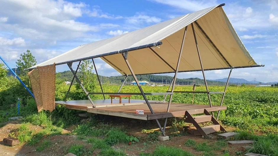 Photo: Korea Tourism Organization photo gallery (270 Jangnam-ro, Yeoncheon-gun, Gyeonggi-do) · KOGL
The best seasons are autumn (October–November) and spring (April–May). Autumn gives you clear air and a manageable breeze, which makes it ideal for long distances. Spring is when the riverside scenery really comes alive.
- Spring — Expect big swings between morning and afternoon temperatures. Layer a thin long-sleeve or a windbreaker, and check the fine dust and yellow dust forecasts before heading out.
- Summer — There’s very little shade, so the difficulty climbs fast. Run only just after sunrise or before sunset, cut your distance, and bring twice as much water as usual. Bug spray helps too.
- Autumn — Prime time. On plenty of days, a short-sleeve top and one light outer layer is all you need.
- Winter — The riverside wind and icy pavement are the real hazards. Watch for thin ice in the shaded stretches, and keep your distance short.
Clothing and Gear Checklist
| Category | What to bring |
|---|---|
| Shoes | Road running shoes (a model with decent grip helps on dirt paths) |
| Top and bottom | Sweat-wicking fabric, seasonal layering (windbreaker recommended) |
| Hydration | Soft flask or running belt, electrolytes |
| Sun | Hat or running cap, sunglasses, sunscreen |
| Safety | Charged phone, reflective gear, a little cash and a transit card |
| Tracking | GPS watch or running app (save offline maps ahead of time) |
Tips for International Runners
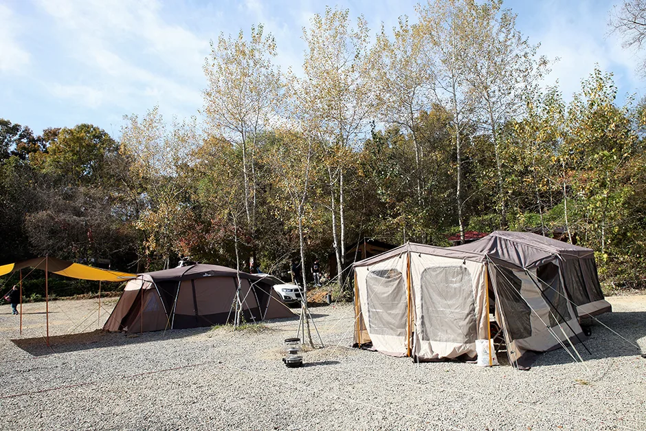 Photo: Korea Tourism Organization photo gallery (115 Jajang-ro, Jeokseong-myeon, Paju-si, Gyeonggi-do) · KOGL
① Course name in romanization
- Course name: DMZ Pyeonghwaui-gil 10-kose (DMZ 평화의 길 10코스) / English meaning: DMZ Peace Trail, Course 10
- Region: Paju-si, Gyeonggi-do
- Nearby bus stops: Jangpa 1-ri, Maeulhoegwan (“village community hall”)
When you’re explaining the trailhead to a taxi driver, don’t bother saying the destination name — pull up the spot on a map app and show them the screen. That’s the surest way.
② Map apps — don’t rely on Google Maps alone Because of legal and data restrictions in Korea, Google Maps’ walking and cycling directions are often inaccurate or simply unavailable. For checking a running route, use KakaoMap or Naver Map. Both have English interfaces, and their walking routes and bus stop info within Korea are far more accurate. Signal can drop out in places, so save an offline map before you head out, and log your GPS track separately with a running app like Strava.
③ Transit apps and transit cards
- Real-time bus and train info: Naver Map, KakaoMap, Kakao Metro
- Hailing a taxi: Kakao T (foreign-issued cards can be difficult to register for payment, so carry cash as a backup)
- Transit cards: pick up a T-money or Cashbee card at a convenience store and top it up with cash — it works on both buses and subways. On buses, you have to tap when you board and again when you get off for transfer discounts to apply.
- Rural routes can run infrequently, so screenshot the times for the last bus or train back before you start running.
④ Water and convenience stores The main convenience store chains in Korea are GS25, CU, 7-Eleven, and emart24, and they all carry bottled water, electrolyte drinks, sports drinks, bananas, and energy bars. That said, this course runs through farmland and border territory, so don’t assume there’ll be a convenience store partway along. Buy your water and snacks at the station or in town before you set off — that’s the right call. For restrooms, plan on stations, bus terminals, and convenience stores, and definitely take care of things once before you start.
⑤ One last piece of advice Given that this is a border area, it pays to respect the signage and any on-site instructions. Stay on the marked route, and follow any notices restricting photography. If you’re running alone, tell your accommodation or a companion your route and when you expect to be back. In an emergency, call 119 (emergency/rescue) or 112 (police). Running under a quiet, wide-open sky is the biggest reward this trail has to offer. Stay safe and enjoy the run.
Other running routes nearby
- Haeparang Trail Course 42 — coastal running route in Yangyang — roughly 165 km as the crow flies
📍 Running the Imjin River in Paju — DMZ Peace Trail Course 10Location
Contact: bumseok.view [at] gmail [dot] com

Comments