Golden Pine Forest Bathing Along the Ridge — Eungbongsan, Uljin
Hiking · Published 8/8/2026 ·
등산로 트랙·시설 (공공데이터: 전국등산로 공간정보) · 🚩시종점 💧음수대 👁️조망점 🏠대피소 🅿️주차장 ⚠️위험 · 지도 © OpenStreetMap ⤓ GPX 다운로드
I need the actual body text of the blog post to translate — the message only includes the title (“응봉산 등산 가이드 / Eungbongsan”) and the formatting instructions, but no Korean content to translate.
At a Glance
| Metric | Rating |
|---|---|
| Accessibility (public transit/parking) | ★★☆☆☆ |
| Trail difficulty | ★★★☆☆ |
| Water/springs on the mountain | ★☆☆☆☆ |
| Overnight stay needed | ★☆☆☆☆ (a day trip is plenty) |
| Seasonal difficulty — Spring | ★★★☆☆ |
| Seasonal difficulty — Summer | ★★★★☆ |
| Seasonal difficulty — Fall | ★★★☆☆ |
| Seasonal difficulty — Winter | ★★★★☆ |
※ Source: Korea Forest Service trail spatial data · accessibility and seasonal ratings are for reference only
Overview
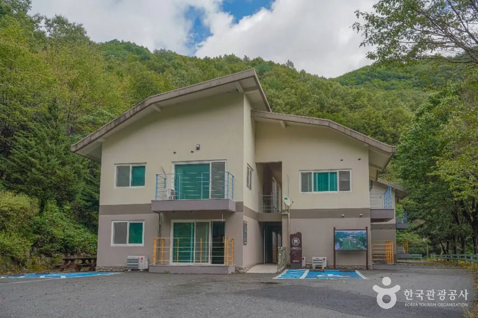
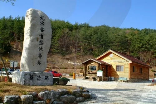 Photo: Korea Tourism Organization photo gallery (Sipiryeong-ro 2721, Guusugok Recreation Forest, Uljin County, Gyeongsangbuk-do) · KOGL
Eungbongsan sits along the mountainous border between Uljin County in Gyeongsangbuk-do and Samcheok in Gangwon-do, a mid-sized mountain with a summit elevation of around 1,000 meters. Hikes here often start near the well-known Deokgu Onsen hot springs, which has made it a popular pick for combining a soak with a hike. Rather than jagged rock peaks, the terrain here is defined by gently rolling ridgelines. It’s a long course — the round trip demands solid stamina and a good chunk of time — but it’s still very doable as a day hike. The data classifies its peak difficulty as “moderate,” so anyone with a bit of hiking experience under their belt shouldn’t have much trouble taking it on.
Mountain Shape and Terrain
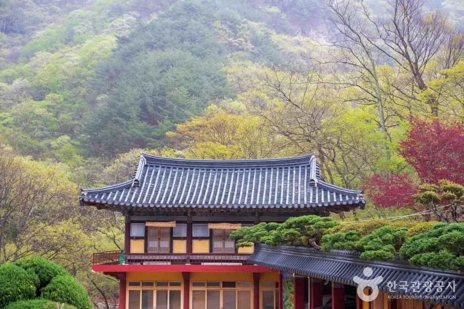
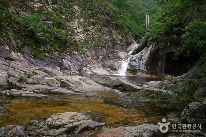 Photo: Korea Tourism Organization photo gallery (Deokgu-ri, Buk-myeon, Uljin-gun, Gyeongsangbuk-do) · KOGL Type 1
Eungbongsan is widely known as more of an “earthen mountain” — the kind with soft, rolling ridgelines and forest cover rather than jagged rock peaks. If you look at the peak POIs registered in the public data, you’ll find several different survey points recorded around the summit area: Eungbongsan (1,024m), the Eungbongsan summit (1,000m), and “Eungbongsan Summit 998.5m” (listed at 1,016m). The scattered readings suggest the summit isn’t a single sharp point so much as a gently sloping ridge where elevation gets measured slightly differently depending on where you stand. Going by actual GPX track data, the highest point comes in at 1,019m. Along the ridge as you climb, you’ll pass through stands of Geumgang pine (also known as Chunyang pine) — a good showcase of the forest character this Uljin-Samcheok area is famous for. Beyond that, patches of shrubs and wildflowers — including Rhododendron microphyllum and mountain blueberry (Vaccinium hirtum) communities — dot the ridge here and there, giving the mountain a soft, varied vegetation landscape quite different from the rockier peaks nearby.
Hiking Impressions
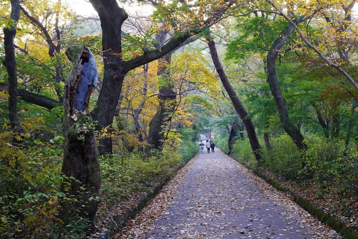
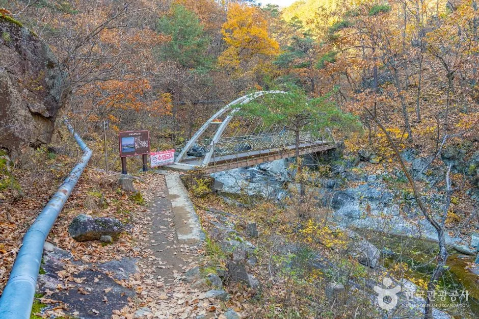 Photo: Korea Tourism Organization photo gallery (905 Deokgu-oncheon-ro, Buk-myeon, Uljin-gun, Gyeongsangbuk-do) · Korea Open Government License
From the trailhead all the way to the summit, this hike up Eungbongsan feels like a walk through dense, unbroken forest most of the way. The early stretch runs alongside a valley, and once you push past the halfway point, you climb onto a ridge thick with Geumgang red pine, the kind of stretch that leaves you feeling like you’ve just had a proper forest-bathing session, phytoncides and all. It’s not a mountain known for dramatic rock sections, so instead of the white-knuckle tension of a rocky ridge scramble, what you get is more of an endurance hike — a long, steady climb along the ridgeline. In spring, shrubs like Rhododendron micranthum and Vaccinium hirtum brighten the ridge with their blooms, and in autumn the red foliage weaving through the Geumgang pines makes the season unmistakable. The summit itself has a helipad, and it’s known as the spot where the view finally opens all the way up.
Major Course (by Trailhead)
| Course (trailhead → summit) | Distance | Elevation gain | Estimated time (one way) | Difficulty | Popularity |
|---|---|---|---|---|---|
| Old Ridge Trail Info Center → Eungbongsan Summit | 11.39km | ↕847m | About 4 hr 16 min | ★★★★★ | ★★★☆☆ |
※ Source: Korea Forest Service Trekking Support Center’s Top 100 Mountains GPX data (distance, elevation, time, difficulty) · Popularity is a reference figure only
Course 1 — Old Ridge Trail Trailhead Center → Eungbongsan Summit
Route: Old Ridge Trail trailhead center → Old Ridge Trail starting parking lot → restroom at the Old Ridge Trail starting point → Rhododendron micranthum colony → Junction 6 → Helipad 1 → Geumgang pine → Geumgang pine grove → Helipad 2 → mountain blueberry colony → Eungbongsan summit → Junction 15 → Eungbongsan summit helipad → Geumgang Pine Trail → observation deck
Getting to the trailhead: The Old Ridge Trail trailhead center is known to sit in a mountainous area near the Deokgu Hot Springs district. There’s no subway access nearby, and the closest registered bus stop in the public data is “Deokgu Hot Springs,” so it’s realistic to plan public transit access around that stop. That said, there’s no official parking lot data registered near the trailhead center itself, so if you’re driving, it’s a good idea to check the parking available at the Deokgu Hot Springs tourist area as well and give yourself extra time to get there.
Highlights and who it’s for: This is a long ridge course that, as a round trip, demands a fairly long distance and elevation gain for a single day’s hike — it suits visitors confident in their stamina or those who enjoy a long walk through the forest. Starting through a valley and wooded section at the trailhead, the route passes through Geumgang pine groves and helipads before reaching the summit, keeping things varied rather than monotonous along the way. That makes it a better fit for people who want to fully take in the forest scenery along the ridge, rather than those just looking to hit the summit and head back down. All in all, it’s a course better recommended to hikers with some long-distance experience than to beginners.
Difficulty, Trail Surface & Cautions
| Section (by administrative district) | Distance | Difficulty | Surface |
|---|---|---|---|
| (unnamed section) | 8.88km | Easy | - |
| Sin-ri section | 8.46km | Easy | - |
| Sangmaeup-ri section | 5.31km | Easy | - |
| Magyo-ri section | 1.34km | Easy | - |
| Hwangjo-ri section | 0.85km | Easy/Moderate | - |
The table above breaks down the trail sections on Eungbongsan by administrative district — it’s not a list of individual named courses, but the total length of trail running through each district within the mountain’s boundaries. There are 5 registered sections in all, and the highest difficulty rating in the data is “Moderate.” No detailed surface-material data is on record, but given the nature of ridge hiking, expect a mix of dirt trail covered in fallen leaves along with some rocky, root-tangled stretches here and there — so watch your footing in the rain or in autumn when leaf litter piles up. According to the public data, there are zero registered hazard zones, viewpoints, or dedicated trailhead/exit markers on this trail, so rather than counting on safety facilities or lookout structures that simply aren’t there, it’s safer to navigate by your own map and trail markers as you go. In winter, keep an extra eye out for ice on the shaded upper sections of the ridge.
Distance and Time Needed
Eungbongsan has zero registered shelter points, so this isn’t the kind of mountain where you knock out the entire trail network (24.84km combined across all sections) in one go — instead, hikers typically pick a single route that fits their plans and do it as a day trip. The Old Ridge Trail route runs 11.39km one way with 847m of cumulative elevation change, which works out to roughly 4 hours 16 minutes one way — so a round trip could easily run past 8 hours, meaning an early start is a good idea. One caveat on the numbers: the recorded ascent/descent times of 444 minutes up and 312 minutes down are cumulative totals across every trail section in the area, not the time for a single route — converting that gives an average ascent pace of about 18 min/km. Going by that pace, Eungbongsan isn’t steep, but the sheer distance means the fatigue adds up over the day. Since there’s no shelter here, there’s no need to plan an overnight stay — a day hike is all you need.
Getting to Eungbongsan (Public Transit & Parking)
There’s no subway connection to the Eungbongsan area, so buses and cars are really your only options. There’s a “Deokgu Hot Spring” bus stop registered in the public data nearby, so the usual approach is to take an intercity or local bus to the Deokgu Hot Spring area and then walk (or transfer to something else) the rest of the way to the trailhead information center. If you’re driving, I couldn’t find any official parking lot data specifically for the trailhead, so it’s worth checking out nearby options in advance — like the parking area at the Deokgu Hot Spring tourist zone. Bus schedules and road routes can shift depending on the season, so I’d definitely recommend double-checking real-time directions and bus times on KakaoMap or Naver Map before you head out.
Spring (April–May) brings blooming shrubs, including royal azaleas, that make the ridgeline scenery beautiful, but with big temperature swings between morning and afternoon, it’s worth packing a jacket. In summer, the dense forest canopy gives you plenty of shade, but the humidity climbs and the hike feels tougher than it looks on paper, so bring plenty of water and something for bugs. Fall (October–November) is often considered the best season for this hike, with the golden pines and autumn foliage playing off each other beautifully — just watch your footing on fallen leaves, since they get slippery. In winter, icy patches can form on the upper ridges, so crampons and gaiters aren’t optional — they’re essential cold-weather, anti-slip gear. And no matter the season, it’s always worth having hiking boots, a change of clothes, a headlamp, emergency food, and a map or map app on hand.
Tips for Foreign Visitors
Eungbongsan is romanized as “Eungbongsan,” and the main trailhead, Deokgu Onsen, is romanized as “Deokgu Onsen.” Since this isn’t a national park, there’s no data confirming whether a hiking permit or entrance fee applies — it’s worth checking with a local visitor center or the municipal tourism office beforehand to be safe. Restroom-wise, trail marker data confirms a “restroom at the old ridge trail starting point,” so you can use the facilities near the trailhead before setting off. That said, there are no water fountains registered past the midpoint of the mountain (zero, per the data), so bring plenty of water. As for map apps, Google Maps’ trail data in Korea is often unreliable, so I’d strongly recommend using KakaoMap or Naver Map instead — and it’s smart to save your current location and descent route before you start hiking. Cell service can be spotty in mountainous areas, so hiking with a companion and sharing your location in advance is a good idea.
Other Nearby Mountains
- Snow-flowers and rime-frosted juniper ridges, Taebaeksan, Gangwon — about 29km straight-line
- The thrill of Sky Bridge across twelve rock peaks, Cheongnyangsan, Bonghwa — about 44km straight-line
📍 Golden Pine Forest Bathing Along the Ridge — Eungbongsan, UljinLocation
Contact: bumseok.view [at] gmail [dot] com
Comments