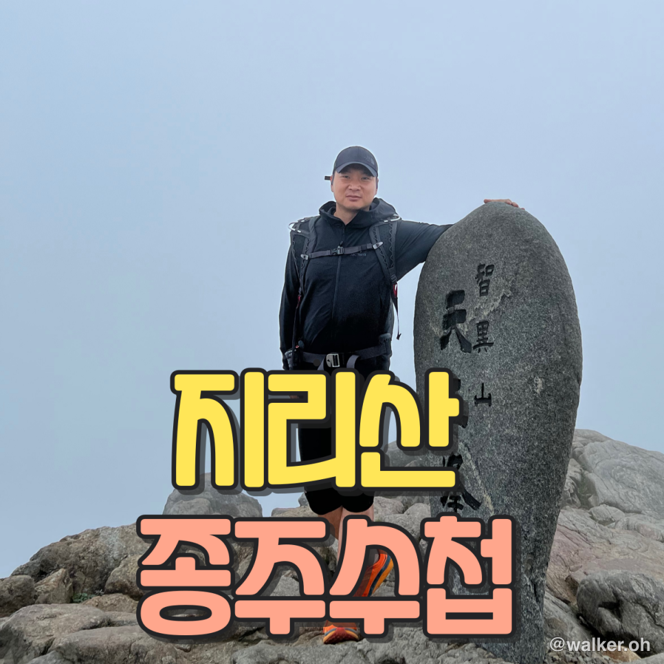
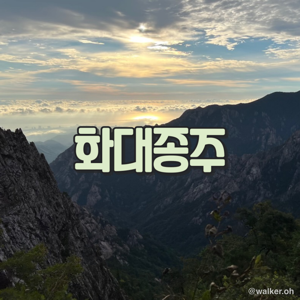
Hiking Jirisan's Hwa-Dae Traverse: A 46.2 km Section-by-Section Guide
Cycling · Published 1/15/2023 ·
Prologue
When people talk about a “traverse” (종주), they usually mean walking the length of a mountain’s or ridge’s main route. It varies by course, but a lot of them run 20 km or more, so you really have to prepare and train thoroughly before taking one on.
The Hwa-Dae Traverse
This is the traverse course on Jirisan that starts at Hwaeomsa Temple, passes over Cheonwangbong Peak, and finishes at Daewonsa Temple — a total of 46.2 km. The Hwaeomsa–Nogodan stretch, and the Jungcheong–Yupyeong–Daewonsa stretch after Cheonwangbong, are both extremely tough sections. That’s why most people opt instead for the Seong-Jung course (Seongsamjae – Jungsanri).
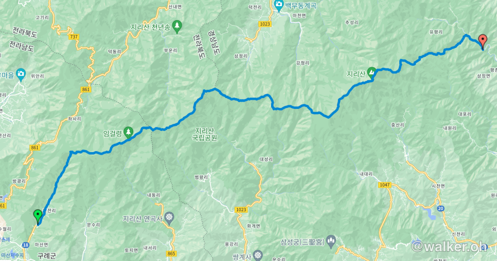
Hwaeomsa – Nogodan (5.5 km)
You set off from Hwaeomsa, cross the bridge on the Yeongiam trail, and start climbing toward Jirisan. After about 2 km of gentle uphill, the grade gradually steepens, and from there it’s a relentless, hard climb. There are a lot of nasty rocky roots underfoot, so you have to watch your step on the way up. Somewhere around 3–6 hours in, you hit the point where the trail merges with the Seongsamjae course, and just 20 more minutes brings Nogodan into view. If you’re aiming to do the Hwa-Dae traverse over two days, you’ll want to knock out the Hwaeomsa section in about 3 hours — but the single-day trail-running version, where you come in under 14 hours, is hugely popular too.
Nogodan – Hwagaejae (6.3 km)
This part rolls up and down fairly gently. From Nogodan to the Banyabong junction it’s mostly easygoing, more of a footpath than anything. The wide-open views from the ridge are spectacular, and the view from Samdobong is especially good. From Samdobong you can see Nogodan behind you, the ridgeline running all the way out to Cheonwangbong ahead, and Bulmujangdeung to the south. Right before you drop down from Samdobong to Hwagaejae, there’s a long set of wooden deck stairs that takes about 15 minutes to descend — a full 597 steps in a row. Going in this direction it’s just a downhill, but in the reverse direction it’s a brutal section. Misjudge your energy here and the rest of the way to Nogodan can get really rough.
Hwagaejae – Tokkibong (1.2 km)
The Hwagaejae-to-Tokkibong section is about an hour of steady climbing, gaining elevation the whole way. It’s the longest sustained ascent on the main ridge, so it’s a relatively demanding stretch.
Tokkibong – Yeonhacheon Shelter (3.0 km)
Yeonhacheon Shelter is the first place you stop to eat. Most people reach it right around breakfast time, which is why they tuck into a proper meal here. On a single-day traverse, though, you’ll probably want to keep it modest — top up your water, grab some trail snacks, and move on. A heavy stomach makes everything much harder.
Yeonhacheon Shelter – Byeoksoryeong Shelter (3.6 km)
It takes about 2–3 hours from Yeonhacheon Shelter to Byeoksoryeong Shelter. The 30 minutes or so just before Byeoksoryeong is the worst boulder field on the whole ridge. You pick your way across a barren scree of rocks and small chunks of stone, hopping from one to the next like stepping stones. Still, you’ve usually got enough left in the tank at this point that you can get through it without too much trouble.
Byeoksoryeong Shelter – Seseok Shelter (6.3 km)
From Byeoksoryeong to Seonbisaem the trail is mostly gentle, so you can take it easy for about an hour. But the 2–3 hours from Seonbisaem to Seseok Shelter are the most tedious and grueling part of the whole ridge. There are lots of boulders pitched at 30 to 50 degrees, and a few spots where you have to haul yourself up the rock using ropes. For about 40 minutes up to Deokpyeongbong you’re going up and down over rock and stone, climbing steadily through forest with no views. Once you reach Deokpyeongbong the view opens up nicely, but the trail on past Chilseonbong and Yeongsinbong to Seseok is no pushover. Long story short: from Byeoksoryeong all the way to Seseok, it’s genuinely hard.
Seseok Shelter – Jangteomok Shelter (3.4 km)
This is the most scenic section of the whole traverse. Passing Seseokpyeongjeon, Chotdaebong, and Yeonhabong — with its dreamlike “Yeonha” mountain scenery — on the way to Seseok, you go up and down without ever feeling bored. Still, you’ve got to pace yourself. By now you’re past the halfway mark, so you’ll want to keep steadily refueling with food and drink as you go.
Jangteomok Shelter – Cheonwangbong (1.7 km)
Past the bare dead-tree zone of Jeseokbong, the rocky peaks blend beautifully into the surroundings all the way to Cheonwangbong. After you pass through Tongcheonmun, the final stretch just below the Cheonwangbong summit has you climbing a steep pitch using ladders and ropes. It’s a constant uphill grind, so it’s tough — and at this altitude you also have to keep an eye on the weather, which can turn fast.
Cheonwangbong – Jungbong (0.8 km)
A steep drop followed by a steep climb. The stairs are narrow, so you need to take care going down and back up.
Jungbong – Chibatmok Shelter (3.2 km)
This section goes over Jungbong and then up and down Sseoribong. With its steep stairs and big elevation swings, it’s a really tough stretch — there are spots where you have to grab a rope, and places where a slip could send you off a cliff, so be careful. If you’re in the middle of the Hwa-Dae traverse, you’ll lose a serious amount of energy here. There’s a bus timetable posted in the shelter’s kitchen, so check the times well ahead.
Chibatmok – Yupyeong Junction (6.2 km)
Endless stairs, winding switchbacks, and stream crossings. If you go in winter, you’ll sometimes be walking across ice frozen over the streambeds. Foot traffic is light here, so the trail can get overgrown and hard to make out. Don’t push it just because this is the last section of the traverse — conserve your energy on the way down. And if you’re truly running on empty and can’t keep going, head 1.8 km on from Chibatmok Shelter to the Saejae fork; from there I’d recommend bailing out toward Saejae. From the fork, Saejae is another 3 km, about an hour.
Yupyeong – Daewonsa Ticket Office (3.5 km)
This is paved asphalt road. After descending to Yupyeong, you make your way to Daewonsa, and then it’s another 2.5 km on foot from Daewonsa down to the ticket office before you’re finally done.
For a single-day finish you generally get 14 hours, though it can vary a bit from race to race. So you’ll want to come in with about 30 minutes to spare — meaning you have to cover the 48 km in 13 hours 30 minutes. That works out to an average pace of 3.7. You can’t hit 3 km/h on the climbs, so on the flats and the downhills you have to keep up a light jog at around 5–6 to make up for it. That’s true trail running, and just thinking about it gets my heart pounding. For now I’m planning to train at an average pace of 3.5 on Bukhansan, and then on my beloved Surisan I’ll do two full loops at around 4 km/h before I take this on.
Some similar traverse courses are the Gangbuk Five-Mountain Traverse (Bul-Su-Sa-Do-Buk), Sobaeksan (the Yuk-Gu traverse), and the Seorak Grand Traverse. So far I’ve only done the Seong-Jung traverse and the Gongnyong (Dinosaur) Ridge traverse — but back then I was in hiking mode, and I’m planning to come back and tackle them trail-running style. ^^
There’s a Hwa-Dae traverse GPX in the attachment. If you’re heading out there, load it onto your Garmin, Suunto, or whatever device you use.
Thanks for reading.
Attachment
Hwadae_Traverse_2022.gpx
#HwaDaeTraverse #JirisanTraverse #NationalParkTraverse
Contact: bumseok.view [at] gmail [dot] com